Private Bozdağ Mountain Experience
Explore Bozdağ village, mountain scenery, forests and selected viewpoints with a flexible private itinerary adapted to the season.
Request a Private Tour





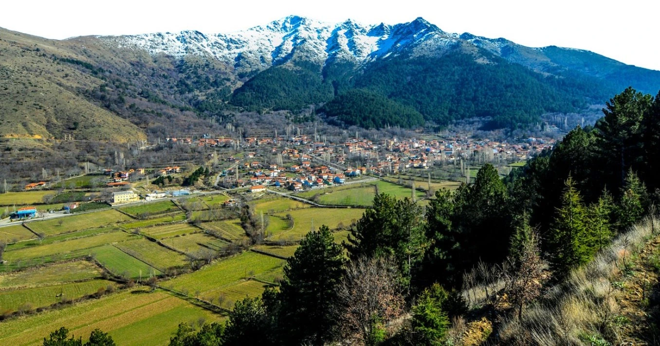
Far from the beaches normally associated with İzmir, Bozdağ reveals a completely different face of the Aegean Region: high mountain ridges, forests, cool summer air, winter snow, traditional settlements and dramatic views over the valleys of western Anatolia.
The Bozdağ Mountains rise immediately north of Ödemiş and Birgi, forming the imposing natural boundary between the fertile Küçük Menderes Valley to the south and the Gediz Basin to the north.
The range reaches approximately 2,159 meters at its highest point, making this one of the most significant mountain environments in İzmir Province. The landscape attracts hikers, mountaineers, nature photographers, paragliding enthusiasts and visitors simply looking for cooler air and peaceful highland scenery.
But Bozdağ is more than a mountain summit. The surrounding village, historic recreation areas, forest roads, springs and connections with Gölcük, Birgi and the Efeler Yolu cultural route make it an excellent destination for slow travel.
Explore some of the highest and most dramatic scenery in İzmir Province.
Discover established walking routes between Bozdağ, Gölcük, Birgi and the surrounding highlands.
Experience green spring landscapes, cool summers, autumn colors and snowy winter scenery.
Combine mountain scenery with village life, local food, springs and traditional recreation areas.
Essential information for discovering the mountains, village landscapes and hiking routes above Ödemiş.
North of Ödemiş in eastern İzmir Province.
Open on Google MapsThe Bozdağ range rises to approximately 2,159 meters.
Hiking, mountain scenery, photography, nature and highland escapes.
Higher elevations regularly experience snow and seasonal winter conditions.
Forests, mountain ridges, springs, valleys, highlands and traditional settlements.
Allow half a day for the village and scenery or a full day when combining Gölcük and Birgi.
Bozdağ brings together mountain scenery, outdoor activities, rural culture and seasonal landscapes within easy reach of Ödemiş and Birgi.
For travelers who know İzmir mainly through the Aegean coast, Bozdağ can be a surprise. Within the same province, the scenery changes from Mediterranean-style lowlands to a genuine mountain environment reaching more than two thousand meters above sea level.
The mountains offer some of the best opportunities in inland İzmir for walking, mountaineering, landscape photography and highland exploration. Several recognized tourism routes cross the area, including trails connecting Bozdağ with Gölcük and Birgi.
Bozdağ also provides a natural extension to a cultural itinerary. A traveler can explore the historic architecture of Birgi in the morning and climb into cool mountain scenery within a relatively short drive.
The character of the destination changes dramatically with the seasons. Spring brings fresh vegetation and clear walking conditions, summer attracts visitors escaping the heat of the valley, autumn creates changing colors, and winter can transform the mountain into a snowy landscape.
Bozdağ lies in the mountainous northern part of the Ödemiş district of İzmir Province. The mountains rise above the Küçük Menderes plain, with Birgi and Ödemiş located to the south.
On the opposite side of the range lies the Gediz Valley and the historic landscape around Sardis and Salihli. This geography has made the mountains an important natural passage between two major valleys since antiquity.
Bozdağ village is approximately 29 kilometers from Ödemiş. It can be reached either from the Ödemiş–Birgi side or from the northern approach through the Sardis and Salihli region.
The Bozdağ Mountains form a long east–west mountain system between the Gediz Basin and the Küçük Menderes Basin. Their steep slopes create one of the most striking geographical features of inland western Türkiye.
The highest part of the range rises north of Birgi, where elevations reach approximately 2,159 meters. From the higher ridges, the landscape falls dramatically toward fertile agricultural plains on both sides.
Elevation creates major differences in climate and vegetation. A journey from Ödemiş toward Bozdağ can begin among orchards and agricultural fields before climbing into oak, pine, chestnut and other mountain vegetation.
The upper mountain landscape provides expansive views across western Anatolia.
Streams and seasonal watercourses cut through the slopes and create changing mountain terrain.
Wooded areas around Bozdağ provide shade, recreation and valuable natural habitat.
Cooler upland areas have long been used for recreation, seasonal agriculture and village life.
The highest elevations can receive significant snowfall during suitable winter conditions.
Clear weather can reveal dramatic contrasts between mountain slopes and the cultivated plains below.
The history of Bozdağ reaches deep into antiquity. The mountain range was associated with the ancient region of Lydia and was known in classical geography as Tmolos or Tmolus.
The mountains stood between important ancient landscapes. To the north lay Sardis, capital of the Lydian kingdom, while the valleys to the south contained settlements connected with the Küçük Menderes region.
Mountain passes therefore had strategic importance, linking communities on opposite sides of the range and providing access between agricultural valleys, highland settlements and regional trade routes.
Later centuries brought Persian, Hellenistic, Roman, Byzantine and Turkish rule to the surrounding region. Nearby Birgi became especially important during the Byzantine period and later as the capital of the Aydınoğlu Beylik.
Local traditions around Bozdağ also preserve memories connected with the Ottoman period, while the village landscape today reflects centuries of highland settlement and interaction with the forests, springs and agricultural lands of the mountain.
The Bozdağ range formed part of the mountainous heartland associated with ancient Lydia.
Classical sources knew the mountain landscape by the ancient name Tmolos or Tmolus.
The ancient Lydian capital lies beyond the northern slopes of the mountain range.
The surrounding valleys remained important settlement and communication zones during Byzantine times.
Nearby Birgi became a major political and cultural center in the early 14th century.
Village life developed in close relationship with forests, springs, seasonal agriculture and mountain routes.
The settlement of Bozdağ lies beneath the high mountain slopes and provides the natural starting point for exploring the surrounding landscape.
This is not a polished resort destination. Its appeal comes from its setting, cool mountain air, village atmosphere, traditional cafés, local recreation areas and direct connection with the surrounding trails.
Visitors arriving from the hot Küçük Menderes plain often notice the difference in temperature immediately, especially during the summer months.
Walk through the settlement slowly and experience the atmosphere of a working mountain community.
Stop for Turkish tea or coffee and enjoy the slower pace of highland life.
The high slopes surrounding the settlement create a dramatic natural backdrop.
Bozdağ is particularly attractive during summer when the valley floor can become very hot.
The village provides access to several mountain routes and long-distance walking stages.
The character of the settlement changes considerably between green summers and snowy winters.
One of the best-known recreation areas around Bozdağ is Mermeroluk, sometimes associated locally with the name Kırkoluk. The forested setting has long been used for picnics, rest stops and summer recreation.
The area lies close to Bozdağ village and is surrounded by mature trees, including chestnut and plane trees, creating a particularly pleasant atmosphere during warmer months.
Springs and shaded forest areas are part of the traditional appeal of Bozdağ as a highland escape from the heat of the plains below.
Dense vegetation makes the area especially pleasant during hot summer weather.
Water sources have historically shaped recreation and settlement in the Bozdağ highlands.
Mature chestnut and plane trees contribute to the area's traditional character.
The area has long been associated with family recreation and day trips from surrounding towns.
Bozdağ has long served as a summer retreat for communities from Ödemiş and the surrounding valleys. Several traditional recreation areas are associated with the settlement and its forests.
A shaded recreation area associated with old plane trees and local history.
A forest recreation area known for its trees, spring water and cool highland setting.
One of the local recreation areas traditionally associated with Bozdağ's mountain environment.
Another name connected with Bozdağ's tradition of springs, water sources and outdoor recreation.
Bozdağ is one of the most important hiking areas in İzmir Province. The combination of elevation, forest, open ridges and connections with historic settlements creates routes suitable for very different levels of experience.
Official tourism routes include a Bozdağ–Gölcük route of approximately 11 kilometers, while the longer route toward the former ski area and the mountain summit is approximately 17 kilometers and is classified as substantially more difficult.
The difficulty of mountain walking should not be underestimated. Elevation, winter snow, fog, heat, route finding and sudden changes in weather can completely change the character of a walk.
Approximately 11 km, connecting two of the region's best-known mountain destinations.
A more demanding mountain route requiring better preparation, fitness and suitable conditions.
Shorter walks around the settlement and recreation areas offer an easier introduction to the landscape.
Bozdağ forms an important stop on the multi-stage Efeler Yolu cultural route.
These seasons often provide particularly attractive conditions for lower and mid-elevation hiking.
Snow and ice require appropriate mountain experience, equipment and careful route planning.
The highest part of the Bozdağ range reaches approximately 2,159 meters, forming the highest mountain landscape in İzmir Province.
The summit environment is very different from the village below. Weather can change rapidly, vegetation becomes more limited, and exposure to wind, cold and sun increases significantly.
For experienced hikers and mountaineers, the upper mountain offers extraordinary views across the surrounding valleys and ridges. However, reaching the summit should be approached as a genuine mountain activity rather than a casual tourist walk.
Winter transforms Bozdağ. While the lower Küçük Menderes Valley may remain relatively mild, the higher mountain can receive significant snowfall.
This contrast has long made Bozdağ one of the best-known winter landscapes in the İzmir region. The mountain has a history of organized winter recreation and skiing, with the Bozdağ ski area originally opening in the late 1990s.
However, winter operations are highly dependent on snowfall, weather, safety conditions and seasonal management. The area has experienced closures and changes in operation, so visitors should never assume that ski lifts or other winter facilities will be operating simply because snow is present.
The mountains can become one of the most dramatic winter landscapes in western Türkiye.
Winter activity depends greatly on current snowfall and local operating conditions.
Snow, ice and fog can affect access and driving conditions at higher elevations.
Temperatures at altitude can be dramatically lower than in İzmir or Ödemiş.
Bozdağ's elevation and steep geography have also made the region known among paragliding enthusiasts.
When weather and wind conditions are suitable, the mountain environment can offer extensive views over the surrounding ridges and plains.
Paragliding is a specialist activity. Visitors interested in flying should arrange the experience only through qualified operators and should never attempt independent flying without the appropriate training, permissions and equipment.
One of the most interesting modern ways to experience Bozdağ is through the Efeler Yolu – Efeler Way, a long-distance cultural and hiking route across inland İzmir.
The approximately 500-kilometer route begins near Bornova, crosses the Nif and Bozdağ mountain systems, continues through highland villages and the Aydın Mountains, and eventually reaches the area around Ephesus and the House of the Virgin Mary.
Bozdağ is an important stage on this route. Official stages connect Birgi with Bozdağ and then continue from Bozdağ toward the highlands of Kiraz. An alternative route also connects Gölcük and Bozdağ.
A major stage connecting architectural heritage in Birgi with the high mountain landscape.
The following stage continues deeper into the highland geography toward Kiraz.
An alternative route links Bozdağ with the mountain lake landscape of Gölcük.
The route connects natural scenery with villages, traditional culture and historic paths.
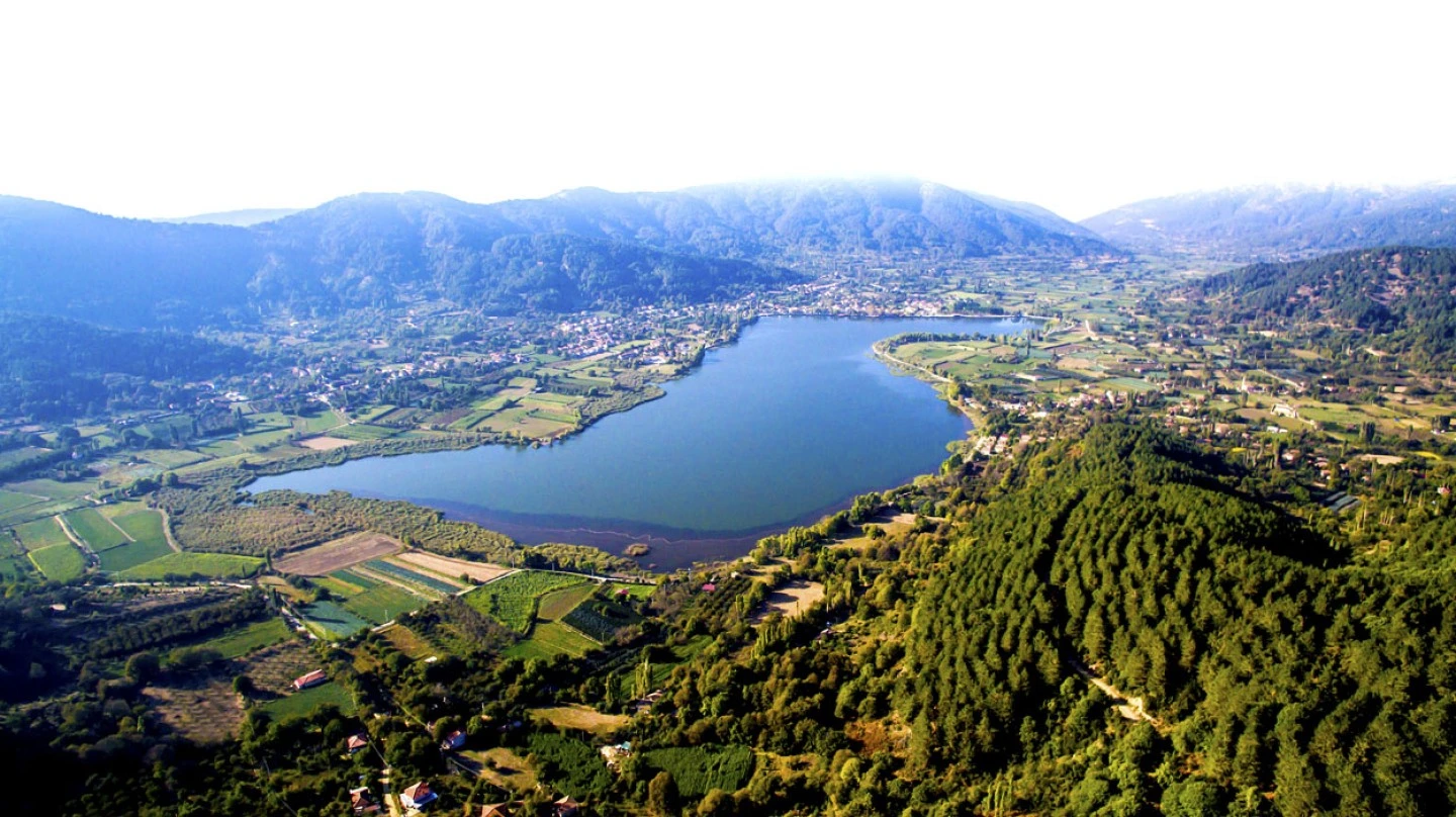
Gölcük is one of the natural companions to a Bozdağ visit. The highland settlement surrounds a mountain lake at roughly 1,050–1,100 meters elevation and lies among forested slopes and cultivated land.
The transition from Gölcük to Bozdağ is one of the most scenic parts of an inland İzmir journey. Rather than treating the two destinations separately, they can be combined into a single mountain day.
An established tourism route connects Bozdağ and Gölcük over approximately 11 kilometers, and the two places can also be connected comfortably by road.
Gölcük adds water, reflections and cultivated highland scenery to a Bozdağ itinerary.
Both destinations provide relief from the summer heat of the Küçük Menderes plain.
The roads between the mountain settlements offer changing views of forests, slopes and agricultural landscapes.
Experienced walkers can connect the two areas through established regional hiking routes.
Few day trips in inland İzmir offer a stronger contrast than Birgi and Bozdağ.
Birgi lies beneath the mountain range and preserves historic houses, mosques, traditional streets and important architecture associated with the Aydınoğlu and Ottoman periods.
After several hours exploring Birgi, the journey can continue upward into Bozdağ's forests, mountain roads and highland scenery.
This combination works particularly well for travelers interested in history, architecture, landscape photography and regional culture, because the character of the scenery changes completely within a relatively small area.
Experience the atmosphere of a traditional settlement surrounded by high mountain slopes.
Enjoy one of the area's best-known forest recreation zones and its mature trees.
Discover an established mountain route linking two very different highland landscapes.
Experience part of the long-distance cultural trail connecting historic villages and mountain passes.
Capture forests, ridgelines, valleys, changing weather and seasonal landscapes.
When conditions allow, experience a snowy landscape rarely associated with the Aegean coast.
Pair mountain scenery with one of western Türkiye's most atmospheric historic settlements.
Complete the day beside the mountain lake and enjoy a slower highland atmosphere.
Start the morning in Birgi, when the historic streets are quieter and the light is particularly attractive for photography.
Spend two or three hours exploring the old town, including the Ulu Mosque, traditional houses and historic streets. Then continue toward the mountains.
Stop in Bozdağ village for lunch, tea or coffee before exploring nearby forest and recreation areas such as Mermeroluk.
Later in the afternoon, continue toward Gölcük for views across the lake and surrounding highlands.
Travelers whose priority is walking should plan the day very differently from visitors combining Birgi and Gölcük by vehicle.
Begin early, check weather and trail information, and choose a route appropriate to your experience. Longer mountain routes can take many hours and should not be rushed.
Begin before temperatures rise and leave generous daylight for the return journey.
Weather at the summit can differ significantly from conditions in Ödemiş or Birgi.
Do not depend entirely on finding reliable drinking-water sources along mountain routes.
Carry current route information and an offline navigation option for longer trails.
Mountain terrain requires footwear with suitable support and grip.
Cloud, wind, snow, heat or fatigue are valid reasons to shorten a mountain day.
Explore Ödemiş and experience its traditional commercial streets or Saturday market.
Continue to Birgi and dedicate several hours to historic architecture and traditional streets.
Stay in the Ödemiş–Birgi–Bozdağ region and enjoy a relaxed regional dinner.
Explore Bozdağ village, forest landscapes and a selected walking route.
Continue toward Gölcük Lake for highland scenery and a slower final afternoon.
Dedicate the entire second day to a serious mountain hike with appropriate preparation.
Excellent for green landscapes, wild vegetation, comfortable temperatures and hiking.
Long daylight and cooler mountain air make this an excellent period for combining Bozdağ with Birgi and Gölcük.
The mountains provide a welcome escape from the extreme heat that can develop on the plains below.
Changing vegetation, softer light and cooler walking conditions create excellent photography opportunities.
Snow can transform the mountain, but road, weather and facility conditions must be checked carefully.
Bozdağ village and lower recreation areas can be enjoyable throughout the year when weather conditions are suitable.
Use layers of ridges and changing light to create depth in wide landscape compositions.
Traditional streets and mountain architecture provide human scale within the wider landscape.
Curving roads, tall trees and filtered light work especially well in spring and autumn.
Snow creates unusually dramatic Aegean landscapes when roads and conditions allow safe access.
Combine mountain scenery with reflections and cultivated highland landscapes around the lake.
Clouds, mist and sunlight can transform the mountains within minutes.
Temperatures can be significantly cooler than in Ödemiş, especially in wind or after sunset.
Mountain conditions can change faster than conditions on the plains below.
Even short walks may involve uneven ground, forest paths or steep surfaces.
Early departures provide more comfortable temperatures and additional daylight for unexpected delays.
Take sufficient drinking water when leaving the village for longer walks.
Offline navigation can be useful where mobile reception becomes less reliable.
Snow and ice can dramatically change driving conditions at altitude.
Keep all waste with you and remain on established routes whenever possible.
Bozdağ should be treated as a real mountain environment. The proximity of villages and roads does not remove the risks associated with altitude, weather and exposed terrain.
Check mountain-specific forecasts rather than relying only on weather reports for İzmir city.
Low cloud can reduce visibility quickly and make route finding considerably more difficult.
Winter conditions require experience and appropriate equipment on higher mountain routes.
Despite the elevation, exposed slopes can still become hot and dehydrating during summer.
Allow enough time to complete walks well before darkness.
For longer independent hikes, share your route and expected return time with someone you trust.
Accessibility varies greatly depending on whether a visitor stays within the village and recreation areas or attempts hiking routes in the surrounding mountains.
Many of the main village and scenic areas can be reached by road.
Gradients and uneven surfaces may make some streets difficult for travelers with reduced mobility.
Natural surfaces, roots and uneven ground are common away from paved areas.
Serious hiking routes are generally unsuitable for travelers with significant mobility limitations.
Snow and ice can reduce accessibility considerably even around normally straightforward areas.
A private car or chauffeured vehicle offers the greatest flexibility for scenic stops and short visits.
Bozdağ can be approached from both sides of the mountain range. The southern route combines particularly well with Ödemiş, Birgi and Gölcük, while the northern approach connects with Sardis and Salihli.
Bozdağ is approximately 29 km from Ödemiş, with routes climbing through the surrounding highlands.
The southern approach allows travelers to combine Bozdağ with one of the region's most important historic towns.
A scenic mountain approach connects the lake and highland landscape with Bozdağ.
Driving distances vary by route; allow roughly 110–130 km depending on the chosen approach.
The northern approach makes Bozdağ a natural extension to an archaeological visit to Sardis.
A private vehicle offers the greatest flexibility for combining villages, hiking areas and scenic stops.
Discover a peaceful mountain lake and highland settlement surrounded by cultivated landscapes and forest.
Explore historic houses, monumental architecture and traditional streets beneath the Bozdağ Mountains.
Experience local food, markets and everyday life in the agricultural heart of the Küçük Menderes Valley.
Cross the mountains toward the ancient capital of Lydia and one of western Türkiye's major archaeological sites.
Continue eastward through less-visited villages and mountain landscapes connected by the Efeler Yolu.
Explore the archaeological landscape near Ödemiş connected with the ancient history of the valley.
Bozdağ is located in the Ödemiş district of İzmir Province, in the mountains north of the Küçük Menderes Valley.
The highest point of the Bozdağ range reaches approximately 2,159 meters above sea level.
Yes, particularly for travelers interested in mountain landscapes, hiking, photography, rural culture and destinations beyond İzmir's coastline.
Bozdağ is known for its mountain scenery, forests, hiking, highland recreation, winter snow and proximity to Birgi and Gölcük.
Yes. Several established routes cross the area, ranging from regional walks to demanding mountain routes.
Yes. An established regional tourism route connects Bozdağ and Gölcük over approximately 11 kilometers.
Experienced hikers and mountaineers can explore routes toward the summit, but these should be treated as serious mountain activities and planned according to weather and seasonal conditions.
Yes. Higher elevations regularly receive snow during suitable winter weather, although the amount and duration vary significantly from year to year.
Bozdağ has a history of organized winter recreation and skiing, but operation of winter facilities depends on snow, weather, safety and current seasonal management. Always check current conditions before travelling specifically to ski.
It is generally cooler than the Küçük Menderes plain, especially in shaded or higher areas, although sunny exposed locations can still become hot.
Spring and autumn are excellent for hiking, summer is ideal for escaping the heat of the lowlands, and winter offers snow scenery when conditions allow.
Bozdağ is approximately 29 kilometers from Ödemiş.
Yes. Birgi and Bozdağ make an excellent combination, allowing travelers to experience historic architecture and mountain scenery in the same day.
Yes. Bozdağ and Gölcük are naturally connected by both road and established walking routes.
Efeler Yolu is a roughly 500-kilometer multi-stage cultural walking route crossing the mountains and villages of inland İzmir. Bozdağ is one of its important stops.
Yes. Official stages connect Birgi with Bozdağ and continue from Bozdağ toward the highlands of Kiraz.
Yes. Mountain ridges, forests, village scenes, snow, mist and nearby Gölcük provide very different photographic subjects.
The village, scenic drives and recreation areas can work well for families, although children should be carefully supervised around mountain roads, water, slopes and natural terrain.
Not for a simple village and scenic visit. Longer mountain routes require suitable footwear, clothing, water, navigation and equipment appropriate to the season.
A private vehicle is highly useful, especially when combining Bozdağ with Birgi, Gölcük and other mountain destinations.
Yes. It is possible as a full-day excursion, particularly by private vehicle, although combining too many mountain and historic stops can make the day rushed.
Wear comfortable shoes and bring an additional layer, even when conditions in Ödemiş or İzmir feel warm. Winter visits require much more substantial cold-weather preparation.
No. They are separate mountain destinations, although both lie in the Bozdağ highlands and are easily combined within the same itinerary.
Bozdağ offers a genuine highland and mountain environment with forests, snow, walking routes and rural settlements rather than beaches and seaside resorts.
Use established paths whenever possible to reduce damage to fragile mountain vegetation.
Carry all rubbish away from forests, trails, springs and viewpoints.
Follow all seasonal fire restrictions and never light fires in prohibited areas.
Observe animals quietly and avoid disturbing natural habitats.
Use local cafés, accommodation and businesses where appropriate.
Do not enter orchards, agricultural land or private property without permission.
Discover Bozdağ, Birgi, Gölcük and the Küçük Menderes Valley with a private itinerary combining mountain scenery, historic settlements, local culture and nature, without compulsory shopping stops.
Experience three completely different landscapes in one carefully paced private journey: historic Birgi, the high mountains of Bozdağ and the lake scenery of Gölcük.
Explore Bozdağ village, mountain scenery, forests and selected viewpoints with a flexible private itinerary adapted to the season.
Request a Private Tour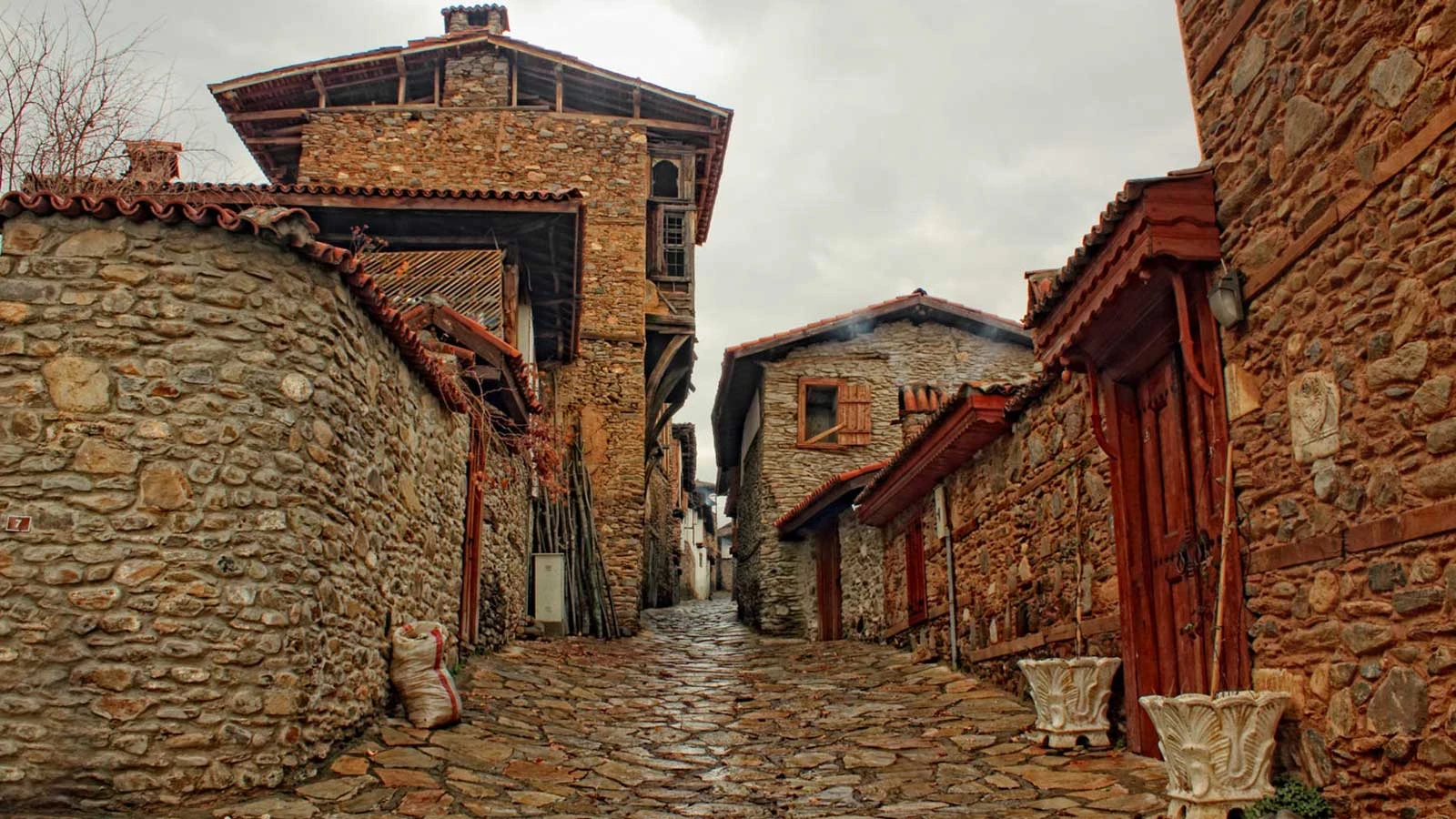
Combine the historic architecture of Birgi with the forests, villages and mountain scenery of the Bozdağ highlands.
Plan Your Birgi & Bozdağ DayExtend the journey deeper into inland İzmir with Gölcük Lake, mountain roads and the rural landscapes surrounding Ödemiş.
Discover mountain lake scenery, cool highlands, forests and village landscapes on a relaxed private journey above the Küçük Menderes Valley.
Create Your Mountain Itinerary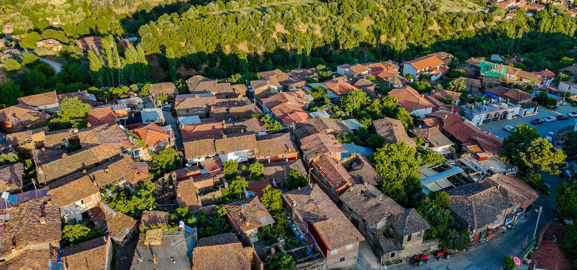
Combine Ödemiş, Birgi, Gölcük and Bozdağ for a deeper journey through the history, food, villages and mountain landscapes of eastern İzmir.
Plan Your Inland İzmir Journey