Private Old Smyrna Archaeology Tour
Explore the Athena sanctuary, city walls, streets, houses and water systems of Bayraklı Höyüğü with a private historical focus.
Request an Old Smyrna Tour





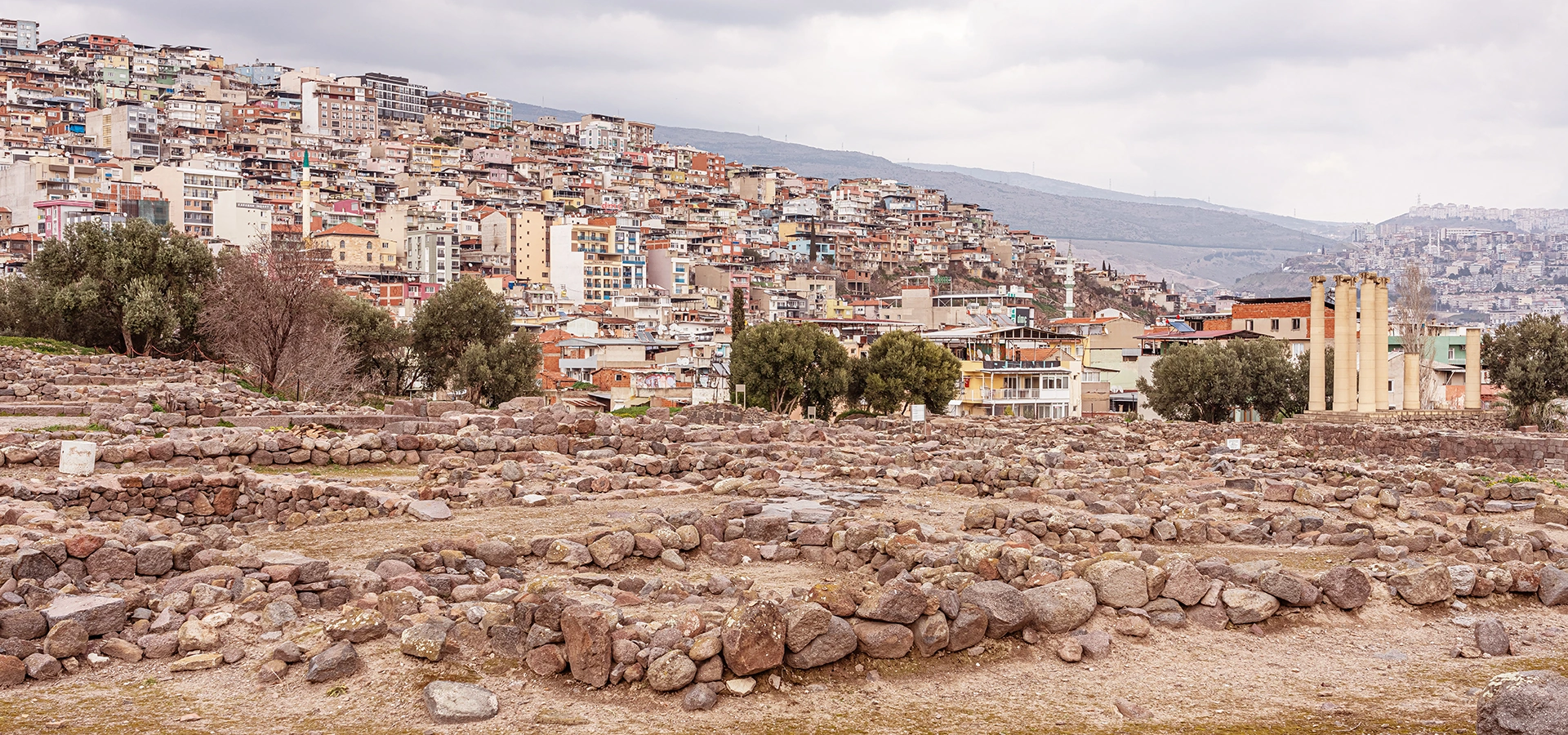
Old Smyrna, also known as Bayraklı Höyüğü or Tepekule, preserves the earlier city of Smyrna before the urban centre moved to the slopes of Mount Pagos, today's Kadifekale. The archaeological mound stands in the northeastern part of the Gulf of İzmir, surrounded today by one of the city's busiest modern districts.
The contrast is extraordinary. Inside the archaeological area are the remains of Bronze Age settlement layers, Iron Age houses, massive city walls, paved streets, a monumental fountain and the sanctuary of Athena. Around them rise apartment blocks, roads and the modern skyline of Bayraklı. Few places show the depth of İzmir's history so directly.
Old Smyrna is particularly important for understanding the Archaic city of western Anatolia. Excavations have revealed a settlement protected by sophisticated fortifications, organised by regular streets and equipped with houses containing storage vessels, bathing installations and drainage features. The sanctuary of Athena became one of the defining monuments of the site.
For travellers who have already seen the Roman Agora or Kadifekale, Bayraklı completes the story. This is where you meet the earlier Smyrna — the city that flourished centuries before the great Hellenistic and Roman metropolis developed around Pagos.
See the sanctuary that became one of the most important early monumental sacred complexes in eastern Greek archaeology.
Examine the powerful defensive system that protected Smyrna and records episodes of destruction, rebuilding and political conflict.
Trace streets, houses and neighbourhoods that reveal how an organised city was developing here during the early first millennium BCE.
Understand the crucial transition from Old Smyrna to the later city around Kadifekale, the theatre and the Agora.
Essential information for visiting Bayraklı Höyüğü, the earlier city of Smyrna and one of İzmir's most important archaeological sites.
Tepekule in Bayraklı, on the northeastern side of the Gulf of İzmir.
Multi-period archaeological mound preserving Bronze Age, Iron Age, Archaic and Classical settlement layers.
Archaeological layers reach back to the 3rd millennium BCE, with later occupation continuing through the first millennium BCE.
The sanctuary and Temple of Athena, whose earliest preserved phases belong to the late 8th and 7th centuries BCE.
Smyrna developed major mudbrick and stone defensive walls, repeatedly rebuilt through the Iron and Archaic periods.
Regular streets and planned neighbourhoods make Old Smyrna important for the history of early urban design in western Anatolia.
An Archaic public fountain and water installations reveal sophisticated infrastructure within the settlement.
Archaeological evidence records a major destruction connected with the Lydian king Alyattes around 600 BCE.
Old Smyrna reached one of its most prosperous phases between roughly 650 and 545 BCE.
A new urban centre developed around Mount Pagos by the early Hellenistic period, shifting Smyrna toward modern Konak.
Allow about 60–90 minutes for a focused visit, or longer if you enjoy detailed archaeology.
Taxi, private vehicle or current İzmir public transport; Bayraklı is well connected with the rest of the city.
Old Smyrna is one of the places where İzmir's history stops being abstract. You can stand inside the earlier city and see how settlement, religion, defence and everyday life developed long before Roman Smyrna.
The first reason to visit is chronology. Many travellers begin İzmir's ancient story with the Agora, but Bayraklı reaches much farther back. The mound preserves settlement from the Bronze Age and especially rich evidence for the Iron, Archaic and Classical periods.
The second reason is urban history. Old Smyrna was not simply a loose cluster of ancient houses. Its walls, streets, public fountain, sacred precinct and increasingly organised residential quarters reveal a community developing the infrastructure and spatial logic of a true city.
The third reason is the Temple of Athena. The sanctuary is fundamental to understanding religion, architecture, writing and artistic exchange in early Smyrna. Architectural fragments and votive objects show that the city was connected to a much wider Aegean and eastern Mediterranean world.
Finally, Bayraklı explains what happened before Kadifekale. Visiting both places allows you to follow Smyrna from its earlier coastal settlement to the much larger Hellenistic city that eventually became one of Roman Asia Minor's great urban centres.
Old Smyrna lies in the modern district of Bayraklı, north-east of central Konak. The archaeological mound is commonly called Bayraklı Höyüğü or Tepekule and today sits within a dense metropolitan landscape.
In antiquity the geography looked very different. The settlement occupied a low rocky peninsula or small promontory surrounded by the sea on its western and southern sides. Over centuries, alluvial deposits transformed the coastline and helped create the modern Bornova plain, leaving the ancient settlement inland from the present shore.
This changing landscape is essential to understanding the city. Old Smyrna originally benefited from access to the Gulf, fertile land behind it and defensible terrain — conditions that helped the settlement grow into an important Aegean community.
Several names are used for the same archaeological landscape. Bayraklı Höyüğü describes the mound itself, while Tepekule is the modern place name commonly associated with the site. Old Smyrna is used by historians and archaeologists to distinguish this earlier settlement from the later Smyrna that developed around Mount Pagos.
This distinction matters because the two sites represent different stages of the city's history. Bayraklı preserves the earlier settlement, especially famous for its Archaic-period remains. The later city spread across the slopes below Kadifekale, with major monuments including the theatre and Agora.
When ancient sources simply mention Smyrna, the context and date determine which urban phase they are describing. For visitors, the simplest way to remember the difference is: Old Smyrna = Bayraklı; later Hellenistic and Roman Smyrna = Pagos/Kadifekale and central Konak.
The history of Bayraklı begins long before the famous Archaic city. Excavations have reached settlement layers belonging to the 3rd millennium BCE, showing that the mound formed part of western Anatolia's Bronze Age settlement landscape thousands of years before Smyrna became a Greek city.
During the early first millennium BCE, the settlement developed into the community known from later historical tradition as Smyrna. Pottery, architecture and other finds document the city's changing cultural connections during the Protogeometric, Geometric and Archaic periods.
By the 8th and 7th centuries BCE, Smyrna had become a fortified and increasingly monumental city. The sanctuary of Athena, regular streets, houses and public infrastructure belong to this period of rapid architectural development. Around the middle of the 7th century and into the early 6th century BCE, the city participated actively in wider Aegean and Mediterranean trade.
Around 600 BCE, Old Smyrna suffered a major destructive attack traditionally connected with the Lydian king Alyattes. The city recovered and rebuilt, but another major turning point came in the mid-6th century BCE during the expansion of Persian power in western Anatolia. The sanctuary lost its earlier prominence and the settlement's regional importance declined.
Old Smyrna remained inhabited through the Classical period. By the 4th century BCE, substantial houses again occupied the mound. Eventually, however, the restricted space of Bayraklı could no longer match the needs and ambitions of a growing Hellenistic city. Smyrna's urban centre shifted to the slopes of Mount Pagos around the late 4th to early 3rd century BCE.
The archaeological mound is valuable partly because its history begins before the age most visitors associate with ancient Smyrna. Excavations have revealed Early Bronze Age occupation, including structures built on the rocky top of the mound.
Later Iron Age levels show a community of relatively modest houses built with stone foundations, mudbrick walls and organic roofing materials. One of the best-known early houses at Bayraklı belongs to the early 9th century BCE and demonstrates the simple domestic architecture that preceded the city's later monumental phase.
By around the 9th century BCE, the settlement was developing substantial defences. The creation and repeated rebuilding of city walls marks a significant change: Smyrna was becoming not merely a village but an organised fortified community with increasingly complex political and economic life.
Ancient literary tradition describes Smyrna as an Aeolian foundation that later came under Ionian control. Herodotus and other ancient writers preserve stories of political and cultural change, including the city's eventual association with the Ionian world.
Archaeology adds a more detailed picture. Pottery styles, architectural forms, inscriptions and imported objects reveal a settlement participating in overlapping networks across Aiolis, Ionia, Lydia and the wider Aegean. The city's identity was therefore not static; it changed over centuries as communities, political alliances and trade connections shifted.
For visitors, the most useful approach is to avoid treating the labels “Aeolian” and “Ionian” as simple ethnic boxes. Old Smyrna's material culture shows a city at a cultural crossroads, shaped by western Anatolia as much as by the Aegean islands and mainland Greek world.
The period from approximately 650 to 545 BCE is often described as Old Smyrna's great age. During these generations the city invested in monumental architecture, fortified itself, expanded its sacred spaces and participated in long-distance exchange.
Imported ceramics and other objects show contact with neighbouring Lydia, the eastern Aegean, mainland Greece and regions farther east. Local elites were able to sponsor religious dedications and participate in the artistic language of the broader Mediterranean world.
Writing also became increasingly visible. Dedications associated with the sanctuary of Athena demonstrate the role of literacy in ritual and public identity. The combination of architecture, fortification, planned streets and imported material explains why Bayraklı is so important to scholars of Archaic western Anatolia.
The Temple of Athena is the most celebrated monument at Bayraklı. The goddess Athena served as the city's principal protective deity, and the sanctuary became a major focus of public religion, dedications and architectural display.
The earliest preserved remains associated with the temple date to approximately 725–700 BCE. During the 7th century BCE the sanctuary became increasingly monumental, with terraces, architectural stonework and columned phases that place Old Smyrna at the forefront of early monumental temple architecture in the eastern Greek world.
The temple's history was not continuous. Destruction around 600 BCE was followed by rebuilding, while the mid-6th century BCE brought another major rupture. Votive deposits, inscriptions and architectural fragments help archaeologists reconstruct how the sanctuary changed through these political crises.
What visitors see today is not a complete standing temple. The value of the site lies in its foundations, restored architectural elements, column reconstructions and the archaeological context that reveals how one of the city's central sacred spaces developed over time.
Athena, regarded as the city's principal protective goddess.
Preserved remains reach back to the late 8th century BCE.
Major architectural expansion took place during the 7th and early 6th centuries BCE.
The sanctuary is central to the study of early monumental architecture, cult and cultural exchange in western Anatolia.
Old Smyrna possessed one of the most important early defensive systems known from western Anatolia. The settlement was protected by a sequence of mudbrick and stone fortifications that were built, damaged, repaired and replaced over several centuries.
An early mudbrick defensive phase belongs to the 9th century BCE. Later builders strengthened the city with increasingly substantial walls, including stone foundations constructed with carefully fitted blocks. Excavations on the eastern and southern sides have revealed long stretches of these defences.
The fortifications are especially valuable because they preserve evidence of actual conflict. Destruction layers, military debris and rebuilding phases allow archaeologists to connect the physical history of the walls with Old Smyrna's political struggles, including the Lydian attack around 600 BCE.
Ancient tradition records conflict between Smyrna and the kingdom of Lydia. Archaeology at Bayraklı has provided unusually vivid evidence for a major attack around 600 BCE, generally associated with the Lydian king Alyattes.
Excavations identified destruction deposits and a siege-related accumulation near the defensive system. Weapons and damage patterns helped archaeologists reconstruct an episode in which the fortified city was attacked and overwhelmed.
The destruction did not end Smyrna. The city rebuilt parts of its fortifications and restored the sanctuary of Athena. This recovery is important because it shows that Old Smyrna remained resilient even after one of the most serious military crises in its history.
When walking along the walls, remember that these are not only architectural remains. They are evidence for a real political struggle between an independent coastal city and one of western Anatolia's most powerful kingdoms.
One of Old Smyrna's most remarkable features is its regular street network. By the later 7th century BCE, major streets and narrower cross streets organised the settlement into a geometric pattern that makes Bayraklı an important case study in the early history of planned cities.
A principal route commonly called Athena Street connected the sanctuary area with other parts of the settlement and, in the ancient landscape, toward the harbour zone. Parallel and perpendicular streets created an increasingly ordered urban fabric.
Excavations have also revealed early stone-paved routes. These streets were functional infrastructure: they managed movement between houses, public areas, the sanctuary, city gates and commercial activity.
The grid should not be imagined as a perfectly modern chessboard imposed all at once. It developed through time, adapting to earlier buildings and the mound's topography. That long evolution is precisely what makes the site archaeologically valuable.
The domestic remains at Bayraklı make the site unusually human. Instead of preserving only temples and walls, Old Smyrna reveals how people lived inside the city — how houses were arranged, how food and water were stored and how domestic cleanliness was organised.
Early Iron Age houses were often simple single-room structures. In later centuries, more complex plans appeared, including megaron-type houses, multi-room buildings and courtyard houses. Stone foundations supported walls of mudbrick, while timber and organic materials were used for roofs and upper construction.
Large storage jars, basins, louteria and bathtub-like installations found in domestic contexts offer evidence for food storage, water use, washing and ritual purification. The archaeology therefore gives a much richer picture than monumental ruins alone.
Stone foundations with mudbrick superstructures were common in domestic architecture.
Single-room houses, megaron forms and later multi-room or courtyard residences.
Large ceramic jars were used for grain, liquids and household supplies.
Louteria and bathtub forms illuminate everyday hygiene and ritual practices.
Near the fortification system, archaeologists uncovered an important Archaic fountain structure. Its existence shows that Smyrna invested not only in walls and temples but also in public infrastructure serving the daily needs of its inhabitants.
Water management was a central challenge for ancient cities. At Bayraklı, channels, drainage features and the fountain demonstrate an understanding of how water could be collected, controlled and distributed within a densely occupied fortified settlement.
The fountain is particularly useful for visitors because it changes the way we imagine Old Smyrna. This was not simply a ceremonial centre; it was a functioning city whose inhabitants required reliable systems for drinking water, household use, washing and craft activities.
Old Smyrna's prosperity was closely tied to its position on the Gulf and to its participation in wider exchange networks. Imported pottery, figurines, luxury objects and artistic influences show that the city was connected far beyond the immediate İzmir region.
Contacts with Lydia were especially important — sometimes commercial, sometimes political and military. Objects from the eastern Mediterranean, including Cypriot and Near Eastern traditions, also reached Smyrna, while Attic pottery became increasingly influential during the 6th century BCE.
These connections affected architecture and religion as well as trade. The artistic language of the Athena sanctuary, imported objects and changing pottery styles reveal a city participating in the cosmopolitan world of the Archaic Aegean.
After the mid-6th century BCE, Old Smyrna no longer held the same regional prominence it had enjoyed during the Archaic period. The sanctuary of Athena ceased to function in its earlier monumental form, and the city entered a quieter historical phase.
The settlement did not disappear. Archaeology shows continued occupation, and by the 4th century BCE the mound again supported substantial residential architecture. Large courtyard houses with multiple rooms indicate the presence of prosperous households and local elites.
This period is important because it bridges the gap between Archaic Old Smyrna and the foundation of the new city around Pagos. Bayraklı was still alive when broader political changes after Alexander transformed western Anatolia.
By the late Classical and early Hellenistic periods, the old mound at Bayraklı had become too restricted for the ambitions of a growing city. The site covered only a limited area, while new Hellenistic urban centres increasingly demanded broader streets, monumental public architecture and space for larger populations.
Ancient tradition associates Alexander the Great with the decision to establish Smyrna around Mount Pagos, but the large-scale development of the new city belongs mainly to the generations after Alexander, during the Successor period.
Around the late 4th and early 3rd centuries BCE, the centre of Smyrna shifted toward the slopes of Pagos. The new city eventually included the acropolis at Kadifekale, the great theatre, the Agora and urban districts extending toward the ancient harbour.
Visiting Bayraklı and Kadifekale on the same day creates one of the best historical comparisons in İzmir: the compact Archaic city at the Gulf's edge versus the monumental Hellenistic metropolis spread across a hillside.
Systematic excavation at Bayraklı began in 1948 through a British-Turkish project led by John M. Cook and Ekrem Akurgal. These early campaigns established the importance of the mound and revealed major parts of the fortifications, houses and Athena sanctuary.
Ekrem Akurgal returned to the site in 1966, beginning a long second phase of research that continued through 1992. Work during these decades clarified the settlement sequence and brought major areas of the Archaic city to light.
A third major excavation phase continued from the 1990s into the 2010s, followed by renewed investigations focusing on the city entrance, defensive system, Bronze Age layers, domestic quarters and the sanctuary. Archaeological work has therefore repeatedly changed how scholars understand the site.
Recent projects have continued to investigate the Athena Temple surroundings, Classical-period defensive walls and earlier occupation levels. The site remains an active research landscape rather than a completely finished archaeological park, so what is visible can change from one visit to another.
Temple foundations, terraces and reconstructed architectural elements mark the city's principal sacred area.
Substantial stretches of stone-founded walls, towers and entrance zones reveal the scale of Smyrna's defences.
Excavated street surfaces and routes make the urban organisation of the settlement easy to recognise.
Stone wall bases outline domestic buildings from different phases of the city.
The remains of the ancient water structure preserve an important piece of civic infrastructure.
Open archaeological sectors reveal how deeply layered the mound is and how much of its history remains under study.
Old Smyrna requires a little imagination. It is not a city of tall standing façades like Ephesus, but its archaeological value is exceptional. The walls, house plans and streets allow you to read the structure of an early city directly in the ground.
Old Smyrna remains an active archaeological site. Recent excavation seasons have continued to investigate the Athena sanctuary, defensive systems and deeper Bronze Age levels, meaning the interpretation of some sectors is still developing.
In 2026, municipal planning and construction programmes have also included projects intended to improve the visitor reception area and the public surroundings of Smyrna Höyüğü. Because archaeological and landscaping work can affect entrances, paths or the presentation of individual features, visitors should check current local information shortly before arrival.
This active state is part of the site's appeal. Bayraklı is not simply preserved archaeology; it is a place where new evidence continues to reshape the history of İzmir.
Comfortable temperatures and greener vegetation make the exposed archaeological site pleasant to explore.
Warm and bright, with good conditions in the morning before the strongest heat develops.
Very hot around midday. Visit early, carry water and use strong sun protection.
Excellent for archaeology, photography and combining Bayraklı with central İzmir sights.
Cooler and quieter, though rain can make archaeological surfaces slippery or muddy.
Often peaceful with clear light after rain; check weather and site conditions in advance.
For most visitors, spring and autumn offer the best balance of comfort and visibility. Old Smyrna is exposed, so summer timing matters more than almost anything else.
Early morning is best in hot weather. The light is cleaner, temperatures are lower and you can spend time examining streets and walls without rushing between exposed areas.
Late morning works well if Old Smyrna is the first stop of a larger archaeological day before continuing to the Agora, Kemeraltı or Kadifekale.
Late afternoon gives warmer light across stone walls and reconstructed columns, but do not arrive so late that you have no time to understand the site before closing or fading daylight.
Because excavation and visitor arrangements can change, confirm current opening information before building a tightly timed itinerary around the site.
One of the easiest options from central İzmir, particularly if you are combining Bayraklı with several archaeological sites.
Convenient for a multi-stop day, but follow current navigation carefully because the site is surrounded by dense urban roads.
Bayraklı is served by the city's suburban rail network; continue from the most convenient nearby station according to current routing.
Multiple city services operate through Bayraklı, but route numbers and stop patterns can change.
Allow extra time for urban traffic, especially on weekdays and during commuting hours.
Bayraklı is relatively close, making Old Smyrna an easy archaeological addition to a north-shore day.
Use current İzmir transport information on the day rather than relying on old bus numbers. Navigation apps are particularly useful for the final approach to Tepekule.
The archaeological area is best understood by walking slowly between the sanctuary, streets, houses and defensive sectors.
Expect ancient stone, earth paths, changes in level and active excavation areas.
Site signs and plans help transform low wall foundations into understandable houses, streets and fortifications.
Temporary ropes or barriers may protect newly excavated sectors; never cross them for a closer photograph.
Many parts of the mound are exposed to the sun, especially in summer.
Old Smyrna rewards careful observation more than a fast walk through the site.
Enough for the Athena sanctuary, a quick look at the walls and an overview of the site plan.
Best for most visitors who want to understand the main monuments, streets and domestic areas.
Ideal for archaeology enthusiasts who want to study wall phases, house plans and excavation sectors carefully.
Combine Old Smyrna with the İzmir Archaeology Museum or another historical stop.
Follow the complete Smyrna story from Bayraklı to Kadifekale, the Agora and Kemeraltı.
Allow at least one hour and read the site's historical sequence before focusing only on the reconstructed columns.
This is one of the strongest archaeology routes in İzmir because it follows the city's development through space as well as time: Bayraklı → Pagos → Agora → historic harbour district.
Use the reconstructed columns as a vertical focal point against the archaeological mound and city skyline.
Frame ancient foundations against modern towers to show İzmir's extraordinary continuity of settlement.
Elevated angles help reveal the geometry of roads, house blocks and the settlement plan.
Side lighting brings out stone joints, polygonal masonry and differences between construction phases.
Often cleaner and cooler, especially useful for wide archaeological views in summer.
Never stand on walls, enter trenches or move archaeological material to improve a composition.
Old Smyrna can be interesting for families if children enjoy archaeology, ancient cities and the idea of seeing real houses and streets rather than only museum objects. The fortifications and Athena sanctuary provide clear visual anchors for explaining the site.
Young children should be supervised carefully around excavation edges, uneven stones and exposed wall foundations. The site is not a playground, and climbing ancient masonry can damage fragile structures as well as cause injury.
Accessibility is limited by archaeological terrain. Some areas may be easier than others, but earth paths, stones, level changes and active excavation sectors can make a completely step-free visit difficult. Travellers with limited mobility should confirm the current entrance arrangement and accessible route before visiting.
Ancient masonry can be damaged by repeated foot traffic even when the stones look strong.
Temporary boundaries may protect newly exposed archaeology or conservation work.
Never remove pottery fragments, stones or objects; their archaeological position matters.
Use established visitor routes rather than creating shortcuts across sensitive areas.
Help preserve the mound as both an archaeological site and an urban heritage space.
If excavation is active, give archaeologists room to work and follow all on-site instructions.
Knowing the difference between Bronze Age, Archaic, Classical and later Smyrna will make the low ruins much easier to interpret.
The site can be hot and exposed in late spring and summer.
Expect stone, earth, archaeological surfaces and occasional uneven ground.
Excavation, conservation and visitor-area works may temporarily change entrances or routes.
Old Smyrna is academically important because of its early layers, not because it preserves tall Roman façades.
The Athena sanctuary is only one part of the site; the walls, streets and houses tell just as much of the story.
A plan helps you recognise house blocks and street lines that can otherwise look like disconnected foundations.
Pair Bayraklı with Kadifekale and the Agora to understand how Smyrna physically moved and expanded.
Early morning provides a much more comfortable archaeology walk from June through September.
Bayraklı is part of a busy metropolitan corridor, so add buffer time when moving to or from central İzmir.
The acropolis of later Smyrna on Mount Pagos, essential for understanding the city's Hellenistic relocation.
Roman civic architecture, vaulted galleries, inscriptions and one of the strongest archaeological experiences in central İzmir.
The great theatre on the slope below Kadifekale, still an active excavation area.
A valuable complement for seeing sculpture, ceramics and archaeological material from İzmir and the wider region.
The living historic commercial centre of İzmir, ideal after an archaeology-focused morning.
The Clock Tower and waterfront provide a natural finish to a day tracing İzmir from ancient settlement to modern city.
An easy nearby contrast with modern Gulf life, cafés and ferry connections.
Neighbouring districts preserve additional layers of İzmir's urban and Levantine history beyond the ancient mound.
The essential chronological pairing: early Smyrna at Bayraklı and the later city around Pagos.
Compare Archaic urban archaeology with the monumental civic centre of Roman Smyrna.
Ideal for travellers who want field archaeology followed by object-based context.
Move from ancient urban foundations to the living commercial streets of historic İzmir.
A relaxed north-shore day combining archaeology with ferries, waterfront walking and modern neighbourhood life.
Bayraklı → Kadifekale → Smyrna Theatre → Agora → Kemeraltı is the strongest history-focused route.
Old Smyrna in the morning followed by the Agora gives a compact but highly contrasting archaeological itinerary.
Add Konak, historic mosques, synagogues, hans and the waterfront after the archaeological sites.
Old Smyrna is the archaeological settlement at Bayraklı Höyüğü or Tepekule, representing the earlier city of Smyrna before the urban centre shifted to Mount Pagos.
No. Old Smyrna is in Bayraklı and preserves the earlier settlement. The Agora belongs to the later Hellenistic and Roman city around Pagos in modern Konak.
The archaeological mound lies in modern Bayraklı. “Höyük” means a settlement mound formed by successive layers of human occupation.
Tepekule is the modern place name commonly used for the mound and surrounding area. Archaeological publications often use Tepekule together with Bayraklı Höyüğü and Old Smyrna.
Excavations have documented settlement at Bayraklı reaching back into the 3rd millennium BCE, while the famous fortified Greek city developed much later during the early first millennium BCE.
There is no single foundation date for the entire mound. The site had Bronze Age occupation, while the settlement known historically as Smyrna developed through the Iron Age and became a major Archaic city.
Ancient tradition describes an Aeolian foundation later taken by Ionians. Archaeology shows a culturally mixed city connected with Aiolis, Ionia, Lydia and the wider Aegean.
It was Old Smyrna's principal sanctuary, dedicated to Athena. Its early monumental phases make it one of the most important temples for the study of Archaic architecture in western Anatolia.
The earliest preserved remains associated with the sanctuary date to roughly 725–700 BCE, with major monumental development during the 7th and early 6th centuries BCE.
The site includes reconstructed architectural elements used to help visitors understand the temple. What survives archaeologically is primarily foundations, terraces and original stone fragments rather than a complete standing temple.
Around 600 BCE, Smyrna suffered a major destructive attack generally associated with King Alyattes of Lydia. Archaeological destruction evidence and siege-related deposits support a violent event at the fortifications.
Yes. Parts of the city and Athena sanctuary were rebuilt, demonstrating that Smyrna continued after the destruction.
The city lost much of its earlier regional importance after the mid-6th century BCE, but occupation continued through the Classical period.
The limited space of the Bayraklı mound was poorly suited to the scale of a growing Hellenistic city. A new urban centre developed around Mount Pagos in the late 4th to early 3rd century BCE.
Ancient foundation tradition connects Alexander with the new city around Pagos, but the major urban development took place mainly under his successors. It is more accurate to speak of a Hellenistic relocation process than a single act by Alexander.
The main remains include the Athena sanctuary, fortifications, city entrance areas, ancient streets, house foundations, water infrastructure and active excavation sectors.
Yes for travellers interested in archaeology, early urban history and İzmir's origins. It is especially rewarding when combined with Kadifekale and the Agora.
About 60–90 minutes is comfortable for a first visit. Archaeology enthusiasts may want two hours.
Spring and autumn are usually the most comfortable. Summer is best early in the morning because the site is exposed.
Yes. Together they provide the clearest overview of Smyrna's relocation from Bayraklı to Mount Pagos.
Yes. The comparison is excellent because Bayraklı preserves the earlier city while the Agora represents the monumental later city.
Yes. Archaeological research has continued in recent years, including work around the Athena sanctuary, defensive systems and deeper settlement layers.
Visitor arrangements can change with season, excavation and site-improvement work. Check current official information shortly before your visit.
Accessibility is limited by archaeological surfaces and uneven terrain. Confirm the current entrance and accessible route before visiting.
Yes with supervision, particularly for children interested in archaeology. Keep them away from excavation edges and ancient walls.
Looking only at the reconstructed temple columns. The city walls, streets, houses and water systems are essential to understanding why Old Smyrna matters.
Old Smyrna → Kadifekale → Smyrna Theatre → Agora → Kemeraltı follows the city's development from its earlier settlement to the later metropolis and historic commercial centre.
A private historical route can connect Bayraklı Höyüğü with Kadifekale, the Smyrna Theatre, Agora and Kemeraltı, turning more than two thousand years of urban change into one coherent story.
Tell us whether your priority is early Greek archaeology, ancient urban planning, religious architecture, photography or a complete history of Smyrna, and we can shape the day around your interests.
Explore the Athena sanctuary, city walls, streets, houses and water systems of Bayraklı Höyüğü with a private historical focus.
Request an Old Smyrna Tour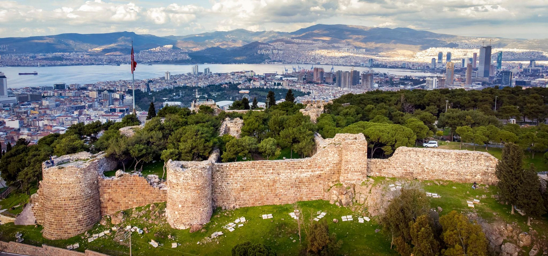
Compare the Archaic city at Bayraklı with the later Hellenistic acropolis and urban landscape around Mount Pagos.
Plan the Two Smyrnas Route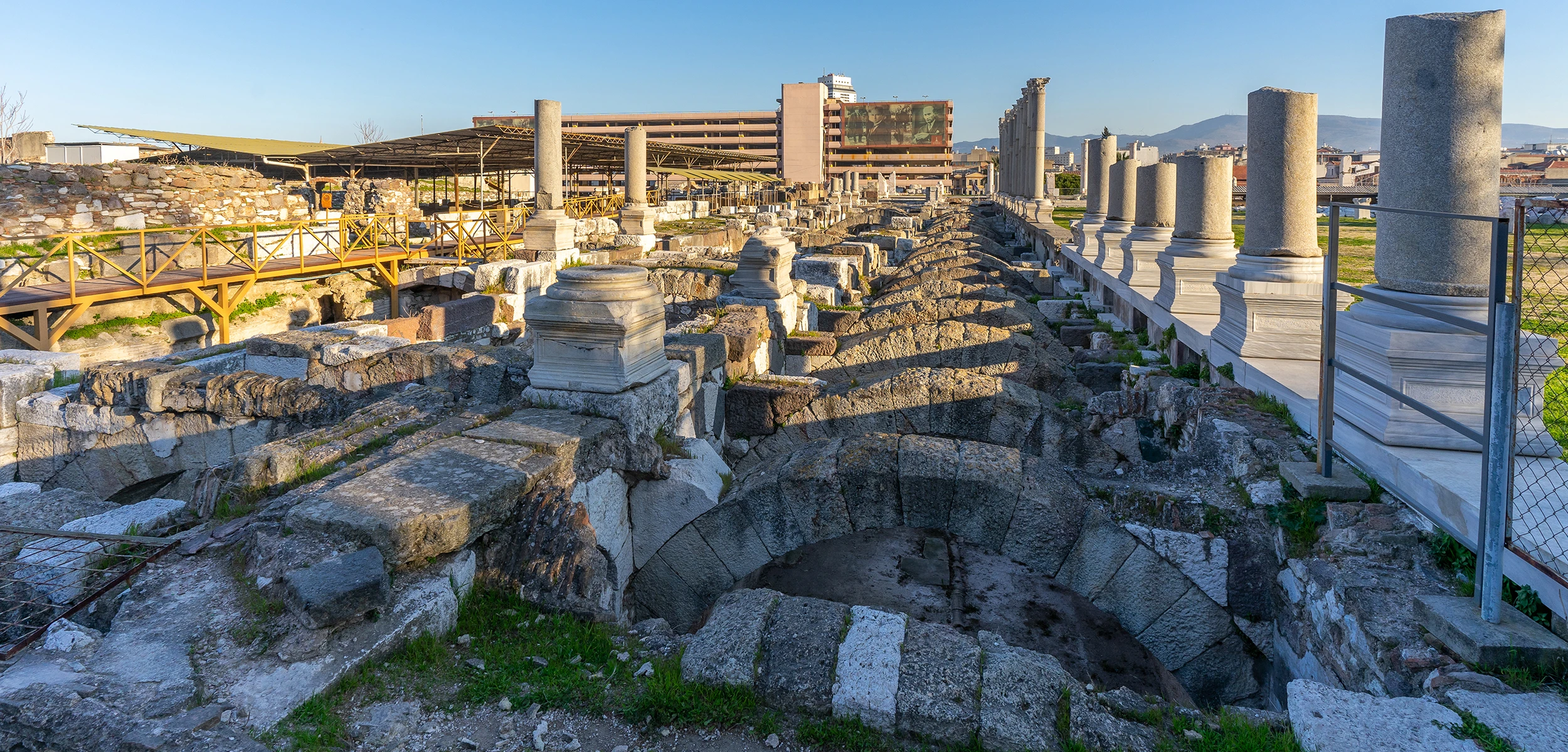
Continue from Bayraklı to Kadifekale, the Smyrna Theatre and Agora for the fullest archaeological timeline of ancient İzmir.
Explore Smyrna Ancient City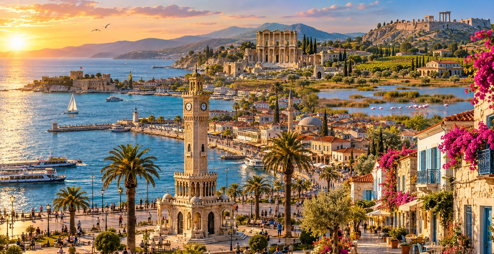
Continue with our complete İzmir guide for archaeology, historic districts, coastal destinations, food and day trips across the province.
View İzmir Guide