Private Pınarhisar & Vize Route
Ask us to design a private heritage journey focused on Byzantine fortifications, Roman archaeology, local history and the towns of eastern Kırklareli.
Request a Custom Tour





On a commanding hill at the northern edge of Pınarhisar, weathered towers and stretches of wall preserve the remains of one of Kırklareli Province's most intriguing Byzantine fortifications. The castle once extended downhill toward the present town centre, linking the upper defensive position with a wider fortified settlement.
Its precise construction date is unknown. Official local sources commonly associate the first fortress with the 5th-century Byzantine period and the reign of Emperor Theodosius II, while the surviving fabric reflects repairs, alterations and changing uses across many centuries.
Today the monument is not a complete, enclosed castle. Its remains are distributed between the northern hill and the urban area below. Two circular structures and a near-rectangular ruin survive on the upper site, while further round towers and wall fragments can still be traced in town.
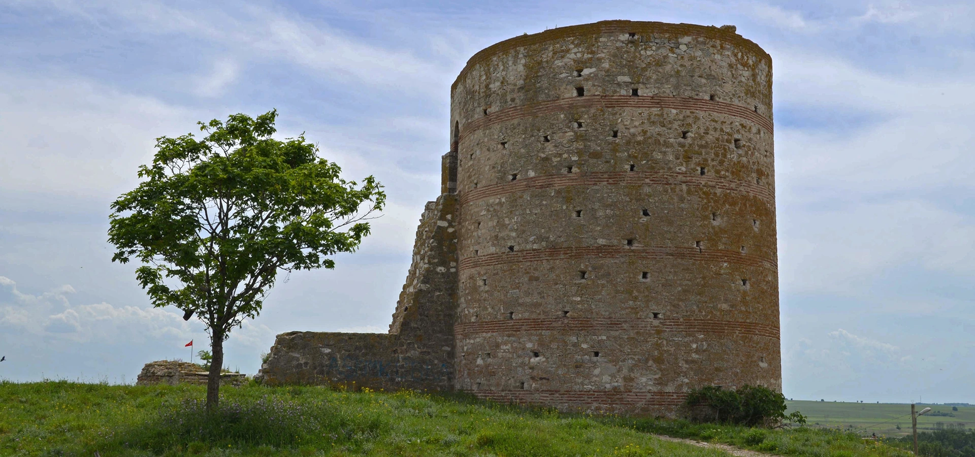
The most impressive standing tower rises to approximately 15 metres. Built of rubble stone with brick bonding courses, it retains arched openings and access points that once connected with the curtain walls. A second circular structure appears to have been adapted as a cistern, revealing how the fortress continued to evolve after its first construction.
Pınarhisar Castle is best understood as an archaeological landscape woven into a living town. It rewards visitors who slow down, look for separate fragments and imagine the former defensive line between the hill, the springs and historic Brysis.
The fortress is generally attributed to the Byzantine period, traditionally to the 5th century.
Three prominent structures survive on the northern hill and four circular towers remain in the town.
The strongest surviving circular tower dominates the upper archaeological area.
Walls and towers stand among modern streets, parks and neighbourhoods rather than inside a formal museum complex.
Essential information for exploring the surviving towers and walls of Pınarhisar's historic fortress.
Camiikebir neighbourhood and the northern hill above Pınarhisar, Kırklareli Province.
Open on Google MapsExact date unknown; generally attributed to the Byzantine period and traditionally to the 5th century.
A fragmented hill-and-town fortification with circular towers, curtain walls and a rectangular structure.
Rubble-stone masonry strengthened with brick bonding courses in important surviving sections.
A protected cultural property within a designated third-degree archaeological site.
An open-air heritage area with no standard sightseeing ticket or formal museum entrance.
The castle preserves the clearest architectural evidence of Pınarhisar's development as a fortified Byzantine settlement in inland Thrace.
Pınarhisar stood in a landscape of roads, fertile plains, water sources and approaches to the Istranca Mountains. A fortified position here could observe movement across the surrounding country while protecting the settlement that developed around the hill.
The castle is particularly valuable because its remains reveal more than a single isolated tower. The upper structures and lower urban fragments indicate a defensive system that once descended from the hill toward the centre of town. Although modern construction and centuries of stone removal have broken that system apart, its former scale can still be read across the landscape.
The strongest circular tower preserves distinctive masonry of rubble stone divided by brick courses. Arched passages show how defenders moved between the tower and adjoining walls, while the interior platform rests above a brick dome. Nearby, another round structure was lined and used as a water reservoir or cistern.
The monument also represents the continuity of Pınarhisar itself. The settlement known in Byzantine sources by forms related to Brysis later became Ottoman Bunarhisar and modern Pınarhisar, names connected with the area's abundant springs and its fortress.
Rather than presenting a reconstructed castle, the site offers something more archaeological: the chance to trace the changing relationship between defence, water, terrain and town life over many centuries.
The exact foundation date of the castle has not been established by a surviving inscription. Local official accounts commonly place its origins in the 5th century, during the reign of the Eastern Roman emperor Theodosius II. A local tradition associates its construction with a figure named Kozmos Dimitriyadis, but this attribution should be understood as tradition rather than securely proven architectural history.
The settlement grew around a place of plentiful water sources. Its Byzantine name is recorded in forms such as Brysis, Brysesis, Virisis and Verissa, all linked in local historical interpretation with the idea of springs. The fortress probably served as a regional strongpoint supporting the wider defensive and administrative network of eastern Thrace.
Medieval Pınarhisar remained connected with nearby Vize, an important Byzantine religious and political centre. Local histories describe periods of conflict and occupation, including disruption associated with Latin forces, before the settlement passed into Ottoman control in the 14th century.
Pınarhisar is traditionally said to have been taken for Sultan Murad I by Gazi Mihal in 1367. The Ottomans called the town Bunarhisar, and the fortress received repairs and adaptations during the Ottoman period. The contrast between circular Byzantine towers and a later rectangular structure may reflect this long sequence of use.
By the 17th century, Evliya Çelebi described the area's castle, water sources, gardens and local life. Over time the walls lost their defensive function, parts were dismantled or incorporated into the expanding town, and the once-connected circuit became the separate remains visible today.
Official local histories commonly associate the first fortress with the era of Theodosius II.
The historic name is linked with the springs that shaped the identity and settlement of the area.
Local tradition places the Ottoman capture in 1367 under Gazi Mihal during the reign of Murad I.
The fortress continued to be repaired and adapted after the region entered Ottoman rule.
Pınarhisar Castle is not contained within one intact circuit. The principal remains occupy two connected zones: the northern hill, where the largest towers stand in an open green area, and the town below, where surviving round bastions and sections of wall mark the course of the former fortifications.
The northern hill provided the strongest natural defensive position and a broad view over the surrounding landscape. From there, walls once continued southward into the settlement. Modern streets and buildings have interrupted this line, so the visitor must mentally reconnect fragments that now appear separate.
The official cultural inventory records three substantial remains in the northern area: a tall circular tower, a second circular structure adapted as a cistern and a near-rectangular building ruin. Four further circular towers remain to a significant degree within the town centre.
This distribution suggests a fortified settlement rather than a small freestanding watchtower. Seeing both the upper and lower remains is therefore essential for understanding the monument's original role and extent.
The elevated zone preserves the tallest circular tower, a cistern-like round ruin and a rectangular structure.
Fragments reveal that the upper fortress once connected with defences running down toward the town.
Four circular bastions survive among the streets and buildings of central Pınarhisar.
The wider protected area preserves both visible masonry and the potential for remains below ground.
The most distinctive surviving masonry combines rubble stone with horizontal brick bonding courses. This technique helped bind irregular stonework and created the striped appearance associated with many Byzantine fortifications in Thrace.
The principal circular tower on the northern hill rises to approximately 15 metres. Its arched entrance faces south, while two additional arched doorways at upper level once provided passage onto the curtain walls. The upper platform is carried above a brick dome, a remarkable structural detail that can still be understood from the surviving fabric.
About 50 metres to the south lies a lower circular ruin. Its interior is plastered and has held water, supporting its interpretation as a former tower later converted into a cistern. This adaptation illustrates how defensive buildings could be reused to meet the practical needs of the settlement.
Approximately 80 metres farther south is a near-rectangular structure measuring roughly 10 by 15 metres. Its walls are around 2 metres thick, and the surviving northern wall reaches about 10 metres. Beam sockets or bonding traces indicate that the interior once contained an upper floor.
South of the hill, other wall sections survive to lower heights. Recorded fragments include approximately 50 metres of wall with a circular tower standing to around 3 metres, and a southeastern section where wall and bastion remains reach approximately 4 metres.
Rounded bastions project from the defensive line and offered wider fields of observation and defence.
Horizontal brick bands strengthen and visually organize the rubble-stone masonry.
Doorways in the main tower connected its interior with the adjoining wall walks.
The upper level of the principal tower rests above a brick-built dome.
A second round tower appears to have been plastered internally and reused to store water.
The heavy-walled southern ruin may represent a later phase within the castle's long architectural history.
Begin with the northern hill, where the largest remains can be understood together, then continue into the town to identify surviving wall sections and towers. Because the monument is fragmented, observation and orientation are as important as the individual structures.
Study the best-preserved tower, its tall cylindrical mass and the transition between stone and brick courses.
The arched doorway gives access to the principal tower and reveals the thickness of its masonry.
Two upper arched openings show where passages once connected the tower to curtain walls on either side.
Look for the domed construction supporting the tower's upper platform.
The lower circular ruin retains internal plaster associated with its later use for water storage.
Notice the massive wall thickness and traces showing that the interior once had more than one level.
A surviving length of curtain wall and round bastion helps reconstruct the line toward the town centre.
Separate circular bastions embedded in the urban landscape reveal the fortress's former scale.
The broad view explains why the elevated northern position was chosen for defence and observation.
Relate the castle to the settlement and water-rich landscape that gave Pınarhisar its identity.
The northern section lies on an undeveloped hill overlooking Pınarhisar and is the clearest place to begin a visit. The cultural inventory records an area of approximately 40,907 square metres associated with the protected remains and surrounding parkland.
The principal circular tower is the landmark most visitors recognize. At roughly 15 metres high, it preserves enough of its original form to show the defensive relationship between tower, interior levels and curtain walls. Its masonry uses rubble stone interrupted by brick courses, while arched openings survive at both entrance and wall-walk level.
Fifty metres south, a second round ruin has a plastered interior and has contained water. It is interpreted as a tower converted into a cistern, perhaps after the surrounding fortifications no longer required the same defensive arrangement.
A further 80 metres south stands the near-rectangular ruin. Only part of the building survives to its former height, yet its approximate 10-by-15-metre plan, 2-metre-thick walls and internal floor traces make it an important contrast to the circular Byzantine towers.
The main circular tower, approximately 15 metres high, with arched openings and a domed upper platform.
A circular tower stump about 50 metres south, plastered internally and adapted as a cistern.
A near-rectangular ruin about 80 metres farther south, with massive walls and evidence of an upper floor.
The open hill gives the best sense of the fortress's relationship with the plain and modern town below.
Pınarhisar Castle is an open-air archaeological monument rather than a staffed museum. The remains are distributed between a hilltop green area and several points within the town, so there is no single indoor route, exhibition or complete circuit to follow.
Historic masonry may be unstable, and ground conditions can include grass, loose soil, slopes and uneven surfaces. Observe all barriers and local signs, keep away from unprotected edges and never enter closed structures or climb the towers.
The castle can be viewed throughout the year, but dry conditions make the grassy hill and uneven paths safer. Morning and late-afternoon light emphasize the rounded tower forms and the horizontal brick bands in the masonry.
Cooler temperatures and quieter surroundings suit a careful walk around the upper remains.
Low light can reveal the texture, openings and cylindrical form of the principal tower.
Green vegetation and mild weather make the hill especially attractive, though rain can leave slippery ground.
Comfortable temperatures are ideal for combining Pınarhisar with Vize and Kırklareli.
Allow extra care on mud, wet grass, slopes and stone surfaces.
Wind, frost or snow may make the exposed hill uncomfortable and historic surfaces hazardous.
The time required depends on whether you see only the landmark northern tower or follow the fortification line into the town centre.
Enough for the principal circular tower and a quick look at the nearby upper-castle remains.
Best for most visitors, with time to see all three northern structures and the surrounding views.
Useful for photographers and travellers tracing additional wall and tower fragments within Pınarhisar.
Combine Pınarhisar Castle with the springs of Kaynarca and the Byzantine monuments of nearby Vize.
The principal tower is the strongest visual subject, but wider views showing the hill, town and surviving structures explain the castle more completely. Photograph only from safe public ground and never use the masonry as a platform or support for equipment.
Step back to include the cylindrical tower, its arched opening and the surrounding green space.
Use side light to reveal the contrast between rubble masonry and horizontal brick bonding courses.
Frame the entrance and wall-walk openings to show the thickness and organisation of the tower.
Photograph the relationship between the main tower, cistern ruin and rectangular building across the hill.
Wider views help place the fortress above Pınarhisar and the surrounding Thracian landscape.
Do not fly without confirming current aviation rules, local restrictions and heritage-site permissions.
Pınarhisar lies on the D020 corridor east of Kırklareli city. The principal castle remains stand on the northern side of town, while additional wall and tower fragments continue toward the centre. Use live navigation to locate the upper site and avoid driving into narrow residential streets unnecessarily.
The northern tower is a short local drive or uphill walk from the central streets, depending on your starting point.
Follow the D020 east for approximately 30 kilometres toward Pınarhisar.
Pınarhisar and Vize are close enough to combine comfortably on a regional Byzantine heritage route.
Approach Pınarhisar from the south using the principal regional roads and current navigation.
The road journey is roughly 165–170 kilometres, depending on the starting point and route selected.
Regional bus services can change; confirm current schedules and local connections before travelling.
Pınarhisar stands between the cultural monuments of Kırklareli and Vize and the forests, caves and water-rich landscapes of the Istranca region.
Visit a nearby town known for its abundant springs, traditional streets and traces of a long multicultural past.
Continue to Erenler village for a local sacred site associated with the early Ottoman settlement of the district.
Compare Pınarhisar's circular towers with another important Byzantine and Ottoman fortified site in eastern Thrace.
See the only known surviving Roman theatre in Turkish Thrace and explore ancient Bizye.
Discover Byzantine, Roman and Ottoman monuments in one of Kırklareli Province's richest heritage towns.
Continue north into forest landscapes shaped by rivers, caves, wildlife and traditional villages.
Explore museums, Ottoman monuments, prehistoric sites, local food and the wider province's natural attractions.
Discover local rural culture and community memory in a village near Pınarhisar.
The principal remains stand on a hill at the northern side of Pınarhisar in Kırklareli Province. Additional towers and walls survive farther south within the town centre.
Its exact construction date is unknown. Official local sources generally attribute the first fortress to the Byzantine period, traditionally the 5th century and the reign of Theodosius II.
A local tradition associates the castle with Kozmos Dimitriyadis, described as an important figure of the Theodosian era. This should be treated as a traditional attribution because no surviving foundation inscription securely proves the builder's identity.
Yes. The fortress is accepted as Byzantine in origin, although it was repaired, adapted and reused during later centuries, including the Ottoman period.
The settlement is associated with names such as Brysis and Brysesis, with later forms including Virisis and Verissa. Local histories connect these names with the area's abundant water sources.
Local historical accounts place the Ottoman capture in 1367, when Gazi Mihal took the settlement during the reign of Sultan Murad I.
The official cultural inventory records three prominent structures on the northern hill and four circular towers in the town, along with fragmented sections of curtain wall.
The best-preserved circular tower on the northern hill rises to approximately 15 metres.
Yes. A circular ruin about 50 metres south of the principal tower has a plastered interior and is interpreted as a tower later adapted for water storage.
It is a heavy-walled ruin measuring approximately 10 by 15 metres, located south of the round structures. Its exact function and date are not certain, but internal traces indicate that it once had an upper floor.
No. It survives as separate towers, building remains and wall fragments rather than an intact enclosure. Visitors need to view several points to understand the former fortified circuit.
There is no standard sightseeing ticket because the castle is an open-air heritage area rather than a staffed museum.
The remains are normally visible outdoors, but conservation work, weather or local safety measures can change access without notice.
Allow 45–60 minutes for the principal northern remains. Add more time if you plan to identify towers and wall fragments in the town centre.
No. Do not climb, enter unstable openings or walk on historic walls. The ruins are protected, and loose masonry or unguarded drops can be dangerous.
The sloping, grassy and uneven upper area may be difficult for wheelchairs or visitors with limited mobility. Check current local conditions and consider assistance.
Nearby possibilities include Kaynarca, Erenler village, Vize Castle, Vize Ancient Theatre, Kırklareli city and the natural landscapes of the Istranca Mountains.
Yes—especially for travellers interested in Byzantine fortifications, archaeological landscapes and lesser-known historic towns in Turkish Thrace. The main tower is impressive, and the fragmented remains tell a more complex story than a single monument.
Stay off towers, wall tops, arched openings and all surviving historic masonry.
Closed sections protect both visitors and ruins; never cross fences or warning signs.
Every stone, brick and pottery fragment belongs to the protected archaeological site.
Do not dig, move soil, light fires or drive vehicles onto the archaeological area.
Some remains stand near homes and local streets; keep noise low and never enter private property.
Take all litter away and never carve, paint or attach anything to the monument.
Follow the fortified towns of eastern Thrace through Pınarhisar and Vize, combining Byzantine towers, Roman archaeology, Ottoman monuments and the landscapes of the Istranca foothills.
Combine Pınarhisar Castle with Vize Castle, the ancient theatre and historic churches or mosques on a tailor-made journey through the lesser-known archaeology of Turkish Thrace.
Ask us to design a private heritage journey focused on Byzantine fortifications, Roman archaeology, local history and the towns of eastern Kırklareli.
Request a Custom Tour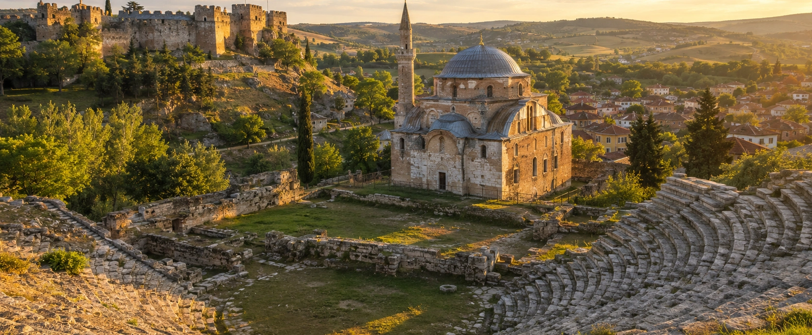
Continue to ancient Bizye for a castle, Roman theatre, Byzantine heritage and the layered history of one of Thrace's most important towns.
View Vize GuideDiscover more fortified sites, archaeology, historic towns and natural landscapes across Kırklareli Province.
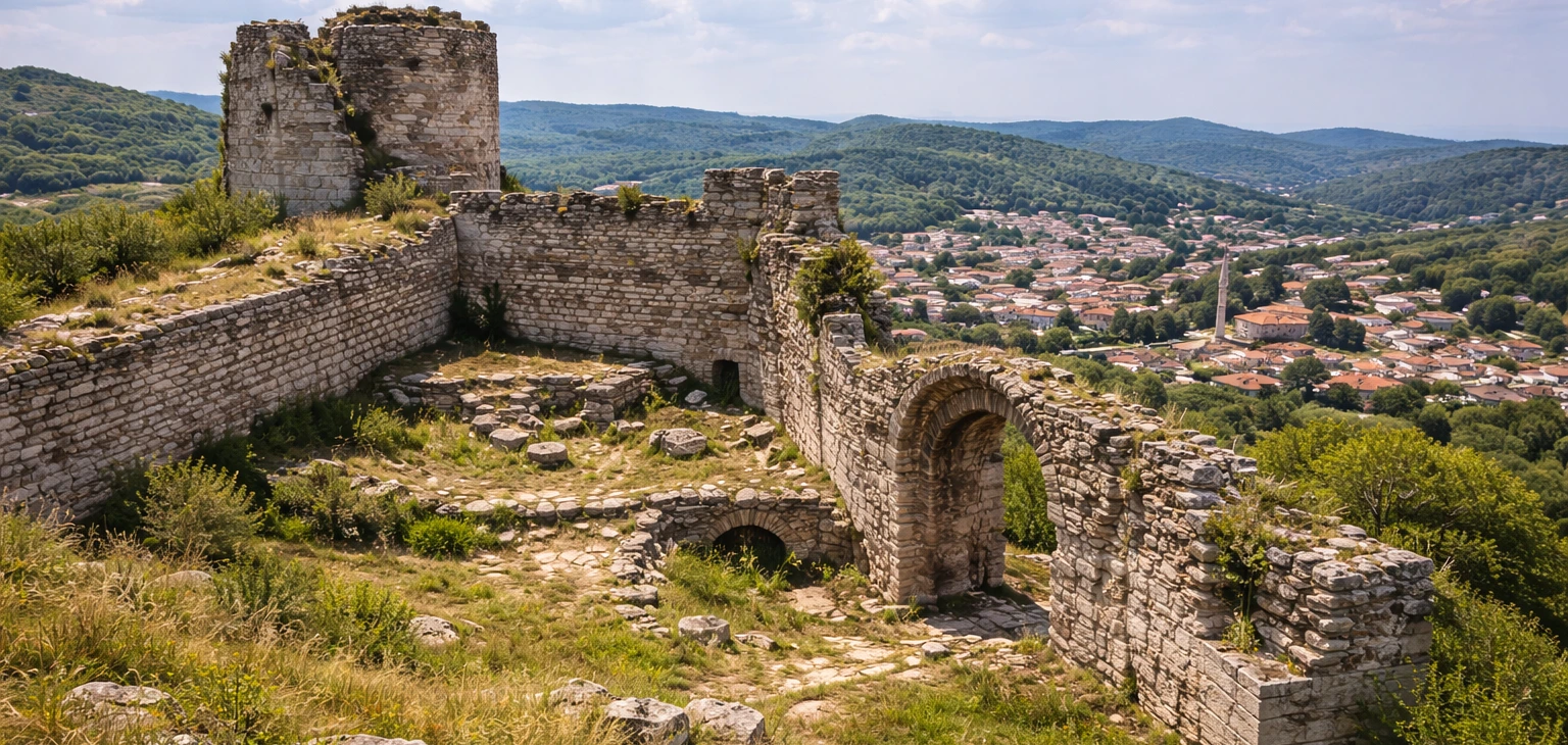
Compare Pınarhisar with Vize's surviving gates, towers and walls, shaped by Roman, Byzantine and Ottoman history.
Discover Vize Castle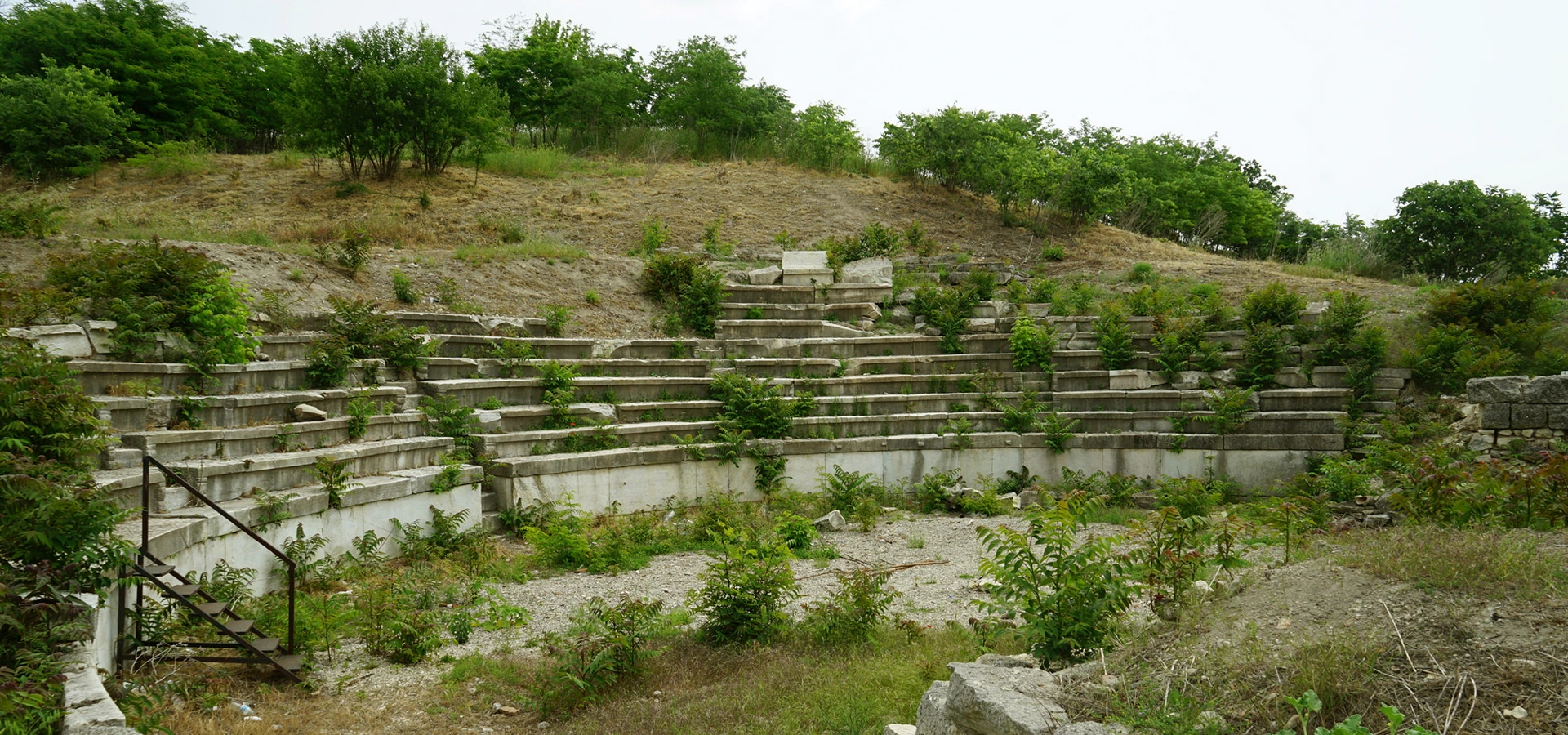
Visit Turkish Thrace's only known surviving Roman theatre and explore the archaeological story of ancient Bizye.
Discover the Theatre
Plan a wider journey through prehistoric settlements, historic towns, fortifications, forests, caves and the Black Sea coast.
View Kırklareli Guide