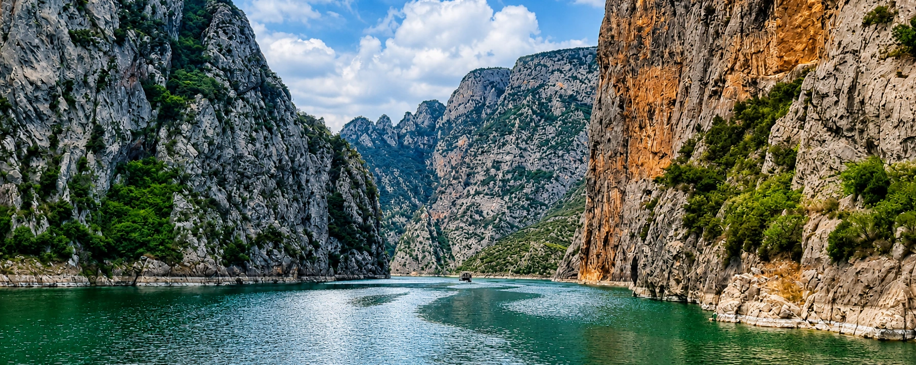
Private Şahindere Canyon & Kazdağı Experience
Ask us about a tailor-made route combining the canyon viewpoint, Altınoluk, village scenery, local food and selected Kazdağı stops.
Request a Custom Tour





On the southern face of Kazdağı — ancient Mount Ida — one of the mountain's deepest natural corridors cuts from the forested interior toward the Edremit Gulf. Şahindere Canyon, also written locally as Şahinderesi Kanyonu, lies immediately behind Altınoluk in the Edremit district of Balıkesir and forms part of the protected landscape of Kazdağı National Park.
Türkiye's official Culture Portal describes Şahindere as an approximately 27-kilometre-long canyon within the national park, with a sightseeing route running at an average elevation of around 600 metres. The canyon is not simply a narrow stream gorge. It is a large north–south valley system carved into the steep southern flank of Kazdağı, connecting higher forest country with the hot coastal plain around Altınoluk.
For most travellers, the easiest way to understand the scale of the canyon is from the Şahindere Canyon Glass Observation Terrace. Built at approximately 836 metres above sea level, the terrace looks across forested slopes and the canyon toward the Edremit Gulf. Official national-park information places the viewpoint near the Ayı Kapısı entrance control point, reached from the Doyran side of the mountain.
Şahindere also has an unusual place in local climate folklore. Tourism publications have long described the canyon as a natural air corridor or “chimney”, carrying cool forest air toward Altınoluk and helping coastal air move upslope. Claims that the area has the world's “second-highest oxygen level after the Alps” are repeated in older promotional material, but they should not be treated as a scientifically established global ranking. What visitors can genuinely experience is the striking transition from hot Aegean coast to shaded mountain air within a very short distance.
Türkiye's official Culture Portal identifies Şahindere as an approximately 27-kilometre canyon within Kazdağı National Park.
The glass observation terrace stands at roughly 836 metres above sea level and opens across the canyon, forest and gulf.
The canyon belongs to one of north-western Türkiye's most important protected mountain ecosystems.
Şahindere rises directly behind the northern Aegean resort of Altınoluk, creating a dramatic mountain-to-sea landscape.
Essential information for planning a visit to the canyon and glass observation terrace above Altınoluk.
Above Altınoluk in the Edremit district of Balıkesir, on the southern slopes of Kazdağı.
Şahindere Canyon lies within Kazdağı National Park.
Approximately 27 kilometres according to Türkiye's official Culture Portal.
The Şahindere Canyon Glass Observation Terrace is at roughly 836 metres above sea level.
Panoramic canyon and Edremit Gulf views from the glass observation terrace and permitted national-park routes.
Official park information describes nature walks from controlled entrances as activities carried out with an area guide.
Steep gorge, forested slopes, mountain streams, high viewpoints and views toward the northern Aegean coast.
Local tourism literature describes the canyon as an important natural corridor for air movement between Kazdağı and the coast.
The glass terrace is reached from the Doyran / Ayı Kapısı side; other national-park routes use separate controlled entrances.
National-park or viewpoint fees and operating arrangements can change; check the current tariff before travelling.
Allow around 1.5–2.5 hours for the viewpoint, short permitted walks, photography and the mountain drive.
Spring and autumn for walking and visibility; summer for cooler mountain air, subject to seasonal fire restrictions.
Şahindere combines scale, forest, geology and sweeping coastal views in a way that feels completely different from the beaches only a few kilometres below.
The first reason to visit is scale. Şahindere is not a short roadside ravine. Official tourism information describes a canyon system extending for roughly 27 kilometres through the southern Kazdağı massif. From the upper slopes, the gorge appears as a vast wooded incision running toward Altınoluk and the Edremit Gulf.
The second reason is the glass observation terrace. Many visitors do not have the time, equipment or permission arrangements for a demanding mountain hike. The terrace provides a relatively straightforward way to experience the depth of the landscape from an elevated position without entering the canyon floor.
The third reason is the extraordinary contrast between coast and mountain. Altınoluk is associated with beaches, olive groves and summer heat; only a short drive inland, the road climbs into dense forest and much cooler air. Looking back from the canyon toward the sea makes the geography of the Edremit Gulf immediately understandable.
Finally, Şahindere belongs to the wider cultural and ecological world of Mount Ida. Antandros Ancient City, Doyran, Altınoluk, the Kazdağı forests and the ancient mythology of Ida all lie within the same landscape. A canyon visit therefore works best not as an isolated photo stop, but as part of a day exploring how mountain, archaeology, villages and Aegean coast fit together.
Şahindere Canyon is in the Edremit district of Balıkesir Province, within Kazdağı National Park and directly north of Altınoluk. The canyon cuts through the steep southern slopes of the Kazdağı massif before opening toward the Edremit Gulf.
The lower course of Şahindere reaches the plain close to Altınoluk. Provincial tourism information identifies Bent, about 2 kilometres east of Altınoluk, as the point where Şahindere comes out onto flatter ground. The mountain experience, however, lies higher inside and around the protected national-park landscape.
For the glass observation terrace, official national-park information directs visitors from the Altınoluk–Güre / Çanakkale–İzmir road toward Doyran. The terrace lies approximately 8 kilometres from Doyran and shares its location with the Ayı Kapısı national-park entrance control point.
One reason visitors become confused about Şahindere is that the name is used for several related experiences: the canyon itself, the Şahindere stream corridor, lower recreation areas near Altınoluk and the much higher glass observation terrace inside Kazdağı National Park.
The large geomorphological valley system cutting north–south through the southern Kazdağı massif, officially described as approximately 27 km long.
Water draining from the mountain follows the gorge toward the coastal plain and eventually the Edremit Gulf.
A developed high-level viewpoint at about 836 m elevation, designed to reveal the canyon's scale without requiring a canyon-floor trek.
Controlled forest routes around the canyon offer deeper exploration, with official guidance describing nature walks with authorised area guides.
For a first visit, think of Şahindere as a landscape rather than a single attraction. The glass terrace gives the broadest overview, while the road from the coast reveals how rapidly altitude, vegetation and temperature change as you climb into Kazdağı.
Kazdağı is a geologically complex mountain massif built from ancient metamorphic rocks together with younger geological units. Academic studies describe the southern slopes as strongly fractured and deeply dissected by streams including Şahindere, Manastır Çayı, Kızılkeçili Çayı and Zeytinli Çayı.
The key to Şahindere's dramatic form is the combination of steep relief and persistent water erosion. Rainfall and mountain springs feed streams that descend sharply toward the Edremit Gulf. Over long periods, flowing water exploited fractures and weaker zones in the rock, cutting downward while slope processes widened and reshaped the valley walls.
The result is not a perfectly uniform slot canyon. Şahindere alternates between narrow rocky sections, wider forested slopes, tributary gullies and high ridges. From the observation terrace, this larger geomorphological structure is easier to appreciate than from any single point near the stream.
Kazdağı's south-facing valleys are also important because they create numerous microclimates. Elevation, shade, moisture, wind exposure and the orientation of the gorge can produce noticeably different conditions over short distances, helping explain the mountain's remarkable biodiversity.
The Şahindere Canyon Glass Observation Terrace has become the canyon's most accessible signature viewpoint. Balıkesir Metropolitan Municipality information places the terrace at approximately 836 metres elevation, high above the forested gorge.
The project was developed through cooperation involving the Ministry of Agriculture and Forestry, Balıkesir Metropolitan Municipality, the South Marmara Development Agency and the General Directorate of Nature Conservation and National Parks. Its purpose is straightforward: allow visitors to experience the canyon's scale while concentrating foot traffic at a managed viewpoint rather than dispersing people across sensitive slopes.
Official national-park information states that the terrace is reached from the Doyran / Ayı Kapısı approach and that a kiosk operates in the area for basic day-use food and drink needs. Facilities and opening arrangements can change seasonally, so do not build a tightly timed itinerary around old social-media information.
Approximately 836 metres above sea level.
Forested canyon slopes, Kazdağı ridges and, in suitable visibility, the Edremit Gulf and northern Aegean coast.
The viewpoint is associated with the Ayı Kapısı entrance control point on the Doyran side of the park.
Official park information lists a kiosk for basic refreshments; services may vary by season and management.
For decades, travel literature about Altınoluk has repeated a striking claim: that the Şahindere area has exceptionally high oxygen levels, sometimes described as “second in the world after the Alps” or among the world's top few locations. The claim even appears in older official local tourism publications.
It is better not to present that ranking as established scientific fact. The official promotional sources that repeat it do not provide a modern, standardised global measurement study comparing Şahindere with every other mountain region. Atmospheric oxygen concentration at ordinary elevations does not vary between tourist destinations in the simple way such rankings imply.
There is, however, a more meaningful physical observation behind the story. Edremit Municipality tourism material describes Şahindere as a natural air-circulation corridor: the canyon channels cooler forest air downslope toward Altınoluk while coastal air moves inland and upward. Combined with forest shade, elevation and the rapid escape from summer coastal heat, this produces the fresh-air sensation for which Altınoluk is famous.
So the best way to describe the experience is simple: Şahindere is an important mountain-to-sea ventilation corridor with a noticeably cool, forested microclimate. Enjoy the clean-air reputation, but treat numerical world rankings as local tourism tradition rather than verified atmospheric science.
Kazdağı National Park was declared on 17 April 1993 and protects roughly 21,450 hectares of the southern Kazdağı massif. Official sources identify its principal values as biodiversity, forest and water ecosystems, geomorphology, geology, scenery and cultural heritage.
Şahindere is one of the clearest expressions of the park's geomorphology. The national park's south-facing slopes are cut by a series of deep valleys and canyons running toward the Edremit Gulf, creating strong changes in elevation, moisture, sunlight and habitat over comparatively short distances.
National-park access is controlled for conservation and safety. The Ministry's ecotourism information describes area-guide accompanied nature walks from the principal park entry points and identifies the Şahindere glass terrace as one of the managed visitor facilities. That distinction matters: seeing the glass terrace is not the same thing as independently setting off on an unrestricted cross-country hike.
Visitors should always follow the current entrance system, signs and seasonal restrictions. Kazdağı is a protected mountain environment, not an open-access recreational forest where every visible track is automatically a public walking route.
Kazdağı's biodiversity is one of the principal reasons the mountain has national-park protection. Ministry information records approximately 1,000 plant taxa across Kazdağı and identifies 32 taxa endemic specifically to Kazdağı, in addition to many wider Turkish endemics and locally restricted species.
The canyon landscape helps create this diversity. North- and south-facing slopes receive different amounts of sunlight; sheltered gullies retain moisture; exposed ridges are hotter and drier; elevation changes rapidly; and streams create cool linear habitats through the forest.
Among the wider mountain's best-known plants is the Kazdağı fir, together with species such as Kazdağı tea and locally distinctive herbaceous plants. Not every emblematic Kazdağı species should be expected immediately beside the glass terrace, because vegetation changes significantly by altitude and location.
Wildlife is part of the same protected system. Observe animals quietly, avoid feeding them and do not collect plants, branches, stones or other natural material. In a national park, the landscape is not simply scenery; it is habitat.
The most direct panoramic experience of the gorge and the best first stop for understanding its scale.
Look along the long north–south incision of the valley rather than focusing only on the platform beneath your feet.
In clear weather, the mountain-to-sea relationship becomes one of the strongest elements of the panorama.
Observe how vegetation changes between exposed ridges, shaded gullies and stream-fed sections.
Broken and steep rock faces reveal the structural complexity that helped guide water erosion through the massif.
Şahindere belongs to a wider network of springs and streams draining Kazdağı toward the coast.
The approach road adds village and agricultural scenery to the forest experience before reaching the higher viewpoint.
Seeing the coast from above makes clear how abruptly Kazdağı rises behind the resort strip.
Cloud shadow and late-day light move dramatically across the canyon, constantly changing the apparent depth of the slopes.
Step away from conversation for a few minutes and listen to wind, insects, birds and distant water.
Use the terrace to read the canyon as a landform created by water cutting into a steep, fractured mountain front.
Remember that the gorge belongs to ancient Ida, a mountain landscape that has shaped mythology, settlement and travel for millennia.
There is an important difference between visiting the glass terrace and trekking in the Şahindere landscape. The viewpoint is a developed visitor facility. Deeper walking routes enter a protected mountain environment with steep terrain, changing weather, forest roads, stream crossings and seasonal restrictions.
Official Kazdağı National Park information states that nature walks from controlled park entrances are conducted with an area guide. For travellers interested in a genuine Şahindere trek rather than a viewpoint stop, the correct approach is therefore to arrange the route through current national-park procedures or a properly authorised local operator.
Do not assume that a GPS track downloaded from a hiking website proves a route is currently open. A track may cross areas closed for fire prevention, conservation, forestry operations or safety. National-park rules always take priority over an old route file.
If your goal is simply to experience the canyon without a demanding trek, the glass terrace and permitted short walking areas are enough. If your goal is to enter the mountain interior, treat it as a separate activity requiring more preparation.
A normal visit to the developed observation terrace does not require hiring a private tour guide simply to stand at the viewpoint, subject to current entrance rules.
Ministry visitor information describes nature walks inside controlled sections of Kazdağı National Park as taking place with an authorised area guide.
Official information also refers to safari activities through approved private operators from designated park entrances.
If you plan to go beyond the developed viewpoint, confirm the current route and guide requirements before setting out.
This system protects both visitors and the park. Kazdağı contains difficult terrain, sensitive habitats and routes that may close temporarily. An authorised local guide can also explain the vegetation, water systems and geography that are easy to miss when simply following a track.
The glass terrace makes Şahindere look easily accessible, but the wider canyon is serious mountain terrain. Steep slopes, loose stone, sudden drops, heat exposure, cold shaded gullies and variable mobile coverage can all become important away from the developed visitor area.
Never climb beyond railings or safety barriers for a photograph; the canyon edges are not forgiving.
Fire-prevention and conservation closures are legal safety measures, not suggestions.
Use shoes with reliable grip if you plan to walk beyond the immediate terrace area.
Even when the mountain air feels cooler, summer sun and dry wind can cause dehydration quickly.
Mountain conditions can differ from the coast, and cloud, wind or storms can reduce visibility and comfort.
Navigation apps do not know whether a national-park route is legally open or safe on the day you visit.
Şahindere's glass terrace is a managed visitor facility within Kazdağı National Park. Entrance arrangements, tariffs and operating hours can change with national-park policy, local management and season.
Avoid copying an entrance price from an old blog or social-media post. If a precise fee matters to your plans, confirm the current tariff shortly before travelling. The same applies to kiosk hours and any seasonal vehicle-access rules.
Summer fire measures are particularly important. In 2026, authorities restricted public access to large areas of Kazdağı National Park from 15 June to 30 September, while specifically keeping the Şahindere Canyon Glass Observation Terrace open as one of the exempt visitor areas. That exemption is useful for 2026 visitors, but it should not be assumed to apply unchanged in future years.
Cool, changeable weather and fresh vegetation; excellent for atmosphere, though rain can make mountain roads and paths more demanding.
One of the best periods for green forest, comfortable temperatures, long daylight and generally good hiking conditions.
The canyon provides a refreshing contrast to coastal heat, but summer fire restrictions can limit access beyond designated visitor areas.
Warm coast, cooler mountain and often clearer air; check ongoing seasonal restrictions before choosing a deeper route.
Excellent for quieter roads, autumn colour, photography and comfortable daytime exploration.
Atmospheric but less predictable; rain, wind, cold, fog and mountain road conditions require more flexibility.
For most visitors, May, early June, late September and October provide the best balance of pleasant temperatures, forest scenery and manageable visitor numbers. In midsummer, the glass terrace can still be an excellent choice precisely because it is much cooler than the coast below.
Morning is usually the easiest choice for a relaxed visit. Roads are quieter, summer temperatures are lower and haze over the Edremit Gulf can be less developed than later in the day.
Late afternoon can be visually spectacular. Lower-angle light reveals the shape of ridges and gullies, and the coast often takes on warmer colours. However, allow enough time for the mountain drive back before darkness, especially if you are unfamiliar with the road.
Midday is perfectly workable in summer because elevation and forest create relief from coastal heat, but overhead sun can flatten the canyon's visual depth and increase glare on the glass terrace.
After rain or on partly cloudy days, moving cloud shadow can produce some of the best photographs of the canyon. If cloud descends onto the mountain, however, the long-distance gulf view may disappear completely.
Leave the coastal corridor and climb toward the Kazdağı foothills, following current signs for Doyran, the national park and Şahindere Canyon Glass Observation Terrace.
Drive west along the Edremit Gulf toward Altınoluk, then turn inland for the Doyran / Şahindere approach.
Continue west toward Güre and Altınoluk before taking the mountain road toward the canyon viewpoint.
Official national-park information places the glass terrace approximately 8 km from the Doyran side of the Altınoluk–Güre corridor.
The most practical option for most independent visitors and especially useful if combining the canyon with Altınoluk, Antandros or another Kazdağı stop.
Do not assume frequent public transport reaches the upper viewpoint; check current local transport or arrange a taxi/private transfer from the coast.
Save offline directions before leaving the coast and follow official signs rather than blindly accepting the shortest navigation-app route. Forest roads can be seasonally restricted, rough or inappropriate for ordinary vehicles even when a map app displays them as through-roads.
Enough for a quick glass-terrace visit and several photographs if you are already driving through the area.
A comfortable minimum for the viewpoint, short permitted walks and time to absorb the landscape.
Recommended for most visitors once the mountain approach, viewpoints, photography and a relaxed break are included.
Combine Şahindere with Altınoluk, Doyran, a village stop or Antandros Ancient City.
Add Antandros, another Kazdağı nature stop, local food and an Edremit Gulf sunset.
Treat any guided national-park walking route as a separate activity whose duration depends on the authorised route and current conditions.
Include people, the terrace edge or distant ridges in some frames so the canyon does not look visually flat.
Telephoto compositions compress successive forested slopes and create a powerful sense of depth.
Wide-angle photographs that connect the canyon with the Edremit Gulf explain Şahindere's geography better than isolated forest shots.
Move the camera close to the glass and change angle to reduce unwanted reflections from the observation platform.
Earlier hours often offer cleaner long-distance visibility before coastal haze becomes stronger.
Afternoon side-light can reveal the folds and gullies of the canyon far better than harsh midday sun.
Never climb over barriers or leave an open route simply to improve a photograph. Şahindere's strongest images come from understanding the vast landscape, not from standing dangerously close to an unprotected edge.
The glass observation terrace makes Şahindere much more accessible to families than a conventional canyon trek. Children can experience a dramatic mountain landscape without completing a long hike, and the viewpoint gives an immediate sense of height, forest and geography.
Young children should nevertheless remain closely supervised around viewing edges, parking areas and any uneven paths. Strong wind and sudden weather changes can also make conditions feel more demanding than on the coast.
Detailed, current official information about complete step-free accessibility is not consistently published. The main terrace is a developed facility, but approach surfaces, gradients and ancillary paths may still matter for wheelchair users or travellers with limited mobility.
If accessibility is essential, confirm current conditions before travelling rather than assuming every part of the site is step-free because the main platform is modern.
Carry out bottles, food packaging, wipes, cigarette ends and every other item you bring into the mountain.
Summer restrictions are essential in Kazdağı; never light open flames outside explicitly permitted areas and periods.
Do not bypass gates, ropes or closure signs because an old map shows a path continuing beyond them.
Do not collect endemic plants, wildflowers, branches or other natural material.
Human food changes animal behaviour and damages natural feeding patterns.
Amplified music and shouting undermine the nature experience and disturb wildlife.
For deeper trekking, follow current national-park procedures and guide requirements.
Buying food or regional products from legitimate local businesses helps spread tourism benefits beyond the viewpoint itself.
Morning usually means cooler weather, quieter roads and better long-distance visibility.
The upper canyon can feel substantially cooler and windier than Altınoluk even on a hot day.
Choose proper shoes if you plan to walk beyond the immediate developed platform.
Do not rely completely on the kiosk, especially outside the busiest season.
Mountain mobile coverage can vary, so save your route before leaving the coast.
A viewpoint can remain open while surrounding forest routes are closed.
Entrance tariffs and opening arrangements change; verify current information close to your visit.
Enjoy Şahindere's fresh microclimate, but treat global “second-highest oxygen” claims as promotional tradition rather than proven science.
The canyon's natural coastal base, with beaches, old settlement areas, olive culture and direct views toward Kazdağı.
A mountain-side settlement on the approach to the glass terrace and part of the transition between olive country and higher forest.
An important archaeological site beneath ancient Mount Ida, especially known for Roman domestic remains and mosaics.
A popular Kazdağı day-use area around cool mountain spring water and forest shade.
A waterfall and natural rock pool near Zeytinli combining Kazdağı water scenery with one of the region's best-known legends.
A historic settlement associated with thermal waters, olive landscapes and easy access to the southern Kazdağı foothills.
A village strongly associated with Turkmen/Yörük culture and one of the most interesting cultural stops around Kazdağı.
A scenic stream landscape west of Altınoluk with old bridge remains, pools and waterfall scenery near the Balıkesir–Çanakkale border.
Explore other currently permitted viewpoints, waterfalls, day-use areas and guided mountain routes across the protected massif.
Combine the canyon with ancient archaeology and the coast for the most coherent half- or full-day route.
Continue west along the northern Aegean toward ancient Assos, stone village streets and dramatic sea views.
Head south for historic stone neighbourhoods, former churches, island scenery and one of Türkiye's great olive-oil landscapes.
Explore Güre, Zeytinli and smaller mountain settlements where olive culture meets the lower Kazdağı slopes.
For a very different provincial experience, visit Ottoman monuments, Kuva-yı Milliye heritage and the inland city centre.
Şahindere sits between the mountain food traditions of Kazdağı and the olive-and-seafood culture of the Edremit Gulf. A good meal after the canyon should reflect that transition.
Local extra-virgin olive oil is the defining flavour of the gulf; look for simple dishes where the oil is allowed to dominate.
Seasonal Aegean herbs and greens may be served boiled, sautéed or dressed with olive oil and lemon.
Balıkesir's strong dairy tradition makes village breakfasts and cheese plates especially worthwhile.
Honey and other forest products are commonly associated with the villages around Kazdağı.
Back on the coast, Altınoluk and the wider Edremit Gulf provide a natural shift from mountain food to Aegean seafood.
Balıkesir's best-known cheese-based dessert makes a fitting regional finish to the day.
It is above Altınoluk in the Edremit district of Balıkesir, within Kazdağı National Park on the southern slopes of Mount Ida.
Yes. Türkiye's official Culture Portal and national-park sources identify Şahindere Canyon as part of Kazdağı National Park.
The official Culture Portal describes it as approximately 27 kilometres long.
Balıkesir Metropolitan Municipality and Anadolu Agency sources describe the terrace as being at approximately 836 metres elevation.
Do not confuse route elevation with canyon depth. Official tourism information refers to a sightseeing route averaging around 600 metres in elevation; it does not establish a uniform 600-metre vertical canyon depth.
Yes. The terrace is a developed visitor facility reached by road, so you can experience the canyon panorama without completing a long trek.
Not simply to visit the developed glass terrace under normal operating conditions. For deeper nature walks inside controlled national-park routes, official information describes activities with an authorised area guide.
Do not assume every mapped track is open for independent use. Confirm current national-park route and guide requirements before entering the mountain interior.
For most travellers, driving from Altınoluk toward Doyran and the Ayı Kapısı / glass observation terrace approach is the simplest option.
Official national-park information places the terrace approximately 8 kilometres from Doyran.
A national-park or viewpoint tariff can apply. Fees can change, so check the current rate rather than relying on old blog posts.
Operating hours can vary by season and management. Confirm current information if you intend to arrive very early or late.
Official Ministry information lists a kiosk at the glass observation terrace, although opening days and services may vary seasonally.
The claim is repeated in older local tourism material, but it is not presented with a modern standardised global scientific comparison. It is safer to describe Şahindere as a cool, forested air corridor rather than repeat the ranking as proven fact.
Local tourism literature describes Şahindere as a natural corridor that helps circulate air between the Kazdağı forests and the Edremit Gulf, while elevation and forest shade also reduce heat.
May, early June, late September and October usually provide an excellent balance of green scenery, comfortable temperatures and good visibility.
Yes, and the higher elevation can be a welcome escape from coastal heat. However, summer fire-prevention restrictions may close surrounding forest routes.
The glass observation terrace was specifically exempt from the wider Kazdağı National Park restrictions running from 15 June to 30 September 2026. This did not mean every surrounding forest route was open.
Morning is excellent for cooler conditions and clearer long-distance views; late afternoon is often best for dramatic side-light across the ridges.
Allow around 1.5–2.5 hours for a relaxed glass-terrace visit, short permitted walking and photography, excluding the drive from the coast.
Yes for a supervised viewpoint visit. Keep children close around edges, parking areas and uneven mountain surfaces.
The transparent sections and exposed panorama can feel intense. Visitors uncomfortable with heights can still enjoy the surrounding mountain scenery without spending long on the outer glass sections.
The terrace is a developed facility, but complete current step-free accessibility information is not consistently published. Confirm approach gradients and surfaces before travelling if accessibility is essential.
Not for a simple viewpoint stop, but shoes with good grip are advisable for any permitted walking on natural or uneven surfaces.
Do not assume recreational drone flight is permitted inside a national park. Check current protected-area, aviation and local management rules before flying.
Altınoluk, Doyran, Antandros Ancient City, Pınarbaşı, Sütüven–Hasanboğuldu, Güre, Tahtakuşlar and Mıhlı Stream are all natural additions.
Yes. An early canyon visit followed by Antandros and lunch or sunset in Altınoluk makes one of the strongest full-day combinations in the area.
Definitely. The glass observation terrace exists precisely to provide a dramatic experience of the canyon and Kazdağı landscape without requiring a difficult mountain trek.
Sütüven and Hasanboğuldu are intimate stream-and-waterfall experiences. Şahindere is primarily about canyon scale, elevation, forested mountain geography and panoramic views toward the Edremit Gulf.
A private route can combine Şahindere Canyon with Altınoluk, Antandros, Kazdağı villages, waterfalls and local food for a much richer day than a simple viewpoint stop.
Tell us whether your priority is canyon scenery, easy nature walks, mythology, archaeology, village life, photography or food, and we can shape a private Edremit Gulf itinerary around your available time.
Ask us about a tailor-made route combining the canyon viewpoint, Altınoluk, village scenery, local food and selected Kazdağı stops.
Request a Custom Tour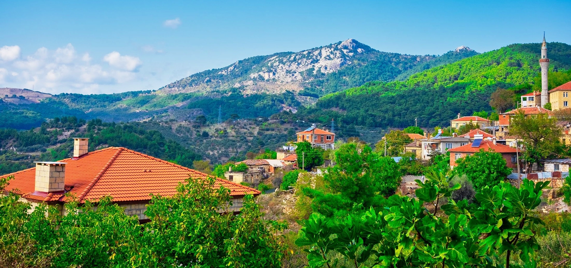
Explore the wider protected mountain through its mythology, biodiversity, waterfalls, villages, viewpoints and canyon systems.
View Kazdağı National Park Guide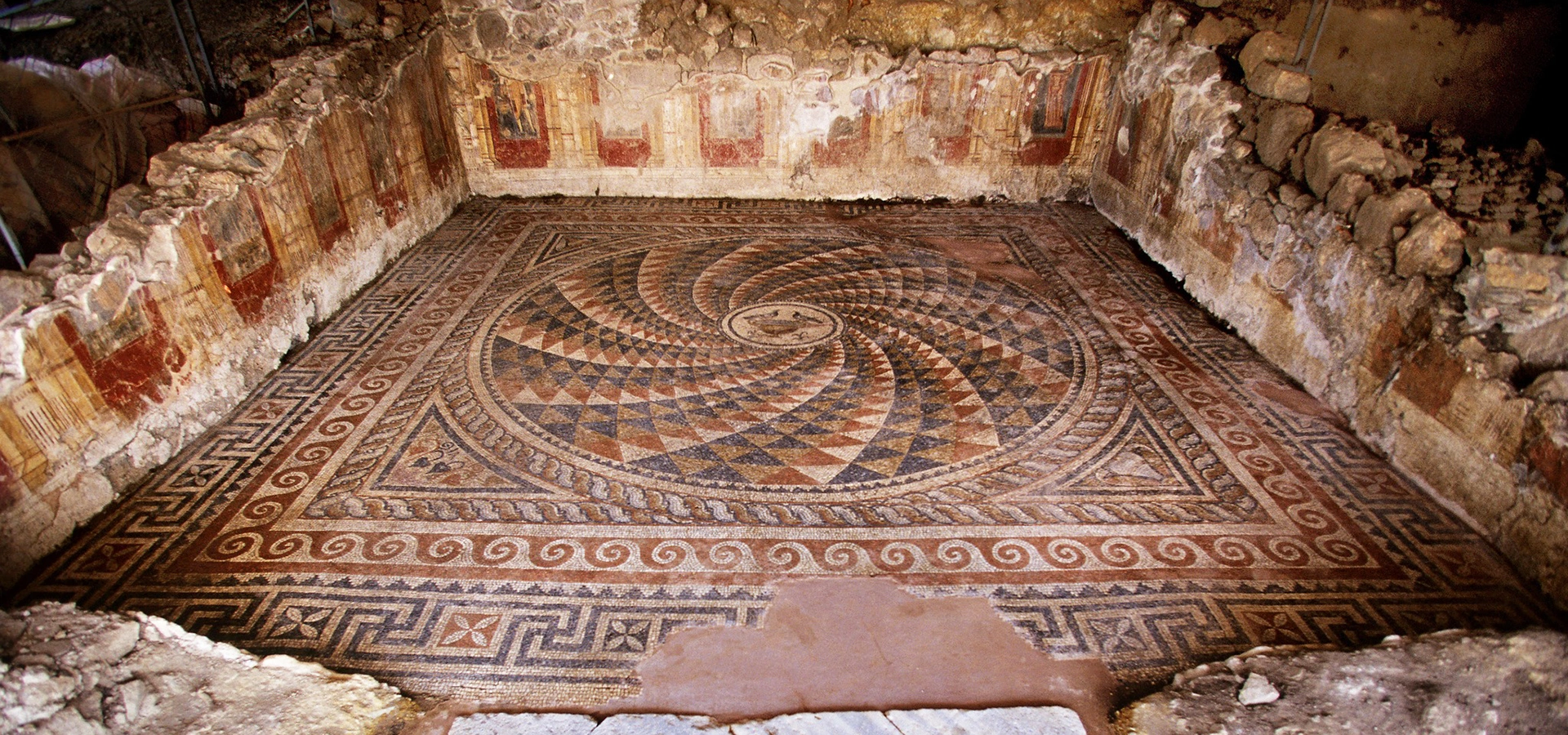
Continue from the natural geography of Mount Ida to Roman villas, mosaics and the archaeology of ancient Antandros.
View Antandros Guide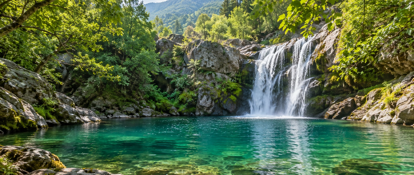
Pair Şahindere's huge canyon panorama with Kazdağı's most famous waterfall, forest pool and local love legend.
View Sütüven & Hasanboğuldu Guide