Private Klazomenai & Liman Tepe Archaeology Tour
Explore prehistoric Liman Tepe, Ionian Klazomenai, the ancient olive-oil workshop and the maritime landscape with a private historical focus.
Request a Klazomenai Tour





Klazomenai, one of the historic cities of Ionia, lies in the İskele neighbourhood of Urla on the southern shore of the Gulf of İzmir. At first glance the site can seem quieter than Ephesus or Pergamon, but its archaeology tells an unusually broad story: prehistoric maritime networks, Early Bronze Age urbanism, an Archaic Ionian city, large-scale olive-oil production, painted terracotta sarcophagi, Persian conquest, island settlement and underwater harbour archaeology.
The deepest part of that story belongs to Liman Tepe, the prehistoric settlement occupying the same coastal landscape. Archaeological research has revealed occupation stretching back thousands of years before the classical city, including Bronze Age fortifications, substantial architecture and evidence for strong contacts across the Aegean. Liman Tepe is one of the key sites for understanding how western Anatolia became connected to island and maritime worlds long before the famous Ionian poleis emerged.
The best-known monument for visitors today is the Klazomenai Olive Oil Workshop. Dating to the 6th century BCE and reconstructed on its archaeological footprint, it provides rare physical evidence for organised oil production on a scale larger than ordinary household processing. Together with ceramic kilns, metalworking evidence and transport amphorae, it reveals Klazomenai as a city of production and trade as much as philosophy and art.
Klazomenai was also the homeland of the philosopher Anaxagoras, while its decorated terracotta sarcophagi became some of the most distinctive funerary artworks of Archaic Ionia. For travellers exploring Urla, the site offers an exceptional opportunity to connect archaeology with the living olive culture, coastline and maritime identity of the peninsula.
See one of Anatolia's earliest known large-scale olive-oil production installations, reconstructed on its original archaeological setting.
Discover the prehistoric harbour settlement that reveals deep connections between western Anatolia, the Aegean islands and the wider eastern Mediterranean.
Trace an ancient city shaped by fortifications, workshops, necropoleis, Persian conquest, maritime trade and movement between mainland and island.
Meet the intellectual and artistic legacy of a city famous for philosophy and elaborately decorated terracotta funerary monuments.
Essential information for understanding this multi-layered archaeological landscape before you explore ancient workshops, settlement remains and Urla's historic coast.
İskele, Urla, on the southern shore of the Gulf of İzmir in western Türkiye.
Ionia, on the northern side of the Urla–Çeşme Peninsula.
Liman Tepe preserves occupation extending back into the prehistoric millennia, long before the Iron Age city of Klazomenai.
Klazomenai was counted among the twelve cities traditionally associated with the Ionian League.
The reconstructed 6th-century BCE olive-oil workshop, one of the most important industrial archaeology remains in ancient Ionia.
Liman Tepe and Klazomenai preserve evidence for prehistoric seafaring and later Archaic and Classical harbour installations.
Anaxagoras, the influential 5th-century BCE philosopher later associated with Athens.
Painted terracotta Klazomenian sarcophagi, among the most distinctive funerary artworks of Archaic western Anatolia.
From the early 5th century BCE much of the population lived on today's Karantina Island.
The official Turkish Museums listing currently shows entry to Klazomenai Archaeological Site as free.
Allow about 1–2 hours for the main archaeological site, longer if you explore the wider İskele and Karantina landscape.
Combine Klazomenai with Urla İskele, Urla town centre, local olive culture and the peninsula's coastal heritage.
Klazomenai is not a site built around one monumental temple. Its strength lies in the way thousands of years of settlement, industry, maritime history and cultural exchange overlap within the same Urla landscape.
The first reason to visit is the extraordinary chronological depth. Liman Tepe preserves evidence for prehistoric communities that occupied this coastline long before Greek city-states existed. By the Early Bronze Age the settlement already possessed substantial fortifications and large architecture, revealing a level of organisation that makes the site central to discussions of early urbanism on the western Anatolian coast.
The second reason is the Klazomenai Olive Oil Workshop. Ancient olive cultivation is usually discussed through amphorae, texts or later Roman installations. Here, visitors can stand beside an excavated and reconstructed Archaic production system that makes the mechanics of crushing, pressing, separation and storage unusually easy to understand.
The third reason is Ionian cultural history. Klazomenai produced distinctive painted ceramics and terracotta sarcophagi, maintained long-distance commercial contacts, developed specialised workshops and was the birthplace of Anaxagoras. The archaeology therefore connects economy, art, philosophy and maritime mobility rather than reducing the city to a single political narrative.
Finally, the setting makes the experience especially rewarding. Klazomenai sits inside modern Urla rather than far from contemporary life. The archaeological site, İskele waterfront, Karantina Island and modern olive landscape all belong to one continuous coastal environment, making it easy to understand how geography shaped settlement for millennia.
Klazomenai Archaeological Site is located in the İskele neighbourhood of Urla, approximately 40 kilometres west of central İzmir depending on your starting point and route. The principal visitor area lies close to the shoreline, only a short distance from Urla İskele and directly opposite the wider Karantina Island landscape.
The ancient city was far larger than the fenced archaeological area visible today. Its remains extend across the mainland around Liman Tepe, Ayyıldız Tepe and Cankurtaran Hill, while later Classical, Hellenistic and Roman settlement developed on Karantina Island. Necropoleis occupied several zones outside the inhabited centre, and parts of the ancient harbour now lie underwater.
This spread is important for visitors to understand. Klazomenai is best imagined not as one compact ruin field but as a coastal archaeological landscape. Modern roads, houses, fields and shoreline development now cross areas that once belonged to the ancient city.
Visitors often encounter the names Klazomenai and Liman Tepe together and assume they are simply two names for the same ancient city. The reality is more interesting. Liman Tepe refers primarily to the prehistoric settlement occupying this coastal zone, while Klazomenai is the Iron Age and Classical Ionian polis that developed in and around the same landscape.
The significance of Liman Tepe is that it proves the Urla coast was already deeply connected with the Aegean long before the rise of the Ionian city. Archaeological layers reveal prehistoric communities, Bronze Age fortifications, large buildings, domestic architecture and extensive maritime contacts.
Klazomenai later emerged within this already ancient landscape. Its earliest Iron Age evidence belongs to the later 10th century BCE, and by the Geometric and Archaic periods the settlement had developed houses, fortifications, workshops, necropoleis and long-distance commercial networks.
The two research projects therefore overlap geographically but answer different historical questions. Liman Tepe explains the prehistoric and Bronze Age foundations of the coast; Klazomenai explains the later Ionian city and its transformation through the Archaic, Classical, Hellenistic and Roman periods.
The story begins thousands of years before written history. Liman Tepe preserves prehistoric occupation reaching back into the Chalcolithic period and possibly earlier phases identified in the wider research programme. During the Bronze Age, the settlement became a major coastal centre whose architecture and material culture reveal close connections with the Aegean islands and other regions of the eastern Mediterranean.
The first securely identified Ionian-period occupation at Klazomenai appears during the Late Protogeometric period, around the middle of the 10th century BCE. By the Geometric period, inhabitants lived in apsidal and rectangular houses, and during the 7th century BCE the city was surrounded by fortifications.
Klazomenai expanded economically during the Archaic period. Workshops produced ceramics, olive oil and other goods, while commercial links carried local products beyond the immediate Urla peninsula. This development was interrupted around 546 BCE, when Persian control reached the Ionian cities after the conquest of Lydia.
Archaeological evidence indicates a return to the mainland settlement around 525–520 BCE. The final quarter of the 6th century BCE became a period of renewed prosperity: olive-oil production intensified, craft activity expanded and Klazomenai participated in the commercial world of the eastern Mediterranean.
The Ionian Revolt, which began in 499 BCE, changed the city again. Ancient tradition and archaeology indicate that much of the population shifted to the offshore settlement on today's Karantina Island. During the Classical period Klazomenai therefore became strongly associated with island life, although the mainland continued to be used in changing ways.
In the first half of the 4th century BCE, political divisions produced a remarkable second mainland settlement known as Khyton, laid out on a grid in the Liman Tepe area. This settlement was abandoned around 350 BCE. Later Hellenistic and Roman Klazomenai centred mainly on the island, whose ancient connection to the mainland became linked in tradition with Alexander the Great.
Liman Tepe is one of the most important prehistoric sites on the western Anatolian coast. Its archaeological sequence demonstrates that the shoreline of modern Urla was occupied and connected with maritime networks for millennia before Klazomenai became an Ionian polis.
Research has revealed cultural layers from the Chalcolithic through the Bronze Age. During the Early Bronze Age, the settlement developed substantial defensive architecture and large buildings, including a corridor-house type structure interpreted as a centre of political or economic authority. Parts of the fortification system survive to an impressive height.
The material culture also demonstrates sustained contact with the Cyclades and the wider Aegean. Pottery, architecture and imported or exchanged objects show that the sea was not a barrier separating western Anatolia from the islands; it was the principal route connecting communities.
Liman Tepe therefore changes how visitors think about the later fame of Ionia. The maritime orientation that made Klazomenai prosperous did not appear suddenly in the 1st millennium BCE. It was built on a much older tradition of coastal settlement, seafaring and exchange.
Occupation reaches back thousands of years before the Iron Age city of Klazomenai.
Bronze Age fortifications and large architecture reveal substantial organisation on the western Anatolian coast.
Material evidence demonstrates strong interaction with the Cyclades and other maritime regions.
The coastal position made Liman Tepe a key settlement in prehistoric maritime exchange.
The Bronze Age levels at Liman Tepe are especially valuable because they preserve evidence for organised settlement on a scale that goes beyond a small coastal village. Archaeologists have uncovered a substantial fortification system, including sections whose preserved height demonstrates the defensive investment made by the community.
Within the settlement stood large buildings, including a corridor-house type structure associated with the concentration of authority, storage or administration. Similar architectural traditions appear elsewhere in the Aegean, making Liman Tepe important for comparing western Anatolia with contemporary island and mainland communities.
Later Bronze Age levels include different domestic forms and continued evidence for coastal interaction. Rather than presenting one unchanging prehistoric town, the excavation reveals a settlement that repeatedly reorganised itself while remaining tied to the sea.
For visitors, much of this story must be reconstructed from excavation results rather than monumental standing buildings. Liman Tepe is therefore a site where understanding the archaeological sequence is more important than looking for a single dramatic ruin.
Archaeological evidence for the Iron Age community of Klazomenai begins around the middle of the 10th century BCE. This was part of the wider transformation of the western Anatolian coast that eventually produced the historic cities identified with Ionia.
During the Geometric period, inhabitants lived in apsidal and rectangular houses. By the 7th century BCE, the city had invested in fortifications, indicating both population growth and the need to define and protect an increasingly organised urban community.
Klazomenai stood in what modern scholarship often calls North Ionia, with Smyrna to the east and Erythrai to the west. Its territory extended well beyond the immediate settlement, linking the city with farmland, coastal resources, road networks and sanctuaries across the peninsula.
The city was never simply a Greek settlement detached from Anatolia. Its archaeology reflects continuous interaction between local western Anatolian traditions, Aegean networks and the wider eastern Mediterranean world.
Around 546 BCE, the conquest of Lydia brought the Ionian cities under Persian power. At Klazomenai, archaeological evidence suggests a temporary interruption in occupation on the mainland, lasting roughly two decades.
By about 525–520 BCE, inhabitants had returned to the old urban areas. The revival was rapid. Settlement expanded again, workshops became active and industrial production increased across several parts of the city.
The late 6th century BCE is the period most closely associated with the flourishing of olive-oil production. The reconstructed workshop belongs to this broader economic environment, while ceramic production, metalworking and overseas exchange reveal a city whose prosperity depended on specialised labour and trade.
This recovery also explains why Klazomenai mattered during the political tensions that produced the Ionian Revolt. The city was not a marginal settlement. It was an economically active coastal polis deeply embedded in regional and international networks.
The Klazomenai Olive Oil Workshop is the archaeological feature most visitors remember. Excavated in the Hamdi Balaban Field area, the installation dates to the 6th century BCE and preserves evidence for an organised production sequence extending beyond small-scale household oil making.
The workshop had more than one phase. Its first major use belongs to the first half of the 6th century BCE. It was interrupted around the period of Persian conquest, then reorganised and brought back into use during the city's revival in the final quarter of the century. It appears to have been abandoned around the time of the Ionian Revolt and the wider movement away from the mainland settlement.
The archaeological system includes installations connected with crushing olives, pressing the paste and separating oil from water and sediment. Large storage vessels and working areas help reconstruct how production was organised, while the scale of the complex suggests that part of the output served trade rather than only local domestic consumption.
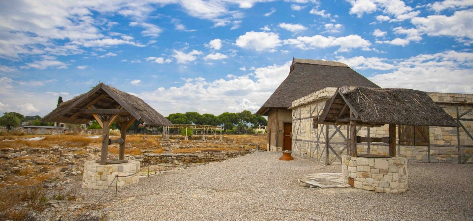
Between 2004 and 2005, the workshop was reconstructed on site using the archaeological evidence as a guide. The result is especially useful for visitors because wooden and mechanical components that rarely survive in excavation can be visualised again around the original stone installations.
6th century BCE, with more than one phase of use.
Crushing olives, pressing paste, separating liquids and organising larger-scale production.
The installation reflects specialised production in a city connected to overseas trade.
The workshop was reconstructed on its archaeological setting in 2004–2005 to make the production process easier to understand.
Olive oil was only one part of the Klazomenian economy. Excavations have identified ceramic kilns, metalworking areas and evidence for specialised bone working, showing that production occupied important sectors of the Archaic city.
Ceramics were especially significant. Klazomenai developed distinctive painted wares and transport containers, while locally produced amphorae helped move commodities through the city's maritime networks. Archaeologists can track these containers far beyond Urla, turning pottery into evidence for trade routes and commercial reach.
The organisation of workshops also reveals how ancient urban planning worked. Activities involving smoke, heat, waste or heavy transport were often concentrated in particular zones rather than distributed randomly through domestic neighbourhoods.
Seen in this context, the olive-oil workshop is not an isolated curiosity. It belongs to a broader industrial landscape in which agriculture, craft production and maritime exchange supported the prosperity of Klazomenai.
Klazomenai gave its name to a remarkable class of painted terracotta sarcophagi. Produced mainly during the Late Archaic and Early Classical periods, these large ceramic coffins were decorated around their broad upper frames with animals, warriors, chariots, mythological creatures, floral motifs and geometric designs.
Their size and weight make local production highly likely, and examples found at Klazomenai became important evidence for the city's ceramic skill. Today, Klazomenian sarcophagi and fragments are preserved in museums in Türkiye and abroad, allowing the artistic identity of the city to be recognised far beyond the archaeological site itself.
The funerary landscape was extensive. Archaeologists have identified multiple necropolis zones around the city, including areas at Kalabak, Monastirakia, Yıldız Tepe and Akpınar. Burials included sarcophagi, amphora graves and inhumations, and several cemeteries were used over long periods.
These burial grounds are important not only for art history but for understanding social organisation. The distribution of separate cemetery areas may reflect different family, lineage or community groups within the ancient population.
Klazomenai is remembered not only for trade and archaeology but as the homeland of Anaxagoras, one of the most important natural philosophers of the 5th century BCE.
Anaxagoras later became associated with Athens, where his ideas influenced intellectual life and figures connected with the age of Pericles. He attempted to explain celestial and natural phenomena through rational investigation rather than mythological storytelling.
One of the concepts most associated with his philosophy is Nous, usually translated as Mind or Intelligence, which he used to explain order and motion in the cosmos. His broader thought explored matter, change, the heavens and the structure of the natural world.
Remembering Anaxagoras while visiting Klazomenai adds an intellectual dimension to the archaeological site. The city participated in the same Ionian environment that produced some of antiquity's earliest traditions of systematic inquiry into nature and the universe.
The Ionian Revolt beginning in 499 BCE transformed Klazomenai. Ancient sources record Persian action against the city, while archaeology on the mainland shows destruction and widespread abandonment around the transition from the 6th to the 5th century BCE.
From the early 5th century BCE, the population increasingly lived on the offshore island now known as Karantina Island. The move offered a naturally more defensible position and permanently changed the geography of the city.
For at least a century, the mainland urban areas show far less evidence for ordinary occupation. This does not mean the territory ceased to matter. Fields, workshops, roads, cemeteries and access points continued to connect island residents with the resources of the surrounding peninsula.
The shift is one of the clearest examples in Ionia of politics and warfare physically reshaping a city. Klazomenai did not simply rebuild the same streets after crisis; it changed the very place where urban life was concentrated.
Klazomenai's movement to the island did not end mainland urban life forever. In the first half of the 4th century BCE, political disagreement within the community produced a separate mainland settlement identified as Khyton.
Archaeological evidence indicates that Khyton was organised with a grid plan, reflecting a deliberate approach to urban design. Official interpretations associate its foundation with a group that did not support the Athenian-aligned political faction dominant elsewhere in the community.
The settlement was relatively short-lived and appears to have been abandoned around 350 BCE. Afterward, Klazomenian life again focused on the island while much of the mainland returned to agricultural and other non-urban uses.
Khyton is especially interesting because it shows that ancient cities were not always unified communities occupying one permanent centre. Political identities could divide populations and produce entirely new urban landscapes within the same territory.
The sea is fundamental to the history of both Liman Tepe and Klazomenai. Changes in shoreline, sedimentation and sea level mean that parts of the ancient harbour landscape now lie beneath the water rather than on land.
Underwater archaeological work began in 2000 through cooperation between Ankara University and the University of Haifa, later continuing under the coordination of ANKÜSAM – Ankara University's Mustafa V. Koç Centre for Maritime Archaeology. These investigations formed the first underwater harbour excavation programme of its kind in Türkiye.
Research documented a submerged breakwater extending for roughly 100 metres, together with associated harbour structures. Excavation within the harbour identified stratified remains connected with 6th- and 4th-century BCE phases, allowing archaeologists to study how the waterfront was rebuilt and reused over time.
The importance of the project goes beyond Klazomenai. Underwater sediment can preserve timber, anchors, harbour surfaces and other materials that rarely survive on dry land. The site therefore provides a laboratory for understanding how ancient ports actually functioned at the edge between city and sea.
Today's Karantina Island became the principal settlement zone of Klazomenai from the early 5th century BCE. Ancient literary tradition connects the later causeway between island and mainland with the age of Alexander the Great, although the precise development of the connection remains an archaeological question.
The island contained the Hellenistic and Roman city, including fortifications, streets and public architecture. Early excavations also documented a paved road and Late Roman structures with mosaic floors. Much of the ancient architecture, however, was robbed for building material over later centuries, leaving the island less visually monumental than its historical importance might suggest.
Karantina Island later acquired an entirely different significance. During the Ottoman period it became associated with the Urla Tahaffuzhanesi, a quarantine complex created to control infectious diseases arriving through maritime traffic. This later history adds another remarkable layer to a place already shaped by ancient seafaring.
Visitors should treat Karantina Island as a separate visit from the standard Klazomenai archaeological site. Access arrangements can involve organised or group visits and may change according to the institutions using the island, so confirm current conditions before planning to enter.
The Hellenistic and Roman city developed primarily on Karantina Island. Ancient traditions describe a mainland connection associated with Alexander the Great, while archaeological evidence indicates a more organised island settlement with fortifications and urban infrastructure.
After the Peace of Apamea in 188 BCE, Klazomenai was among the cities recognised as free from direct territorial control by the victorious Roman settlement in western Anatolia. The community continued under Roman power while preserving local civic institutions.
The island remained inhabited into Late Antiquity, although the ancient urban fabric was gradually reduced and heavily reused. By around the 5th century CE the principal ancient settlement on the island appears to have declined substantially.
Later ecclesiastical references demonstrate that the name and Christian community of Klazomenai survived beyond the end of the classical city. Some evidence suggests that later Byzantine activity may have shifted to other parts of the surrounding territory.
Modern archaeological interest in Klazomenai developed gradually. Travellers recorded remains on Karantina Island in the 18th and 19th centuries, while painted terracotta sarcophagi attracted growing international attention during the late 19th century.
The first scientific excavations were conducted in 1921–1922 by G. P. Oikonomos. His work investigated parts of the island settlement and Archaic cemeteries on the mainland, although the difficult historical circumstances of the period limited publication and preservation of the results.
After rescue work by the Ministry of Culture in 1979–1980, systematic excavations at Klazomenai began in 1981 under Güven Bakır. Since 2007, the Klazomenai project has continued under Prof. Dr. Yaşar E. Ersoy, with research focused on settlement history, urbanism, fortifications, industrial zones, cemeteries and material culture.
Research at Liman Tepe developed along a parallel path. Prehistoric remains were recognised by Ekrem Akurgal, rescue excavation began in 1979, and work led by Hayat Erkanal established the site's Bronze Age importance. A renewed programme began in 1992, and underwater research followed from 2000. Today the maritime work is closely associated with Ankara University's ANKÜSAM centre.
The most immediately understandable visitor feature, with reconstructed production equipment arranged around the archaeological installations.
Foundations and working zones connected with olive oil, craft production and the economic life of the city.
Water installations help explain the practical infrastructure that supported production and settlement.
Wall lines and excavated structures reveal different phases of the mainland city rather than one single building period.
Excavations around the wider site have revealed defensive systems belonging to both prehistoric and Archaic phases.
The prehistoric mound and surrounding research areas preserve deeper Bronze Age levels, though not every excavation zone is part of the standard visitor route.
The later ancient city lies on the island, but access is separate and should not be assumed to be included in an ordinary Klazomenai visit.
Major parts of the ancient harbour can only be studied archaeologically underwater and are not a normal walk-through visitor attraction.
Klazomenai is a site where interpretation matters. Visitors expecting columns and a complete theatre may be surprised by how archaeological the landscape feels. Its reward comes from understanding production, settlement layers, changing shorelines and the long relationship between land and sea.
Klazomenai and Liman Tepe remain active archaeological research landscapes. The mainland city, prehistoric settlement and submerged harbour are studied through related but distinct projects, each focused on different parts of the long chronological sequence.
Recent Klazomenai research continues to refine the understanding of fortifications, urban development, workshops, cemeteries and the relationship between the mainland and island settlements. Work presented from recent excavation seasons demonstrates that the site is still producing evidence capable of changing older reconstructions of the city.
At Liman Tepe, land and underwater archaeology remain central to the study of prehistoric and later maritime activity. The project is especially important for reconstructing ancient shorelines, submerged architecture and harbour development, subjects that cannot be understood through excavation on land alone.
Because both sites are active research areas, visitors may encounter protected trenches, conservation zones or sections not open to the public. Always respect barriers even when an archaeological feature appears physically easy to reach.
The official Turkish Museums listing currently shows Klazomenai Archaeological Site as free to enter. As of 2026, the published seasonal opening schedule is:
Opening hours, ticket policies and access to individual excavation areas can change. Check the latest official Turkish Museums information shortly before travelling, especially outside the main tourism season or during active archaeological work.
Comfortable walking temperatures, green landscapes and excellent conditions for combining archaeology with Urla.
Warm and bright, with long days for exploring both the site and the peninsula before peak summer heat.
Hot and sunny. Visit early in the morning and continue to the waterfront or shaded areas later in the day.
One of the best periods, especially for travellers interested in Urla's vineyards, olive culture and coastal food.
Quiet and atmospheric, though rain can make archaeological ground slippery.
Cool and peaceful with fewer visitors; check weather and seasonal opening details before travelling.
For most travellers, April–June and September–October provide the easiest balance of mild weather, clear light and time to explore the wider Urla peninsula.
Morning is the best choice from late spring through early autumn. The site is exposed to the sun, and cooler temperatures make it easier to stop at information panels and study the archaeological details rather than rushing through the ruins.
A morning visit also works perfectly with a wider Urla day. Spend one to two hours at Klazomenai, continue to the İskele waterfront, then move inland toward Urla town centre for lunch, local history or other peninsula stops.
Late afternoon can offer attractive light across the stone foundations and reconstructed olive-oil workshop, but make sure you allow enough time before the official closing hour.
The site does not require a full day on its own. The best experience usually comes from combining focused archaeology with time in the surrounding coastal landscape.
Drive west toward Urla, then continue north toward İskele and follow local signs for Klazomenai Archaeological Site.
Klazomenai lies only a short drive from central Urla in the İskele neighbourhood.
Travel east toward Urla and continue to İskele, making Klazomenai an easy historical stop on a peninsula route.
The easiest option if you plan to combine Klazomenai with Karantina Island, Urla centre, vineyards or other archaeological sites.
Practical from Urla centre or nearby accommodation, especially if you do not want to depend on local service timing.
Search specifically for Klazomenai Archaeological Site / Klazomenai Örenyeri in İskele rather than only “Liman Tepe.”
Public transport routes and service frequencies can change, so use current İzmir and Urla transport information on the day of travel rather than relying on old route numbers.
The official archaeological area and olive-oil workshop are explored on foot.
Do not stop after the reconstructed press; settlement foundations and surrounding trenches add essential context.
Liman Tepe, cemetery zones and Karantina Island extend beyond the normal visitor circuit.
Expect gravel, earth, archaeological stone and occasional changes in level.
Klazomenai is easier to understand when you match visible foundations with the chronological story.
Active excavation zones may be fenced or inaccessible even when they appear close to visitor paths.
Enough for a focused visit to the olive-oil workshop and the most accessible archaeological remains.
A comfortable first visit with time to read the site information and understand the wider chronology.
Best for archaeology-focused travellers who want to study the workshop, settlement remains and Liman Tepe story more carefully.
Combine Klazomenai with Urla İskele, Karantina Island viewpoints and a relaxed waterfront stop.
Add Urla town centre, local olive culture and another historical or coastal stop on the peninsula.
Allow around 1.5 hours at Klazomenai, then continue exploring Urla.
This route works particularly well because it follows the same themes that made Klazomenai important in antiquity: sea, agriculture, production and exchange, then connects them with the living culture of modern Urla.
Use the reconstructed wooden structures, stone installations and large vessels to explain ancient production visually.
Roofed wells and stonework create strong foreground elements within the excavation area.
Side light helps low walls and room lines stand out more clearly than harsh midday sun.
Include modern Urla, trees and coastline to show how the ancient city sits inside a living environment.
Early visits provide cleaner light and cooler conditions for photographing the archaeological site.
Coastal viewpoints help explain the movement of the city from mainland to island.
Never move pottery fragments, stones or archaeological material for a photograph.
Do not cross barriers, enter trenches or climb reconstructed structures for a better angle.
Klazomenai can work especially well for families because the olive-oil workshop provides a clear, practical story. Instead of asking children to imagine an entire city from foundations alone, you can follow a process: olives were collected, crushed, pressed, separated and stored.
The maritime story is equally accessible. Liman Tepe can be explained as a prehistoric harbour community connected to distant islands, while Karantina Island shows how people later moved their city for security and continued to depend on the sea.
The main archaeological site is relatively compact compared with many large ancient cities, but surfaces can include gravel, earth, uneven stone and changes in level. Visitors with reduced mobility should confirm current accessible routes before travelling.
Children should be supervised around excavation edges, wells, low walls and reconstructed equipment. Archaeological structures may look robust but should never be climbed.
Restricted areas may contain active excavations, fragile architecture or conservation work.
Avoid standing on ancient walls, wells, installations or reconstructed workshop elements.
Pottery fragments and small stones can be archaeologically meaningful even when they look ordinary.
Walking through open trenches or across low walls can damage evidence that is difficult to see from above.
The archaeological landscape includes shoreline and underwater heritage as well as visible ruins.
If excavation is active, follow instructions and do not interrupt work areas for photographs.
The site makes more sense once you separate prehistoric Liman Tepe from Iron Age and Classical Klazomenai.
The landscape includes prehistoric western Anatolian cultures thousands of years older than the Ionian city.
Follow each production stage rather than photographing the reconstruction and moving on immediately.
Urla can become hot and bright in summer, and much of the site is exposed.
Archaeological ground is easier with stable footwear than sandals or smooth soles.
A hat and sunscreen are useful from late spring through early autumn.
The visitor site is only part of Klazomenai; much of its later history belongs to Karantina Island.
Some of the most important harbour archaeology cannot be seen from the land at all.
Seasonal schedules can change, so confirm official opening information shortly before your visit.
The archaeological story becomes richer when paired with modern olive culture, food and the İskele waterfront.
The closest modern coastal stop, ideal for understanding the harbour landscape and enjoying the waterfront after the archaeological site.
The later ancient city and Ottoman quarantine landscape; check current organised-visit arrangements before planning to enter.
Historic streets, food culture, local markets, art spaces and access to the wider peninsula.
Continue west for castle history, coastal scenery, stone architecture and the peninsula's best-known resort towns.
Another major Ionian city on the peninsula, overlooking the Aegean from modern Ildırı.
Compare Klazomenai's industry and harbour history with the Dionysus sanctuary, theatre and civic architecture of Teos.
Castle streets, marina and coastal atmosphere make an excellent continuation after visiting nearby Teos.
Continue with Smyrna, Old Smyrna, Kadifekale and the İzmir Archaeology Museum for a broader regional picture.
The easiest pairing: archaeology first, then the waterfront and the coastal landscape that shaped the city.
A balanced day connecting ancient production and trade with modern food, streets and local culture.
Follow the city's movement from mainland to island, then add the later Ottoman quarantine story if access is arranged.
Compare two important Ionian cities on opposite sides of the Urla–Çeşme Peninsula.
A strong archaeology day comparing two Ionian cities with very different monuments, economies and sacred landscapes.
Combine ancient history with a later castle, coastal architecture and the western peninsula.
Build a private route around Klazomenai, Teos, Erythrai or other sites according to your interests and available time.
Use Klazomenai as the archaeological starting point for understanding why olive cultivation remains central to Urla's identity today.
Klazomenai was an ancient Ionian city in modern Urla, İzmir. Its archaeological landscape includes mainland settlement areas, workshops, cemeteries, Karantina Island and submerged harbour remains.
Liman Tepe is the prehistoric and Bronze Age settlement occupying the same Urla coastal landscape. It preserves archaeology thousands of years older than the Iron Age city of Klazomenai.
They overlap geographically, but the names usually describe different chronological parts of the archaeological story. Liman Tepe is primarily prehistoric; Klazomenai refers to the later Ionian city.
It is in the İskele neighbourhood of Urla, on the southern shore of the Gulf of İzmir, roughly 40 kilometres west of central İzmir depending on route.
Yes. Ancient tradition counted Klazomenai among the twelve cities associated with the Ionian League.
The archaeological sequence extends back into the prehistoric millennia, with important Chalcolithic and Bronze Age levels long before Klazomenai emerged as an Ionian polis.
The earliest clear Iron Age evidence belongs to the Late Protogeometric period, around the middle of the 10th century BCE.
Its 6th-century BCE olive-oil workshop, painted terracotta sarcophagi, maritime archaeology and association with the philosopher Anaxagoras are among its best-known features.
Yes. The archaeological installations date to the 6th century BCE. The wooden working system visible today is a modern reconstruction based on the excavated remains.
Popular tourism sources sometimes use that phrase. A more careful description is that Klazomenai preserves one of the earliest known large-scale olive-oil production installations in Anatolia and an exceptionally important Archaic workshop.
Olives were crushed, the paste was pressed, and the resulting liquid was separated so that oil could be collected apart from water and sediment. The reconstructed equipment helps visitors visualise the process.
The scale of production, transport amphorae and wider trade evidence indicate that Klazomenian agricultural products were part of overseas exchange rather than being produced only for household use.
Anaxagoras was a 5th-century BCE philosopher from Klazomenai who later became influential in Athens. He is especially associated with natural philosophy and the concept of Nous, or Mind.
They are large painted terracotta coffins, especially associated with the Late Archaic and Early Classical periods, decorated with animals, warriors, mythological figures and ornamental patterns.
The archaeological site explains the funerary landscape, but important Klazomenian sarcophagi and fragments are preserved in museum collections rather than standing exposed in the excavation area.
The mainland settlement was interrupted around 546 BCE. Archaeology indicates a return around 525–520 BCE, followed by renewed prosperity in the final quarter of the 6th century BCE.
From the beginning of the 5th century BCE, much of the population shifted from the mainland to the island now known as Karantina Island, changing the city's urban geography.
Khyton was a grid-planned mainland settlement created in the first half of the 4th century BCE during a period of political division within Klazomenai. It was abandoned around 350 BCE.
Ancient tradition associates the connection between the island city and mainland with the age of Alexander. The island is still linked to the mainland today, though the modern connection has also been altered by later construction.
It is the island where much of Classical, Hellenistic and Roman Klazomenai developed. It later became famous for the Ottoman-era Urla quarantine complex.
Visits can be possible under separate arrangements, but access is not the same as entering the main Klazomenai archaeological site. Check current group or appointment conditions before travelling.
Part of the harbour landscape is now underwater. Archaeologists have excavated submerged breakwaters and harbour layers, but these are not a normal land-based visitor attraction.
The harbour project preserves stratified submerged remains from different ancient phases and became a pioneering underwater harbour excavation programme in Türkiye.
The main visitor experience includes the reconstructed olive-oil workshop, ancient wells, foundations, workshop areas and excavation remains, supported by the wider story of Liman Tepe and Karantina Island.
Yes. Archaeological research continues at Klazomenai, while Liman Tepe and the submerged harbour are also studied through ongoing land and maritime research programmes.
The long-running Klazomenai excavation has been directed since 2007 by Prof. Dr. Yaşar E. Ersoy.
The official Turkish Museums listing currently shows admission as free. Check the official listing before travelling in case the policy changes.
The current official seasonal schedule lists 08:30–19:00 in summer and 08:30–17:30 in winter, with earlier last-entry or office-closing times. Always confirm before arrival.
About 1–2 hours is ideal for most visitors. History-focused travellers may want longer to read the archaeological information carefully.
Spring and autumn are usually the most comfortable. Summer is best early in the morning because the site can be hot and exposed.
Yes. Klazomenai lies within modern Urla and is ideal for combining with İskele, Urla town centre and other peninsula attractions.
Yes. They create an excellent ancient-Ionia day for travellers with private transport, comparing two very different coastal cities.
Yes, especially if you focus on the olive-oil machinery, ships, ancient trade and the idea of a city moving from mainland to island.
Parts of the site may be manageable, but archaeological ground includes gravel, earth and uneven surfaces. Confirm current accessible routes before travelling.
A guide is not essential, but Klazomenai becomes much more meaningful when prehistoric Liman Tepe, the olive industry, Persian history, island settlement and underwater archaeology are explained together.
Do not miss the olive-oil workshop, but also take time to understand Liman Tepe and the wider mainland-to-island history of the city.
Treating Klazomenai only as an olive-oil museum. The workshop is important, but the deeper story includes Bronze Age urbanism, Ionian politics, funerary art, philosophy and underwater archaeology.
Think of it as four connected stories: prehistoric Liman Tepe, the Archaic Ionian city, the mainland-to-island transformation, and the long maritime economy linking Urla with the wider Aegean.
A private historical route can connect Klazomenai with Urla, Teos, Sığacık, Erythrai, Çeşme or İzmir, creating a day focused on archaeology, maritime history, ancient industry, olive culture, philosophy or the wider development of Ionia.
Tell us whether your priority is prehistoric archaeology, ancient technology, olive-oil history, Ionian cities, maritime trade, philosophy, photography or a relaxed archaeology-and-food day, and we can shape the route around your interests.
Explore prehistoric Liman Tepe, Ionian Klazomenai, the ancient olive-oil workshop and the maritime landscape with a private historical focus.
Request a Klazomenai Tour
Connect the ancient city with Urla İskele, local olive culture, coastal history and the modern character of the peninsula.
Plan an Urla Heritage Day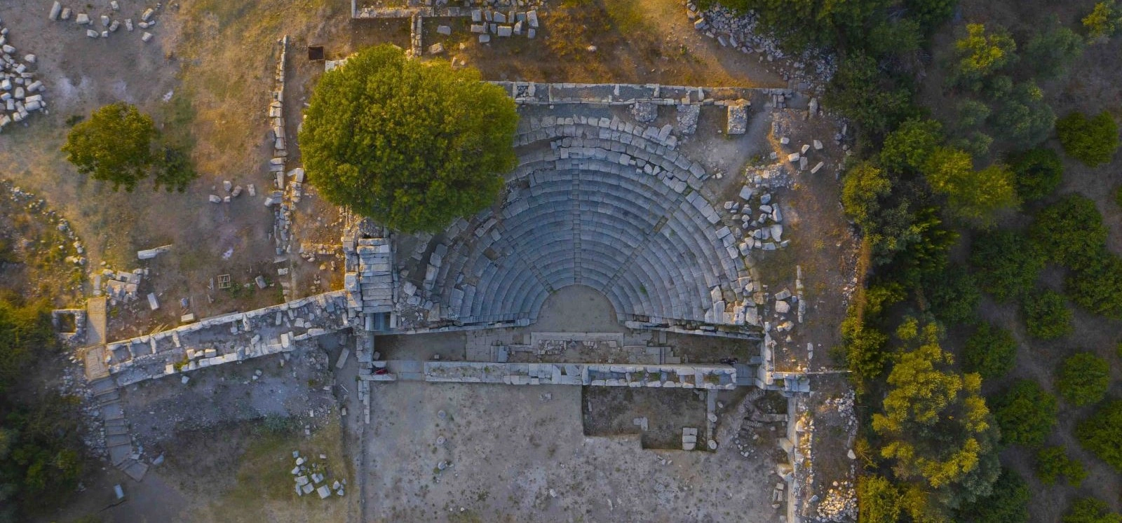
Compare Klazomenai's prehistoric, industrial and maritime story with the Dionysian sanctuary and civic monuments of Teos.
Explore Teos Ancient City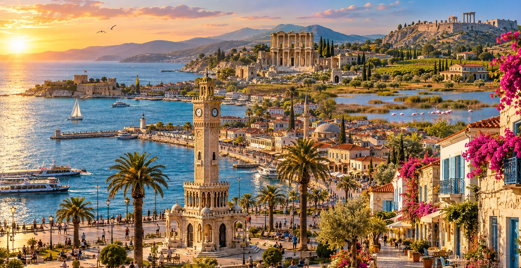
Continue with our complete İzmir guide for ancient cities, historic districts, coastal destinations, local food and day trips across the province.
View İzmir Guide