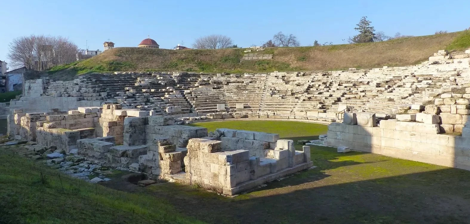
Private Larissa Ancient City Experience
Explore the acropolis, ancient fortifications, palatial foundations and panoramic Gediz landscape with a privately arranged visit focused on archaeology and history.
Request a Private Experience





Rising above the village of Buruncuk near Menemen, the ruins of ancient Larissa occupy one of the most strategically impressive archaeological landscapes in northern İzmir Province.
Known in archaeological literature as Larisa on the Hermos or Larisa am Hermos, the settlement overlooks the broad plain created by the ancient Hermos River — today's Gediz.
Human occupation here stretches back into prehistoric times, while Larissa became particularly important during the Archaic and Classical periods between approximately the seventh and fourth centuries BC.
Unlike Ephesus or Pergamon, Larissa does not confront visitors with reconstructed monumental streets or towering marble façades.
Its attraction is more subtle.
Ancient walls, palace foundations, sanctuary remains, terraces and scattered architectural blocks survive across a commanding ridge from which rulers once watched roads, farmland and the ancient landscape of the Hermos Valley.
For travelers interested in Aeolian archaeology, ancient architecture, fortifications and lesser-known historical landscapes, Larissa is one of İzmir's most intriguing archaeological discoveries.
Larissa belonged to the cultural world of the Aeolian cities of northern western Anatolia.
Palatial buildings, sanctuaries and powerful fortifications once dominated the western hill.
Settlement evidence reaches deep into prehistoric and Bronze Age western Anatolia.
A quiet archaeological landscape far removed from the crowds of Türkiye's most famous ancient cities.
Essential information for discovering this remarkable ancient settlement above Buruncuk in the Menemen district of İzmir.
Buruncuk, Menemen district, İzmir Province, western Türkiye.
Open on Google MapsAeolis, close to the ancient Hermos — today's Gediz River.
Settlement history reaches back into prehistoric times and at least the 3rd millennium BC.
Late Archaic fortifications, palace architecture, sanctuary remains and panoramic position.
Scientific investigation began in 1902 and continues to influence the study of Aeolian architecture.
The hilltop ruins command exceptional views across the fertile Gediz Plain.
Larissa rewards travelers who enjoy reading an ancient landscape rather than simply photographing monumental ruins.
The first impression is the landscape.
Larissa occupies a ridge above the vast Gediz Plain, a position that gave the ancient settlement control over agricultural land, routes of communication and approaches through the region.
The second impression is the silence.
This is very different from the busy archaeological parks of Ephesus, Pergamon or Hierapolis.
Visitors encounter foundations, ancient walls, terraces and architectural fragments emerging among grass and exposed rock.
Understanding Larissa therefore requires imagination — but that is also part of its appeal.
Here, the archaeology remains closely connected to the topography that originally determined where the city was built.
Visitors may encounter several different spellings and descriptions of the site.
Larissa is widely used in modern travel material, while academic archaeological publications frequently use the spelling Larisa.
The additional description “on the Hermos” distinguishes this settlement from other ancient places that carried the same name.
Hermos was the ancient name of the river now known as the Gediz.
The precise linguistic origin of the ancient place-name has been interpreted in different ways, and several ancient settlements around the Aegean world were called Larisa or Larissa.
Larissa's location was one of its greatest advantages.
The settlement rose above the plain of the Hermos River, creating both a defensive position and an exceptional observation point.
The landscape visible today, however, is not identical to the landscape known by the ancient inhabitants.
Over thousands of years, sediment carried by the Gediz changed the surrounding plain and dramatically altered the relationship between inland settlements and the Aegean coastline.
Areas that today appear firmly inland once had a much closer relationship with coastal environments and waterways.
Larissa should therefore be understood not as an isolated hilltop fortress but as a settlement positioned within a constantly changing network of river, plain, agriculture, routes and Aegean communication.
Larissa's history began long before the monumental buildings visible in archaeological plans were constructed.
Evidence from the site demonstrates occupation extending back into prehistoric and Bronze Age western Anatolia.
Official cultural sources place settlement here as early as the 3rd millennium BC.
This deep chronology is important because it shows that the hill was valued for thousands of years before Larissa emerged as a major Aeolian center.
Its strategic position, access to fertile agricultural land and proximity to regional routes made the ridge attractive to successive communities.
Later monumental construction sometimes disturbed or covered these earlier occupation levels, leaving archaeologists to reconstruct the earliest story from fragmented architectural and ceramic evidence.
Larissa became part of the cultural landscape traditionally known as Aeolis.
Ancient Aeolis extended across parts of the northern Aegean coast of western Anatolia and the nearby islands.
Its cities never formed a single centralized state in the modern sense.
Instead, they shared cultural, linguistic and religious connections while maintaining their own political identities.
Larissa occupied an especially important position in the southern part of this world, close to the Hermos Valley and major routes connecting inland Anatolia with the Aegean coast.
One of the most important Aeolian cities of the northern İzmir region.
A spectacular mountain city preserving another remarkable expression of Aeolian urban culture.
A fortified settlement distinguished by monumental architecture and its strategic position above the Hermos Plain.
Aeolian communities participated in trade, politics and cultural exchange across western Anatolia and the Aegean.
Much of Larissa's archaeological importance comes from the centuries between approximately the 7th and 6th centuries BC.
During this period the settlement was transformed by substantial construction projects.
Fortifications protected the acropolis.
Monumental buildings occupied commanding positions across the plateau.
Sanctuary architecture demonstrated the religious and political importance of the community.
Architectural terracottas, stone decoration and carefully designed masonry reveal a city participating fully in the artistic developments of the eastern Aegean.
Larissa therefore provides archaeologists with an unusually valuable case study for understanding the architecture of Archaic Aeolis.
The western hill contained Larissa's principal monumental area.
Today archaeologists refer to this sector as Larisa West.
Here stood the acropolis with its defensive walls, sanctuaries and important buildings associated with the city's rulers or governing elite.
Although many walls survive only to foundation level, their scale reveals that this was no minor rural settlement.
The acropolis occupied a highly visible position above the Hermos Plain.
Political authority, religious activity and monumental architecture were therefore concentrated in a place that could be seen across the surrounding landscape.
Larissa's defensive walls are among the site's most significant surviving remains.
Research into the Late Archaic acropolis fortifications has revealed a carefully organized defensive system incorporating walls, towers and strengthened sections.
Some masonry uses carefully fitted irregular or polygonal blocks.
The construction displays an impressive understanding of both defensive architecture and the difficult topography of the hill.
The walls were not simply barriers.
They defined the monumental acropolis and communicated the power and resources of the community capable of constructing them.
Large masonry sections demonstrate considerable investment in the defense of the acropolis.
Strategically positioned towers strengthened vulnerable sections and improved observation over the surrounding landscape.
Carefully shaped stonework makes several sections especially interesting to students of ancient construction.
Steep slopes enhanced the protection already provided by artificial fortifications.
One of the most unusual characteristics of Larissa is the presence of architecture interpreted as palatial or elite administrative buildings.
The monumental complex on the acropolis has attracted archaeological attention since the earliest excavations.
A major Late Classical complex occupied a commanding location close to the northwestern edge of the acropolis plateau.
Its position allowed it to dominate views toward the Hermos Plain and the routes crossing the landscape below.
The building therefore communicated authority both through architecture and location.
Older scholarship sometimes interpreted Larissa's palatial architecture through strong eastern comparisons.
Modern research has re-examined several of those interpretations, showing how archaeological understanding of the complex continues to evolve.
Research into the acropolis suggests that parts of Larissa were organized into distinct architectural zones.
Among the structures examined by archaeologists is a building incorporating the form known as a megaron.
The megaron — broadly characterized by a rectangular hall and axial arrangement — had very deep roots within Aegean and Anatolian architecture.
At Larissa, its presence forms part of a larger discussion about elite occupation, political authority and the transformation of the acropolis through time.
Rather than representing a single construction phase, the monumental center developed, changed and was rebuilt as the political circumstances of western Anatolia evolved.
Religious architecture formed another important element of ancient Larissa.
Excavations and later studies identified temple and sanctuary remains within the monumental western sector of the city.
These buildings connected political power with the sacred landscape of the acropolis.
Although visitors today encounter foundations rather than complete temples, the surviving plans help archaeologists reconstruct how religious spaces were positioned among the city's defensive and palatial architecture.
Fragments of decorated stone and architectural terracotta also reveal that these buildings were originally far more visually impressive than their surviving foundations suggest.
Ancient Greek architecture is often imagined today as bare stone.
Larissa provides an important reminder that monumental buildings could once be richly decorated.
Excavations produced architectural terracotta elements associated with roofs, walls and decorative systems.
Such pieces could combine geometric patterns, vegetal decoration and figural imagery.
Color formed an essential part of the original appearance.
These architectural fragments allow researchers to reconstruct something of the visual impact that Larissa's buildings once created across the acropolis.
Decorated fired-clay components protected buildings while also forming part of their visual design.
Architectural fragments reveal sophisticated decorative traditions during the Archaic period.
Ancient architecture was considerably more colorful than the exposed stone ruins suggest today.
The surviving pieces help define the distinctive architectural culture of northern western Anatolia.
Early archaeological work concentrated heavily on the acropolis.
Modern surveys have demonstrated that Larissa extended across a much broader landscape.
The ancient remains occupy two principal hills along the Buruncuk ridge.
Larisa West contained the monumental acropolis as well as settlement and necropolis areas.
Larisa East included another fortified hilltop and habitation below it.
The lower terrain between the two also formed part of the ancient landscape and included areas connected with agriculture and daily economic activity.
Larissa should therefore be imagined as a complex cityscape rather than a single fortified summit.
Earlier archaeological interpretations proposed that parts of Larissa may have followed an organized grid plan.
Recent architectural survey has returned to this question.
Repeated wall orientations, possible road lines and terrace arrangements suggest a degree of regular planning.
However, current evidence is not strong enough to reconstruct a complete rigid street grid with certainty.
This makes Larissa an excellent example of how archaeology works.
Old excavation conclusions are not simply repeated forever.
New measurements, surveys and technologies allow researchers to reconsider how ancient settlements were organized.
Larissa's most important centuries unfolded during a period of enormous political change in western Anatolia.
The rise of the Lydian kingdom, followed by the expansion of the Achaemenid Persian Empire, transformed the political environment of the region.
Cities such as Larissa were not isolated Greek settlements separated from Anatolia.
They existed at cultural and political crossroads.
Architecture, ceramics, political institutions and elite culture developed through interaction among local Anatolian, eastern Mediterranean and Aegean traditions.
That complexity is one of the reasons Larissa is so valuable to modern researchers.
The fifth and fourth centuries BC brought repeated political changes to the cities of western Anatolia.
Larissa experienced phases of destruction, rebuilding and renewed monumental construction.
Modern scholarship continues to reconsider the precise dating of individual destruction levels and architectural phases.
Ancient historical tradition also places Larissa within military conflicts between Persian power, Greek cities and armies arriving from across the Aegean.
In 399 BC, the Spartan commander Thibron is associated with an unsuccessful attempt to take Larissa.
Later in the fourth century BC, Alexander's invasion transformed the political organization of western Anatolia once again.
Larissa did not disappear in a single moment.
Archaeological and historical sources indicate several episodes of destruction and rebuilding.
Traditional accounts connect serious damage with conflicts of the late fifth century BC.
The city subsequently recovered and continued to occupy an important position during the Classical period.
A major turning point came around 279 BC, when Galatian movements through western Anatolia were associated with renewed destruction.
Archaeological research suggests that by the early third century BC the settlement had largely lost the urban importance it once possessed.
Larissa's monumental centuries had come to an end.
Modern archaeological interest in Larissa began remarkably early.
Swedish archaeologists began investigating the site in 1902.
Further major work followed during 1932, 1933 and 1934 as part of German-Swedish archaeological research.
These excavations documented the acropolis, monumental buildings and important architectural finds.
Results published during the first half of the twentieth century formed the basis of Larissa studies for decades.
Archaeology, however, does not stop when an excavation ends.
Modern researchers have returned to the original plans, surviving structures and museum collections to reassess many early interpretations.
The modern study of Larissa demonstrates how dramatically archaeological methods have changed.
Early excavators concentrated strongly on monumental structures and visually impressive finds.
Recent research examines the entire archaeological landscape.
Walls are precisely measured.
Older plans are compared with surviving remains.
Settlement areas beyond the acropolis receive greater attention.
Architectural fragments preserved in museums are reconsidered alongside structures still standing on the hill.
The result is a more complete picture of Larissa as an evolving city, fortress, political center, sanctuary and agricultural landscape.
Many of Larissa's most important archaeological finds are no longer located on the ancient hill.
Architectural pieces and artifacts recovered during the early excavation campaigns entered museum collections.
Important Archaic architectural material is preserved in the İzmir Archaeology Museum.
Other archaeological material associated with Larissa is held in İstanbul and Stockholm.
This creates an interesting situation for visitors.
The ancient city preserves the architecture within its original landscape, while museums preserve many of the details that once decorated those buildings.
Substantial defensive masonry remains among the most impressive surviving features of the ancient city.
Stone foundations preserve the outlines of monumental buildings associated with Larissa's ruling elite.
Temple and sacred-area foundations reveal the religious importance of the acropolis.
Sections of the ancient fortification system demonstrate how carefully the ridge was protected.
Scattered wall lines and terraces preserve traces of the broader settlement beyond the monumental center.
The panoramic landscape remains one of the most powerful ways to understand why Larissa developed here.
Larissa requires a different approach from Türkiye's heavily developed archaeological parks.
Begin with the landscape rather than individual stones.
Walk toward the elevated areas and observe how the ridge dominates the surrounding plain.
Then identify the surviving defensive walls.
Their scale helps establish the boundaries and importance of the acropolis.
Within the monumental zone, look for rectangular building foundations, terraces and changes in masonry.
Rather than searching for a single spectacular monument, gradually reconstruct the ancient city from the relationship between its walls, buildings and natural topography.
Larissa is experienced primarily as a landscape of ruins rather than a conventional indoor museum.
Do not expect extensive visitor facilities, cafés or the infrastructure found at major archaeological parks.
Natural terrain, stones, vegetation and exposed archaeological remains require careful walking.
The hill can become very exposed during hot and sunny weather.
Visitor numbers are generally far lower than at İzmir's famous archaeological attractions.
The relationship between the ruins and the Gediz Plain is central to understanding the ancient city.
Larissa is not presented to visitors in the same way as Türkiye's major ticketed archaeological parks.
Current official tourism information identifies the archaeological settlement and its location but does not publish a conventional daily admission schedule or standard ticket tariff comparable with sites such as Ephesus or Pergamon.
The final approach, accessible areas and local conditions may also change.
For that reason, visitors making a special journey should confirm the latest access situation before departure.
Enough for a brief look at the principal hilltop remains and surrounding landscape.
A more comfortable visit allowing time to examine walls, foundations and viewpoints without rushing.
Appropriate for archaeology enthusiasts who want to study masonry, building plans and the wider topography carefully.
Larissa lies above Buruncuk, a settlement immediately north of Menemen in İzmir Province.
Buruncuk sits close to the main road corridor running north from İzmir toward Aliağa and Çanakkale.
From the village, local roads lead toward the archaeological ridge.
The final approach is more rural than the access roads serving major archaeological parks, so navigation should be checked carefully before arrival.
Travel north toward Menemen and continue toward Buruncuk before following the local approach toward Larissa.
Buruncuk is only a short road journey north of the town, making Larissa easy to combine with a Menemen itinerary.
A private car or arranged vehicle provides the simplest way to reach the rural approach to the archaeological site.
Use an up-to-date map application and verify the final access route rather than relying solely on the position of the archaeological marker.
Open the archaeological settlement in Google Maps and plan your route toward Buruncuk.
View Locationİzmir's suburban rail and local transport network can bring visitors into the wider Menemen area.
From there, onward road transport is required toward Buruncuk.
Local bus and minibus routes can change, so same-day route planning is recommended.
The most important point is to remember that arriving in Buruncuk does not necessarily mean arriving directly at the archaeological remains.
A final walk or local road connection may still be required.
Larissa is a hilltop archaeological landscape with natural surfaces.
Visitors should expect grass, loose earth, exposed stone, uneven foundations and sections of sloping terrain.
Strong walking shoes are considerably more suitable than sandals or smooth-soled footwear.
Vegetation conditions also change through the year.
Spring can bring tall grasses and wild plants, while summer produces much drier and more exposed conditions.
Uneven ground and loose stones require stable footwear.
Do not rely on finding visitor facilities once you reach the archaeological area.
A hat and sunscreen are especially useful from late spring through early autumn.
Ancient walls and foundations can create sudden changes in ground level.
Larissa should not be expected to offer the accessibility infrastructure of a modern museum or fully developed archaeological park.
Natural ground, slopes, vegetation and exposed ruins may present significant difficulties for visitors with limited mobility.
Conditions can also vary depending on weather and the exact approach used.
Visitors with specific mobility requirements should obtain current local information before making a special journey to the site.
Green landscapes and wildflowers can make the Gediz Plain and archaeological hill especially beautiful.
Long daylight hours are useful, although heat and exposed sunshine become increasingly important.
Visit early in the morning or later in the afternoon to avoid the most intense heat.
Lower temperatures create more comfortable conditions for walking across the archaeological terrain.
Clear days can be atmospheric, but rain may make rural paths and uneven ground more difficult.
Usually the most comfortable choice for photography, walking and combining Larissa with another destination.
Larissa is particularly rewarding for photographers who enjoy combining archaeology with landscape.
Use angled light to emphasize individual stone blocks and ancient masonry techniques.
Wide compositions reveal the strategic landscape that made the hill so important.
Slightly elevated viewpoints help architectural plans become more understandable in photographs.
Green grass and wildflowers create a striking contrast with weathered ancient stone.
Low-angle light gives greater depth to walls, terraces and the surrounding terrain.
Look for masonry joints, worked surfaces and differences between construction phases.
Larissa can be fascinating for older children who enjoy exploration and ancient history.
The site allows families to discuss why cities were built on hills, how defensive walls worked and why controlling a fertile plain mattered.
However, this is not a highly developed archaeological park with continuous paths and barriers.
Children should therefore remain closely supervised around uneven terrain, slopes and ancient masonry.
For younger children, a shorter visit focused on the fortifications and panoramic views may be more enjoyable than attempting to examine every surviving foundation.
Even apparently loose fragments may form part of the archaeological record.
Ancient masonry can be unstable and repeated climbing accelerates deterioration.
Remain aware of agricultural areas, property boundaries and local access arrangements.
Ceramic fragments, worked stones and other archaeological material must remain where they are found.
Carry water and supplies in, and take all litter away with you.
Respect archaeological work zones, barriers and any instructions encountered at the site.
Larissa is not a place to race between famous monuments.
Begin by standing still.
Look across the Gediz Plain.
Notice how far the view extends.
Then turn toward the surviving fortification walls and imagine how different the hill must have appeared when those defenses were complete.
Walk into the monumental area and follow the foundations of individual buildings.
Look for changes in stone size and masonry.
Consider how rulers, priests, soldiers, craftspeople and ordinary inhabitants used different spaces.
Larissa gradually becomes understandable not through one spectacular monument but through the relationship between architecture, power and landscape.
The modern plain below Larissa is itself part of the historical story.
The Gediz River carried enormous quantities of sediment toward the Aegean over thousands of years.
As deposits accumulated, coastlines and wetlands changed.
Settlements that once interacted directly with coastal or estuarine environments gradually became farther inland.
This process helps explain why ancient geography can sometimes look confusing when viewed on a modern map.
Larissa's position becomes far more understandable when the long-term transformation of the Hermos-Gediz delta is taken into account.
Larissa contributes to several major questions in the archaeology of western Anatolia.
Its long occupation sequence helps researchers investigate connections between prehistoric communities and later Iron Age settlement.
Its monumental architecture provides rare evidence for political and palatial buildings in Aeolis.
Its fortifications preserve sophisticated Late Archaic defensive design.
Its architectural decoration reveals the visual culture of elite and religious buildings.
Its location illustrates the close connection between settlement, agricultural plains and interregional routes.
Most importantly, continuing research demonstrates that Larissa is not a finished archaeological story.
Old interpretations are still being tested against new surveys and new readings of material excavated more than a century ago.
Larissa preserves some of the region's most important evidence for monumental building traditions.
The acropolis walls provide valuable evidence for defensive architecture in Late Archaic western Anatolia.
Elite complexes offer rare insight into political architecture during the Archaic and Classical periods.
Modern survey helps reconstruct settlement areas beyond the better-known acropolis.
The city demonstrates how geography and changing river systems influenced ancient settlement.
More than a century of archaeological work makes Larissa important to the history of archaeology itself.
Larissa works particularly well as part of a wider exploration of Menemen.
The district occupies a landscape shaped by the Gediz River and preserves archaeological remains from many different periods.
Menemen is also famous for its long tradition of pottery production.
Combining archaeology with a pottery workshop or traditional ceramic neighborhood creates an itinerary linking ancient material culture with a craft tradition that remains alive today.
Explore the historic district, Gediz landscape, traditional neighborhoods and cultural heritage surrounding Larissa.
Discover one of western Türkiye's enduring ceramic traditions and the workshops that continue producing pottery today.
Continue your exploration of Aeolis at a dramatic mountain city preserving monumental walls and public architecture.
Explore ancient Phokaia, Ottoman heritage, coastal streets and the beautiful landscape of the northern İzmir shoreline.
Larissa is located above Buruncuk in the Menemen district of İzmir Province in western Türkiye.
Yes. Both spellings are used. Archaeological publications commonly use “Larisa,” while “Larissa” is also widespread in modern tourism material.
No. The archaeological site near Menemen is an ancient western Anatolian settlement often identified academically as Larisa on the Hermos to distinguish it from other ancient places with the same name.
Hermos was the ancient name of the river now known as the Gediz, whose broad plain lies below Larissa.
Settlement evidence reaches back into prehistoric times and at least the 3rd millennium BC, although the best-known monumental remains belong mainly to the first millennium BC.
Yes. Larissa belonged to the cultural and historical world of ancient Aeolis in northern western Anatolia.
The city is especially important for its acropolis fortifications, palatial architecture, sanctuary remains, architectural decoration and commanding position above the Gediz Plain.
Visitors can examine surviving defensive walls, towers, building foundations, terraces, sanctuary areas and archaeological remains spread across the ancient ridge.
No. Most structures survive principally as foundations, wall sections and architectural fragments, so understanding the site requires more interpretation than at highly reconstructed archaeological parks.
Yes. Monumental buildings interpreted as palatial or elite administrative complexes formed an important part of the ancient acropolis.
The Late Archaic fortifications include towers, reinforced defensive sections and sophisticated masonry that make them particularly important for the study of ancient western Anatolian fortification architecture.
Modern archaeological investigation began in 1902 with Swedish researchers.
Early Swedish work was followed by major German-Swedish excavation campaigns during 1932–1934. Modern Turkish and international researchers have subsequently re-examined the architecture and archaeological record.
Important finds and architectural fragments are preserved in archaeological museum collections including İzmir, İstanbul and Stockholm.
The city experienced more than one destruction phase. Ancient and archaeological traditions record serious disruptions during the Classical period and major destruction associated with Galatian movements around 279 BC.
The elevated ridge provided defense, visibility across the Hermos-Gediz Plain and control over important agricultural land and communication routes.
Current official tourism information does not publish a conventional ticket tariff for Larissa comparable with major staffed archaeological parks. Visitors should check the latest local access arrangements before travelling.
Official tourism information does not currently provide a standard daily opening-hours schedule for the archaeological settlement. A daylight visit and confirmation of current access conditions are recommended.
Approximately 1–1.5 hours is comfortable for most visitors, while archaeology enthusiasts may wish to spend longer examining the architecture and wider landscape.
The archaeological terrain is uneven and includes natural slopes, stones, vegetation and exposed foundations, so good walking shoes are recommended.
Shade can be limited across the exposed archaeological ridge, particularly during summer.
Spring and autumn usually provide the most comfortable walking temperatures. Spring can be especially attractive when the landscape is green.
Yes. Larissa is north of İzmir near Menemen and can be visited as a half-day excursion or combined with other destinations in northern İzmir.
Public transport can take visitors into the Menemen and Buruncuk area, although an additional walk or local connection may be needed for the final approach. Current connections should be checked before travelling.
Yes. For travelers particularly interested in Aeolian archaeology, Larissa and Aigai offer two very different but complementary ancient landscapes in northern İzmir.
Yes. Combining Larissa with Menemen's traditional pottery culture creates an interesting day connecting ancient archaeology with a living regional craft tradition.
Larissa is particularly rewarding for travelers interested in lesser-known archaeological sites, Aeolian history, ancient fortifications, architecture and historical landscapes away from major tourist crowds.
Discover the forgotten Aeolian city above the Gediz Plain and combine its archaeology with the history, landscapes and living traditions of northern İzmir.
Explore a quieter side of İzmir where ancient fortifications, fertile plains and traditional craftsmanship reveal thousands of years of cultural continuity.
Explore the acropolis, ancient fortifications, palatial foundations and panoramic Gediz landscape with a privately arranged visit focused on archaeology and history.
Request a Private Experience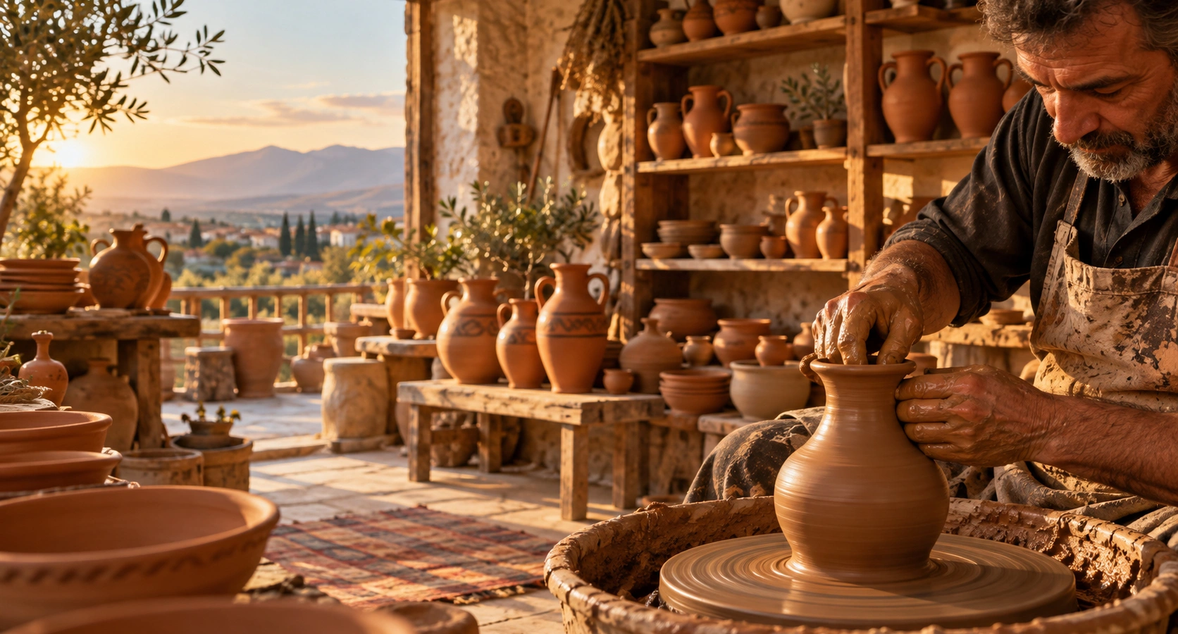
Combine an ancient Aeolian hilltop city with Menemen's historic landscape and traditional pottery culture for a distinctive journey through northern İzmir.
Plan Your Menemen Day