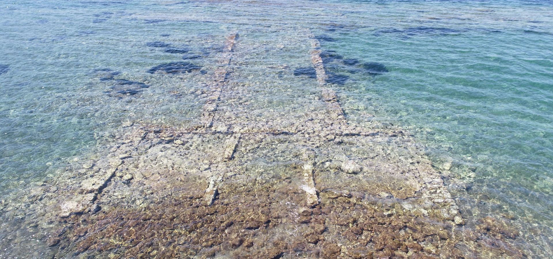
Private Atarneus & Dikili Experience
Explore the fortified hill of Atarneus, discover the remarkable story of Hermias and Aristotle and continue toward Dikili for the landscapes of the northern Aegean coast.
Request a Private Experience





A few kilometers inland from the Aegean coast near Dikili, a fortified hill rises above the surrounding plain.
This is Atarneus.
Known in Turkish sources also as Aterneus, the ancient settlement occupies the slopes and summit of Kale Tepe — sometimes called Ağılkale — overlooking one of the most historically important landscapes of northern İzmir.
At first sight, Atarneus may appear far quieter than nearby Pergamon.
There are no reconstructed marble libraries, monumental theaters or famous temples welcoming large numbers of visitors.
Yet the city's historical connections are extraordinary.
Herodotus connected the territory of Atarneus with one of the dramatic episodes that followed the Persian conquest of Lydia.
Centuries later, the city became the center of a powerful local state ruled by Hermias of Atarneus.
Hermias was closely connected with philosophers from Plato's Academy, and his political territory included nearby Assos.
After Plato's death, Aristotle came to this remarkable intellectual and political environment.
He became a close friend of Hermias and later married Pythias, Hermias' niece and adopted daughter.
Atarneus therefore stands at a fascinating intersection of archaeology, Persian imperial history, Greek political power and the life of one of the most influential philosophers in human history.
Atarneus occupied the strategically positioned Kale Tepe above the plain east of modern Dikili.
The city reached particular political importance during the fourth century BC under the ruler Hermias.
Hermias' circle brought Atarneus and neighboring Assos directly into the intellectual history surrounding Aristotle and Plato's Academy.
Fortification walls, settlement terraces, ceramics and necropolis areas survive across a dramatic but comparatively little-visited landscape.
Essential information for understanding the fortified ancient settlement overlooking the Dikili landscape of northern İzmir.
Kale Tepe near Dikili, İzmir Province, western Türkiye.
Open on Google MapsAtarneus stood within the cultural borderland between ancient Aeolis and Mysia, opposite the island of Lesbos.
A strongly fortified hilltop settlement dominating the surrounding plain and routes between the coast and the Kaikos Valley.
Hermias of Atarneus, the powerful fourth-century BC ruler associated with Assos and Plato's philosophical circle.
Aristotle joined the intellectual circle within Hermias' territory after the death of Plato and married Hermias' relative Pythias.
Fortification walls, terraces, foundations, ceramics, settlement traces and archaeological landscapes remain around Kale Tepe.
Atarneus combines an impressive fortified landscape with a historical story connecting Persia, ancient Greek politics, Hermias and Aristotle.
Atarneus is one of those archaeological sites where the importance of the place is much greater than its modern fame.
Its hilltop location immediately reveals the strategic thinking behind the ancient settlement.
From Kale Tepe, ancient inhabitants could observe the surrounding agricultural land, inland routes and approaches toward the Aegean coast.
Massive defensive walls protected a city whose political importance became especially significant during the fourth century BC.
Yet Atarneus is equally fascinating because of the people connected with it.
The story includes Persian kings, Chian landowners, ambitious local dynasts, philosophers trained within Plato's Academy and ultimately Aristotle.
Few relatively unknown ancient cities possess such a remarkable intellectual biography.
For travelers who enjoy archaeology away from heavily visited monuments, Atarneus offers the opportunity to experience an ancient city largely through landscape, fortifications, history and imagination.
The ancient city is most commonly called Atarneus in English-language historical and archaeological literature.
Ancient and later sources preserve several related forms of the name.
These include Atarneus, Atarna and Atarnea.
Modern Turkish sources frequently use the spelling Aterneus.
The city's territory was sometimes referred to as the Atarneitis.
Ancient geographical descriptions place Atarneus opposite the island of Lesbos, within the complex cultural frontier where Aeolian coastal communities met the landscape traditionally identified as Mysia.
Understanding Atarneus begins with geography.
The city occupies Kale Tepe, a prominent hill northeast of modern Dikili.
The elevated position dominates the surrounding agricultural plain and commands long views across the northern Aegean landscape.
To the west lies the coast and the maritime world connecting western Anatolia with Lesbos and the wider Aegean.
To the east lies the route toward the ancient Kaikos — Bakırçay — Valley and Pergamon.
Atarneus therefore occupied a natural meeting point between inland and coastal networks.
Its hilltop setting also made defense significantly easier.
Fortification walls could transform the naturally elevated terrain into a powerful stronghold capable of controlling surrounding territory.
Atarneus had a long history before the famous political events of the Classical period.
Archaeological research has recovered material indicating occupation reaching back into the Late Bronze Age and Early Iron Age.
Regional archaeological assessments report ceramic material from approximately the late second millennium BC.
This evidence demonstrates that Kale Tepe was not simply a fourth-century political foundation created by Hermias.
Communities had recognized the defensive and geographical advantages of the hill centuries earlier.
Over time, the settlement expanded, contracted and changed according to the political conditions of western Anatolia.
Its long archaeological sequence is especially valuable because the later fortified city developed directly above these earlier phases.
Ancient geography rarely follows modern provincial boundaries.
Atarneus illustrates this particularly well.
Ancient authors could describe the territory as belonging to Mysia, while its position opposite Lesbos and close relationship with Aeolian communities tied it strongly to the cultural world of Aeolis.
Modern archaeological literature therefore sometimes places Atarneus within different regional frameworks depending on the historical period being discussed.
Rather than imagining a permanent line separating Mysia and Aeolis, it is better to understand the area as a cultural and geographical frontier.
People, goods, armies and ideas moved continually between the Aegean coast, Lesbos, Pergamon and the interior.
The island lies offshore and formed part of the maritime world closely connected with the northern Anatolian coast.
The ancient Aeolian coastal city occupied modern Çandarlı south of Atarneus.
The great inland city later became the dominant political center of the Kaikos Valley.
Farther north, Assos became closely connected with Atarneus during the rule of Hermias.
Atarneus appears dramatically in the Histories of Herodotus.
The story belongs to the period following the Persian conquest of the Lydian kingdom during the sixth century BC.
A Lydian named Pactyes rebelled against Persian authority and eventually sought refuge among Greek communities of the Aegean coast.
After moving between Cyme, Mytilene and Chios, Pactyes fell into the hands of the Chians.
Herodotus states that the Chians surrendered him to the Persians.
In exchange, they received Atarneus, which Herodotus described as a district of Mysia opposite Lesbos.
The transaction carried a powerful religious stigma.
Because Pactyes had been taken from sanctuary, Herodotus says the Chians avoided using agricultural produce from Atarneus in sacred offerings for a long period afterward.
Herodotus' account describes Atarneus not simply as a city but as valuable territory.
The episode demonstrates the agricultural importance of the surrounding plain.
Land was wealth.
Control of productive territory provided food, revenue and political influence.
Atarneus therefore mattered not only because Kale Tepe could be fortified.
The land surrounding the hill formed an essential part of the settlement's economic power.
The unusual religious restrictions remembered by Herodotus also reveal how political events could become embedded within collective memory for generations.
For ancient readers, Atarneus was therefore associated both with physical territory and with the moral consequences of the surrender of a suppliant.
The defensive character of Atarneus remains one of the most striking features of the archaeological landscape.
Kale Tepe already provides strong natural protection.
Ancient builders strengthened that advantage with substantial fortification walls.
Sections of ancient masonry survive around parts of the hill and help reveal the scale of the settlement.
Walls were essential during a period when western Anatolia was divided between competing cities, Persian authorities, local dynasts and later Hellenistic kingdoms.
Atarneus was not simply a peaceful agricultural town.
It was a defensible political center.
Its rulers needed to protect inhabitants, food supplies, military resources and the territory controlled from the hill.
Steep slopes reduced the number of approaches available to attacking forces.
Substantial masonry strengthened the naturally defensive form of Kale Tepe.
The elevated position allowed movement across the surrounding plain to be observed from considerable distance.
The fortifications reflect the importance of Atarneus as more than a small rural settlement.
The political story that eventually connected Atarneus with Aristotle begins with a ruler named Eubulus.
Ancient traditions describe Eubulus as a man who rose to control Atarneus and neighboring territory during the fourth century BC.
His government operated within a complicated political environment.
Western Anatolia officially remained connected with the Persian Empire, but local rulers could exercise considerable independence when imperial power was weak or distracted.
Atarneus' strong fortifications and productive territory made such independence possible.
Hermias initially rose within the political circle of Eubulus.
When Eubulus died, Hermias eventually became the dominant ruler of the territory.
The result was the most famous period in the history of Atarneus.
No individual is more closely associated with the political history of Atarneus than Hermias.
His career was extraordinary.
Ancient biographical traditions describe him as having risen from a subordinate position within the household or administration of Eubulus.
He eventually became ruler of Atarneus and Assos.
By approximately the middle of the fourth century BC, Hermias controlled a significant territory along the northwestern Anatolian coast.
His importance was not based only on military power.
Hermias had strong intellectual connections with philosophers associated with Plato's Academy in Athens.
These relationships transformed his territory into an unusual meeting point between political power and Greek philosophy.
Atarneus became associated with a ruler who was attempting to govern strategically while maintaining close relationships with some of the most important thinkers of his generation.
The connection between Atarneus and Greek philosophy was not accidental.
Hermias maintained relationships with men associated with Plato's Academy.
Among them were the philosophers Erastus and Coriscus of Scepsis.
Hermias encouraged philosophical activity within his territory, particularly at Assos.
This created an intellectual environment unlike that of an ordinary regional fortress.
Political administration, education and philosophical discussion became unusually closely connected.
When Plato died in Athens in 348/347 BC, several philosophers left the Academy.
One of them was Aristotle.
His journey to the territory governed by Hermias would permanently connect Atarneus with the biography of one of history's most influential thinkers.
Atarneus is frequently described as one of the ancient places associated with Aristotle.
The relationship requires a little explanation.
After the death of Plato, Aristotle left Athens and traveled to the territory controlled by Hermias.
The philosophical community in which he participated was particularly associated with Assos.
But Assos and Atarneus were politically united under Hermias.
Aristotle therefore entered a political world whose ruler was known throughout antiquity as Hermias of Atarneus.
During this period Aristotle developed a close personal friendship with Hermias.
He also married Pythias, traditionally described as Hermias' niece and adopted daughter.
This relationship created a family connection between Aristotle and the ruling house of Atarneus.
The philosopher later remembered Hermias with extraordinary respect.
After Hermias was captured and executed, Aristotle composed a famous hymn honoring his friend.
Aristotle's years in northwestern Anatolia came during an important transition in his life.
He had spent approximately two decades connected with Plato's Academy.
After Plato's death, he entered a very different environment.
Instead of the intellectual institutions of Athens, Aristotle now lived within the political world of a regional Anatolian ruler.
The relationship between philosophers and political leaders was not merely theoretical.
Hermias was governing real cities, negotiating with powerful neighbors and balancing relationships with the Persian Empire and Macedonia.
For Aristotle, this was an environment in which ideas about government, ethics, friendship and political organization existed beside practical statecraft.
Atarneus therefore forms part of the geographical background to an important phase in Aristotle's intellectual development.
Hermias' political success eventually attracted dangerous attention.
During the fourth century BC, the Persian Empire was increasingly concerned about political developments along the western Anatolian coast and the expanding power of Philip II of Macedon.
Hermias appears to have developed connections with Macedonia.
For Persian authorities, a strong semi-independent ruler controlling strategic territory opposite Lesbos could therefore become a serious security concern.
In approximately 341 BC, Hermias was captured through the actions of the Persian commander Mentor of Rhodes.
He was taken into Persian custody and ultimately executed.
Ancient tradition remembered him as refusing to betray his friends.
His death effectively ended the remarkable political and philosophical experiment associated with his rule.
Aristotle later honored Hermias in verse and preserved the memory of their friendship.
Atarneus cannot be understood only as a Greek city.
For much of its Classical history, western Anatolia existed within the political world of the Achaemenid Persian Empire.
Local communities could retain Greek language and civic traditions while simultaneously existing within Persian imperial structures.
This created a complex political environment.
Rulers might cooperate with Persian satraps during one period and act with considerable independence during another.
Atarneus was particularly suited to semi-independent rule because of its defensible hilltop location and productive territory.
The careers of Eubulus and Hermias demonstrate how powerful local dynasts could emerge within the wider imperial system.
Hermias' eventual capture also demonstrates the limits of that independence.
The political map of western Anatolia changed dramatically after the campaigns of Alexander the Great.
The Persian imperial framework that had shaped the world of Hermias disappeared.
In its place emerged competing Hellenistic kingdoms.
For Atarneus, one development eventually became especially important.
Nearby Pergamon rose from a fortified stronghold into the capital of the Attalid kingdom.
The Kaikos Valley became the center of one of the most powerful states in the Hellenistic Aegean.
Atarneus remained occupied during part of this changing political landscape.
Archaeological finds from the settlement and surrounding burial areas demonstrate continued activity.
However, the city eventually declined while Pergamon grew into the dominant urban center of the region.
The archaeological story of Atarneus extends beyond the fortified city itself.
Ancient burial grounds occupied areas around the settlement.
One particularly important monument is the Armuttepe Tumulus, located within the southeastern necropolis of Atarneus.
The mound contained a limestone sarcophagus positioned near its center.
Archaeological assessment dates the tomb to the Early Hellenistic period.
Unfortunately, the tumulus suffered extensive destruction through illicit digging.
Even damaged archaeological monuments remain extremely valuable because their architecture, surviving objects and position within the landscape can help reconstruct ancient funerary traditions.
The tomb demonstrates that elite burial practices continued around Atarneus during the Hellenistic period.
One of the most interesting questions surrounding Atarneus is why such a strongly fortified settlement eventually declined.
Archaeological studies indicate that the principal ancient occupation decreased significantly by approximately the second century BC.
The precise cause remains uncertain.
Regional studies have explored possible environmental changes affecting the surrounding plain.
Changes in drainage, wetland conditions and disease environments have been considered among the possible factors.
Political and economic changes must also be considered.
The extraordinary rise of nearby Pergamon transformed settlement patterns throughout the region.
Trade routes shifted.
Political authority became increasingly centralized.
Communities that had once required heavily defended independent hilltop centers could gradually lose their earlier strategic role.
The decline of the ancient urban settlement did not mean that Kale Tepe disappeared from human history.
Strategic hills often remained useful long after the cities originally built upon them had declined.
Archaeological observations indicate later activity and reuse in the area.
The wider Dikili region passed through Roman, Byzantine, medieval Turkish and Ottoman political worlds.
Ancient stone was frequently reused in later periods throughout western Anatolia.
Atarneus gradually became an archaeological landscape rather than an active urban center.
Soil movement, vegetation, stone removal and centuries of natural erosion obscured many ancient buildings.
The result is the atmospheric site seen today.
Atarneus has never been transformed into the kind of extensively reconstructed archaeological attraction represented by Ephesus or Pergamon.
For archaeologists, that can be an advantage.
Large areas of ancient settlement remain embedded within their original landscape.
Surface survey, ceramic study, architectural recording and topographical analysis allow researchers to reconstruct the development of the city.
Ceramics are particularly valuable.
Changes in vessel form, fabric and decoration help establish when different parts of Kale Tepe were occupied.
Architectural traces reveal the organization of terraces and defensive systems.
Burial areas provide additional evidence about social structure and funerary practices.
Together these methods have established a long chronology extending far beyond the famous age of Hermias.
The steep terrain of Kale Tepe strongly influenced the organization of the ancient city.
Unlike settlements constructed across completely flat plains, Atarneus had to adapt its buildings to natural slopes.
Terraces created usable areas for houses and other structures.
Roads and pathways connected different elevations.
Defensive walls followed the shape of the hill.
The highest areas would have held strategically important structures commanding the surrounding territory.
Much of the architecture is now preserved only as foundations, wall lines and stone concentrations.
Yet when viewed together with the topography, these remains reveal the basic form of a substantial fortified settlement.
The highest parts of Kale Tepe provided the strongest defensive position and widest views.
Artificial terraces allowed buildings to occupy the naturally steep hill.
Defensive masonry followed the contours of the settlement and protected important approaches.
Roads, agricultural land and burial areas connected the fortified center with the surrounding territory.
Atarneus is best approached as an archaeological landscape rather than as a restored monument complex.
Visitors should expect ancient remains integrated with natural terrain.
Stone defensive remains provide some of the clearest evidence for the scale and strength of ancient Atarneus.
Low wall lines and structural traces survive across areas of the settlement.
The slopes preserve evidence of the platforms that once supported urban buildings.
Pottery fragments documented by archaeologists help establish the long chronology of occupation.
Burial areas surrounding the city demonstrate how ancient cemeteries extended beyond the fortified urban zone.
The hill itself remains one of the most important surviving features for understanding why Atarneus became powerful.
Begin with the hill itself.
Before searching for individual walls, look across the surrounding plain.
Notice how easily movement through the landscape could be observed from above.
Then examine surviving stretches of fortification.
Their position makes the defensive logic of Atarneus immediately understandable.
As you move through legitimate accessible areas, look for changes in elevation and artificial terraces.
These help reveal where ancient neighborhoods and structures once stood.
Finally, remember the human history.
This was the political center associated with Hermias.
Its territory connected directly with Assos and with the circle of philosophers that received Aristotle after his departure from Athens.
Do not expect reconstructed columns, paved visitor streets or large interpretation centers.
The archaeological hill includes natural slopes, loose stones, vegetation and uneven ground.
The defensive walls and shape of the hill are among the most immediately understandable ancient features.
Atarneus remains far quieter than major archaeological attractions such as nearby Pergamon.
The real reward comes from understanding the extraordinary people and political events connected with the site.
The elevated setting provides an excellent introduction to the geography of the Dikili and northern Aegean region.
Atarneus should not be approached in the same way as a major ticketed archaeological park.
Public visitor information does not consistently present the site with a conventional ticket office, fixed visitor circuit or standardized opening schedule comparable with major museums and excavated cities.
Conditions can therefore change according to archaeological protection, land access and local arrangements.
Travelers should verify current access locally before entering archaeological areas.
Protected zones, fenced areas and private property must always be respected.
Never cross agricultural land or enter an archaeological parcel simply because ancient walls or pottery are visible beyond the road.
Enough for a short introduction to the landscape and views if accessible conditions limit exploration.
A comfortable amount of time for examining the fortified hill and understanding its archaeological setting.
Better for archaeology enthusiasts who want time to study walls, terraces and the surrounding geography slowly.
Atarneus is located on Kale Tepe near Dikili in northern İzmir Province.
The site lies inland from the modern Aegean coast and close to the main road corridor connecting Dikili with Bergama and the İzmir–Çanakkale highway.
The archaeological hill is only a short distance from central Dikili, making it possible to combine ancient history with a visit to the coastal town.
Travelers coming from Pergamon can continue west toward Dikili and the Aegean.
Atarneus lies only a few kilometers inland from the town and is most conveniently reached by private vehicle or taxi.
Follow the road toward Dikili and the northern Aegean before approaching the Kale Tepe area.
Travel north through Aliağa toward the Dikili–Bergama region; Atarneus works particularly well as part of a full-day northern İzmir itinerary.
A private car or arranged transfer provides the easiest way to combine Atarneus with other archaeological sites in the region.
Open the Kale Tepe archaeological area near Dikili and plan your route.
View LocationDikili itself is served by regional road transport, but reaching the archaeological hill is less straightforward than reaching the town center.
Public buses and minibuses in northern İzmir can connect travelers with Dikili and surrounding settlements.
The final section toward Atarneus may require a taxi or arranged vehicle.
Local routes and frequencies can change according to season and municipality schedules.
Travelers relying on public transport should therefore verify both the outward and return journey before departure.
Walking conditions at Atarneus are very different from those at a fully developed archaeological attraction.
The terrain can include steep slopes, loose stones, soil, dry vegetation and ancient masonry.
There may not be formal pathways throughout every archaeological area.
Strong footwear is therefore highly recommended.
Visitors should never climb directly over ancient walls.
Doing so can damage archaeological masonry and creates a significant risk of falling.
Wear shoes with good grip rather than sandals or smooth-soled footwear.
Expect natural terrain rather than continuous paved archaeological pathways.
Carry sufficient water and sun protection because exposed sections of the hill offer limited shade.
Observe masonry from safe ground and never climb unstable archaeological structures.
Atarneus is unfortunately not among the easiest archaeological sites for travelers with limited mobility.
The ancient settlement occupies a natural hill with uneven archaeological terrain.
Loose stones, slopes and vegetation can make extended exploration difficult.
Wheelchair access across the archaeological hill should not be assumed.
Travelers who cannot undertake the climb may still appreciate the geography of Atarneus from accessible surrounding roads and viewpoints.
A private vehicle also makes it easier to approach the area without unnecessary walking.
One of the best periods, with mild temperatures and greener landscapes across the surrounding plain.
Long daylight hours work well for combining Atarneus with Dikili or Pergamon.
The exposed hill can become extremely hot, making early morning or late afternoon preferable.
Generally comfortable temperatures make archaeological walking much easier than during peak summer heat.
The landscape can be atmospheric but wet ground, strong wind and rain may make the slopes more difficult.
Low afternoon light emphasizes the texture of ancient walls and produces beautiful views across the surrounding landscape.
Atarneus rewards photographers who enjoy archaeological landscapes rather than reconstructed monuments.
Use side lighting to emphasize the texture, scale and construction of surviving ancient masonry.
Wide landscape compositions help show why the location was chosen for a fortified settlement.
Views from the hill reveal the agricultural territory that supported the ancient city.
Low-angle photographs can make subtle settlement structures easier to recognize.
Vegetation growing between ancient stones creates atmospheric images showing the passage of time.
Softer light works especially well across stone walls and the northern Aegean landscape.
Atarneus can become surprisingly engaging for older children when the visit is built around stories rather than isolated stones.
Begin with the fortress.
Why would an ancient ruler choose this hill?
How could guards see approaching armies?
Where would food and water have been stored during danger?
Then introduce Hermias.
Explain that a powerful ruler here became friends with philosophers who studied the biggest questions about nature, politics and human life.
Finally introduce Aristotle.
One of history's most famous thinkers became connected with this small Anatolian kingdom through friendship and marriage.
The combination of forts, kings, betrayal and philosophy gives Atarneus a story far more dramatic than its quiet ruins initially suggest.
Pottery fragments, stones and small objects remain archaeological material even when lying loose on the ground.
Removing soil destroys the archaeological context that allows objects to be scientifically interpreted.
Ancient masonry may be unstable and can be damaged by unnecessary climbing.
Protected archaeological parcels and private land must never be entered without authorization.
Carry litter away and help preserve the natural environment surrounding Kale Tepe.
Do not investigate suspicious digging yourself; archaeological damage should be left to the appropriate authorities.
Atarneus rewards travelers who are willing to slow down.
Stand on the hill and forget the modern road for a moment.
Look toward the Aegean.
Beyond the horizon lies Lesbos, an island deeply connected with the communities of this coast.
Look east toward the inland valleys.
Those routes eventually lead toward Pergamon and the political heart of the Kaikos region.
Then look at the walls.
They once protected a ruler powerful enough to challenge Persian authority and significant enough to become connected with Macedonia.
Somewhere within this political world moved philosophers educated in the tradition of Plato.
Aristotle arrived after leaving Athens.
Hermias became his friend and relative by marriage.
A quiet ruined hill near Dikili had entered the intellectual history of the Mediterranean.
That contrast is what makes Atarneus extraordinary.
Visitors interested in philosophy can extend the story of Atarneus far beyond Kale Tepe.
Hermias controlled both Atarneus and Assos.
The two cities therefore formed different parts of the same political landscape during the years surrounding Aristotle's arrival.
Atarneus represents the power base traditionally attached to the name of Hermias.
Assos preserves the monumental city where philosophers associated with Plato's Academy gathered and taught.
Together they create one of Türkiye's most fascinating itineraries for travelers interested in ancient intellectual history.
The journey connects physical archaeology with questions that shaped Western philosophy for more than two thousand years.
Politics, ethics, friendship, education and the relationship between rulers and philosophers were not abstract ideas here.
They belonged to a real fourth-century world.
Atarneus contributes to several important areas of ancient history.
Its long settlement sequence helps document the development of communities in the northern Aegean region.
Herodotus connects its territory directly with the expansion of Persian power into western Anatolia.
Its fortifications demonstrate the importance of defensible regional centers.
The government of Eubulus and Hermias provides evidence for local dynastic power operating between Greek cities and the Persian Empire.
Its connection with Plato's philosophical circle gives the city unusual intellectual importance.
And the relationship between Hermias and Aristotle places Atarneus within the biography of one of antiquity's greatest thinkers.
Archaeological material demonstrates occupation long before the Classical political history for which Atarneus became famous.
Herodotus preserves an important story linking Atarneus with Cyrus, Pactyes and the Chians.
The city's walls and hilltop position reflect its role as a strong regional political center.
The fourth-century ruler transformed Atarneus into the center of an unusually important local state.
Hermias' relationship with Aristotle connects Atarneus with the history of philosophy and Plato's Academy.
The unrestored landscape preserves an authentic sense of how ancient settlements survive outside major tourism circuits.
Atarneus and Pergamon form an exceptionally interesting archaeological combination.
Both are fortified settlements occupying commanding elevated positions.
Yet their historical destinies were completely different.
Atarneus became particularly important during the fourth century BC under Hermias.
Pergamon later developed into one of the greatest capitals of the Hellenistic world.
Visiting both therefore demonstrates how political power shifted across the region.
Atarneus offers quiet, minimally reconstructed archaeology.
Pergamon offers monumental architecture, royal terraces, temples and theaters.
Together they provide a much broader understanding of northern İzmir's ancient landscape than either site can provide alone.
Atarneus stands only a short distance from the modern coastal town of Dikili.
This makes it easy to combine archaeology with the Aegean.
After exploring the hilltop city, continue toward the waterfront.
The contrast is striking.
Atarneus represents an inland fortified center controlling land and routes.
Dikili opens directly toward the sea.
A relaxed lunch on the coast creates a pleasant break after walking through rough archaeological terrain.
Travelers can then continue toward Çandarlı and Pitane, Bergama and Pergamon, or the thermal and natural landscapes inland from Dikili.
Discover the ancient Aeolian settlement beneath modern Çandarlı, famous for its two harbours, necropolis and Roman pottery production.
Explore the monumental Hellenistic capital that later dominated the political landscape surrounding the Kaikos Valley.
Enjoy the northern Aegean coast, beaches and waterfront of the modern town closest to ancient Atarneus.
See archaeological discoveries from Pergamon and the surrounding region and place the ancient settlements of northern İzmir into a wider context.
Atarneus is located on Kale Tepe near Dikili in İzmir Province, western Türkiye, a short distance inland from the northern Aegean coast.
Yes. Atarneus is the common English archaeological spelling, while Aterneus is frequently used in Turkish sources. Ancient sources also preserve related forms such as Atarna and Atarnea.
Ancient authors could place Atarneus within Mysia, while its position opposite Lesbos and close cultural relationships also connected it strongly with the Aeolian world. The regional boundaries varied through time.
Archaeological material indicates occupation extending back into the late second millennium BC, although the city is especially famous for its Classical-period history.
Atarneus is particularly famous for its fortified hilltop settlement, its ruler Hermias, its relationship with the Persian Empire and its close connection with Aristotle and philosophers associated with Plato's Academy.
Hermias was a powerful fourth-century BC ruler who controlled Atarneus and Assos and maintained close relationships with philosophers associated with Plato's Academy.
Aristotle entered the territory ruled by Hermias after Plato's death. His philosophical activities in the region are particularly associated with Assos, but Atarneus was part of the same political domain and gave Hermias his traditional title.
Aristotle became a close friend of Hermias and later married Pythias, traditionally identified as Hermias' niece and adopted daughter.
Aristotle married Pythias, who belonged to the family circle of Hermias. This created a personal and family connection between Aristotle and the ruling house associated with Atarneus.
Hermias was captured in approximately 341 BC through the actions of the Persian commander Mentor of Rhodes and was later executed by Persian authority.
Herodotus described Atarneus as territory in Mysia opposite Lesbos and stated that the Chians received it after surrendering the Lydian rebel Pactyes to the Persians.
According to Herodotus, because Pactyes had been taken from sanctuary and surrendered, the Chians avoided using agricultural produce from Atarneus in religious offerings for a long period.
Visitors can experience the fortified hilltop landscape, surviving stone walls, terraces, building traces and the commanding geography surrounding Kale Tepe.
No. Atarneus is not presented as a completely excavated and reconstructed archaeological city. Much of its character comes from unrestored ruins and the surviving ancient landscape.
Yes. Its hilltop location and substantial defensive masonry demonstrate that fortification played a central role in the city's political importance.
Armuttepe is an Early Hellenistic burial mound associated with the southeastern necropolis of Atarneus. A limestone sarcophagus was discovered within it.
The precise explanation remains uncertain. Settlement declined significantly by around the second century BC, and researchers have considered political, economic and environmental factors rather than one securely proven cause.
Atarneus is not generally presented like a conventional ticketed archaeological park. Access conditions can change, however, and protected or private areas should never be entered without authorization.
There is no consistently published standard visitor schedule comparable with major ticketed archaeological sites. Travelers should check current local access conditions before visiting.
Approximately 60–90 minutes is suitable for most visitors, while archaeology enthusiasts may prefer around two hours depending on accessibility and weather.
Parts of the archaeological landscape can be rough and uneven, with slopes, loose stones and vegetation. Strong walking shoes are recommended.
Yes. Atarneus lies only a short distance inland from Dikili and can easily be incorporated into a private regional itinerary.
Yes. Atarneus and Pergamon make an excellent combination, showing two very different fortified centers within the same wider northern Aegean and Kaikos landscape.
Yes. Atarneus and Pitane offer contrasting perspectives on northern İzmir's archaeology: one a fortified inland hilltop center and the other an Aeolian maritime settlement at modern Çandarlı.
Atarneus is especially rewarding for travelers interested in hidden archaeological sites, Persian and Classical history, ancient fortifications, Aristotle and places away from Türkiye's busiest archaeological routes.
Discover the fortified city of Hermias, explore the landscape connected with Aristotle and combine Atarneus with the extraordinary archaeological heritage of Dikili and Pergamon.
Explore Atarneus privately and discover how this quiet hill near Dikili became connected with Persian history, Plato's Academy, Hermias and Aristotle.
Explore the fortified hill of Atarneus, discover the remarkable story of Hermias and Aristotle and continue toward Dikili for the landscapes of the northern Aegean coast.
Request a Private Experience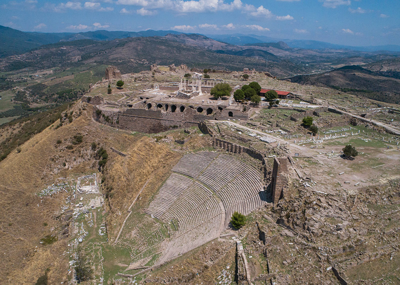
Connect the hidden fortress of Hermias with the monumental Hellenistic capital of Pergamon on a privately arranged journey through the ancient Kaikos region.
Plan Your Northern İzmir Day