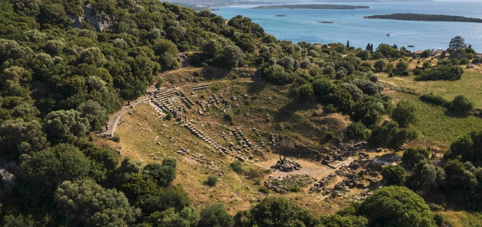
Private Erythrai Ancient City Tour
Explore the theatre, Athena sanctuary, acropolis, fortifications and maritime landscape with a private historical focus.
Request an Erythrai Tour





Erythrai, today spread across the hills and shoreline of Ildırı in the Çeşme district of İzmir, was one of the historic cities of Ionia. Its setting is immediately memorable: the ruins rise above a sheltered Aegean bay, looking toward offshore islands and the coast of Chios beyond. Yet the landscape is more than beautiful. Archaeology reveals a settlement history reaching back to the Early Bronze Age and a major Ionian city that later became known for trade, wine, millstones, sacred architecture, powerful walls and the celebrated prophetic tradition of the Erythraean Sibyl.
The most striking remains for visitors are the ancient theatre on the northern slope of the acropolis, the sanctuary of Athena Polias on the summit, sections of the city's extensive fortifications, the Heroon, and the wider archaeological zones extending toward Cennettepe and the ancient waterfront. Unlike a compact archaeological park, Erythrai is woven into modern Ildırı, with village lanes, cultivated land, hillsides and the sea all forming part of the ancient landscape.
Erythrai's importance comes from the combination of archaeology and historical depth. The site preserves evidence from prehistoric settlement through the Archaic, Classical, Hellenistic, Roman and Byzantine periods. It also occupies a strategic position on the Karaburun–Çeşme Peninsula, facing the eastern Aegean islands and controlling a coastline naturally suited to maritime movement and trade.
For travellers already exploring Çeşme, Alaçatı or Urla, Erythrai offers one of the peninsula's most rewarding historical contrasts: a quiet village landscape where the foundations of temples, theatre seats and Hellenistic walls still sit above the same sea that shaped the city's economy more than two thousand years ago.
Walk through the remains of one of Erythrai's most visible monuments, built into the northern slope of the acropolis and later repaired during the Roman period.
Climb toward the summit where an important Archaic sanctuary produced figurines, offerings and the famous 6th-century BCE Kore statue now associated with İzmir's archaeological collections.
Discover the tradition of Herophile, the prophetess whose fame made Erythrai one of the ancient Mediterranean's best-known centres of Sibylline legend.
Trace massive fortifications, elite Roman neighbourhoods and the maritime geography that connected Erythrai with Chios and the wider eastern Aegean.
Essential information for understanding the archaeological landscape above modern Ildırı before you begin the climb through the theatre, acropolis and ancient city.
Ildırı neighbourhood, Çeşme district, İzmir Province, on the western Aegean coast of Türkiye.
Ionia, on the Karaburun–Çeşme Peninsula opposite the islands of the eastern Aegean.
Erythrai was traditionally counted among the twelve cities of the Ionian League.
The summit above the theatre held the sanctuary of Athena Polias and commands exceptional views across the bay.
The hillside theatre, whose surviving cavea and architectural remains reveal Hellenistic construction and later Roman repairs.
Erythrai was celebrated in antiquity as the homeland of the Sibyl Herophile, one of the ancient world's legendary prophetesses.
Fortifications once enclosed the settlement for several kilometres, with impressive sections still preserved around the wider landscape.
Wine, millstones, maritime trade and specialised local production were important elements of Erythrai's economy.
A monumental Archaic Kore statue from the Athena sanctuary is among the site's most important sculptural discoveries.
Ancient settlement extended between acropolis, slopes, harbour zones and coastal neighbourhoods now partly integrated with modern Ildırı.
Allow around 1.5–2.5 hours for a rewarding first visit, longer if you explore the village and wider fortification landscape.
Expect uneven archaeological ground, stone paths and a noticeable uphill climb toward the theatre and acropolis.
Erythrai rewards travellers who enjoy archaeology in its original landscape. The ruins do not form one polished monumental complex; instead, the ancient city unfolds across the same hills, village lanes and coastline that shaped its history.
The first reason to visit is the setting. From the upper slopes, the Aegean opens below in a wide panorama of coves, islands and distant coastline. This is not simply a scenic bonus. The view explains why Erythrai developed as a maritime city. Its connection with Chios and the eastern Aegean is visible from the moment you reach the acropolis.
The second reason is the site's Ionian archaeology. Erythrai preserves the remains of an Archaic sanctuary of Athena Polias, a Hellenistic theatre, strong defensive walls, funerary monuments, Roman residential areas and evidence for sacred and industrial zones. These remains make it possible to follow the development of an Ionian city through many centuries rather than seeing only one famous building.
The third reason is the city's cultural identity. Ancient authors and later traditions associated Erythrai with the Sibyl Herophile, while archaeological finds such as the monumental Kore demonstrate the sophistication of local religious art. The city was also known for trade, wine, millstones and a strong regional political role.
Finally, Erythrai remains comparatively quiet. Even in the busy Çeşme region, Ildırı feels far removed from the atmosphere of large resort centres. That contrast—ancient stone, village life, olive-covered hills and open sea—is one of the site's greatest strengths.
Erythrai Ancient City lies in Ildırı, approximately 20–22 kilometres northeast of central Çeşme and roughly 60 kilometres west of central İzmir as the crow flies, with road distance varying according to your route. The main archaeological remains rise immediately behind and above the modern coastal settlement.
The city occupied a naturally defensible and commercially valuable position on the peninsula. Its acropolis dominates the bay, while the lower settlement extended toward ancient harbour zones. Offshore islands lie directly opposite the city, and Chios is part of the wider maritime horizon. The geography made Erythrai both a coastal community and a gateway between western Anatolia and the eastern Aegean.
Modern Ildırı now overlaps parts of the ancient city. Some remains stand inside or beside the village, while other archaeological zones stretch across hillsides, roads and cultivated land. This means Erythrai is best understood as a living archaeological landscape rather than one fenced field of ruins.
The ancient name Erythrai is commonly connected with the Greek word erythros, meaning red. Turkish cultural authorities note the traditional explanation that the name referred to the reddish colour of the local soil, giving the city the sense of the “Red City.”
Ancient foundation traditions offered another explanation. Pausanias associated the city's origins with Erythros, a Cretan leader linked to Rhadamanthys. Like many ancient foundation stories, this tradition combines mythology, migration memory and local identity rather than functioning as a modern archaeological account of how the settlement actually began.
The name survived in changing forms long after antiquity. Medieval and later sources used variants such as Erythre, Rhtyrai and Lythri, while forms related to Ilderen and Ildırı became established in the Ottoman and modern periods.
Archaeological finds indicate that the Ildırı area was occupied long before the historic Ionian city emerged. Evidence from the wider site reaches back to the Early Bronze Age, demonstrating that this coastline attracted settlement for millennia before Greek literary traditions began describing Erythrai.
By the early first millennium BCE, Erythrai had become part of the cultural world of Ionia. Ancient traditions connected its population with Cretan, Carian, Lycian, Pamphylian and later Ionian elements, while archaeology on the acropolis has produced strong Archaic material from the 8th–6th centuries BCE. Erythrai became one of the twelve cities associated with the Ionian League and participated in the political and religious networks of the Panionion.
The city passed through the wider regional struggles involving Lydia and the Persian Empire. Like other Ionian communities, it experienced changing degrees of autonomy and participated in the political upheavals of the late Archaic and Classical periods. By the 4th century BCE, Erythrai was again an important regional actor and maintained relationships with powerful figures such as the Carian ruler Mausolos.
The age of Alexander the Great and the following Hellenistic centuries transformed the cityscape. Major fortification phases belong to the Late Classical and Hellenistic periods, while the theatre developed into one of the settlement's principal civic monuments. Under the kingdoms that followed Alexander, Erythrai changed political alignment several times before eventually becoming associated with Pergamon.
After the kingdom of Pergamon passed to Rome in 133 BCE, Erythrai belonged to the Roman world while retaining important civic privileges. Roman-period wealth is visible in the elite residential zones of Cennettepe, in mosaic floors and in repairs to major public monuments. Ancient and later sources also remembered the city for wine, trade and the prestige of the Erythraean Sibyl.
The settlement continued into Late Antiquity and the Byzantine period but gradually lost the political and commercial importance it had enjoyed earlier. After the medieval period, the ancient city became increasingly absorbed into the landscape of the community now known as Ildırı.
Erythrai is often introduced as an Ionian city, but archaeological evidence makes clear that the story of Ildırı began much earlier. Finds from the site demonstrate occupation in the Early Bronze Age, placing the peninsula within the wider prehistoric settlement networks of western Anatolia and the Aegean.
This long chronology matters because it prevents the city from being understood simply as a later Greek foundation. Coastal western Anatolia was already inhabited, connected and culturally dynamic before the emergence of the historic Ionian poleis. The later city developed within a landscape that had been used for generations.
Much of the prehistoric story is less visible to ordinary visitors than the theatre or city walls. It survives in excavation layers, ceramics and scientific interpretation rather than monumental standing architecture. For archaeology-focused travellers, this is a reminder that the most important history of a site is not always represented by the largest surviving stones.
Erythrai was traditionally counted among the twelve Ionian cities that participated in the Panionion, the regional religious and political association of Ionia. Its neighbours in the northern part of the Ionian world included Klazomenai and Phokaia, while Chios lay directly across the sea.
Membership in the Ionian League did not mean that all cities shared one government. Each polis maintained its own institutions, territory, alliances and political conflicts. The League was instead a framework of common religious identity, regional cooperation and competition.
Erythrai's position gave it a distinctive character. It controlled fertile land and stone resources while also facing some of the most important maritime routes of the eastern Aegean. Ancient evidence associates the city with agricultural products, goats, wine, millstones, specialised pottery and trade.
The archaeological remains of the Athena sanctuary, fortifications, civic monuments and elite residences demonstrate that Erythrai was not a peripheral town. It was one of the important urban communities shaping the political and cultural life of the peninsula.
The 8th–6th centuries BCE are among the most important periods for understanding Erythrai's early urban identity. Excavations on the acropolis revealed the sanctuary of Athena Polias together with pottery, figurines, bronze objects, ivory finds and other votive material.
The sanctuary developed over time. The earliest architectural phase is generally placed in the second half of the 8th century BCE, with later additions during the 7th and 6th centuries BCE. Its polygonal masonry and unusual internal features make it an important example of early Ionian sacred architecture.
One of the most remarkable discoveries from the sanctuary area was a monumental Kore statue of the 6th century BCE. Although the head is missing, the surviving drapery and scale of the figure reveal the artistic ambition of Archaic Erythrai and its connection with sculptural traditions across the eastern Aegean.
The Archaic city was also connected with long-distance exchange. Imported styles and local adaptations visible in its art and material culture demonstrate that Erythrai participated in the same networks linking western Anatolia with Samos, Chios, the Cyclades and other eastern Mediterranean centres.
Like the other Ionian cities, Erythrai was drawn into the expansion of Lydian and then Persian power over western Anatolia. The Persian conquest of the region in the 6th century BCE transformed the political environment of Ionia and created the conditions that eventually produced the Ionian Revolt.
Erythrai participated in the wider conflicts and alliances that followed. During the 5th century BCE, Ionian cities repeatedly shifted between Persian authority and Athenian-led alliances according to military circumstances, local politics and regional strategy.
The 4th century BCE was especially important for Erythrai. Inscriptions and historical evidence show the city engaging with powerful regional leaders, including Mausolos of Caria. Such relationships illustrate the complex reality of western Anatolian politics: autonomy, Persian imperial structures, local dynasts and Greek civic institutions all operated at the same time.
This period also set the stage for major changes in the city's fortifications and urban organisation. The surviving wall system belongs largely to the Late Classical and Hellenistic transformation of Erythrai.
The campaigns of Alexander the Great in 334 BCE changed the political balance of western Anatolia. Ancient tradition and later historical interpretation associate Erythrai with renewed civic freedom following Macedonian control of the region.
The late 4th and 3rd centuries BCE were also decisive for the physical form of the city. Major parts of the fortification system were constructed or rebuilt, encircling the settlement across the rugged terrain of the peninsula. Inscriptions and architectural analysis place important wall phases around the late 4th and early 3rd centuries BCE, with later Hellenistic modifications.
The theatre developed in this same broad period. Built into the northern slope of the acropolis, it provided a monumental gathering place for civic performances and public life. Its size has encouraged archaeologists to consider whether the Hellenistic city was reorganised through a process of synoikismos, bringing dispersed communities into a more unified urban centre.
After Alexander's death, Erythrai moved through the unstable political world of the successor kingdoms. Eventually it came into the orbit of Pergamon before the Attalid kingdom was transferred to Rome in 133 BCE.
Under Roman rule, Erythrai remained an important coastal city in the province of Asia. Its political circumstances changed over time, but local civic institutions, trade and religious traditions continued to shape urban life.
The city's Roman prosperity is especially visible in the residential area known as Cennettepe, where excavations uncovered substantial houses and mosaic floors. These remains indicate the presence of wealthy residents and provide a glimpse of domestic life beyond the public monuments of the acropolis.
The theatre and other civic buildings also received attention during the Imperial period. Archaeological interpretation and inscriptions associate important repairs with the age of Hadrian, reflecting the broader pattern of imperial investment in cities across Roman Asia Minor.
Erythrai was famous for high-quality wine, and local amphora production supported the movement of agricultural goods through maritime networks. The city's reputation also became inseparable from the Erythraean Sibyl, whose prophetic fame was remembered far beyond Ionia.
Among the names most strongly associated with Erythrai is Herophile, the legendary prophetess known as the Erythraean Sibyl. In the ancient Mediterranean, a Sibyl was a woman believed to deliver inspired prophetic statements, often in connection with sacred places and moments of crisis.
Ancient authors preserved several competing traditions about the Sibyl's birthplace, travels and chronology. Erythrai nevertheless became one of the places most closely identified with her, and the city actively celebrated the association during the Roman period.
A structure discovered at Ildırı was once proposed as a sanctuary connected with the Sibyl because of inscriptions referring to her Erythraean identity, although the precise identification of the building remains debated. This is a useful example of how archaeology and literary tradition do not always align perfectly.
The Sibyl's fame gave Erythrai an intellectual and religious identity extending far beyond its local territory. For visitors, the tradition adds another layer to the site: Erythrai was not only a trading city and fortified polis, but also a place remembered through prophecy, myth and sacred authority.
At the highest part of the acropolis stood the sanctuary of Athena Polias, the protective goddess of the city. Excavations revealed architectural remains, votive objects and pottery demonstrating long use from the Archaic period onward.
The earliest temple phase is generally dated to the second half of the 8th century BCE. It was enlarged and modified during the following centuries. The sanctuary is especially important for its polygonal wall construction and an internal ramp arrangement unusual enough to make the building a key reference for early Ionian architecture.
Excavations east of the temple produced numerous terracotta goddess figurines along with pottery, stone objects and other offerings from the 7th and 6th centuries BCE. These finds reveal the intensity of cult activity and the role of the acropolis as the city's sacred centre.
The most famous sculptural discovery is the monumental Archaic Kore, a standing female figure dated to around the 6th century BCE. Today it is one of the most important artworks associated with Erythrai and helps connect the weathered ruins on the hill with the refined artistic world that once filled the sanctuary.
The theatre is the most immediately recognisable monument within the main visitor route. It occupies the northern slope of the acropolis, using the natural hillside to support the semicircular seating area.
The first major construction phase is generally placed in the early Hellenistic period, around the 3rd century BCE, although the monument developed over time. The cavea was organised with two horizontal circulation zones, while the stage building survives mainly at foundation level.
During the Roman Imperial period, especially in the age of Hadrian, parts of the theatre appear to have been repaired or modified. This long architectural life is typical of ancient theatres, which were repeatedly adjusted to changing performance, civic and ceremonial needs.
Today much of the seating is damaged or displaced, and visitors should not expect the nearly complete appearance of theatres such as Aspendos. Its power comes instead from the combination of archaeology and landscape: stone terraces, the acropolis rising above and the Aegean environment opening beyond the ancient city.
Northern slope of the acropolis, reached from the main archaeological route above Ildırı.
Hellenistic in its principal early form, with later Roman-period repairs and alterations.
Parts of the cavea, seating zones, retaining architecture and foundations of the stage building.
Take time to look back toward the bay while climbing; the theatre's position explains its relationship with the city and acropolis.
Near the route toward the theatre stands the Heroon, an important funerary or commemorative monument associated with an elite or celebrated individual from the city.
In Greek and Hellenistic cities, a heroon could honour a founder, military leader, benefactor or other figure considered worthy of exceptional commemoration. Such monuments were more than tombs: they linked personal memory with civic identity and could become places of ritual attention.
The Erythrai Heroon helps visitors understand that the area around the theatre was not simply an entertainment district. It was part of a monumental urban approach where public gathering, commemoration and civic display were closely connected.
Erythrai was protected by a major fortification circuit that extended for several kilometres around the settlement. Turkish cultural authorities describe a wall system of approximately five kilometres, with important phases beginning in the Late Classical period and major construction during the Hellenistic centuries.
Some of the strongest surviving sections lie near the road between Ildırı and Barbaros, where masonry can still reach impressive heights. The walls demonstrate how the ancient city used the peninsula's natural ridges together with constructed defences.
Fortifications are valuable historical evidence because they reflect more than warfare. Their scale tells us about population, labour organisation, territorial control and the resources a city could mobilise. Building a multi-kilometre wall across rugged terrain required substantial political coordination.
Visitors exploring the wider area should remember that wall sections can lie outside the main theatre–acropolis route. Do not cross private land or archaeological barriers to reach isolated stretches; view them from legal public access points.
The area known as Cennettepe, near the entrance to modern Ildırı and close to the coast, preserves another side of Erythrai. Excavations here revealed substantial residential architecture associated with the Roman and Early Byzantine periods.
The most celebrated finds are mosaic floors, which belonged to wealthy houses and demonstrate the prosperity of at least part of the city's population. Decorative pavements are especially valuable because they preserve evidence for domestic taste, artistic connections and the organisation of elite living spaces.
Cennettepe is important for balancing the monumental story of theatre and temple. Ancient cities were lived environments, and the villas show how status and wealth were expressed through private architecture as well as public buildings.
Not every excavated residential area is necessarily open as part of the normal visitor circuit. Treat the wider Cennettepe zone as an archaeological research landscape and respect any restricted or protected areas.
Ancient Erythrai possessed an important cult of Herakles. Literary sources describe a distinctive sacred image, while archaeological research has long attempted to identify the sanctuary associated with the god.
Modern excavations in areas containing concentrations of andesite blocks and Archaic architectural fragments produced evidence suggesting sacred use, including decorated terracotta architectural pieces from the Late Classical and Early Hellenistic periods.
The precise interpretation and architectural history of the Herakleion remain part of ongoing archaeological study. This makes it different from a monument such as the theatre, whose basic form is immediately visible. Here, fragments, foundations and excavation context must be combined to reconstruct the ancient sanctuary.
Erythrai's economy was shaped by both land and sea. The peninsula supplied agricultural products and stone resources, while the coast connected the city with Chios, other Ionian centres and wider Mediterranean trade routes.
Ancient and modern sources repeatedly associate Erythrai with millstones. Stone suitable for grinding equipment was an important commercial product, and the city's ability to export such material demonstrates the value of local geology as an economic resource.
The city was also known for wine, particularly during the Hellenistic and Roman periods. Specialised amphora forms helped transport agricultural products, allowing archaeologists to trace commercial networks through ceramic evidence.
Goats and other regional products also appear in ancient descriptions. Together, these references create a picture of a diversified economy: agriculture, animal husbandry, craft production, quarrying and maritime trade all contributed to the city's prosperity.
The sea was central to Erythrai. The bay below the acropolis provided natural shelter, while nearby islands and the short crossing toward Chios placed the city within a dense network of Aegean movement.
Archaeological research has shown that part of the ancient coastal landscape now lies below modern sea level. Changes in shoreline, sedimentation and long-term coastal processes mean that the visible land ruins represent only part of the ancient city.
The maritime setting helps explain Erythrai's economic strength. Wine, stone products, ceramics and other goods could move by sea far more efficiently than over difficult peninsula roads, while imported objects and artistic influences arrived through the same routes.
When you stand on the acropolis, the relationship between city and sea becomes immediately clear. The view is effectively an archaeological map: hills provide defence, bays provide anchorage, islands structure navigation and the horizon points toward the wider Ionian world.
Erythrai did not disappear at the end of the Roman Imperial period. Settlement continued into Late Antiquity and the Byzantine era, although the city gradually lost the regional prominence it had enjoyed earlier.
Christian buildings and later reuse of ancient structures reflect the transformation of the urban landscape. Materials from older monuments were often incorporated into newer buildings, while population and activity shifted according to changing political, economic and defensive conditions.
The wider site includes remains interpreted as Byzantine or Late Antique, but these are generally less monumental than the theatre or Hellenistic walls. They are nevertheless essential to understanding that Ildırı's history continued long after classical antiquity.
After antiquity, the settlement's name appeared in several changing forms. Turkish cultural sources record variants such as Erythre, Rhtyrai and Lythri, before names related to Ilderen and finally Ildırı became established.
Modern Ildırı grew directly within the ancient landscape. Houses, gardens, roads and village spaces now overlap areas once occupied by the ancient city. This makes the relationship between past and present unusually visible.
For visitors, Ildırı is not simply the access point to Erythrai. The waterfront, fishing tradition, village streets and views toward the islands help preserve the same environmental logic that shaped the ancient settlement: a community oriented toward the sea, sheltered bays and the resources of the peninsula.
Modern archaeological excavation at Erythrai is closely associated with Ankara University. Major campaigns began in the 1960s under Prof. Dr. Ekrem Akurgal and continued through the early 1980s. These excavations revealed key monuments including the theatre, Athena sanctuary and important areas of the ancient city.
A new generation of research began in 2007, developing the study of Erythrai beyond the monuments known from earlier campaigns. Work expanded into urban zones, sacred areas, domestic architecture, production, the coastal landscape and the long settlement history of Ildırı.
Research has continued into the present decade. Results from the 2025 excavation season were presented at Türkiye's national excavation symposium in 2026, demonstrating that Erythrai remains an active field project rather than a completed excavation.
In August 2026, the Çeşme District Governor's office reported an official visit to the site and identified Dr. Özlem Vapur as the head of the excavation team briefing the delegation on continuing archaeological research. This current work means that interpretations, accessible zones and conservation priorities can still change as new evidence emerges.
The best-known visible monument, with surviving cavea sections and architectural blocks on the acropolis slope.
Foundations and archaeological remains on the acropolis where important Archaic votives and sculpture were discovered.
A monumental commemorative or funerary structure near the approach to the theatre.
Substantial defensive stretches survive around the wider settlement, especially along parts of the inland side.
Roman and Early Byzantine residential archaeology associated with wealthy houses and mosaic floors.
Research zones connected with Herakles, Cybele and other aspects of religious and urban life.
Later structures demonstrate the continued occupation and transformation of the city after antiquity.
The view itself is essential evidence for understanding Erythrai's maritime position, harbours and relationship with Chios.
Erythrai is an archaeological site where context is more important than monument count. Many structures survive only as foundations or scattered blocks, and some excavated areas are protected or inaccessible. The site becomes much richer when you understand how theatre, sanctuary, walls, harbour and village fit together within one ancient urban landscape.
Erythrai remains an active archaeological site. Excavation seasons continue to investigate areas beyond the monuments exposed by the first generation of research, including neighbourhoods, production zones, sacred spaces and the relationship between the city and its coastline.
Recent research has placed increasing emphasis on everyday urban life. Workshops, storage areas, ceramics and textile-related finds help reconstruct how people worked and produced goods, while architectural studies refine the chronology of streets, houses and public spaces.
Because the site is still being excavated, visitors may encounter fenced trenches, conservation areas or routes that change from season to season. A section that appears open in an older photograph may be restricted during current fieldwork.
The best approach is to treat Erythrai as a working research landscape. Respect barriers, avoid walking on ancient masonry and never move pottery fragments or stones. The smallest object can carry archaeological information when it remains in its original context.
The official Turkish cultural listings identify Erythrai as an archaeological site in Ildırı, but a single stable 2026 opening schedule is not consistently published across official visitor pages. Recent local listings commonly describe access as free, while reported opening hours vary considerably by source and season.
For that reason, do not build a tight itinerary around an old timetable found online. If your visit depends on a specific opening hour, confirm locally in Çeşme or Ildırı shortly before travelling. Active excavation or conservation work may also affect access to individual zones even when the main site is open.
Green hillsides, mild temperatures and comfortable conditions for the climb toward the acropolis.
One of the best periods for clear views, long daylight and warm but generally manageable walking conditions.
Hot, dry and bright. Visit early or later in the afternoon and carry more water than you think you will need.
Excellent for combining archaeology with Çeşme, Urla and the quieter rhythm of the peninsula after peak summer.
Peaceful and atmospheric, though rain can make the slopes and exposed stone slippery.
Cool and quiet. Choose a dry day and check local access conditions before travelling.
For most travellers, April–June and September–October offer the easiest balance of comfortable walking, good visibility and enough daylight to enjoy both the archaeological site and Ildırı waterfront.
Morning is the best practical choice in summer. The climb toward the theatre and acropolis is much easier before the strongest heat, and archaeological details are clearer when you are not rushing to find shade.
Late afternoon is the most atmospheric time for photography. Warm side light catches the ancient stones and the islands beyond the bay, while the view from the upper slopes becomes especially dramatic as the sun lowers.
If you visit later in the day, allow enough time to descend safely. Parts of the route are uneven and should not be treated as a night walk. Do not assume the site remains open until sunset simply because the hillside is visible from the village.
A very effective plan is to explore Erythrai first and then finish with a relaxed stop on the Ildırı waterfront, where the ancient relationship between settlement and sea becomes even easier to appreciate.
Drive northeast toward Ildırı. The journey is roughly 20–22 km depending on your starting point and route.
Travel north and east across the peninsula toward Ildırı, making Erythrai an easy half-day cultural addition to an Alaçatı stay.
Approach from the east through the peninsula road network; private transport makes it easy to combine Erythrai with Klazomenai.
Use the İzmir–Çeşme corridor, then continue toward Ildırı according to current navigation.
The most flexible option if you want to combine Ildırı with Çeşme, Alaçatı, Klazomenai or other peninsula stops.
Local services toward Ildırı can change seasonally. Check current Çeşme and İzmir transport information on the day you travel.
For navigation, search specifically for Erythrai Ancient City / Erythrai Antik Kenti in Ildırı. The archaeological landscape has more than one visible zone, so a map pin may identify only the main access area rather than every ancient monument.
The main theatre and acropolis route is a walking experience once you reach the archaeological area.
The acropolis stands above the village. The climb is manageable for many visitors but noticeably steeper than a flat ruin field.
Loose stone, dry earth and ancient masonry can be slippery, especially on descents.
The theatre helps orient the main visitor route between the lower settlement and upper acropolis.
The city walls and other remains extend across a wide landscape, some beyond normal public access.
Active trenches and conservation areas may be closed even when they sit directly beside an open path.
Enough for a quick look at the theatre and lower archaeological area if your time is limited.
A reasonable first visit with time to climb, pause for views and understand the main monuments.
Ideal for most history-focused visitors who want the theatre, acropolis, sanctuary context and photography time.
Best for archaeology enthusiasts who move slowly, read details and explore the village setting carefully.
Combine the ancient city with Ildırı waterfront, lunch and nearby coastal viewpoints.
Add Çeşme, Alaçatı, Klazomenai or another peninsula heritage stop with private transport.
This route works because it combines archaeology with geography. Erythrai makes the most sense when the acropolis, harbour, islands and modern coastline are experienced as parts of one continuous landscape.
Higher viewpoints reveal the curve of the cavea and show how the monument fits into the hillside.
Use the bay and offshore islands to explain why Erythrai developed as a maritime city.
Low walls, olive trees and Mediterranean scrub create strong natural frames around the archaeology.
Side light gives more texture to the theatre seats and warm tones to the dry summer landscape.
Include the modern village to show the unusual overlap between living settlement and ancient city.
Details of large Hellenistic blocks make excellent close photographs when viewed from public access routes.
Never reposition pottery fragments, blocks or archaeological material for a photograph.
Avoid climbing walls, theatre blocks or fragile structures to gain height for a photograph.
Erythrai can be rewarding for families, especially if you focus on clear stories: an ancient theatre built into a hill, a city protected by kilometres of walls, ships crossing toward Chios and a famous woman believed to speak prophecies about the future.
The main challenge is the terrain. Reaching the upper parts of the site involves climbing on uneven archaeological paths and slopes. Young children need close supervision around loose stones, wall edges and excavation areas.
Visitors with reduced mobility should expect limitations. The combination of steep gradients, earth, stone and irregular surfaces makes the acropolis significantly more difficult than a flat museum or fully restored archaeological park. Current accessible routes should be confirmed before travelling if step-free access is essential.
In summer, heat can be more challenging than distance. Carry water, use sun protection and avoid the strongest midday hours, especially with children or older travellers.
Closed trenches may contain fragile remains or active conservation work even when the area looks safe to enter.
Ancient masonry can shift under weight and may be more fragile than it appears.
Surface fragments lose archaeological value when removed from their original position.
Parts of the ancient city overlap private land and active village spaces.
Dry Mediterranean vegetation can be extremely vulnerable to fire; never use open flame or discard cigarettes.
Observe fieldwork from permitted routes and do not interrupt active trenches for photographs.
It is the easiest monument for understanding the scale and orientation of the ancient city.
The Athena sanctuary and panoramic view give the historical landscape its full meaning.
The site is exposed, and there is no guarantee of visitor facilities once you begin the archaeological route.
Stable footwear is far more useful than sandals on loose stone and dry slopes.
Hat, sunscreen and light clothing are essential in the warm season.
Online listings conflict. Confirm current access locally if your itinerary depends on a precise time.
The islands, bay and coastline are part of the archaeological explanation, not just scenery.
The modern waterfront helps connect ancient maritime history with the living character of the village.
Routes, barriers and visible excavation areas can change between seasons.
Klazomenai or Teos provides an excellent comparison with Erythrai's sacred and fortified landscape.
The closest continuation, perfect for understanding Erythrai's coastal geography and relaxing after the acropolis climb.
Continue to Çeşme Castle, the archaeology museum, marina and historic centre for a broader view of peninsula history.
Stone houses, wind culture, old streets and a very different chapter of the peninsula's architectural history.
Compare Erythrai with another northern Ionian city famous for Liman Tepe, ancient olive-oil production and maritime archaeology.
Combine archaeological history with İskele, local olive culture, food and the modern character of the peninsula.
Continue into southern Ionia for the Temple of Dionysus, theatre, harbour history and a contrasting urban landscape.
Castle streets and marina atmosphere create an easy pairing with nearby Teos.
Use Smyrna, Old Smyrna, Kadifekale and museum collections to place Erythrai within the larger history of western Anatolia.
The simplest and most natural pairing: archaeology on the hill, then the modern waterfront below.
Combine an Ionian city with Çeşme Castle, museum collections and Ottoman-era coastal history.
A balanced day of archaeology followed by stone architecture, local streets and modern peninsula culture.
Compare two northern Ionian cities and see how different harbour landscapes shaped their economies and monuments.
Link ancient maritime history with the modern olive, food and coastal identity of the peninsula.
A serious archaeology day connecting two Ionian cities with contrasting sacred, civic and harbour monuments.
Build a private day around Erythrai, Klazomenai and Teos according to opening conditions and available time.
Visit Erythrai later in the day for Aegean light, then continue to a coastal sunset stop on the Çeşme Peninsula.
Erythrai was an ancient city of Ionia located at modern Ildırı in the Çeşme district of İzmir. Its remains include a theatre, acropolis sanctuary, city walls, Heroon, Roman residential areas and other archaeological zones.
It is in Ildırı, approximately 20–22 kilometres northeast of central Çeşme on the western coast of İzmir Province.
Yes. Ancient tradition counted Erythrai among the twelve cities associated with the Ionian League and the Panionion.
The name is commonly linked with the Greek word for red, possibly referring to the local reddish soil. Another ancient tradition connected the name with the founder figure Erythros.
The historic Ionian city flourished in the first millennium BCE, but archaeological evidence shows settlement in the area reaching back to the Early Bronze Age.
The city is known for its Ionian history, Athena Polias sanctuary, ancient theatre, fortification walls, the Erythraean Sibyl, Roman villas, wine and maritime trade.
She was a legendary prophetess, often called Herophile, whose tradition became strongly associated with Erythrai in antiquity.
Ancient traditions differ on details of the Sibyl's life and origins. Erythrai nevertheless became one of the places most strongly associated with her and actively celebrated that connection.
The ancient theatre is the most immediately recognisable monument for visitors, while the Athena Polias sanctuary on the acropolis is equally important archaeologically.
Its principal early form belongs to the Hellenistic period, probably beginning around the 3rd century BCE, with later repairs and alterations during Roman times.
No. Parts of the cavea and architectural structure survive, but it is heavily damaged and should not be expected to look like a fully restored Roman theatre.
It was the principal sacred area on the acropolis, dedicated to Athena as protector of the city. Its earliest major architectural phase belongs to the Archaic period.
It is a monumental Archaic statue of a standing young woman, discovered near the Athena sanctuary and dated to the 6th century BCE.
A Heroon is a funerary or commemorative monument dedicated to a person of exceptional civic importance, such as a founder, benefactor or celebrated leader.
Turkish cultural sources describe a fortification circuit of approximately five kilometres, with major surviving sections dating mainly to the Late Classical and Hellenistic periods.
Yes, sections survive around the wider landscape, especially inland from the settlement, although not every stretch is part of the standard visitor route.
Cennettepe is a residential archaeological area associated with wealthy Roman and Early Byzantine houses, including important mosaic floors.
It was a sanctuary connected with the cult of Herakles. Archaeologists continue to study the sacred area and its architectural remains.
Yes. Its sheltered bay and position facing Chios made maritime trade fundamental to the city's economy and regional importance.
Ancient and archaeological evidence associates the city with wine, millstones, amphorae and other agricultural or craft products moved through Aegean trade networks.
Yes. Roman-period sources and archaeological evidence connect the city with quality wine production and specialised transport amphorae.
Like other Ionian cities, Erythrai experienced Persian domination after the Persian conquest of western Anatolia and later moved through changing alliances and periods of autonomy.
Ancient and later historical traditions connect Alexander's campaign with Erythrai, and the city regained greater autonomy during the Macedonian transformation of western Anatolia.
In the Hellenistic period the city eventually came into the orbit of the Attalid kingdom of Pergamon before the region passed into Roman control.
The city continued as an important coastal community, with trade, elite residences and repairs to public monuments. Its Sibyl tradition also became especially famous.
Yes. Archaeological excavation and research are active in 2026, and recent seasons continue to produce new evidence about the city's neighbourhoods, sacred spaces and production areas.
Major Ankara University excavations were associated with Prof. Dr. Ekrem Akurgal from the 1960s into the early 1980s. A second-generation programme began in 2007 and continues today.
Official Çeşme reporting from August 2026 identified Dr. Özlem Vapur as head of the excavation team during the current field season.
Recent local visitor sources commonly report free entry, but current access conditions should be confirmed before travelling because official online listings do not always provide a complete visitor schedule.
Published online hours are inconsistent. Confirm current access locally before your visit rather than relying on an old timetable.
About 1.5–2.5 hours is ideal for most visitors. Allow longer if you want detailed photography or time in Ildırı after the archaeological site.
The main challenge is the uphill climb and uneven ground. Comfortable shoes and moderate mobility are helpful, especially for the acropolis.
The steep terrain and irregular archaeological surfaces make full access difficult. Confirm any current accessible lower routes before travelling.
Yes for curious children who enjoy history, but close supervision is necessary on slopes, loose stone and around excavation areas.
Spring and autumn are the most comfortable. Summer is best early in the morning or later in the afternoon.
Morning is best for comfortable walking; late afternoon is excellent for photography and warm Aegean light.
Yes. Erythrai is only around 20–22 kilometres from central Çeşme and combines very easily with the castle, museum and waterfront.
Yes. The ancient city works well as a morning historical visit followed by an afternoon or evening in Alaçatı.
Yes. With private transport, the two sites make an excellent northern-Ionia route comparing very different ancient coastal cities.
A guide is not essential, but Erythrai becomes far more meaningful when the Athena sanctuary, theatre, Sibyl tradition, wall system and maritime geography are explained together.
Do not miss the theatre, acropolis and Athena sanctuary context, but also stop to understand the city walls and the view across Ildırı Bay.
Treating Erythrai as only a ruined theatre. The real site is the entire landscape: sanctuary, fortifications, harbour, residential zones, village and Aegean geography.
Think of it as four connected stories: an ancient coastal settlement, an Ionian sacred and political centre, a Hellenistic fortified city, and a Roman harbour community whose memory survived in modern Ildırı.
A private historical route can connect Erythrai with Ildırı, Çeşme, Alaçatı, Klazomenai, Urla or Teos, creating a day focused on ancient Ionia, archaeology, maritime history, sacred landscapes, photography or the wider story of the Çeşme Peninsula.
Tell us whether your priority is Ionian history, ancient religion, theatre architecture, archaeology, maritime trade, photography, village life or a relaxed archaeology-and-coast day, and we can shape the route around your interests.
Explore the theatre, Athena sanctuary, acropolis, fortifications and maritime landscape with a private historical focus.
Request an Erythrai Tour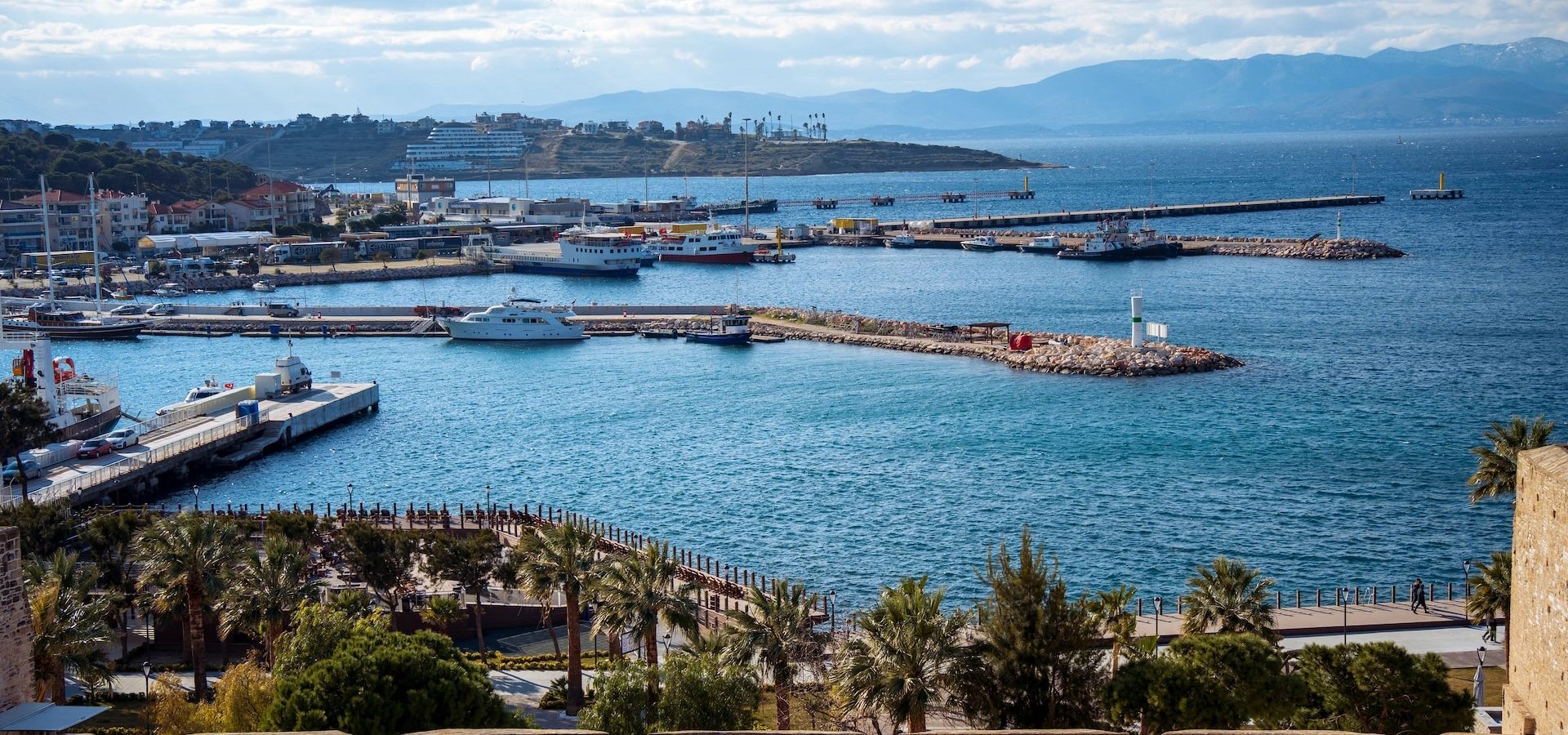
Combine ancient Ionia with Çeşme Castle, peninsula history, Alaçatı stone architecture and the modern Aegean coast.
Explore Çeşme & Alaçatı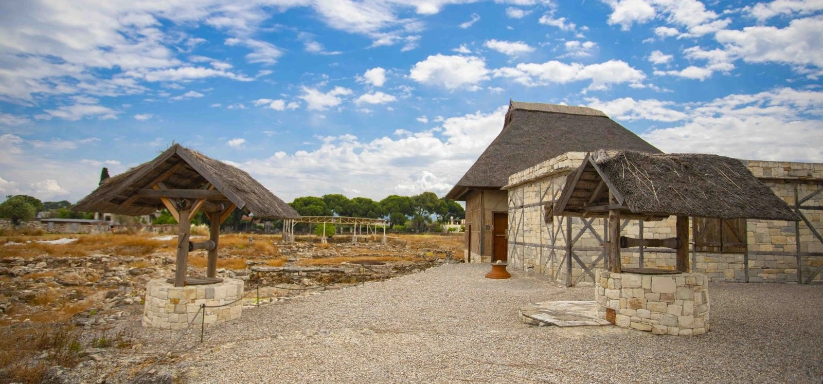
Compare Erythrai's theatre, sanctuary and fortifications with Klazomenai's prehistoric harbour, olive-oil industry and island history.
Explore Klazomenai
Continue with our complete İzmir guide for ancient cities, historic districts, coastal destinations, local food and day trips across the province.
View İzmir Guide