Private Çine Archaeological Heritage Experience
Ask us about a tailored archaeological itinerary exploring the early history of the Çine Valley, with any Tepecik site visit subject to current access arrangements.
Request a Custom Experience





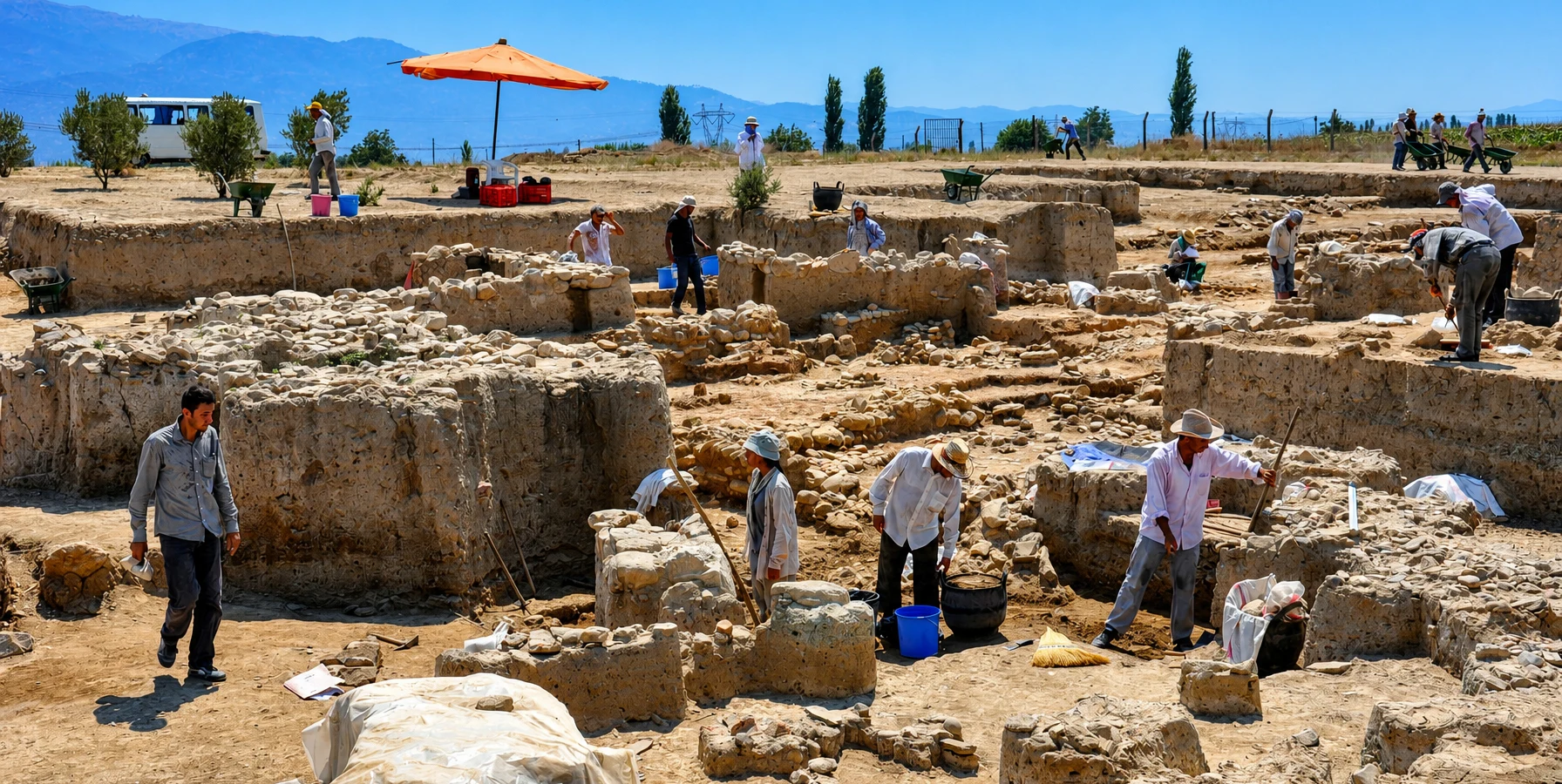
Tepecik Höyük, also known as Çine-Tepecik Höyüğü, is one of the most important archaeological settlements in southwestern Türkiye. Located on the fertile Çine Plain in Aydın Province, this ancient mound preserves evidence of communities that lived, farmed, produced pottery, exchanged goods and developed increasingly complex settlements over thousands of years.
The archaeological record extends from the Chalcolithic period through the Bronze Age, with additional traces from the Carian-Geometric and Roman periods. The earliest clearly documented cultural horizons in official archaeological descriptions reach back to approximately 5500–5000 BC, while archaeological research has also examined evidence for earlier settlement in the region.
What makes Tepecik especially remarkable is the variety of discoveries. Archaeologists have uncovered domestic buildings, storage installations, defensive walls, towers, pottery workshops, obsidian tools, figurines, burial grounds and imported or locally imitated Mycenaean ceramics.
Among the most significant discoveries are seal impressions bearing Anatolian hieroglyphic inscriptions. Together with evidence of Aegean connections, these finds have contributed to discussions about political authority, commerce and cultural relationships between western Anatolia and the Hittite world during the second millennium BC.
Tepecik is primarily an archaeological research site rather than a fully developed visitor attraction. Its importance lies not in monumental standing buildings but in the extraordinary information recovered from the earth, revealing everyday life and cultural change in the ancient Çine Valley.
Discover evidence of agricultural communities dating back thousands of years.
Learn about fortified walls, towers and organized settlement architecture.
Trace connections with the Aegean islands, Mycenaean world and Anatolia.
Explore the significance of Anatolian hieroglyphic seal impressions.
Essential information about the archaeological mound near Çine in Aydın Province.
Çine Plain, approximately 5 km west of Çine town, Aydın Province, Türkiye.
Open on Google MapsChalcolithic, Early, Middle and Late Bronze Age, with later Carian-Geometric and Roman evidence.
Important early cultural horizons date to approximately 5500–5000 BC.
Systematic excavations began in 2004 under Prof. Dr. Sevinç Günel of Hacettepe University.
Mycenaean pottery, defensive towers, storage jars, obsidian tools and hieroglyphic seal impressions.
An archaeological excavation area. Confirm permitted access and any restrictions before arrival.
The mound connects prehistoric village life with the emerging political and commercial systems of the Bronze Age.
Tepecik Höyük is important because it preserves a long sequence of human activity in the interior of the Aegean region. Archaeological discoveries demonstrate that the Çine Plain was connected to wider cultural developments long before the construction of the famous Greek and Roman cities of western Anatolia.
Its earliest communities cultivated crops, raised animals, made tools, worked stone and produced pottery. Over time, architectural remains and material discoveries indicate increasingly complex systems of storage, craft production, settlement organization and social differentiation.
During the second millennium BC, Tepecik developed the characteristics of a substantial Bronze Age settlement. Defensive architecture, large storage vessels, workshops and imported ceramics suggest a community participating in important regional economic networks.
The discovery of hieroglyphic seal impressions is particularly significant. These objects provide rare evidence relevant to the relationship between southwestern Anatolia and the political world known through Hittite-period texts.
For historians, Tepecik helps connect archaeological evidence with the complicated geography of Late Bronze Age western Anatolia. For visitors, it reveals the much older foundations of a region more commonly associated with Carian, Hellenistic and Roman heritage.
Tepecik Höyük is situated within the modern district of Çine, approximately 36 kilometers south of Aydın city and around 5 kilometers west of Çine town. The mound lies near the Çine Çayı, historically associated with the ancient Marsyas River, in a fertile agricultural landscape.
The settlement's location was particularly advantageous in antiquity. The river valley provided water, cultivable land and natural passages connecting inland western Anatolia with the broader Büyük Menderes basin and the Aegean coast.
These corridors helped communities move people, materials and ideas across the region. The availability of farmland, river resources and routes toward other settlements contributed to Tepecik's long history of occupation.
Modern visitors should not expect a prominent classical ruin rising above the surrounding countryside. Tepecik is an archaeological mound whose ancient history is preserved mainly in excavated layers beneath the present landscape.
The history of Tepecik stretches across several major periods of Anatolian archaeology. Each generation added buildings, hearths, pottery, tools and other remains to the settlement, gradually forming the mound that archaeologists investigate today.
During the Chalcolithic period, communities practiced agriculture and animal husbandry while developing pottery traditions, stone-tool production and forms of symbolic expression.
The Early Bronze Age brought changes in architecture, social organization, burial customs and material culture. Some substantial structures suggest differences in social status or communal functions.
In the Middle Bronze Age, the settlement participated in the expanding cultural and economic networks of western Anatolia. Architectural and artistic discoveries demonstrate connections with both local traditions and the wider eastern Mediterranean.
The Late Bronze Age produced some of Tepecik's most remarkable finds, including fortifications, specialized storage buildings, Mycenaean pottery and hieroglyphic seal impressions.
Evidence from the Carian-Geometric period and Roman-period burials shows that the location retained significance after the main Bronze Age settlement phases.
Important early Chalcolithic evidence documents agricultural life, pottery and stone-tool industries.
Substantial architecture, marble figurines and distinctive burial practices become visible.
New architectural forms, specialized objects and regional connections characterize the settlement.
Fortifications, storage complexes, Mycenaean ceramics and hieroglyphic seals reveal increasing complexity.
Later ceramic and settlement traces document activity after the Bronze Age.
Tile-covered graves provide evidence that part of the ancient mound was used for burials.
The Turkish word höyük refers to a settlement mound created by repeated human occupation. Over centuries or millennia, buildings were constructed, repaired, abandoned and rebuilt, gradually accumulating layers of cultural material.
Many early communities used mudbrick, stone foundations, timber and earth. When buildings deteriorated or were demolished, their remains often became part of the ground upon which later structures were built.
At Tepecik, archaeologists investigate these accumulated layers to reconstruct how people lived during different historical periods. Pottery fragments, animal bones, tools, building foundations and traces of ancient surfaces help establish a sequence of occupation.
The process is called stratigraphic excavation. The position of an object within a carefully recorded layer can be as important as the object itself, because it helps researchers understand chronology, activity and cultural development.
Successive building phases reveal how the community changed through time.
Earthen construction materials preserve traces of ancient walls, floors and destruction episodes.
Changing ceramic forms and decoration help archaeologists distinguish periods and cultural connections.
Soil, plant remains, animal bones and geological deposits provide environmental information.
Studies of sediments and buried landscapes help reconstruct the ancient environment.
Excavation records preserve information that would otherwise disappear when deposits are removed.
The early settlement phases provide valuable evidence about the lives of farming communities in western Anatolia. Agriculture, animal husbandry, food preparation, pottery making and craft production formed essential parts of daily life.
Grinding stones indicate the processing of plant foods, while storage installations demonstrate the importance of preserving agricultural produce. Loom weights suggest that textile production was practiced within the community.
Animal remains document the use of cattle, sheep and goats, alongside wild animals such as deer. These discoveries reveal a mixed economy in which livestock raising and hunting contributed to subsistence.
Stone blades, sickle elements, bone implements and worked tools demonstrate the practical technologies of the period. Pottery vessels were used for cooking, storage, transport and serving food.
Decorated ceramics and figurines also show that material culture had symbolic and artistic dimensions beyond everyday utility.
Cultivation and storage formed foundations of the early settlement economy.
Sheep, goats and cattle provided important animal resources.
Stone implements help reconstruct food preparation and processing.
Loom weights provide evidence for weaving and domestic manufacturing.
Useful and decorated vessels demonstrate a developed ceramic tradition.
Specialized implements supported farming, processing and household activities.
One of the most important aspects of Tepecik's archaeological record is the presence of obsidian, a naturally occurring volcanic glass used to produce sharp-edged tools.
Obsidian does not occur at every archaeological settlement. Its presence can therefore provide valuable evidence about movement and exchange between distant regions.
Research at Tepecik has identified obsidian associated with central Anatolian sources and the Aegean islands of Melos (Milos) and Giali (Gyali).
These discoveries demonstrate that communities living inland in the Çine Valley obtained materials connected to exchange networks reaching far beyond their immediate environment.
Obsidian production debris indicates that raw material or partially prepared pieces were worked at the settlement. Tepecik was not simply receiving finished tools; local craftspeople also participated in the manufacture of stone implements.
The discoveries are particularly valuable because they show that the interior valleys of western Anatolia were connected to the Aegean world long before the historical Greek city-states developed.
Volcanic glass from inland sources reveals connections across Anatolia.
Material associated with the Aegean island demonstrates maritime exchange connections.
Another Aegean volcanic source adds to the evidence for long-distance contacts.
Production debris shows that stone artifacts were worked at the settlement.
The second millennium BC brought important developments in the layout and architecture of Tepecik. Archaeological remains demonstrate the existence of increasingly sophisticated buildings associated with storage, production and settlement organization.
The Late Bronze Age settlement was protected by a defensive wall with towers. Excavated sections reveal substantial foundations designed to support structures built with stone and mudbrick.
According to published archaeological descriptions, sections of the defensive wall measured approximately 2.20 meters in thickness, while identified square towers measured about 6.36 by 6.36 meters.
Researchers have interpreted the arrangement of walls and towers as evidence of planned defensive architecture, although the complete ancient circuit has not been exposed.
Within the settlement, buildings containing large storage jars indicate organized agricultural storage and possibly administrative control of goods.
These remains distinguish Tepecik from a simple small agricultural village and suggest the existence of a community with developed economic and social institutions.
Substantial structures protected parts of the Late Bronze Age settlement.
Tower foundations suggest an organized fortification system.
Ancient walls combined stone foundations with earthen building materials.
Specialized rooms contained large vessels used for agricultural products and other goods.
Excavated installations provide evidence of production and processing activities.
Architecture indicates an organized community rather than unrelated isolated structures.
Large ceramic storage jars, known as pithoi, are among the most informative finds from Bronze Age Tepecik. Such vessels were important for storing agricultural produce and other commodities.
Archaeologists have investigated buildings where large jars were positioned in organized arrangements, sometimes partially embedded in the ground. These installations point toward systematic storage rather than purely occasional household use.
Other discoveries include groups of shallow dishes, bowls and pottery vessels, sometimes found stacked together. Their context contributes to interpretations of production, storage and the management of goods.
Excavations have also revealed evidence of ceramic manufacturing, including an approximately 3,500-year-old pottery kiln reported during the modern excavation program.
In 2023, excavators announced a substantial structure tentatively interpreted as having a palatial or religious function, together with grain-storage installations. Such interpretations remain subject to further research as additional architectural evidence becomes available.
Large jars preserved substantial quantities of goods within specialized buildings.
Manufacturing installations demonstrate knowledge of ceramic production technologies.
Arranged storage vessels suggest planned economic activities.
Seal impressions and storage contexts raise questions about authority and the control of goods.
Among Tepecik's most historically significant discoveries are seal impressions containing Anatolian hieroglyphic signs, a writing system associated with the Hittite-period world and its successor states.
These impressions were discovered in archaeological contexts connected with the Bronze Age settlement and storage activities. They are important because they provide written evidence in a region where the political geography of the second millennium BC remains the subject of scholarly investigation.
One seal impression contains a human figure carrying a bow, together with hieroglyphic signs. Published readings have associated the inscription with a princely title and a name rendered as Tamipiya.
Another inscription has attracted attention because proposed readings connect it with names and political traditions associated with the kingdom of Mira, a western Anatolian polity mentioned in Hittite records.
These findings strengthen the importance of Tepecik in discussions of Late Bronze Age administration and western Anatolian political relationships. However, identifying the exact territorial boundaries of ancient kingdoms remains difficult.
Seal impressions are especially informative because they can reflect the authorization, identification or control of goods and their containers. Their presence alongside storage installations opens valuable questions about the organization of Tepecik's economy.
Written signs connect the settlement with wider Late Bronze Age administrative traditions.
One inscription has been interpreted as naming a prince.
Other readings have contributed to debates concerning the political geography of western Anatolia.
Sealing practices suggest formal procedures associated with stored or transferred goods.
Tepecik has produced pottery associated with the Mycenaean cultural tradition, which developed prominently in mainland Greece and spread through the Aegean during the Late Bronze Age.
These discoveries are important because Tepecik lies inland rather than directly on the coast. The presence of Mycenaean-style vessels demonstrates that Aegean cultural and commercial networks extended into the valleys of southwestern Anatolia.
Excavations have identified painted pottery, including kraters and stirrup jars, alongside local ceramic forms. Some Mycenaean-style vessels appear to have been imported, while others were produced locally in imitation of Aegean traditions.
Among the most interesting finds are decorated vessels showing figurative scenes, including warriors and animals. Such images offer insights into artistic conventions and cultural exchange across the Late Bronze Age Aegean.
Local undecorated pottery nevertheless remained an important part of the settlement's ceramic repertoire. The archaeological evidence therefore shows a community maintaining its own traditions while participating in broader networks.
Decorated vessels reveal artistic influences from the Mycenaean world.
Distinctive Aegean ceramic forms document wider connections.
Figurative pottery includes scenes related to Late Bronze Age artistic traditions.
Craftspeople adopted selected foreign forms while maintaining local production.
Goods and ceramic traditions moved between coastal and inland communities.
The pottery demonstrates contact without requiring the assumption of a Mycenaean population takeover.
One particularly intriguing aspect of the archaeological research at Tepecik concerns volcanic deposits identified within the Middle Bronze Age sequence.
Archaeological reports have associated volcanic ash found at the settlement with the great eruption of Thera, modern Santorini, in the Aegean Sea.
The Thera eruption was a major natural event of the Bronze Age. Its effects have been investigated across the eastern Mediterranean, and the dating of the eruption remains an important subject of scientific and archaeological research.
At Tepecik, reported ash deposits provide an opportunity to study environmental change, ancient settlement conditions and possible chronological relationships between western Anatolia and the Aegean.
Researchers use geological analysis, archaeological stratigraphy and comparisons with other sites to evaluate the source and significance of volcanic material.
Excavations at Tepecik have produced figurines and carefully crafted objects that illuminate the symbolic world of its inhabitants.
Among the discoveries are terracotta animal figurines and pottery vessels decorated with modeled animal heads. These objects show that animals played a role not only in subsistence but also in artistic expression and potentially in ritual life.
Marble figurines associated with the Kilia type are particularly important to the study of Chalcolithic western Anatolia. Their stylized human forms, including distinctive heads and facial details, contribute to the understanding of prehistoric artistic traditions.
Middle Bronze Age discoveries include a striking anthropomorphic storage vessel with modeled facial features, arms and jewelry details. Such objects demonstrate sophisticated pottery craftsmanship and an interest in representing the human body.
Another group of finds includes models decorated with stylized bovine imagery, sometimes described using the term bucranium.
Although some objects may have had ceremonial or religious functions, archaeological interpretation requires caution. The beliefs associated with particular figurines cannot always be reconstructed with certainty.
Stylized marble human representations associated with prehistoric western Anatolia.
Modeled creatures reveal artistic interests and possible symbolic meanings.
A remarkable ceramic vessel incorporates modeled human features.
Stylized cattle-related imagery appears in some modeled objects.
Burial discoveries provide a deeply human perspective on the communities that occupied Tepecik. Excavated graves reveal differences in the treatment of adults and children, as well as the placement of objects associated with the deceased.
During the late Chalcolithic and Early Bronze Age, archaeologists have identified simple earth graves and large-vessel burials for adults, alongside smaller pottery burials for infants.
Grave goods include ceramic vessels, jewelry and ornaments fashioned from stone, bone and marine shells. Some burials preserve unusual arrangements that may reflect local customs or individual circumstances.
One notable discovery involved a woman buried with bronze earrings near an infant placed in a pottery vessel. Other graves include ornamental objects and distinctive arrangements involving animal materials.
Such discoveries help researchers investigate family relationships, social practices, personal identity and attitudes toward death. However, the meanings assigned to particular grave goods are interpretations rather than direct statements from the ancient community.
Later in the site's history, Roman-period tile graves provide evidence of renewed funerary use of the mound.
Systematic excavations at Çine-Tepecik began in 2004 under the direction of Prof. Dr. Sevinç Günel of Hacettepe University, with authorization from Türkiye's Ministry of Culture and Tourism.
The project has investigated the settlement's long cultural sequence through excavation, artifact studies, architectural documentation and interdisciplinary scientific research.
Work has concentrated on questions relating to early settlement, agricultural production, defensive architecture, craft traditions, long-distance exchange and the political organization of Bronze Age western Anatolia.
Geoarchaeological investigations have also studied the ancient landscape surrounding the mound. Sediment cores and geological observations help reconstruct environmental conditions and the relationship between the settlement and the Çine Valley.
Research is particularly valuable because many deposits are buried beneath modern ground level. Scientific excavation provides access to information that cannot be understood simply by observing the surface.
Beginning of systematic excavations under the modern research project.
Academic institution associated with the excavation program.
Archaeology combines with environmental, geological and material studies.
Research has continued to reveal architecture, ceramics, manufacturing evidence and storage installations.
Tepecik is fundamentally different from monumental ancient cities such as Ephesus or Aphrodisias. Much of its significance lies in archaeological trenches, foundations and artifacts documented during excavation.
What can actually be seen on a particular day depends on excavation activity, conservation requirements, protective coverings and site access arrangements.
Observe the landscape that accumulated through successive phases of ancient occupation.
Where permitted and visible, examine preserved traces of ancient buildings.
Learn about the defensive wall and tower foundations documented by archaeologists.
Understand how large pottery jars and specialized buildings formed part of the settlement economy.
Appreciate the agricultural landscape and river routes that helped sustain the settlement.
Study published photographs, museum displays and research documenting objects recovered from the site.
Because Tepecik is located within an agricultural landscape and has been used for archaeological research, a visit requires different preparation from a trip to a major museum or established tourist attraction.
Ask about current permission requirements before entering protected archaeological areas.
Rural tracks and archaeological surroundings can have loose soil and uneven surfaces.
Daytime is best for orientation, photography and safe movement.
Do not assume that refreshments or public facilities are available directly at the mound.
Keep away from exposed trench edges, covered structures and work areas.
Unpaved access routes may become muddy after rain, especially during winter.
Leave every pottery fragment, stone tool and archaeological material in place.
Save the location and route before traveling into the rural surroundings of Çine.
Tepecik Höyük is listed by official Turkish cultural and educational authorities as an archaeological heritage location. However, it should not be treated in the same way as a fully managed archaeological museum with a guaranteed ticket office, marked tour route and permanent visitor facilities.
The Turkish Ministry of National Education's outdoor learning listing describes the location as accessible throughout the week, but this general listing does not establish unrestricted entry to active excavation trenches or conservation areas.
There is no independently confirmed standard tourist admission charge or fixed visitor service schedule in the information reviewed for this guide. Before planning a special journey, contact the relevant cultural authorities to verify current access and any restrictions.
The Çine Plain has a Mediterranean climate with hot summers and generally wetter winters. Since the archaeological mound is exposed and visitor infrastructure is limited, weather conditions are an important part of planning.
Generally comfortable temperatures and a green agricultural landscape make spring attractive.
Milder weather is suitable for exploring archaeological and rural heritage locations.
Visit early if access is permitted, before strong heat develops across the open plain.
Rain can make unpaved roads muddy and the archaeological surroundings difficult to navigate.
Dry conditions make it easier to understand the terrain and avoid slippery ground.
Excavation activity can affect access, so verify arrangements rather than assuming the site is open to visitors.
The recommended duration depends primarily on whether a visit is permitted and what areas can be viewed safely. Tepecik is relatively modest in visible monumental remains, so most general travelers will not need several hours at the mound itself.
A brief exterior orientation to the archaeological landscape, using only permitted areas.
A useful introductory visit if the site's accessible areas and conditions allow.
Specialized academic access may require advance authorization and considerably more time.
Combine a permitted visit with local heritage, landscape exploration and a stop in Çine.
Consider combining Tepecik's broader historical context with nearby archaeological sites.
Use age-appropriate explanations and avoid all excavation trenches and restricted areas.
Tepecik offers opportunities for landscape photography and archaeological documentation where access is permitted. The visual appeal comes from the relationship between exposed ancient structures, the mound and the surrounding agricultural plain.
Show the mound in relation to the fertile Çine Plain.
Where permitted, photograph exposed foundations without entering excavated areas.
Low sunlight can reveal textures in earth, stone and ancient masonry.
Use photographs to document the relationship between structures and their surroundings.
Ask before photographing archaeological work, researchers or restricted excavation areas.
Do not fly a drone without the necessary aviation and archaeological-site permissions.
Tepecik is a rural archaeological mound rather than a purpose-built visitor attraction. Ground conditions and the absence of confirmed permanent visitor infrastructure can present difficulties for travelers with limited mobility.
Archaeological and rural surfaces may include loose stones, exposed soil and changes in level.
Step-free access to the mound or excavation areas is not independently confirmed.
Road surfaces and suitable stopping points should be checked before travel.
Do not assume that seating, shade, toilets or drinking water are available on-site.
Unpaved paths and excavation areas may be unsuitable for strollers.
Travelers unable to visit the mound can explore its history through archaeological publications and museum collections.
Tepecik lies west of Çine town in the agricultural plain. The most practical way to reach its vicinity is by private vehicle or a locally arranged transfer, using reliable navigation and checking the condition of the final approach.
The mound is approximately 5 kilometers west of town. Follow verified local directions.
Travel south toward Çine and continue to the archaeological area's local access roads.
Convenient for reaching rural heritage locations, particularly when combining several stops.
Arrange the return journey and waiting time in advance rather than expecting taxis at the site.
Regional services reach Çine, but direct transport to the mound should not be assumed.
Check unpaved roads carefully, as muddy conditions can prevent safe vehicle access.
The area surrounding Çine contains remarkable archaeological landscapes, from prehistoric settlement mounds to the ancient cities of Caria. Tepecik can provide the earliest chapter in a broader exploration of the region's history.
Explore an unusual Carian sanctuary landscape known for its mysterious inscriptions and monumental stone remains.
Discover the remains of an important Carian city with temples, civic buildings and a theater.
Explore archaeological heritage from different historical periods across Aydın Province.
Take a break in the local district center and discover the agricultural traditions and everyday life of the region.
Appreciate the river corridor and landscape that helped connect communities across ancient western Anatolia.
Explore a wider region shaped by prehistoric societies, Carian communities and later Greek and Roman civilizations.
Tepecik Höyük is a prehistoric and Bronze Age settlement mound in the Çine district of Aydın Province, southwestern Türkiye. It preserves important archaeological remains spanning several thousand years.
It is located on the Çine Plain, approximately 5 kilometers west of Çine town and around 36 kilometers south of Aydın city.
Official archaeological descriptions identify early cultural horizons dating to approximately 5500–5000 BC. Research has also considered evidence of earlier occupation within the broader settlement sequence.
Höyük is the Turkish term for an archaeological settlement mound created by the accumulation of buildings, occupation surfaces and cultural deposits over many generations.
It provides evidence for early farming societies, Bronze Age architecture, ancient trade connections, storage systems and written administrative traditions in western Anatolia.
Systematic archaeological excavations began in 2004 under Prof. Dr. Sevinç Günel of Hacettepe University, working with authorization from Türkiye's Ministry of Culture and Tourism.
The second-millennium BC settlement developed substantial architecture, defensive structures and organized storage facilities. These discoveries support interpretations of an increasingly complex settlement.
Yes. Archaeological excavations have identified substantial Bronze Age defensive walls and square towers.
Discoveries include prehistoric pottery, stone and bone tools, marble and terracotta figurines, large storage jars, Mycenaean ceramics, metal objects and hieroglyphic seal impressions.
Seal impressions bearing Anatolian hieroglyphic inscriptions have been recovered. They provide important evidence concerning Tepecik's connections with the Hittite-period political and administrative world.
Some archaeological and epigraphic interpretations connect discoveries at Tepecik with the kingdom of Mira. However, the precise political geography and administrative relationships remain scholarly questions.
Yes. Excavations identified Mycenaean-style ceramics, including painted vessels and locally produced imitations, demonstrating cultural and commercial connections with the Aegean.
Obsidian associated with Aegean island sources such as Melos and Giali provides evidence of long-distance exchange networks reaching the settlement.
Researchers have reported volcanic deposits interpreted as connected with the Thera eruption. The precise nature and scale of the eruption's effects at Tepecik require careful scientific interpretation.
Excavations reported in 2023 revealed a substantial Bronze Age building provisionally interpreted as having palatial or religious characteristics, together with storage installations. Its exact function is not conclusively established.
Archaeologists have identified evidence of ceramic production, including an approximately 3,500-year-old kiln.
Yes. Discoveries include Early Bronze Age adult and infant burials, as well as later Roman-period graves.
It is a recognized archaeological heritage site, but access to excavated and protected areas may be restricted. Check with the relevant cultural authorities before planning a visit.
A current standard tourist admission fee has not been independently confirmed. Visitors should check whether permission or other arrangements are required.
An educational authority listing describes the site as accessible throughout the week, but this should not be interpreted as permission to enter active excavations. Confirm access before arrival.
If a visit is permitted, approximately 30–60 minutes may be sufficient for a general introduction. Specialized archaeological visits require different arrangements.
Accessible paths and facilities have not been independently confirmed. Rural ground conditions and excavation trenches may present significant barriers.
Spring and autumn generally offer comfortable weather. In summer, mornings are preferable because the Çine Plain can become very hot.
The history can be educational for children, but archaeological trenches and exposed surfaces require close supervision. Access must be confirmed and restricted areas avoided.
No. Archaeological material must remain in place. Collecting objects removes valuable historical evidence and may violate heritage protection laws.
For travelers especially interested in prehistoric archaeology and Bronze Age western Anatolia, Tepecik is historically fascinating. However, its significance is largely archaeological rather than monumental, and access should be checked in advance.
Archaeological settlement mounds are exceptionally sensitive environments. Even small disturbances can destroy the relationship between an artifact and the layer in which it was preserved.
Do not cross fences, excavation markers or conservation barriers.
Never collect pottery fragments, stones, bones or other archaeological materials.
Avoid standing, climbing or leaning on exposed architectural remains.
Do not interfere with excavation work, equipment or scientific documentation.
Stay on permitted routes and respect privately cultivated fields.
Carry away all litter and help protect the rural archaeological landscape.
Explore the extraordinary heritage of Aydın, from prehistoric settlement landscapes to Carian cities and Roman monuments. Our private cultural itineraries can be shaped around your interests, with archaeological-site access checked individually and no compulsory shopping stops.
Combine the historical context of Tepecik Höyük with the remarkable heritage of the surrounding region.
Ask us about a tailored archaeological itinerary exploring the early history of the Çine Valley, with any Tepecik site visit subject to current access arrangements.
Request a Custom Experience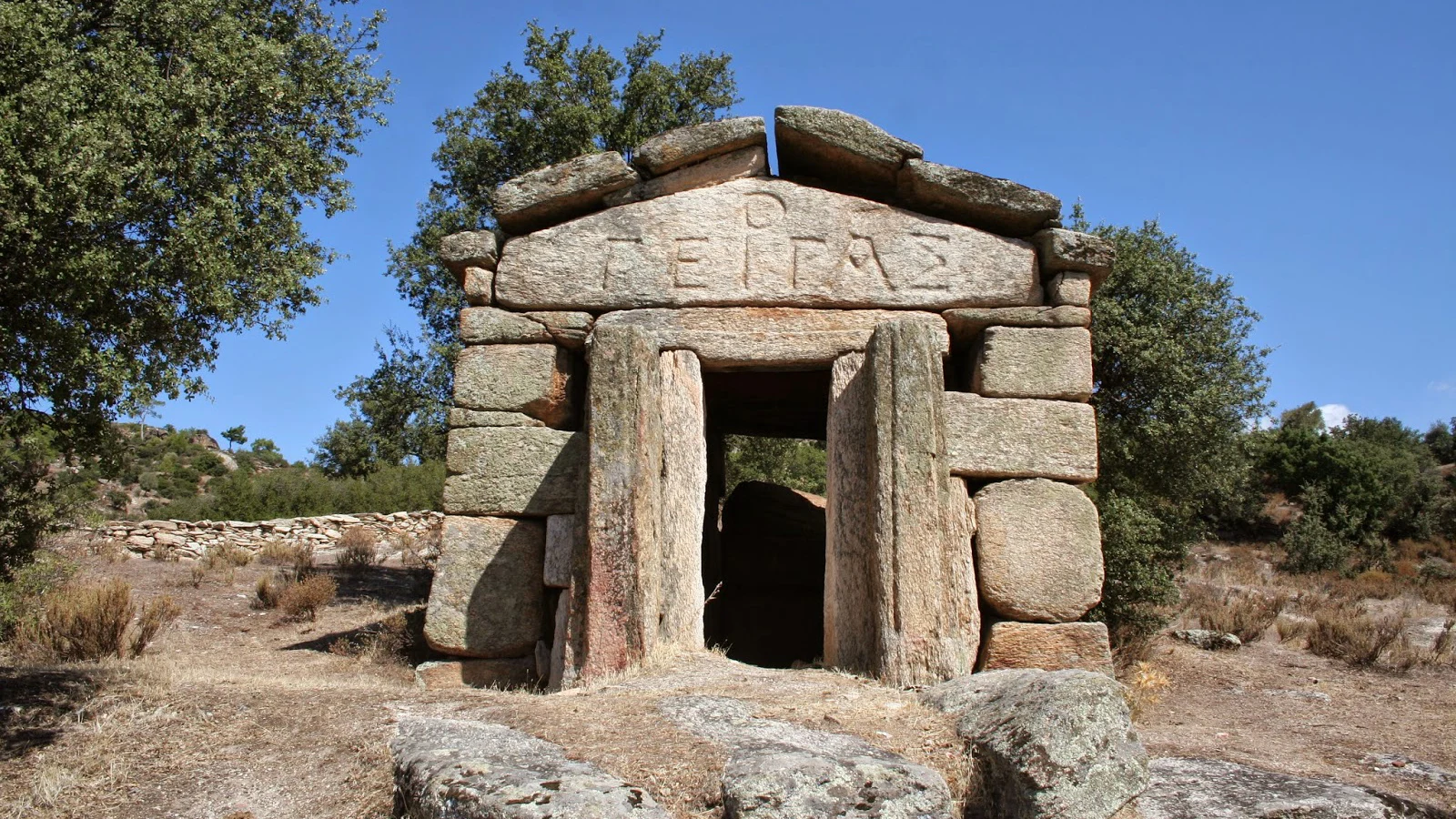
Discover an enigmatic Carian heritage landscape with unusual stone monuments and inscriptions in the hills of Aydın.
Explore GergaTravel through the many chapters of western Anatolian history, from prehistoric communities to the cities of classical Caria.
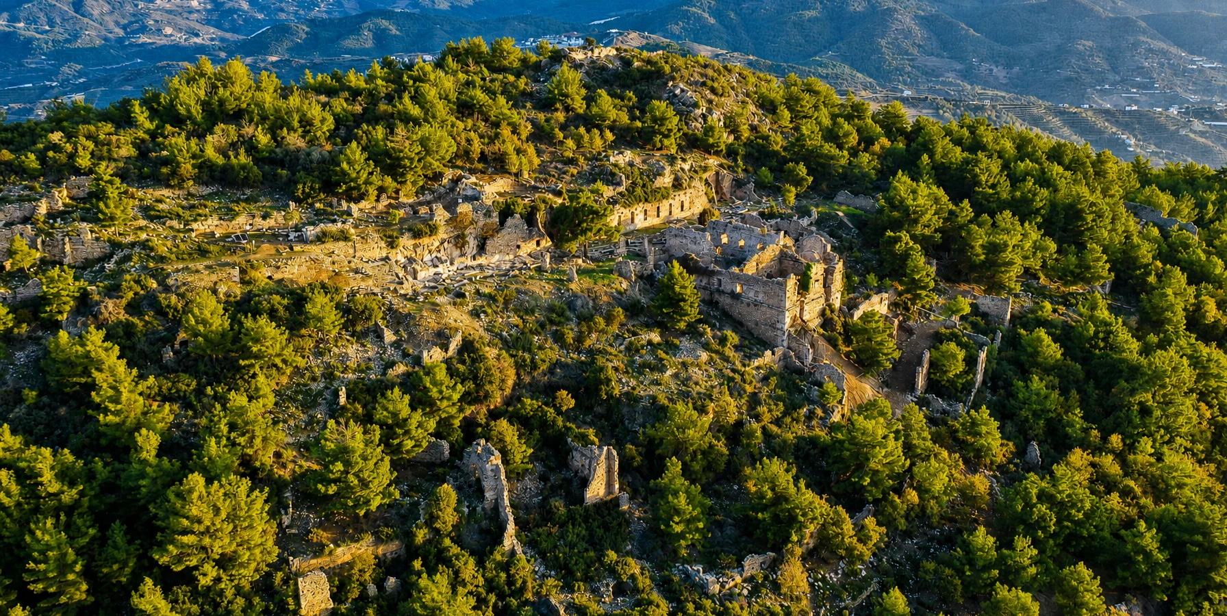
Discover one of Caria's notable ancient cities, with remains reflecting its civic, religious and architectural history.
Explore Alabanda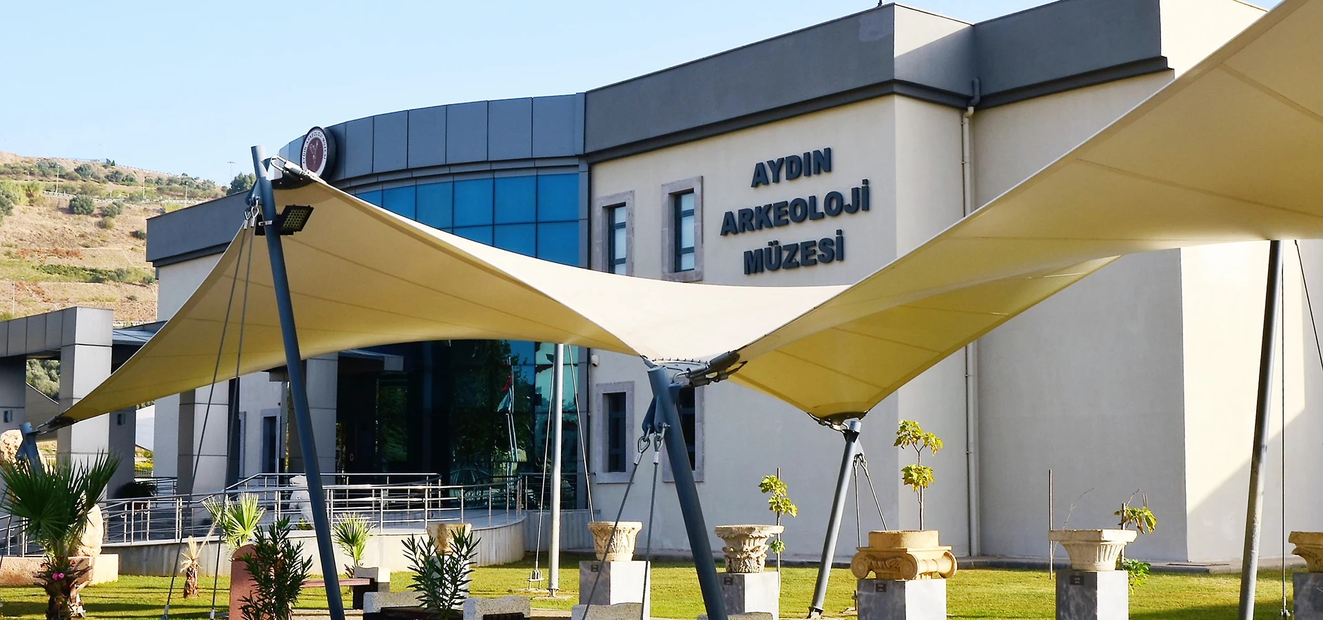
Explore the region's long history through archaeological collections and discoveries from different civilizations.
Explore the Museum