Ancient Mount Ida, Primeval Forests and Wild North Aegean Landscapes

Kazdağları & Yenice Forests – Complete Visitor Guide

Explore the legendary forests of ancient Mount Ida,
from waterfalls and canyons to rare fir trees, mountain villages and hidden forest roads.

Explore Kazdağları & Yenice

Discover Kazdağları & Yenice – Where Mount Ida Becomes a Living Forest

The Kazdağları – ancient Mount Ida form one of northwestern Türkiye's most remarkable mountain landscapes. Rising between the North Aegean coast and the interior of the Biga Peninsula, the range combines deep valleys, cold mountain streams, pine and oak forests, rare plant species, traditional villages and a mythology that reaches back to Homer's Iliad.

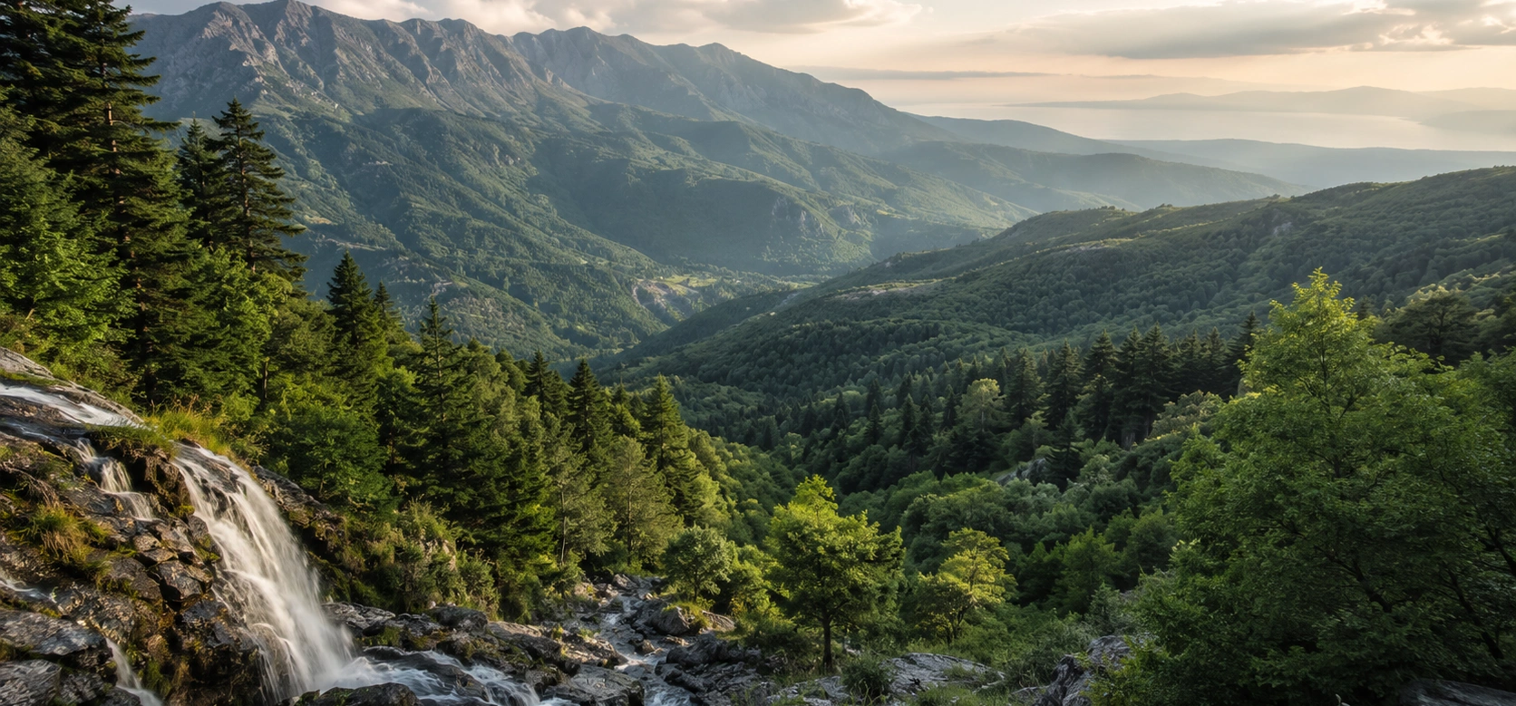
On the southern slopes, Kazdağı National Park protects a major section of the mountain above Edremit and the Gulf of Edremit. The landscape here includes famous natural attractions such as Sütüven Waterfall, Hasanboğuldu, Şahindere Canyon, Pınarbaşı and high mountain routes toward Sarıkız and the upper ridges.

To the north, the district of Yenice opens into another immense world of woodland. Around seventy percent of the district is covered by forest, with mixed communities of pine, oak, beech, hornbeam, chestnut, fir, plane and other species. The area is especially important for the Kazdağı fir, a tree associated specifically with the Mount Ida region.

Together, Kazdağları and Yenice reveal two complementary faces of the same mountain system: the dramatic Mediterranean-facing slopes descending toward the Aegean, and the cooler, deeply forested northern country of Çanakkale. For travellers who love walking, photography, botany, mythology and quiet landscapes, this is one of the most rewarding regions in western Türkiye.

Kazdağı National Park

Explore protected mountain landscapes of forest, canyon, spring water and panoramic highland scenery.

Yenice Forests

Discover one of Çanakkale's richest woodland environments, with extensive mixed forests, lakes and village routes.

Mount Ida Mythology

Walk through the mountain world associated with Zeus, the Trojan War, Sarıkız and generations of local legends.

Rare Biodiversity

Look for the endemic Kazdağı fir and the remarkable variety of plants created by changing altitude, climate and terrain.

Plan Your Visit

Kazdağları & Yenice – Quick Facts

Essential information for exploring the forests, valleys and mountain routes of ancient Mount Ida.

📍

Region

Northwestern Türkiye, spanning the Mount Ida landscape between Balıkesir and Çanakkale on the Biga Peninsula.

⛰️

Highest Point

Karataş Tepe – 1,774 metres, the highest summit of the Kazdağları massif.

🌲

Forest Highlight

The region is famous for rich mixed forests and the distinctive Kazdağı fir.

🥾

Best Experience

Combine forest walking, waterfalls, viewpoints, village roads and mythology over one or two days.


A Mountain Between the Aegean and Marmara Worlds

Understanding the Kazdağları Landscape

Kazdağları is not a single attraction but a broad mountain region shaped by altitude, water, forests, mythology and village life.

The Kazdağları rise across the southern Biga Peninsula, creating a natural transition between the North Aegean coast and the interior of northwestern Anatolia. Ancient writers knew the mountain as Mount Ida, a name inseparable from the mythology and geography of the Troad.

The mountain system is formed by several ridges and highlands cut by deep valleys and watercourses. Its southern slopes descend dramatically toward the Gulf of Edremit, while the northern side opens into the heavily forested country of Bayramiç and Yenice.

Changes in altitude create striking differences in vegetation. Lower slopes may contain red pine, maquis and olive-growing landscapes, while higher and cooler areas support black pine, oak, beech, fir and mixed forest communities.

Water is one of the defining elements of the range. Snowmelt, springs and mountain streams feed waterfalls, pools and canyons and eventually flow toward either the Aegean coast or the interior valleys of the peninsula.

The mountain's isolation and ecological variety have helped preserve unusual plant communities. Modern conservation is therefore central to the Kazdağları experience: visitors are entering not only a beautiful landscape, but also a sensitive ecosystem where access rules may vary by zone.

For travellers, the most important distinction is between Kazdağı National Park on the southern Edremit side and the wider Kazdağları–Yenice forest landscape to the north and west. They belong to the same great mountain environment but are reached through different roads, villages and access systems.

Kazdağı National Park

Kazdağı National Park lies within the Edremit district of Balıkesir and protects the spectacular southern face of the mountain above the Gulf of Edremit. It was declared a national park in 1993 and covers roughly twenty-one thousand hectares of mountain terrain.

The park is valued for its biological diversity, forest and water ecosystems, deep valleys, canyons, geological formations and mythology. It stretches from lower foothills near the coast toward some of the highest parts of the Kazdağları massif.

Deep Valleys

Streams descending from the upper mountain have cut narrow valleys and canyons into the southern slopes.

Mountain Forests

Red pine, black pine, oak and other forest communities change noticeably as elevation increases.

Cold Springs

Numerous springs and mountain watercourses create shaded picnic areas, waterfalls and clear pools.

High Ridges

Upper routes reveal a completely different landscape of exposed peaks, windswept ridges and wide Aegean panoramas.


Some parts of the national park can be visited independently, while access to particular mountain routes may require official permission, designated entrances or an authorised local field guide. Always check current regulations before planning a summit, canyon or back-country route.

What to See

Highlights of Kazdağları & Yenice

The region is large. These are some of the landscapes that best explain its character.

Sütüven Waterfall

A popular waterfall and recreation area on the southern side of Kazdağı, surrounded by forest and cool mountain water.

  • Setting: Forest, stream and rocky cascades
  • Best for: Short nature visit and photography
  • Combine with: Hasanboğuldu

Hasanboğuldu

A famous mountain pool associated with one of the best-known love legends of the Kazdağları and later immortalised in Turkish literature.

  • Character: Cold mountain water and forest
  • Tradition: Hasan and Emine legend
  • Nearby: Sütüven Waterfall

Şahindere Canyon

One of the most dramatic canyon landscapes of the national park, cutting deeply into the southern mountain slopes.

  • Landscape: Deep canyon and forest
  • Experience: Viewpoints and guided nature routes
  • Access: Check current park arrangements

Sarıkız High Country

The upper mountain around Sarıkız is one of the most symbolic landscapes of Kazdağı, combining wide views with powerful local legend.

  • Elevation: High mountain terrain
  • Importance: Local mythology and pilgrimage tradition
  • Visit: Usually requires appropriate access planning

Pınarbaşı

A cool spring-fed recreational area where mountain water emerges beneath forest cover on the Edremit side of the park.

  • Best for: Shade, water and a relaxed nature stop
  • Atmosphere: Especially pleasant in warm weather
  • Setting: Forested foothills

Yenice Forests

Vast mixed forests cover much of Yenice district, creating one of the most impressive woodland landscapes in Çanakkale.

  • Forest cover: Roughly 70% of the district
  • Activities: Walking, photography and birdwatching
  • Character: Quiet roads, valleys, streams and villages

Kalkım

South of Yenice, Kalkım sits between Kazdağları and Asar Dağı in a heavily forested landscape well suited to slow exploration.

  • Best for: Forest routes and rural scenery
  • Nearby: Agonya landscape
  • Experience: Trekking and nature tourism

Yenice Forest Ponds

Yenice district is known for a network of forest ponds that add open water, reflections and birdlife to the woodland landscape.

  • Number: 13 ponds are highlighted by local tourism authorities
  • Best for: Photography and quiet nature stops
  • Access: Road conditions vary by season

Why Yenice Forests Are Special

Yenice lies on the northern slopes of the Kazdağları system and is one of Çanakkale's most heavily forested districts. The landscape is shaped by valleys, ridges, streams and changing microclimates that allow many different tree species to grow close together.

Mixed Forest

Red pine, black pine, oak, chestnut, fir, hornbeam, beech, plane, alder, ash, linden and hazel can all occur within the wider district.

Changing Microclimates

Elevation, slope and exposure create local conditions where Mediterranean, Marmara and cooler forest communities meet.

Quiet Scale

The attraction is not a single monument but the enormous continuity of woodland across hills, valleys and rural roads.

Eco-Tourism

Walking, photography, birdwatching, nature sports and village-based exploration are among Yenice's strongest experiences.


Yenice is particularly rewarding for travellers who enjoy slow scenic driving and flexible walking. Instead of rushing between famous monuments, spend time following forest roads, stopping near streams and ponds, and allowing the landscape itself to become the main attraction.

The Kazdağı Fir

One of the most celebrated plants of the region is the Kazdağı fir, commonly referred to in Turkish as Kazdağı göknarı. It is closely associated with the high forests of Mount Ida and is one of the botanical symbols of the mountain.

Common Name Kazdağı Fir / Kazdağı Göknarı
Scientific Group Abies equi-trojani
Habitat Cooler, higher forest environments of the Kazdağları region
Importance A locally distinctive fir associated with the biodiversity of Mount Ida

The fir is only one part of a much richer botanical picture. Official national-park sources record around 1,000 plant taxa in the wider Kazdağı environment and identify dozens of plants that are endemic to the mountain. This botanical diversity is one of the main reasons the region receives such strong conservation attention.

Visitors should resist the temptation to collect flowers, herbs or other plants. Many species may be protected, rare or difficult to identify, and the best way to experience the mountain's flora is to photograph it and leave it in place.

Forests, Plants and Wildlife

The ecological richness of Kazdağları comes from the meeting of different climate zones, elevations and geological environments. Warm lower slopes, cool upper forests, shaded ravines, open ridges and water-rich valleys all support different communities.

Lower Slopes

Red pine, evergreen shrubs and Mediterranean vegetation dominate many warmer areas closer to the coast.

Middle Elevations

Oak and mixed woodland become increasingly important as altitude and moisture change.

Higher Forest

Black pine, fir and cooler-climate species appear in the upper mountain environment.

Ravines & Streams

Moist corridors support dense vegetation and create some of the greenest landscapes in the region.

Birdlife

Woodland, open ridges, water and agricultural clearings create varied habitats for birdwatching.

Wildlife Etiquette

Keep distance from animals, avoid loud disturbance and never leave food or rubbish in forest areas.

Mount Ida in Greek Mythology

Long before the name Kazdağları appeared, the mountain was known to the ancient Greeks as Ida. It rises behind the landscape of the Troad and became one of the most important sacred mountains in the mythology surrounding Troy.

In Homer's Iliad, Zeus watches events of the Trojan War from Mount Ida. The mountain is therefore not simply scenery in the epic: it is a divine observation point from which the world of gods and the human battlefield below become connected.

Zeus

The king of the gods is repeatedly associated with the heights of Ida and with observing the conflict around Troy.

Gargaron

Ancient literary tradition names Gargaron or Gargaros as an important summit associated with Zeus.

Judgement of Paris

Later mythological tradition places the famous judgement of Hera, Athena and Aphrodite within the wider landscape of Mount Ida.

Troy & the Mountain

From the Trojan plain, the massif forms the great southeastern horizon and remains essential to understanding the geography of the epic world.


The exact modern identification of every ancient peak or mythological location remains open to interpretation. The most meaningful way to experience Mount Ida is therefore to understand the connection between real geography and ancient literary memory rather than expecting every story to correspond to a precisely proven archaeological point.

Sarıkız and the Sacred High Country

Kazdağları also has its own powerful regional folklore. The best-known story is the legend of Sarıkız, whose memory is connected with the high mountain above the Edremit Gulf.

Different versions of the story survive, but they generally centre on a young woman whose honour is falsely questioned, her exile to the mountain and the discovery that she possesses extraordinary spiritual purity or miraculous power. Her father later recognises the injustice done to her, but the story ends tragically.

Landscape High ridges and summit country of Kazdağları
Theme Innocence, exile, faith and tragedy
Living Tradition The story remains part of regional memory and mountain culture
Visitor Note High-country access should be planned according to current national-park regulations

The Sarıkız tradition gives Kazdağları a second mythological identity alongside ancient Mount Ida. One belongs to the world of Homer and the Olympian gods; the other belongs to the living folklore of the communities around the mountain.

Waterfalls, Pools and Canyons

Water transforms the character of Kazdağları. Rainfall, snowmelt and springs descend through steep valleys, producing cold streams, waterfalls, forest pools and deep canyon systems.

Sütüven

A lively waterfall in a popular forest recreation area on the southern side of the mountain.

Hasanboğuldu

A clear mountain pool whose natural beauty is inseparable from the tragic local legend of Hasan and Emine.

Şahindere

A long, dramatic canyon illustrating how deeply water has cut into the mountain's southern geology.

Yenice Streams

The northern forests are crossed by creeks and small waterfalls that appear between villages and along woodland roads.


Mountain water can be extremely cold even in summer, and wet rocks can be slippery. Treat pools and waterfalls as natural environments rather than controlled swimming facilities, especially after heavy rain or during periods of strong flow.

The Ponds of Yenice

Local tourism authorities highlight 13 ponds within Yenice district. These bodies of water create a completely different atmosphere from the fast-moving mountain streams of southern Kazdağı.

Forest ponds are especially attractive for landscape photography, birdwatching, picnics and quiet stops during scenic drives. Their appearance changes significantly through the year as water levels, vegetation and weather shift.

Morning Reflections

Calm early conditions can produce mirror-like reflections of forested hills and changing seasonal colour.

Birdwatching

Open water adds another habitat to the forest environment and can reward patient wildlife observation.

Scenic Driving

Several ponds can be incorporated into flexible forest-road itineraries around Yenice and surrounding villages.

Seasonal Conditions

Minor roads may become muddy or difficult after rain, so route planning should reflect weather and vehicle type.

Villages of Yenice and Kazdağları

The mountains are not empty wilderness. Villages, small agricultural clearings, forest roads and local traditions have developed alongside the woodland for generations.

Kalkım

A forested settlement south of Yenice that works as a gateway to rural routes between Kazdağları and Asar Dağı.

Aşağıçavuş

A village known for its shaded coffeehouse setting, streamside atmosphere and nearby forest scenery.

Yörük Traditions

Seasonal celebrations, village food and local cultural memory add a human layer to the nature experience.

Local Products

Dairy products, village cheeses, tomato and pepper pastes, grains and traditional home cooking reflect the agricultural landscape.


When travelling through small villages, remember that these are living communities rather than open-air museums. Drive slowly, park without blocking local roads, ask before photographing people closely and support small village businesses when possible.

Hıdırlar and the Thermal Landscape

Yenice is also recognised for thermal tourism. The wider district was designated as a thermal tourism centre in 2006, adding another dimension to a region better known for forests and outdoor activities.

Hıdırlar

The Hıdırlar area is known for sulphurous thermal water and mud-bath traditions.

Kum Ilıcası

Another local thermal area where several natural sources emerge from the ground.

Forest & Wellness

Thermal stops can be combined with scenic drives and quiet forest exploration in a slower Yenice itinerary.

Check Before Visiting

Facilities, access and operating arrangements can change, so verify current conditions before travelling specifically for bathing.

Hiking and Nature Routes

Kazdağları and Yenice offer everything from short forest walks to demanding mountain routes. The most important part of planning is understanding that trail conditions and access rules vary greatly.

Easy Experience Short walks near waterfalls, picnic areas, villages and accessible forest roads
Moderate Experience Longer forest paths, pond routes and rolling mountain terrain
Advanced Experience High ridges, remote valleys and canyon routes requiring experience and careful planning
National Park Some routes require authorised access or a local field guide
Best Practice Check weather, current restrictions, road conditions and daylight before starting

Do not assume that every line shown on an online map is a maintained hiking trail. Forestry roads, fire roads and old paths can change after storms, logging operations or seasonal closures. For remote routes, local guidance is considerably safer than relying on a phone map alone.

Photography in Kazdağları & Yenice

The region offers an unusually wide range of photographic conditions within a relatively compact area: shaded forest, moving water, open ridges, village scenes, mist, autumn colour and broad views toward the Gulf of Edremit.

Forest Roads

Curving roads framed by tall trees are especially atmospheric in early morning light or light mist.

Waterfalls

Use surrounding rocks and vegetation to show the scale of the water rather than photographing only the cascade.

Autumn Forest

Yenice's mixed woodland can produce a richer range of seasonal colour than the warmer coastal slopes.

High Viewpoints

Clear days from upper Kazdağı can reveal enormous layers of mountain, coast and Aegean sky.


For the strongest images, avoid treating the entire day as a midday sightseeing schedule. Morning mist and late-afternoon side light often reveal the forest's depth far more effectively.

How to Get to Kazdağları & Yenice

Because Kazdağları is a broad mountain region, there is no single entrance that serves every attraction. Your route depends on whether you are exploring the southern Edremit side, the western Bayramiç–Adatepe side or the northern Yenice forests.

From Edremit & Akçay

Best for the southern national-park entrances, Sütüven, Hasanboğuldu, Pınarbaşı and Şahindere-area routes.

From Küçükkuyu

Ideal for combining the western Kazdağları landscape with Adatepe Village, Zeus Altar and the North Aegean coast.

From Çanakkale

Travel southeast toward Bayramiç or Yenice depending on whether your priority is Mount Ida mythology or deep forest scenery.

Private Vehicle

The most flexible option for combining villages, ponds, forest roads, waterfalls and distant trailheads in one itinerary.


Distances can be deceptive in mountain country. A place that appears close on a map may require a long drive on winding local roads. Plan fewer stops than you would on a highway-based itinerary and leave room for slow driving, photography and unexpected viewpoints.

Visiting Kazdağları National Park & Yenice Forests

Kazdağları is a protected and environmentally sensitive mountain region. Visitor arrangements can differ between recreational areas, national-park routes and ordinary forest roads.

Destination Type National park, mountain forest, canyon, waterfall, rural and eco-tourism region
Recommended Time At least one full day; two days or more for both southern Kazdağı and Yenice
Transport Private vehicle is strongly recommended for flexible exploration
Footwear Walking shoes with good grip for forest paths, stones and wet surfaces
Access Check current national-park permissions, guide requirements and seasonal restrictions

National-park opening hours, entrance fees, fire restrictions and route permissions can change. If a particular summit, canyon or guided route is important to your trip, confirm the latest conditions shortly before travelling.

Best Time to Visit Kazdağları & Yenice

Spring

One of the best seasons for wildflowers, flowing water, green forest and comfortable walking temperatures.

Summer

Popular for cool mountain air and shaded streams, but fire risk and access restrictions can become especially important.

Autumn

Excellent for photography, softer temperatures and changing colour in the mixed forests of Yenice.

Winter

Atmospheric but more demanding, with possible snow, ice, rain, fog and difficult conditions on high or minor roads.


For a first visit, late spring and early autumn offer the easiest balance of greenery, water, comfortable temperatures and road access. In every season, mountain weather can change more quickly than conditions on the coast.

How to Combine Kazdağları and Yenice

Trying to see the southern national park and Yenice forests in a single rushed day would miss the character of both. A two-day journey gives the landscape room to breathe.

Day 1 Morning – Sütüven & Hasanboğuldu Begin with forest, waterfall and the famous mountain pool on the Edremit side
Day 1 Afternoon – National Park Continue toward Pınarbaşı, Şahindere or another accessible guided mountain route
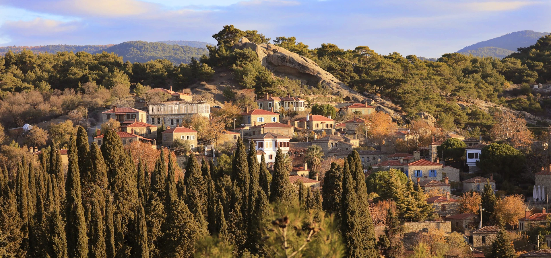
Day 1 Late Afternoon – Adatepe Cross toward the western foothills for stone-village atmosphere and the mythology of Mount Ida
Day 2 Morning – Yenice Forests Enter the northern woodland for scenic forest roads, walking and photography
Day 2 Afternoon – Kalkım & Forest Ponds Explore the rural landscape slowly, adding a village stop, pond or thermal area according to conditions

This route is strongest for travellers who want to experience the mountain as a complete region rather than a checklist: mythology, protected nature, forest ecology, local stories, villages and the dramatic transition from Aegean coast to northern woodland.

Kazdağları & Yenice Travel Tips

Check Access Before You Go

Some national-park routes require permission or a designated field guide, and seasonal restrictions can change.

Do Not Overplan

Mountain roads are slower than they appear on a map. Leave time for unexpected stops and viewpoints.

Carry Water

Even in a region famous for springs, carry your own drinking water rather than depending on an unfamiliar natural source.

Wear Proper Shoes

Wet rock, roots, loose gravel and leaf-covered slopes can all become slippery.

Respect Fire Restrictions

Summer forest-fire precautions can be strict. Follow every current rule concerning picnics, flames and forest entry.

Download Offline Maps

Mobile reception can become unreliable in remote valleys and forest areas.

Protect the Flora

Photograph wildflowers and rare plants rather than picking or removing them.

Start Early

Morning gives cooler walking conditions, softer light and more flexibility if mountain roads take longer than expected.

Watch the Weather

Fog, thunderstorms, strong wind or winter ice can change conditions rapidly at higher elevations.

Travel Slowly Through Villages

Local roads may be narrow and shared with residents, farm vehicles and animals.

Why Visit Kazdağları & Yenice?

Kazdağları and Yenice offer something increasingly rare in western Türkiye: a large landscape where nature, mythology and rural culture still feel inseparable.

Ancient Mount Ida

Few mountain regions in Türkiye carry such a powerful connection with Homer, Troy and classical mythology.

Exceptional Forests

From Mediterranean pine to cooler mixed woodland, the range contains remarkable ecological variety.

Water Everywhere

Springs, waterfalls, pools, streams, ponds and canyons constantly reshape the experience of the mountain.

Living Village Culture

Small settlements and agricultural landscapes prevent the region from feeling like an isolated wilderness park.

Photography

Mist, autumn colour, forest roads, moving water and high viewpoints provide completely different photographic moods.

Perfect for Slow Travel

The area rewards travellers who prefer scenic roads, short walks and discovery over hurried monument-hopping.

Frequently Asked Questions About Kazdağları & Yenice

Where are the Kazdağları?

The Kazdağları are in northwestern Türkiye on the Biga Peninsula, extending across the landscape between Balıkesir and Çanakkale and overlooking the Gulf of Edremit on their southern side.

Is Kazdağı the same as ancient Mount Ida?

Yes. The Kazdağları are traditionally identified with Mount Ida of the ancient Troad, one of the most important mountain landscapes in Greek mythology and Homer's Iliad.

Where is Kazdağı National Park?

Kazdağı National Park is in the Edremit district of Balıkesir and protects a large part of the mountain's southern slopes above the Gulf of Edremit.

When did Kazdağı become a national park?

Kazdağı National Park was declared on 17 April 1993.

What is the highest point of Kazdağları?

The highest summit is Karataş Tepe at approximately 1,774 metres.

Why is Kazdağları famous for biodiversity?

Different elevations, climates, forests, valleys and water systems create a remarkable number of habitats. Official national-park sources record around 1,000 plant taxa and dozens of locally endemic plants.

What is the Kazdağı fir?

The Kazdağı fir is a distinctive fir associated with the Mount Ida region and is one of the best-known botanical symbols of Kazdağları.

What are the Yenice Forests?

The Yenice Forests are the extensive woodland landscapes around Yenice district in Çanakkale, on the northern side of the Kazdağları system.

How forested is Yenice?

According to Çanakkale provincial information, around 70% of Yenice district is covered by forest.

What trees grow around Yenice?

The wider forests include species such as red pine, black pine, oak, chestnut, fir, hornbeam, beech, plane, alder, ash, linden and hazel.

How many ponds are there in Yenice?

Local tourism authorities highlight 13 ponds in Yenice district, creating attractive settings for nature photography, birdwatching and scenic exploration.

What are the most famous natural places in Kazdağı National Park?

Popular highlights include Sütüven Waterfall, Hasanboğuldu, Pınarbaşı, Şahindere Canyon and high mountain routes toward Sarıkız and other upper ridges.

Can I enter every part of Kazdağı National Park freely?

No. Access depends on the area and route. Some mountain sections require authorised entry, a local field guide or specific permission. Always check current national-park rules.

Can I hike in Kazdağları without a guide?

Short public recreational walks may be possible independently, but some protected or remote national-park routes require a guide or permission. Conditions should be confirmed before departure.

Is Yenice good for hiking?

Yes. Yenice is known for trekking, forest walking, nature sports, photography and birdwatching. Choose routes according to weather, road conditions and your experience.

What is Şahindere Canyon?

Şahindere is one of the major canyon systems on the southern side of Kazdağı, cutting deeply through the mountain and creating dramatic forest and rock scenery.

What is Hasanboğuldu?

Hasanboğuldu is a mountain pool near Sütüven Waterfall, famous both for its natural setting and for the tragic local legend of Hasan and Emine.

What is the Sarıkız legend?

Sarıkız is the central figure in one of Kazdağları's most important local legends, a story of accusation, exile, spiritual purity and tragedy associated with the mountain's high country.

Did Zeus watch the Trojan War from Mount Ida?

In Homer's Iliad, Zeus is repeatedly associated with Mount Ida and observes or influences events connected with the Trojan War from the mountain.

What is the best season for Kazdağları?

Spring and early autumn are particularly good for hiking and photography. Summer is popular for shaded forests and water, while winter can bring difficult mountain conditions.

Is autumn good for Yenice Forests?

Yes. Yenice's mixed woodland makes autumn one of the most atmospheric seasons, particularly for photography and scenic driving.

Do I need a car for Yenice?

A private vehicle is highly recommended because forests, ponds, villages and trailheads are spread across a large rural area with limited public transport.

Can I combine Kazdağları with Adatepe?

Yes. Adatepe Village & Zeus Altar is one of the best cultural additions to a Kazdağları itinerary, combining stone architecture, olive culture and Mount Ida mythology.

Can I combine Kazdağları with Assos?

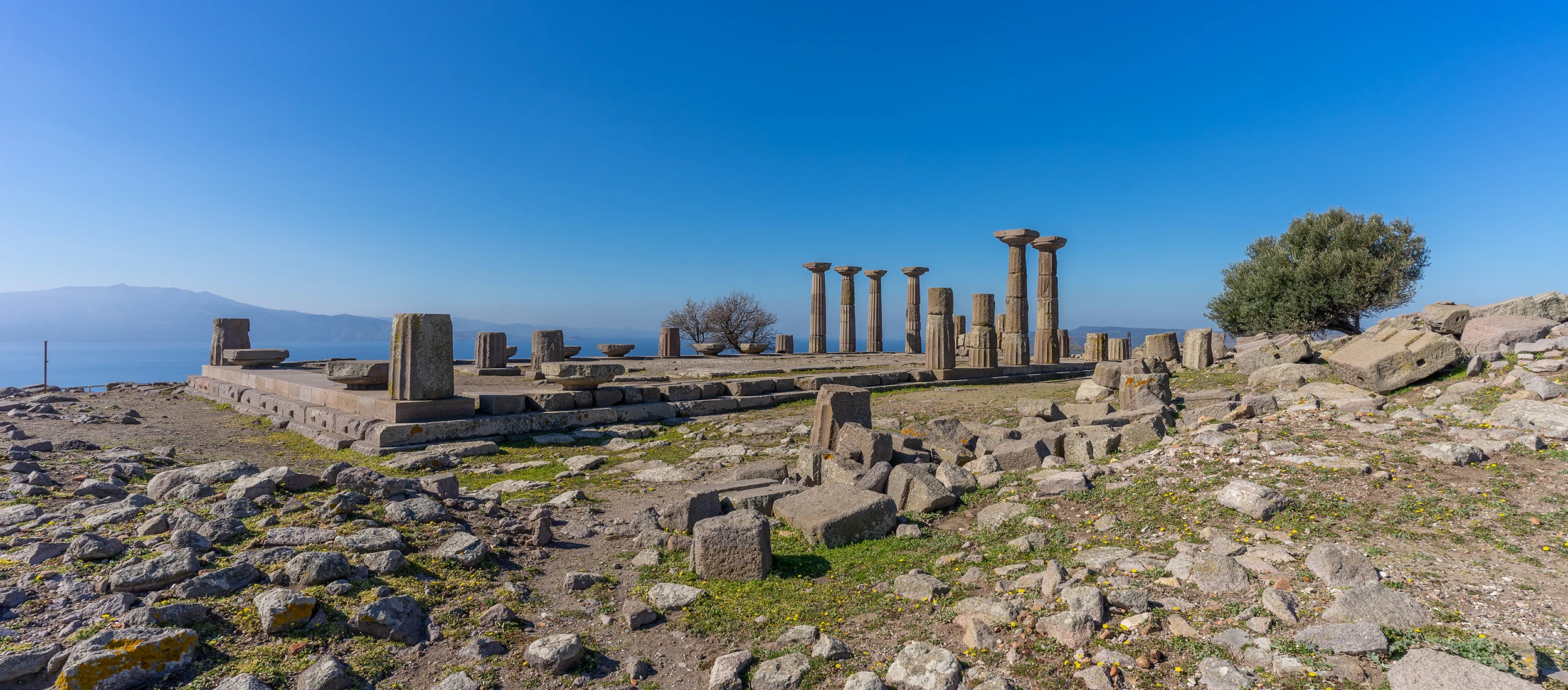
Yes. Assos adds major ancient archaeology and Aegean coastal scenery to a nature-focused journey through Mount Ida.

How many days do I need for Kazdağları and Yenice?

Allow at least two days if you want to experience both the southern national park and the northern Yenice forests without rushing. Three days gives much more flexibility for walking and villages.

Is Kazdağları suitable for families?

Yes, particularly around accessible picnic areas, waterfalls and easy forest walks. Children should be supervised closely near fast water, cliffs, wet rocks and canyon viewpoints.

Are the forests safe during summer?

Summer is popular, but forest-fire restrictions can affect access, picnics and vehicle entry. Follow current official rules and never use open flame where it is prohibited.

Is mobile phone reception reliable?

Not everywhere. Deep valleys and remote forest areas may have weak or no signal, so offline maps and a clear route plan are useful.

Why should nature lovers visit Yenice?

Yenice offers extensive mixed forest, changing microclimates, ponds, streams, village roads, birdlife and the chance to experience the northern side of the Mount Ida ecosystem away from the busiest coastal areas.


Best Photo Spots in Kazdağları & Yenice

Sütüven Waterfall

Use the surrounding woodland and rock to frame the moving water and show the scale of the forest setting.

Hasanboğuldu

Clear pools, stone and overhanging trees create intimate compositions with strong natural colour.

Şahindere Canyon

Wide viewpoints reveal the depth of the canyon and the dense forest covering its slopes.

Yenice Forest Roads

Curving roads disappearing between tall trees are especially powerful in morning mist or low-angle light.

Forest Ponds

Still water can reflect hills, clouds and autumn colour, particularly early in the day.

High Kazdağı

On clear days, upper viewpoints create enormous panoramas linking mountain ridges with the Gulf of Edremit and the Aegean.


If photography is important, build the day around light rather than a long list of attractions. The most atmospheric images often appear when mist, moving cloud, late-afternoon sun or changing weather transforms the forest.

Private Kazdağları & Yenice Experiences

We can include Kazdağları and Yenice in privately designed North Aegean journeys combining nature, mythology, village culture, archaeology and scenic driving.

Private Nature, Mythology & Village Journeys

Flexible programs with private transportation and professional guiding, planned around your interests and current access conditions.

Continue Exploring the North Aegean

Connect the forests of Mount Ida with the villages, archaeology and coast of southern Çanakkale.