Private Bozdoğan Countryside Experience
Ask us about a tailor-made journey combining rural landscapes, traditional food, local heritage and selected natural attractions around Bozdoğan.
Request a Custom Experience





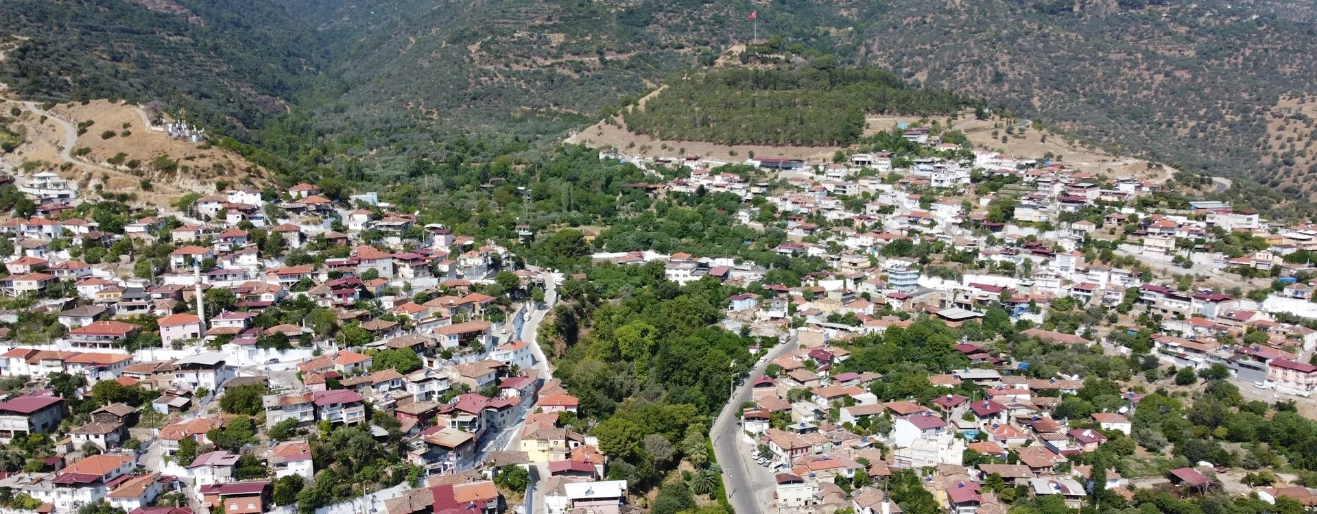
Bozdoğan is an inland district of Aydın Province in southwestern Türkiye, situated between the fertile Akçay Valley and the rugged landscapes of Madran Mountain. Unlike the busy Aegean coastal resorts, Bozdoğan offers a slower journey through traditional neighborhoods, agricultural villages, wooded mountains, historic sites and striking natural scenery.
The district is best known among travelers for the extraordinary Arapapıştı Canyon, where turquoise water winds between imposing cliffs near Kemer Dam. Yet Bozdoğan's attractions extend much further, encompassing mountain waterfalls, the ruins of Piginda Ancient City, the hilltop remains of Körteke Castle and the dramatic rock-cut steps of Malküpü Kırkmerdiven.
Bozdoğan also preserves an important layer of western Anatolian history. The surrounding countryside contains evidence of ancient Carian settlement, while the district center reflects centuries of Turkish, Seljuk, Aydınoğulları and Ottoman cultural development. Mosques, rural architecture, old bridges and local traditions give the area an identity quite different from better-known destinations.
For visitors interested in authentic regional cuisine, Bozdoğan is especially memorable for its traditional pide with buffalo clotted cream and refreshing kar helvası, a local snow dessert associated with Madran Mountain.
Whether you are planning a countryside excursion from Nazilli, an archaeological exploration, a scenic drive or a relaxed introduction to rural Aegean life, Bozdoğan rewards travelers who enjoy discovering places beyond the conventional tourist circuit.
Explore Arapapıştı Canyon, Kemer Reservoir and mountain waterfalls.
Discover Piginda, Körteke Castle and lesser-known Carian remains.
Experience Madran Mountain, forests and traditional highland villages.
Taste Bozdoğan pide, buffalo cream and traditional kar helvası.
Essential information for visiting this historic district of the inland Aegean.
Inland southeastern Aydın Province, south of Nazilli, western Türkiye.
Open on Google MapsAncient Carian sites, medieval Turkish history and Ottoman-era monuments.
Madran Mountain, with a summit reaching approximately 1,792 meters.
Arapapıştı Canyon and the impressive waters of Kemer Dam.
Approximately 28–29 km from Nazilli and 68 km from Aydın city center by road.
One full day for the main attractions or two days for deeper exploration.
A destination where spectacular landscapes, ancient history and everyday Turkish life remain closely connected.
Bozdoğan offers a different perspective on the Aegean region. Much of western Türkiye's tourism focuses on beaches, monumental ruins and large resort towns, while the interior preserves agricultural valleys, mountain communities and comparatively quiet historical landscapes.
The district's most dramatic contrast appears between Madran Mountain and the Akçay Valley. Forested slopes rise above orchards, fields and villages, while the Akçay River and Kemer Reservoir shape a landscape of water, rock and vegetation.
For nature lovers, Arapapıştı Canyon is the outstanding attraction. Its narrow waterways and steep cliffs create one of the most distinctive landscapes in Aydın Province. Beyond the canyon, waterfalls and mountain routes offer additional opportunities for countryside exploration.
History enthusiasts can investigate archaeological sites that remain far less developed than famous ancient cities such as Ephesus and Aphrodisias. Piginda, Körteke and other rural remains offer insight into the complex settlement history of ancient Caria.
Equally important is the district's living culture. Local markets, neighborhood mosques, family-run food establishments and agricultural traditions preserve the atmosphere of a working Anatolian town rather than a purpose-built tourist destination.
Bozdoğan is especially suitable for independent travelers, photographers, walkers, regional-history enthusiasts and visitors seeking meaningful experiences away from large crowds.
Bozdoğan lies within the inland landscape of Aydın Province, in a region shaped by the relationship between mountains, rivers and agricultural valleys. The district occupies part of the Akçay basin, which connects with the wider Büyük Menderes river system.
The Akçay River flows between the mountainous landscapes of southern Aydın, providing water for agriculture and feeding the large reservoir created by Kemer Dam. Its valleys support cultivated land, orchards and rural settlements.
To the west and northwest rises Madran Mountain, also called Madran Baba, one of the major mountain landmarks of the region. Its upper slopes contain forests, rocky outcrops, streams and highland environments that contrast with the warmer agricultural lowlands.
The surrounding landscape includes olive groves, pine-covered hills, cultivated fields and small villages connected by winding roads. Elevation changes significantly across the district, influencing temperature, vegetation and seasonal conditions.
The principal river landscape supporting agriculture and rural settlement.
A prominent mountain landscape rising to approximately 1,792 meters.
A major artificial lake surrounded by hills, agricultural land and canyon scenery.
Pine woods, scrubland and seasonal streams create varied natural habitats.
Olive cultivation, fruit growing and other farming activities shape the countryside.
Small settlements preserve rural architecture, local customs and close connections with the land.
The history of Bozdoğan extends beyond the development of the modern district town. The surrounding landscape was part of the broader cultural world of ancient Caria, a region of southwestern Anatolia where communities occupied river valleys, mountain strongholds and strategically located settlements.
Archaeological remains around Bozdoğan demonstrate that the area was inhabited long before the medieval Turkish settlement associated with the present town. Ancient sites such as Piginda and fortified positions around Körteke reveal the importance of controlling routes through the hills and valleys.
During the Hellenistic and Roman periods, the wider region formed part of the changing political and economic landscape of western Anatolia. Local communities were connected to larger settlements through agricultural exchange, movement along river valleys and regional networks.
In the Byzantine centuries, settlement and religious life continued across the countryside. Certain remains around the canyon and other rural locations have been associated with later defensive or religious uses, although individual structures and their dates are not always securely understood.
Turkish political influence expanded into this part of Anatolia during the medieval period. Local histories associate the development of Bozdoğan with settlement by Turkish groups and its subsequent importance under the Aydınoğulları Beylik during the 14th century.
With the expansion of Ottoman rule, Bozdoğan became part of the Ottoman administrative and economic system. Mosques, bridges, fountains and other historic structures preserve evidence of the town's later development.
Following the establishment of the Turkish Republic, Bozdoğan continued primarily as an agricultural district. The construction of Kemer Dam in the 1950s brought major changes to water management and the surrounding landscape. Today, traditional farming remains important while natural and cultural tourism has become increasingly visible.
Early settlement, hilltop fortifications and archaeological remains across the district.
Regional settlement networks, agricultural development and defensive sites.
Continuing rural occupation and traces of later religious and defensive activity.
Turkish settlement and the emergence of Bozdoğan within the Aydınoğulları sphere.
Growth of the district town, religious monuments and agricultural communities.
Agricultural development, Kemer Dam and increasing interest in rural tourism.
Bozdoğan's attractions are spread across the district rather than concentrated in one historic center. Some can be visited on a straightforward countryside drive, while others require mountain roads, hiking or additional local guidance.
A spectacular canyon with turquoise water, steep cliffs, caves and ancient rock-cut remains.
Explore the reservoir landscape surrounding one of the district's most important water projects.
Discover forested mountain scenery, highland environments and traditional village landscapes.
Investigate a remote hilltop fortress overlooking a dramatic section of the surrounding countryside.
Explore archaeological remains associated with ancient Carian settlement near Çamlıdere.
Discover secluded streams and cascading water in a rugged rural setting.
A mountain waterfall reached through forested terrain and narrow rural paths.
A high-elevation waterfall associated with the upper slopes of Madran Mountain.
Natural pools and cascades along the watercourses near Körteke.
An intriguing series of ancient rock-cut steps in rugged terrain near Güre.
Traditional streets, old mosques, local businesses and everyday Aegean town life.
Discover older bridges and water-related structures reflecting the region's transportation history.
Arapapıştı Canyon, also associated with the names İnceğiz and Körteke, is among the most remarkable natural attractions of inland Aydın. The canyon lies near the meeting area of Aydın, Denizli and Muğla provinces, within the landscape connected to the Kemer Reservoir and Akçay River.
The gorge extends for approximately 6 kilometers, with rock faces reaching heights of up to around 380 meters in descriptions published by local authorities. The canyon's most impressive feature is the striking contrast between its steep, rocky slopes and the turquoise-green water below.
The landscape developed through long geological processes and river erosion. The reservoir created by Kemer Dam transformed the appearance of the lower valley, producing the beautiful water-filled scenes for which the canyon is now famous.
Ancient human activity adds another dimension to the setting. Rock-cut tombs, caves and traces of historic structures are found in and around the gorge. Some features can be difficult to see when reservoir water levels are high.
Organized boat excursions have operated from the Kemer area, allowing visitors to appreciate the canyon from the water. However, boat operations, routes and sightseeing opportunities depend on seasonal schedules, weather, safety decisions and reservoir conditions.
When operating, organized cruises offer views of the rock walls and winding waterways.
The reservoir creates impressive shades of green and blue, changing with light and water conditions.
Historic rock-cut features reveal evidence of human activity in the canyon landscape.
Natural cavities and steep geological formations contribute to the canyon's dramatic appearance.
Cliffs, reflections, river bends and distant mountain views create exceptional compositions.
Discover olive-covered slopes, small communities and the quiet reservoir countryside.
Kemer Dam is one of the major landmarks of Bozdoğan's modern geography. Constructed on the Akçay River, the dam created a large reservoir that transformed the surrounding valley and now contributes to the visual identity of the district.
Construction began in 1954, and the dam entered operation in 1958, according to the Turkish State Hydraulic Works. The project forms part of the wider development of irrigation and water infrastructure in the Büyük Menderes basin.
Today, the reservoir offers some of the most photogenic scenery in the region. Depending on water levels, the shoreline reveals coves, peninsulas, rocky slopes and wooded hills. The landscape changes throughout the year as water conditions and vegetation vary.
For travelers, the Kemer area serves as an important gateway to Arapapıştı Canyon. The combination of engineering heritage, lake scenery and nearby archaeological remains makes it particularly interesting.
Enjoy broad views of water, hills and agricultural countryside.
Understand the development of regional water management in the 1950s.
The Kemer locality is associated with organized Arapapıştı sightseeing excursions.
Photograph changing water colors, surrounding hills and reservoir shorelines.
For a more detailed introduction, read our complete Kemer Dam visitor guide, covering its history, landscape and practical travel considerations.
Madran Mountain, also called Madran Baba Mountain, rises to approximately 1,792 meters and forms one of the most recognizable geographical landmarks in southern Aydın.
The mountain is associated with an extensive natural landscape of forests, rocky terrain, mountain streams and rural settlements. Its slopes support different vegetation zones, including pine forests, scrubland and higher-elevation habitats.
Madran Mountain also has cultural significance. Its name is associated with the traditional Madran Baba site near the summit, reflecting the connection between mountain landscapes, local belief and regional identity.
For travelers, the mountain provides an appealing contrast to Bozdoğan's warmer valley floor. The higher elevations can offer cooler conditions, panoramic views and opportunities to experience the countryside away from main roads.
Enjoy wide views across ridges, forests and surrounding valleys.
Discover pine woods and the varied vegetation of Aydın's mountain landscapes.
Experience communities with long-established farming and highland traditions.
Learn about the mountain's connection with local traditions and its namesake sacred site.
Mountain streams create cascades and waterfalls, particularly when flows are strong.
Suitable for carefully planned rural drives, outdoor photography and experienced walkers.
Bozdoğan's mountains contain several attractive waterfalls and natural pools. They are less developed than major commercial nature attractions, making them appealing to experienced outdoor visitors who appreciate quieter landscapes.
Located near Alhisar Mahallesi, the Alhisar waterfalls are associated with a wooded and rocky landscape southeast of Bozdoğan. Local municipal information places the waterfall area approximately 2 kilometers from the settlement.
The setting includes flowing water, rocks and surrounding vegetation. Access conditions may vary, and visitors should not assume the existence of a maintained public walkway throughout the route.
Güney Waterfall lies near Güney Mahallesi, approximately 20 kilometers from Bozdoğan town center according to the municipality. Water descends through mountain terrain from a stream connected with the Madran drainage system.
The main waterfall has been described as approximately 40 meters high, with several smaller cascades nearby. Reaching the area involves narrow paths and forest terrain.
Madran Waterfall is located high on Madran Mountain, where upper-elevation watercourses descend through steep terrain. The municipality identifies the larger Madran waterfall at an elevation of approximately 1,500 meters.
This is a remote mountain attraction rather than a conventional roadside stop. Access should be planned with appropriate footwear, route information and awareness of changing weather.
Near Körteke, the watercourse locally associated with Deliçay contains natural pools and small cascades. One of the best-known features is called Kral Havuzu, or the King's Pool.
The pools form part of the area's attractive water-carved landscape, but slippery rocks, seasonal flows and difficult approaches make caution essential.
The archaeological heritage of Bozdoğan is scattered across hills, village landscapes and remote valleys. Unlike large excavated ancient cities, many local sites have limited interpretation, few visitor facilities and sometimes difficult access.
Piginda is an ancient settlement site associated with the Carian landscape near Çamlıdere, in the countryside of Bozdoğan. The municipality places the archaeological area approximately 7 kilometers from Çamlıdere village.
The site includes fortified hilltop terrain and surviving architectural remains. Its remote setting is particularly interesting for visitors studying settlement patterns and defensive architecture in ancient southwestern Anatolia.
Much of the site remains difficult to interpret without archaeological background. Visitors should approach it as a landscape containing ancient remains rather than an extensively reconstructed archaeological park.
Explore the history and surviving structures in our Piginda Ancient City guide.
Körteke Castle occupies a prominent hilltop near Körteke Mahallesi, approximately 40 kilometers from Bozdoğan town center according to the municipality.
Surviving fortification elements include towers and water-storage features. The structure shows evidence of different building phases, making precise dating and historical interpretation more complicated than a single-period identification would suggest.
The location demonstrates the importance of elevated defensive positions overlooking movement through the mountainous countryside.
For details, see our Körteke Castle visitor guide.
Malküpü Kırkmerdiven is an intriguing rock-cut feature near Güre Mahallesi. Its name refers to a series of steps carved into the natural rock, in a rugged landscape containing traces of ancient human activity.
The surrounding geology and elevated setting are particularly striking. Although the site has been associated with ancient defensive or settlement activity, its exact historical function should not be treated as conclusively established.
The route is unsuitable for casual visitors without reliable local directions and appropriate hiking preparation.
Old bridges, fountains and cisterns around Bozdoğan reflect the longstanding importance of water management and communication routes. Local histories mention bridges and water-storage structures associated with medieval and Ottoman periods.
Some remains are integrated into the rural environment and may not be signposted or formally prepared for visitors. Their significance lies in understanding the connection between water, agriculture, settlement and travel.
Bozdoğan town center offers a more intimate experience than the district's remote attractions. Small streets, neighborhood mosques, local shops, cafés and traditional food establishments provide a sense of everyday life in inland Aydın.
Local historical accounts identify several mosques associated with the Ottoman period, including Çarşı Mosque, Pabuşçuoğlu Mosque, Baltacıoğlu Mosque and Hıdırbaba Mosque.
The urban fabric has changed considerably over time, so visitors should not expect a completely preserved Ottoman town. Rather, historic religious buildings and older streets appear within a functioning modern district center.
Explore the commercial center, local businesses and the atmosphere of the district's everyday life.
Discover religious monuments associated with Bozdoğan's Ottoman-era heritage.
Sample traditional pide and other regional specialties prepared by local businesses.
Observe the agricultural and commercial traditions that remain important to the town.
Look for older building details and the changing character of different residential areas.
A few Turkish phrases and a relaxed pace can make exploring the town more enjoyable.
Food is one of the pleasures of visiting Bozdoğan. The district's cuisine combines the agricultural character of Aydın with distinctive local traditions involving bread, dairy products, seasonal ingredients and refreshing desserts.
Bozdoğan pide is the district's best-known local specialty. Different versions feature cheese, minced meat or sweet ingredients, but one particularly characteristic serving tradition involves adding manda kaymağı, rich buffalo clotted cream, to freshly baked pide.
The cream softens over the hot bread and adds richness to cheese-based and other preparations. This combination has become closely associated with the area's food identity.
Kar helvası is a refreshing traditional dessert made with finely textured snow or ice and flavored syrup. In Bozdoğan, its history is closely associated with snow preserved from Madran Mountain and traditionally combined with fruit syrups, particularly sour cherry.
The dessert is especially appealing during the warm summer months and represents an interesting connection between mountain geography and local culinary culture.
A signature local combination of baked dough, cheese and rich clotted cream.
A warm baked specialty combining tahini and sweet flavors, sometimes served with cream.
A refreshing snow-based dessert flavored with fruit syrup.
Local olive products reflect the agricultural traditions of Aydın.
Enjoy fresh produce reflecting the district's farming and mountain environments.
Depending on the establishment, discover home-style dishes, vegetables and local meat preparations.
Admire the gorge's turquoise water and dramatic cliffs from authorized viewing or boat-tour areas.
Enjoy lakeside scenery and photograph the changing colors of the Akçay landscape.
Explore the remote archaeological landscapes of Piginda and Körteke with suitable preparation.
Take a countryside drive and appreciate the forests, highlands and panoramic terrain.
Choose a carefully planned outing to Alhisar, Güney or other seasonal waterfall areas.
Enjoy Bozdoğan's signature baked specialty, particularly versions served with buffalo cream.
Capture village scenery, olive groves, mountain roads and everyday architecture respectfully.
Spend time around old mosques, local shops and traditional neighborhoods.
Begin in Bozdoğan town center with a short walk around the çarşı and surrounding streets. Enjoy a traditional breakfast or an early local snack before continuing into the countryside.
Drive toward the Kemer Dam area, appreciating the changing scenery from the agricultural valley to the reservoir and surrounding hills.
If an organized excursion is operating, make Arapapıştı Canyon the principal attraction of the day. Allow enough time for the boat-trip arrangements, sightseeing and photographs without assuming fixed departures.
Enjoy lunch near the reservoir or return toward Bozdoğan for a traditional pide experience. End the visit with a relaxed town walk or a countryside viewpoint, depending on daylight and road conditions.
With two days, it becomes possible to explore the area's natural and archaeological attractions more comfortably. A particularly rewarding approach is to separate the canyon and reservoir from the more demanding mountain and historical sites.
Bozdoğan is a functioning district rather than one managed tourist attraction. There is no general admission ticket or single opening schedule for the district, and facilities differ considerably between the town center and remote natural or archaeological locations.
Visitors can generally explore public streets and ordinary village areas freely, but archaeological sites, reservoir facilities, organized boat excursions and protected natural locations may have different access rules.
Some historic ruins have traditionally been visited without entrance fees, but this does not mean they are staffed, maintained or accessible in every season. Visitors should confirm local conditions before attempting remote routes.
Bozdoğan can be visited throughout the year, but the experience varies between the lowland town, the reservoir and the higher slopes of Madran Mountain. Summers can be very hot in the valleys, while higher elevations are cooler and may experience harsher winter conditions.
One of the best seasons for green landscapes, comfortable sightseeing and countryside exploration.
Long daylight hours and warm weather suit scenic drives and carefully timed canyon visits.
Expect significant lowland heat. Plan outdoor activities early and carry sufficient drinking water.
Often pleasant for photography, village visits, archaeological exploration and local food experiences.
Mountain scenery can be atmospheric, but snow, rain and difficult rural roads may restrict access.
Late winter and spring may provide stronger flows, depending on recent rainfall and snowmelt.
Enjoy Bozdoğan town center, a local meal and a short introduction to its historical atmosphere.
Explore the town and one nearby countryside attraction.
Combine Bozdoğan with the Kemer Reservoir and Arapapıştı Canyon.
Add a carefully selected archaeological site, mountain area or waterfall excursion.
Explore the region at a slower pace with more rural landscapes, heritage and photography.
Favor accessible viewpoints, short town visits and supervised activities over difficult mountain trails.
Bozdoğan offers unusually diverse photographic subjects, from broad mountain panoramas and reservoir reflections to historic masonry, agricultural landscapes and rural daily life.
Use the contrast between turquoise water and steep canyon walls to emphasize the scale of the landscape.
Photograph water reflections, rolling hills and changing shorelines under different lighting conditions.
Capture forested ridges, atmospheric valleys and dramatic weather over the highlands.
Look for textures, defensive walls and the relationship between archaeological remains and natural terrain.
Document rural architecture and agricultural scenery without intruding on residents' privacy.
Photograph flowing water from secure ground, avoiding slippery rocks and dangerous edges.
Accessibility varies widely across Bozdoğan. The town center has ordinary streets, shops and public areas, while many natural and archaeological attractions occupy remote locations with difficult approaches.
Some street-level attractions are straightforward to reach, although pavements and gradients vary.
Certain views may be enjoyed from roadside locations, but safe stopping areas should be identified beforehand.
Ask operators about boarding steps, seating, life jackets and accessibility before reserving a boat trip.
Expect rocky paths, slopes and potentially unstable surfaces without modern visitor infrastructure.
Many require uneven or narrow trails and are unsuitable for visitors with significant mobility limitations.
A vehicle with suitable drop-off arrangements can reduce walking between selected attractions.
Bozdoğan is located inland from the main Aydın–Denizli transportation corridor. The usual approach is through Nazilli, where travelers turn south toward Bozdoğan.
Approximately 28–29 kilometers by road. Local public transport also connects the two district centers.
Approximately 68 kilometers by road, commonly reached via the Nazilli corridor.
The most practical choice for reaching Kemer Dam, archaeological sites and remote villages.
Local minibus services connect Nazilli and Bozdoğan, although timetables should be confirmed locally.
Travel to Nazilli or Aydın first, then continue by suitable local transportation.
Arrange a car, driver or suitable local transport because regular services may not reach sightseeing areas.
Although Bozdoğan is relatively close to Nazilli, destinations such as Körteke Castle, remote waterfalls and higher mountain areas involve additional driving on smaller roads. Allow generous travel time when planning these excursions.
Bozdoğan can form part of a broader journey through inland Aydın, connecting rural landscapes with archaeological sites, traditional towns and the wider heritage of ancient Caria.
Explore an impressive reservoir surrounded by hills and the spectacular canyon landscape.
Discover a lesser-known archaeological site within the historic Carian countryside.
Explore the remains of a remote hilltop fortress overlooking mountainous terrain.
Discover traditional pottery, rural culture and a district famous for its ancient heritage.
Experience one of eastern Aydın's major towns, known for its commercial and agricultural traditions.
Visit the UNESCO-listed ancient city renowned for its Roman sculpture and monumental architecture.
Explore a traditional district in the Büyük Menderes basin, with local food and rural history.
Continue through mountain and valley landscapes associated with ancient Caria.
Bozdoğan is an inland district of Aydın Province in western Türkiye, situated south of Nazilli near the Akçay Valley and Madran Mountain.
Bozdoğan is known for Arapapıştı Canyon, Kemer Dam, Madran Mountain, historic archaeological sites, traditional pide with buffalo cream and kar helvası.
Yes. Bozdoğan is particularly rewarding for nature lovers, photographers, archaeology enthusiasts and travelers who enjoy discovering quieter inland Aegean destinations.
Bozdoğan is approximately 28–29 kilometers from Nazilli by road, depending on the exact starting and finishing points.
Bozdoğan is approximately 68 kilometers from Aydın city center by the usual road route.
Major attractions include Arapapıştı Canyon, Kemer Dam, Madran Mountain, Piginda Ancient City, Körteke Castle and the district's mountain waterfalls.
Arapapıştı Canyon lies near Kemer Dam in the area where Aydın, Denizli and Muğla provinces meet. The Bozdoğan district provides an important access route.
Local official descriptions give the canyon a length of approximately 6 kilometers, with rock faces reaching heights of up to about 380 meters.
Organized boat excursions have operated seasonally. Availability depends on current schedules, reservoir water levels, weather and operational decisions, so confirm before visiting.
The surrounding landscape can be viewed from permitted public areas, but organized boat trips and individual facilities do not necessarily operate throughout the year.
Kemer Dam is a major water infrastructure project on the Akçay River. It entered operation in 1958 and created the reservoir associated with Arapapıştı Canyon.
Madran Mountain reaches approximately 1,792 meters above sea level and is one of the prominent highland landmarks of Aydın Province.
Piginda is one of the district's best-known ancient settlement sites. Other historical remains include Körteke Castle and smaller rural archaeological locations.
Piginda lies in the countryside near Çamlıdere, within Bozdoğan district. The archaeological area is approximately 7 kilometers from Çamlıdere village according to local municipal information.
Körteke Castle occupies a hilltop near Körteke Mahallesi, around 40 kilometers from Bozdoğan town center by the route described by the municipality.
The district includes Alhisar Waterfalls, Güney Waterfall and Madran Waterfall. These natural attractions may require walking through difficult or unmarked terrain.
Bozdoğan pidesi is a traditional local baked specialty, particularly associated with cheese-based pide served with rich buffalo clotted cream, known as manda kaymağı.
Kar helvası is a traditional refreshing dessert made from fine snow or ice and fruit syrup. In Bozdoğan it is historically associated with snow preserved from Madran Mountain.
Spring and autumn generally provide comfortable conditions for sightseeing, countryside drives and exploring archaeological sites. Summer can be very hot in the valleys.
One full day works well for the main town and canyon highlights. Two days allow more time for mountain scenery, waterfalls and remote historical sites.
A car is highly recommended if you want to explore attractions outside the town. Public transport serves the district center, but remote heritage and nature sites are less convenient to reach.
Yes. The town and accessible attractions can be visited independently. However, local guidance can be valuable for remote ruins, unfamiliar mountain routes and coordinated countryside itineraries.
Yes, with appropriate planning. Town visits, local meals and selected scenic viewpoints suit families, while remote ruins and difficult waterfall trails may not be suitable for young children.
No. Bozdoğan is an inland district. Its main attractions are mountains, river valleys, reservoirs, historical sites and rural landscapes rather than beaches.
Yes, the wider region can be incorporated into a multi-day inland Aydın itinerary. The best route depends on the starting point, chosen attractions and road conditions.
The district is generally quieter than Aydın's major coastal resorts. Arapapıştı Canyon can attract more visitors during popular excursion periods, weekends and holidays.
Many of Bozdoğan's most interesting locations are fragile natural environments or archaeological sites with limited visitor infrastructure. Responsible behavior helps preserve the district's landscapes and heritage for future generations.
Never remove artifacts, disturb ancient masonry or enter restricted excavation areas.
Observe animals from a distance and avoid disturbing nesting areas or natural habitats.
Do not leave plastic, food waste or other litter near the reservoir, streams and waterfalls.
Avoid unstable slopes, dangerous canyon edges and unfamiliar mountain shortcuts.
Ask before entering private land, photographing residents or approaching agricultural buildings.
Choose local food establishments and responsible services that contribute to the regional economy.
Discover dramatic canyon landscapes, ancient Carian heritage, mountain villages and authentic Aegean culture through a private journey shaped around your interests, with comfortable transportation and no compulsory shopping stops.
Choose an experience focused on nature, archaeology, scenic photography or traditional rural life.
Ask us about a tailor-made journey combining rural landscapes, traditional food, local heritage and selected natural attractions around Bozdoğan.
Request a Custom Experience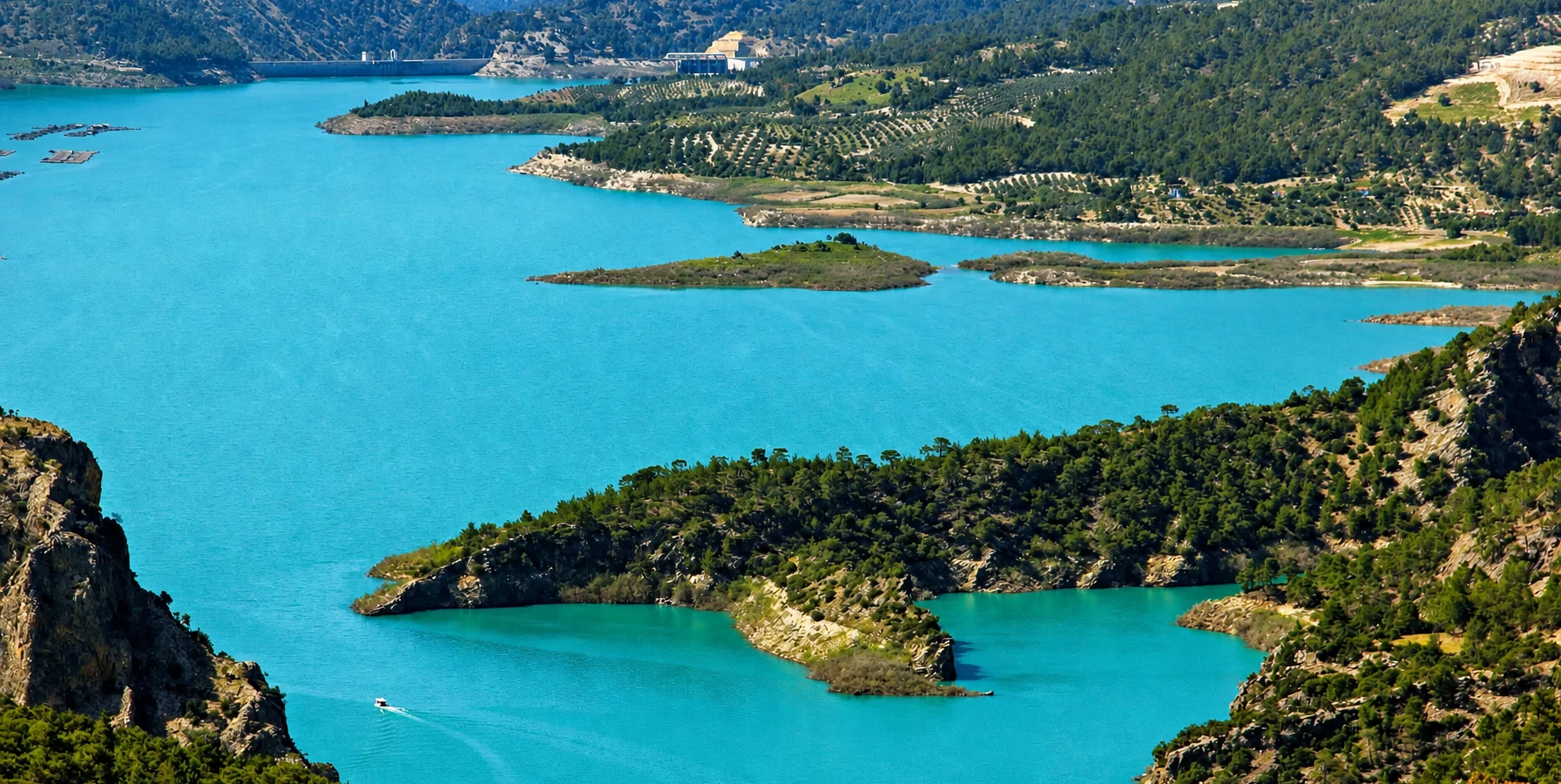
Explore the scenery surrounding Kemer Reservoir and discover the extraordinary natural setting of the Akçay Valley.
Explore Kemer DamConnect Bozdoğan's natural landscapes with lesser-known archaeological sites and regional traditions.
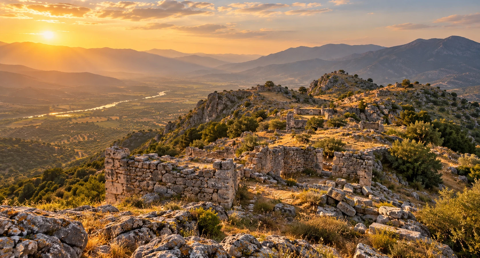
Discover an atmospheric Carian archaeological landscape, with ancient fortifications and traces of settlement in the hills.
Explore Piginda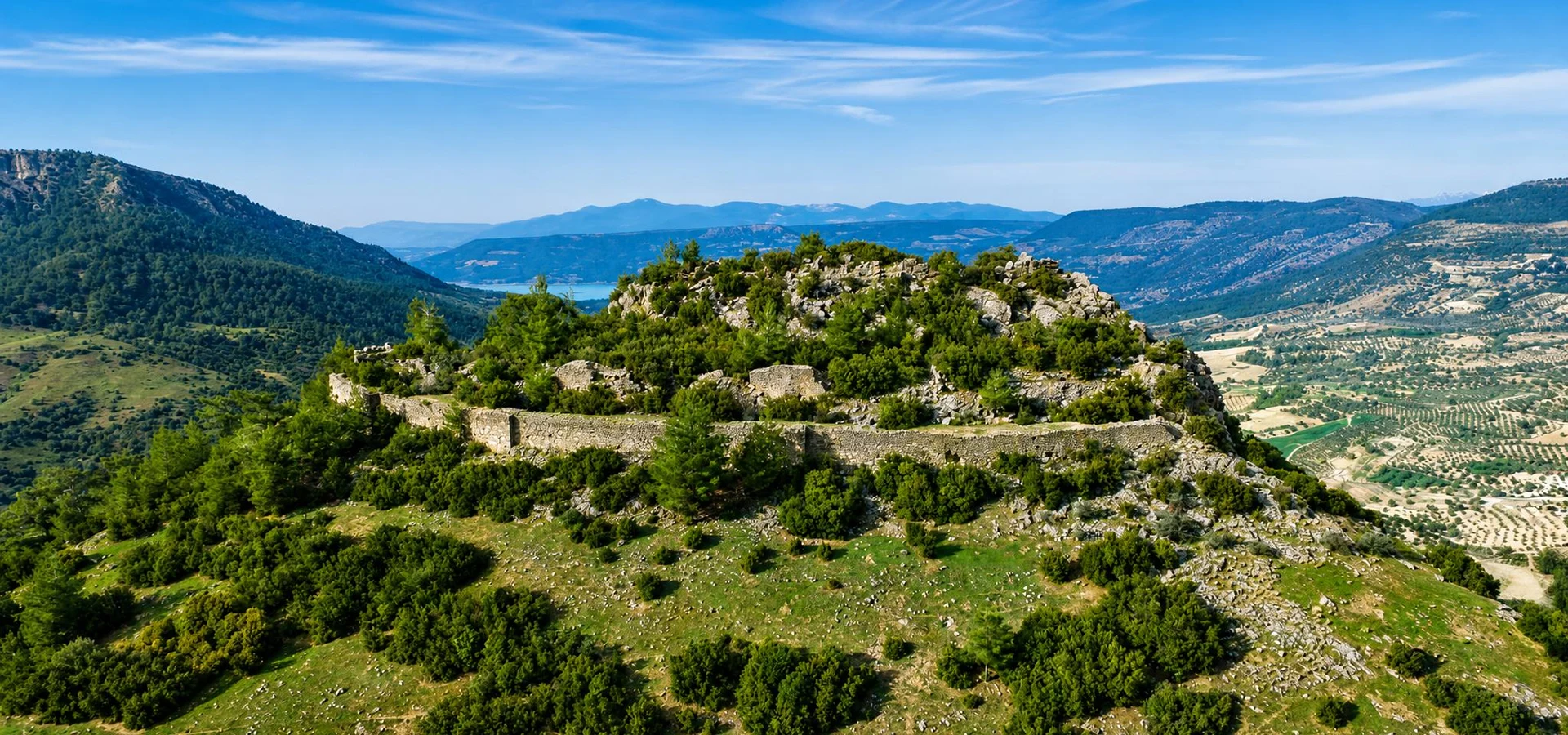
Explore the defensive heritage of inland Caria through a remote hilltop fortress overlooking the rugged countryside.
Explore Körteke Castle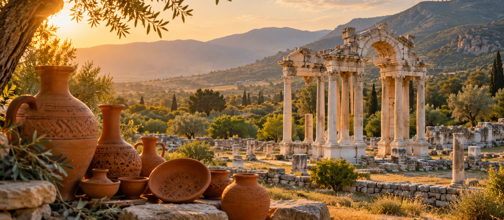
Continue your Aydın journey with traditional pottery, local culture and the historical landscapes surrounding Aphrodisias.
Discover Karacasu