Private Kemer Dam & Bozdoğan Tour
Ask us about a tailor-made experience featuring panoramic reservoir views, rural landscapes, regional history and the beautiful Akçay Valley.
Request a Custom Tour





Hidden among the rugged hills of southeastern Aydın Province, Kemer Dam, known in Turkish as Kemer Barajı, is one of the region's most significant twentieth-century water engineering projects. Built across the Akçay River between 1954 and 1958, the dam created an extensive reservoir surrounded by steep valleys, forested slopes and traditional rural landscapes.
Located in the Bozdoğan district, the dam was constructed to serve three important purposes: hydroelectric power generation, agricultural irrigation and flood control. Its construction transformed the Akçay Valley and helped support the agricultural economy of the wider Büyük Menderes Basin.
Today, the reservoir is also associated with one of Aydın's most spectacular natural attractions: Arapapıştı Canyon. The canyon's towering rock faces, narrow passages and striking water views have made this inland corner of the Aegean region increasingly popular with nature lovers and photographers.
Unlike the crowded coastal destinations of western Türkiye, the Kemer Dam area offers a quieter perspective on Aydın. Visitors encounter mountain villages, agricultural terraces, panoramic viewpoints and a landscape where ancient settlement routes coexist with modern infrastructure.
Kemer Dam is particularly rewarding for travelers interested in landscape photography, regional history, engineering, rural culture and scenic exploration. However, visitors should remember that it is an operating dam rather than a conventional recreational attraction, and access to the structure itself may be restricted.
Discover one of the major hydroelectric and irrigation projects of early Republican-era development.
Enjoy dramatic views of water, wooded hills and winding valleys.
Explore the extraordinary natural landscape connected with the reservoir.
Experience a peaceful side of the province beyond its famous coastal resorts.
Essential information about the dam, reservoir and surrounding Akçay Valley.
Kemer area, Bozdoğan district, Aydın Province, southwestern Türkiye.
Open on Google MapsBuilt between 1954 and 1958; officially inaugurated on 25 September 1958.
Approximately 108.5 meters above the riverbed.
The Akçay River, an important tributary of the Büyük Menderes River system.
48 MW of installed generating capacity.
Allow 30–60 minutes for scenic viewpoints or a half day when combining the area with Arapapıştı Canyon.
Kemer Dam represents a major stage in the modernization of water management and electricity production in western Türkiye.
The significance of Kemer Dam extends far beyond its impressive concrete structure. When completed in 1958, it formed part of Türkiye's broader effort to develop hydraulic infrastructure, increase electricity supplies and improve agricultural productivity.
The Akçay River drains mountain country before joining the Büyük Menderes system. Historically, seasonal changes in rainfall could produce substantial fluctuations in river flow, affecting settlements, farmland and downstream communities.
By storing part of this water, Kemer Dam provided a means of regulating flows and supporting irrigation. The associated hydroelectric power station also contributed electricity to the regional network.
Its construction illustrates the importance of large engineering projects in the economic transformation of Türkiye during the 1950s. Improved roads, construction facilities and energy infrastructure connected previously remote mountain areas more closely with regional centers.
Today, the reservoir continues to demonstrate the relationship between water resources, agriculture, energy and environmental management. Changing rainfall patterns and water demand make the responsible operation of such infrastructure especially important.
For visitors, Kemer Dam offers a compelling combination of industrial heritage and natural scenery, revealing a less familiar but equally important dimension of Aydın's history.
The origins of Kemer Dam belong to a period when Türkiye was expanding its electricity generating capacity and developing large-scale irrigation infrastructure. During the 1950s, water projects became central to national efforts to modernize agriculture, improve transportation and support growing urban and industrial demand.
Planning for the Kemer project focused on the Akçay Valley, where the mountainous terrain provided an opportunity to construct a high concrete dam in a relatively narrow gorge.
In 1954, construction began following agreements involving Turkish authorities and international engineering and construction companies. The project required considerable logistical preparation because the future dam site lay in difficult mountain terrain with limited road access.
New access roads and bridges were constructed to move personnel, equipment and building materials into the valley. These supporting works were themselves important infrastructure improvements for the surrounding area.
The main structure was built using a large volume of concrete. Engineering work included the dam body, water control installations, the hydroelectric generating station and the associated electrical transmission infrastructure.
The completed project was officially opened on 25 September 1958, with Prime Minister Adnan Menderes among those attending the inauguration.
Kemer Dam became an important element in the development of the Akçay and Büyük Menderes water systems. Its reservoir altered the appearance of the valley while contributing to electricity generation and water management.
Decades later, the surrounding lake and canyon scenery also became a focus for tourism, especially following initiatives to develop nature-based visits to Arapapıştı Canyon.
Planning and agreements advance for the development of Kemer Dam and its hydroelectric facilities.
Construction begins, including the development of access roads and supporting infrastructure.
Major construction works progress, with preparations for reservoir impoundment and power generation.
Kemer Dam and Hydroelectric Power Plant are completed and officially inaugurated.
The reservoir remains important for regional water management, irrigation and electricity production.
Arapapıştı Canyon is officially promoted for tourism through a regional ecotourism initiative.
Kemer Dam is classified as a concrete gravity dam. This means the immense weight of its concrete structure provides the principal resistance against the pressure of water stored behind it.
Unlike an arch dam, which transfers much of the water pressure into its surrounding rock walls, a gravity dam relies heavily on its own mass and foundations for stability.
Constructing such a structure within the narrow Akçay Valley required extensive engineering preparation. The geological conditions, foundations, access routes and river flow all influenced the design and construction process.
The dam rises approximately 108.5 meters above the riverbed. Its broad concrete body holds back the reservoir while associated structures regulate water movement and direct suitable flows toward the hydroelectric station.
The power station has an installed capacity of 48 megawatts. Electricity is generated when moving water drives turbines connected to electrical generators. The energy produced depends on factors such as water availability, hydraulic head and operating requirements.
The mass of the concrete structure resists the horizontal pressure exerted by the reservoir.
The dam stands over one hundred meters above the original riverbed.
Water movement is converted into mechanical energy and then electricity.
Reservoir storage helps manage river flow for irrigation and other operational purposes.
Controlled storage and discharge are important parts of managing periods of higher river flow.
The dam illustrates the scale and ambition of Türkiye's infrastructure development during the 1950s.
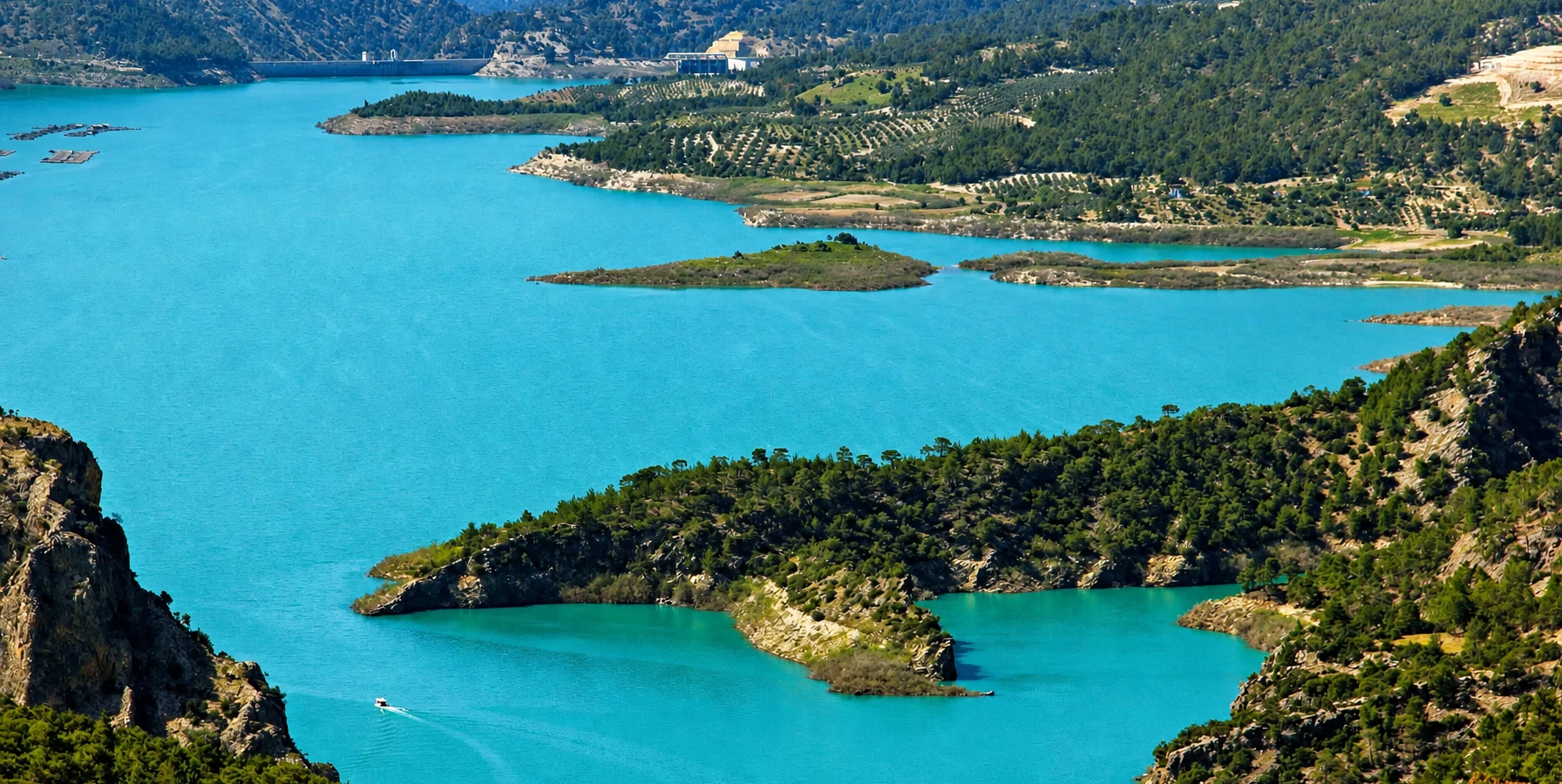
The reservoir created by Kemer Dam is one of the most recognizable landscape features of the Bozdoğan countryside. Known as Kemer Baraj Gölü, the artificial lake occupies a series of valleys and inlets surrounded by mountainous terrain.
At normal operating water level, published technical descriptions give the reservoir an approximate surface area of 14.75 square kilometers. Its actual visible extent changes with rainfall, seasonal inflows, water releases and longer-term water management conditions.
Seen from elevated viewpoints, the lake may appear as a succession of blue or green waterways winding between rocky hills. The irregular shoreline, wooded slopes and distant mountain ridges create particularly attractive panoramic compositions.
The reservoir is also closely connected with the landscape of Arapapıştı Canyon, where the Akçay passes between steep cliffs and narrow rock formations.
The surrounding countryside includes Mediterranean vegetation, pine-covered areas, agricultural fields and traditional rural settlements. In some locations, the contrast between cultivated land and rugged mountain scenery is especially striking.
Although the lake is artificial, it has become a prominent feature of the wider landscape. Its shores and surrounding vegetation provide habitats for wildlife, while its stored water remains important for human activity downstream.
Look across forested ridges, rocky slopes and the broad reservoir basin.
The lake can appear blue, green or turquoise depending on light, water conditions and season.
Winding inlets and exposed slopes reveal the shape of the flooded valleys.
Reservoir levels can change significantly, altering the scenery and accessibility of waterfront areas.
Discover small agricultural landscapes and mountain settlements around the reservoir.
Enjoy a quieter inland alternative to Aydın's busy coastal destinations.
One of the strongest reasons to explore the Kemer Dam region is its connection with Arapapıştı Canyon, also associated with the name İnceğiz Canyon.
The canyon developed over geological time as the Akçay and natural erosional processes shaped a dramatic passage through the mountains near the meeting area of Aydın, Denizli and Muğla provinces.
Official tourism descriptions identify the canyon as approximately 6 kilometers long, with surrounding rock formations rising to around 380 meters in height.
Its narrow waterways and high cliffs create an extraordinary contrast between rock, vegetation and water. When reservoir conditions are favorable, the calm water below the steep canyon walls is especially photogenic.
The canyon landscape also contains traces of human activity, including rock-cut features, caves and historical remains. These connect its natural geography with the long history of settlement and movement through the region.
Nature tourism activities were formally developed around the area in 2017. Organized sightseeing boat excursions have since become one of the best-known ways to experience the canyon, although their operation depends on seasonal schedules, water levels, weather and local management decisions.
See steep rock formations rising above the Akçay waterway.
When operating, authorized boat trips provide access to scenery difficult to appreciate from the road.
Look for historical caves and rock-cut features identified in regional tourism descriptions.
Capture the contrast between narrow waterways, towering cliffs and surrounding mountains.
Discover one of the most unusual inland landscapes of the Aegean region.
Water levels and weather can affect both the canyon's appearance and the availability of boat trips.
Kemer Dam is not a conventional museum or archaeological site. Its appeal lies in the combination of large-scale engineering, expansive water views and the mountain scenery of the surrounding Akçay Valley.
Appreciate the enormous concrete wall from lawful public viewpoints outside restricted operational areas.
Photograph the lake extending between wooded hills and rocky mountain slopes.
Observe the rugged geography that made this narrow valley suitable for a major dam project.
Combine a reservoir visit with the area's outstanding canyon scenery.
Enjoy changing views of the lake, agricultural terraces and distant ridgelines along local roads.
Experience the atmosphere of small communities in the Bozdoğan countryside.
Learn about the old bridge near the dam from which the Kemer project takes its name; access and visibility may be limited.
Notice how the shoreline changes with reservoir levels, exposing different rock and soil formations.
The area is best suited to visitors who enjoy landscapes, gentle exploration and photography rather than highly developed resort facilities. Activities depend on the particular location and the rules governing public access.
Photograph the reservoir, mountain reflections and dramatic contrasts between water and rock.
Follow public roads through the surrounding hills and stop only at safe, permitted viewpoints.
Join an authorized Arapapıştı Canyon excursion when seasonal services are available.
Observe vegetation, birds and the varied habitats of the mountain reservoir landscape.
Explore the stories of old bridges, rural routes, ancient settlements and nearby fortifications.
Enjoy regional Aydın dishes or locally served freshwater fish at an operating restaurant where available.
Walk along safe public tracks where access is permitted and conditions are suitable.
Spend time enjoying the valley's atmosphere without rushing between numerous attractions.
Although the dam itself dates from the twentieth century, the country surrounding the reservoir preserves evidence of a much older human history.
The valleys and mountain corridors of inland Aydın connected communities across Caria and the wider Büyük Menderes region. Ancient settlements developed in locations where access to water, defensible hills and communication routes shaped daily life.
Regional historical sites include Körteke Castle, the ancient settlement of Piginda and historic structures associated with the Akçay Valley.
The surrounding canyon area is also known for rock-cut features and caves. These remains should be approached carefully, as not every feature has been securely dated or developed for tourism.
For visitors interested in history, the region illustrates an intriguing contrast: ancient communities adapted themselves to the natural river valleys, while twentieth-century engineers transformed the same landscape through the construction of a massive reservoir.
Discover a historic mountain fortification associated with the wider Bozdoğan region.
Explore the remains of an ancient settlement near Çamlıdere in the mountainous Aydın countryside.
Learn about the older river crossing that gave the modern dam its name.
Historical features in the canyon area testify to human activity in this rugged landscape.
The surrounding rural settlements preserve aspects of agricultural and mountain life.
Natural river corridors have long influenced movement between the mountains and the plains.
A visit to Kemer Dam requires a different approach from sightseeing in central Aydın or Kuşadası. The surrounding countryside is rural, and facilities may be limited outside established recreation and tourism areas.
A car or private transfer is generally the most practical way to explore the reservoir and canyon area.
Mountain roads and remote viewpoints are easier and safer to navigate during daylight.
Bring sufficient water, especially during the hot and dry summer months.
Some viewing areas and walking surfaces may be rocky, uneven or dusty.
Rain, strong winds and poor visibility can affect driving, photography and boat excursions.
Confirm Arapapıştı Canyon services rather than assuming a departure will be available.
Never cross fences or enter operational areas of the dam and hydroelectric station.
Arrange fuel, meals and essential supplies before traveling into quieter mountain areas.
Begin in Bozdoğan, a traditional inland district surrounded by agricultural landscapes and mountain scenery. From here, continue toward the Kemer reservoir area, following the established public road network.
Choose a safe scenic viewpoint overlooking the reservoir and take time to appreciate the dam's scale and its mountainous setting. Remember that the dam body and power station may have restricted access.
If seasonal boat excursions are operating, continue to the designated Arapapıştı Canyon departure area. A boat visit provides a very different perspective on the landscape, bringing travelers closer to the steep canyon walls and narrow waterways.
Afterward, enjoy a leisurely meal in the region before returning toward Bozdoğan or continuing with a separately planned historical excursion.
For travelers with an interest in archaeology and regional history, sites such as Körteke Castle and Piginda can be considered as additional destinations. Because access roads and terrain may be challenging, these should be planned individually rather than treated as quick roadside stops.
Kemer Dam is primarily a working water management and electricity generation facility. It should not be confused with an attraction offering unrestricted admission to the dam wall, control structures or hydroelectric station.
Public roads and lawful viewpoints in the surrounding landscape may be accessible without a general sightseeing ticket. However, specific facilities, operating areas and authorized tourism services have separate access arrangements.
The Turkish Ministry of National Education's educational site lists visits to the Kemer Dam and Hydroelectric Power Plant during weekday daytime hours and advises contacting the institution before arranging a visit. This information should be treated as guidance for organized educational access rather than confirmation of unrestricted public tours.
Arapapıştı Canyon boat services operate separately from the hydroelectric facility. Departure times, seasonal availability and ticket prices can change.
Kemer Dam and the surrounding mountains can be visited in different seasons, but weather, water conditions and daylight strongly influence the experience.
Generally one of the most attractive periods for fresh vegetation, comfortable temperatures and mountain scenery.
Long daylight hours make scenic exploration convenient, although daytime temperatures can rise quickly.
Visit earlier in the day to avoid the strongest heat and enjoy softer photographic light.
Cooler weather can make sightseeing pleasant, but reservoir water levels may be lower after summer.
Clouds and changing mountain light can create atmospheric scenes, while wet roads and strong weather require caution.
Warm light can illuminate the hills beautifully; finish remote driving and walking before darkness.
Enough for a brief scenic stop at a safe reservoir viewpoint.
Enjoy photography, landscape observation and a relaxed visit to the surrounding area.
Combine several nearby scenic stops with a short drive through the countryside.
Explore Kemer Dam together with an operating Arapapıştı Canyon boat excursion.
Add local food, mountain scenery and a carefully planned regional historical destination.
Choose secure viewpoints and supervised activities rather than unprotected reservoir shorelines.
Kemer Dam offers interesting opportunities for both landscape and engineering photography. The best compositions often combine the scale of the reservoir with the steep terrain surrounding it.
Use elevated public viewpoints to capture the winding shape of the lake.
Frame the massive structure against the surrounding mountains to emphasize its scale.
On calm days, sheltered water may reflect hills, clouds and the changing sky.
Photograph the contrast between towering rock faces and narrow waterways during permitted excursions.
Include agricultural fields, traditional buildings and mountain roads to document the wider landscape.
Use changing reservoir levels to illustrate the interaction between water and terrain.
Accessibility around Kemer Dam varies by location. Some views may be enjoyed from public roads or established stopping places, while rough tracks, steep slopes and waterfront paths can be unsuitable for visitors with limited mobility.
Some scenic views can be appreciated without extensive walking.
Unpaved tracks, loose stones and slopes can create significant mobility challenges.
Verify individual viewpoints and facilities before assuming step-free access.
Ask the current canyon excursion operator about boarding steps, assistance and accessible seating.
Stay at secure, managed stops rather than attempting steep or unprotected waterfront paths.
Do not assume toilets, shaded seating or refreshments are available at every scenic location.
Kemer Dam lies in the mountainous countryside of the Bozdoğan district of Aydın. Traveling by private vehicle is generally the most convenient option because the main attractions are spread across a rural landscape.
Drivers should navigate toward Kemer Barajı, Bozdoğan, Aydın, rather than searching only for the name Kemer, which is shared by several other places in Türkiye.
Follow local roads toward the Kemer area. The reservoir is roughly 27 kilometers from the district center, depending on the destination.
Travel through the inland Aydın road network toward Bozdoğan and the Akçay Valley.
Plan a countryside excursion via the Nazilli or appropriate inland road connections.
Allow sufficient time for a longer inland drive, especially if combining the reservoir with canyon activities.
Regional transport may reach Bozdoğan, but onward connections to specific viewpoints can be limited.
A private transfer or guided vehicle is useful for linking the reservoir, canyon and rural heritage sites.
The area around Bozdoğan is rich in mountain scenery and regional history. While some attractions are relatively close to the reservoir, others are best planned as separate excursions because of the terrain and distances involved.
Explore the spectacular narrow canyon connected with the waters of the Akçay.
Discover historic fortifications overlooking the mountainous countryside.
Explore a lesser-known ancient settlement near Çamlıdere in the Bozdoğan region.
Experience the atmosphere of an inland Aydın district and its agricultural surroundings.
Enjoy mountain scenery, traditional settlements and the river landscape.
Continue toward the Nazilli area to explore a distinctive historic fortified residence.
Discover an ancient sanctuary associated with sacred healing traditions on a wider regional heritage route.
Extend your inland Aydın journey toward traditional craftsmanship and ancient cultural heritage.
Kemer Dam is located on the Akçay River in the Bozdoğan district of Aydın Province, southwestern Türkiye.
It is known for its hydroelectric generation, irrigation and flood-control functions, as well as its attractive mountain reservoir and connection with Arapapıştı Canyon.
Construction took place between 1954 and 1958. The dam was officially inaugurated on 25 September 1958.
The project was developed under Turkish government water and energy infrastructure initiatives, with international engineering and construction involvement during the 1950s.
The concrete dam rises approximately 108.5 meters above the riverbed.
It is a concrete gravity dam, relying primarily on the weight of its structure to resist water pressure.
Kemer Dam is built across the Akçay, a tributary within the Büyük Menderes River Basin.
Yes. Its associated hydroelectric power station has an installed generating capacity of 48 MW.
The main objectives were to produce hydroelectricity, provide water for agricultural irrigation and help regulate flooding.
No. Kemer Reservoir is an artificial lake created by damming the Akçay River.
Published technical specifications give a surface area of approximately 14.75 square kilometers at normal water level. Actual lake area changes as water levels rise and fall.
Yes. The reservoir and the Akçay Valley are closely connected with Arapapıştı Canyon, one of Bozdoğan's best-known natural attractions.
Authorized seasonal sightseeing excursions operate in the Arapapıştı Canyon area when conditions permit. Availability, departure points and ticket prices should be checked in advance.
Do not assume access to the dam crest or technical structures. The facility is operational, and restrictions or permission requirements may apply.
There is no single general sightseeing ticket for viewing the wider reservoir landscape from lawful public areas. Managed facilities and canyon boat tours may have separate charges.
The surrounding landscape has no single visitor timetable. Entry to technical facilities requires authorization, while organized attractions set their own operating hours.
Access is not generally equivalent to public museum admission. Educational or technical visits require prior arrangements and institutional approval.
Visitors should not assume swimming is permitted or safe. Deep water, steep shores, changing water levels and hydraulic infrastructure create risks, and local restrictions must be respected.
Fishing may be regulated by national and local rules, including licensing, seasonal restrictions and protected or operational zones. Check current regulations before fishing.
Camping should only be considered where land access, environmental regulations and local authorities permit it. The surrounding shoreline should not be treated as unrestricted camping land.
Spring and autumn generally provide pleasant temperatures for scenic exploration. Summer mornings are preferable during hot weather, while water levels can vary considerably throughout the year.
Allow 30–60 minutes for a simple scenic visit. A half day or longer is more appropriate if combining the area with Arapapıştı Canyon.
It may be possible to reach Bozdoğan by regional transport, but visiting individual reservoir viewpoints is generally easier with a car, private transfer or organized excursion.
Food services may be available around the wider Kemer and canyon tourism area, including establishments serving regional dishes and freshwater fish. Availability should be checked before traveling.
Yes, a properly planned scenic visit can suit families. Choose safe viewing areas and keep children away from steep slopes, unsecured shorelines and restricted structures.
Accessibility depends on the specific viewpoint or attraction. Vehicle-based viewing may be practical, but rough ground and steep terrain limit access in many locations.
No. Kemer Dam is a twentieth-century dam in Aydın's Bozdoğan district. The Bozdoğan Aqueduct, also called the Valens Aqueduct, is a separate Roman-era monument in Istanbul.
Yes, particularly for travelers who enjoy mountain landscapes, photography, engineering history and quieter destinations. The experience becomes especially rewarding when combined with Arapapıştı Canyon.
Kemer Dam is both an important water resource and part of a sensitive rural landscape. Responsible tourism helps protect the reservoir, surrounding vegetation and local communities.
Never cross fences or enter restricted areas around the dam and power station.
Do not leave rubbish, chemicals or food waste near the reservoir or streams.
Stay away from steep banks, unstable rocks and unprotected edges.
Observe birds and other animals quietly without disturbing their habitats.
Follow all seasonal restrictions on smoking, open flames and outdoor cooking.
Use legitimate local services, respect private property and follow village road etiquette.
Do not damage, move or remove archaeological objects or historic building materials.
Use public roads, designated excursion areas and properly managed viewpoints.
Explore the mountain scenery of Bozdoğan, Kemer Reservoir, Arapapıştı Canyon and the historical landscapes of inland Aydın through a thoughtfully planned private experience tailored to your interests, with no compulsory shopping stops.
Combine scenic landscapes, photography and local heritage in a comfortable private itinerary, subject to seasonal access and activity availability.
Ask us about a tailor-made experience featuring panoramic reservoir views, rural landscapes, regional history and the beautiful Akçay Valley.
Request a Custom Tour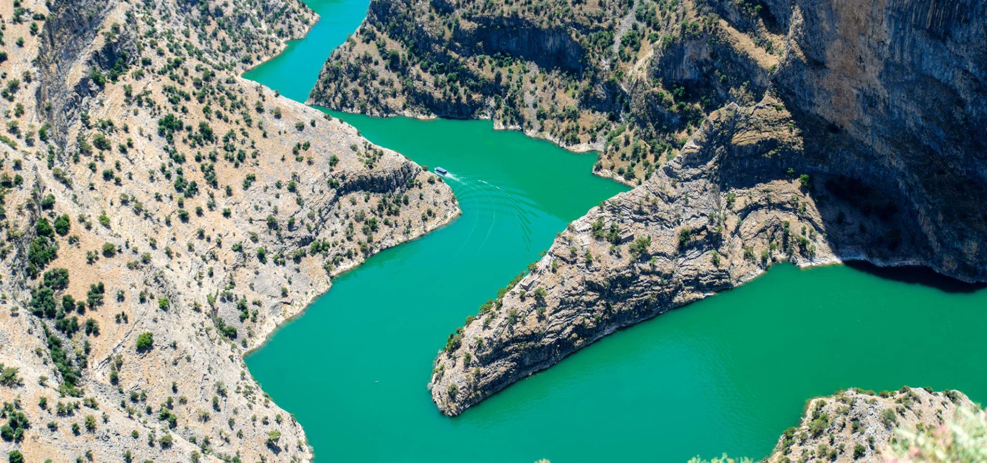
Discover the dramatic canyon scenery of inland Aydın, with a seasonal boat excursion when authorized services and conditions allow.
Plan Your ExperienceConnect the landscapes of Bozdoğan with ancient settlements, historic fortifications and the cultural traditions of the Büyük Menderes region.
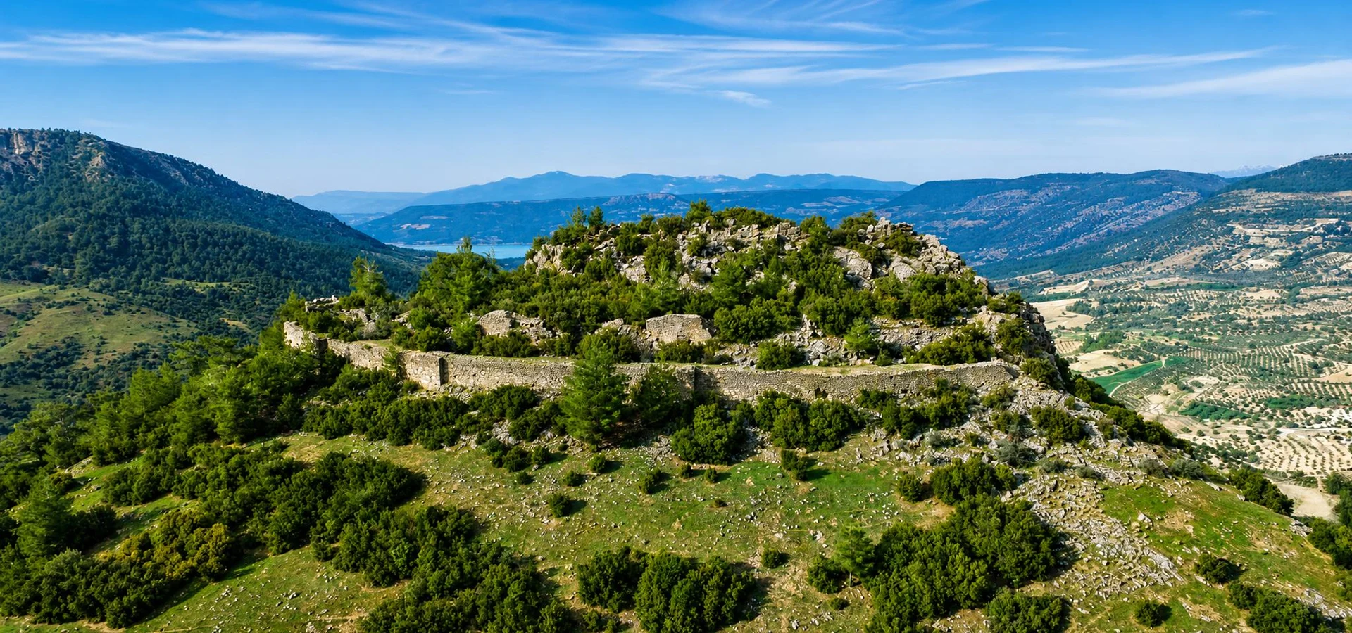
Discover a historic mountain fortification that reflects the strategic importance of inland Aydın.
Explore Körteke Castle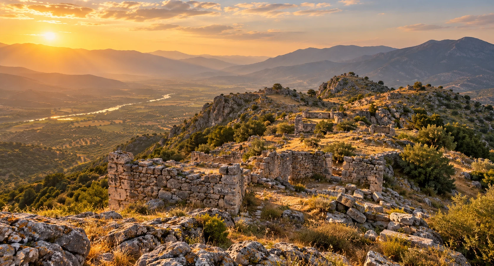
Explore the little-known ancient settlement associated with the mountainous countryside near Çamlıdere.
Discover Ancient Piginda
Continue toward Karacasu and discover traditional craftsmanship, ancient heritage and the landscapes beyond Aydın's coast.
Explore Karacasu