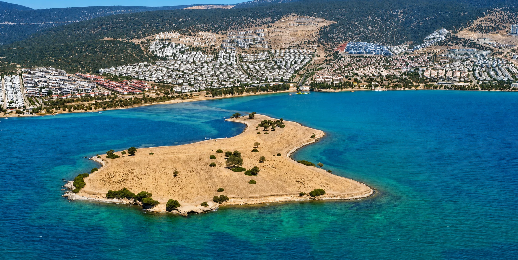
Private Saplı Ada & Akbük Experience
Ask us about a tailor-made coastal excursion featuring Saplı Ada viewpoints, Akbük Bay, seaside photography and scenic stops at a comfortable pace.
Request a Custom Experience





Saplı Ada, also known as Saplı Island, is one of the most distinctive natural landmarks on the Aegean coast of Türkiye. Located near Akbük in the Didim district of Aydın Province, this small island attracts attention because of its unusual shape, geological character and remarkable connection to the mainland.
Approximately 100 meters offshore, Saplı Ada is separated from the surrounding coast by shallow water and a narrow natural passage of sand, gravel and stones. Under suitable sea conditions, visitors can walk across this passage, experiencing the unusual sensation of approaching an island on foot through the Aegean Sea.
From elevated viewpoints, the formation resembles a spoon extending into the water. Its Turkish name, Saplı Ada, reflects this distinctive appearance, with the narrow connecting passage resembling the handle of a spoon.
The island is also associated with a fascinating geological story. Regional tourism accounts describe deposits of volcanic material linked to an ancient eruption in the Aegean region. Although the exact geological interpretation requires specialist investigation, the island's layers and coastal landforms contribute to its scientific and educational interest.
Today, Saplı Ada offers a very different experience from the larger beaches and resort areas of Didim. Visitors come to enjoy its panoramic views, examine the changing shoreline, photograph the shallow-water crossing and experience a small but memorable part of the Aegean landscape.
Reach the island through a shallow natural passage when sea conditions permit.
Discover a coastal formation associated with ancient volcanic deposits.
Explore a place recognized for its natural and archaeological significance.
Capture extraordinary compositions of the island, sea and surrounding hills.
Essential information for visiting this unusual natural landmark near Akbük and Didim.
Near Akbük Bay, Didim district, Aydın Province, southwestern Türkiye.
Open on Google MapsSmall coastal island connected to the mainland by a shallow sand-and-gravel passage.
Approximately 100 meters from the nearby mainland shoreline.
Walking may be possible through shallow water, depending on depth, wind and sea conditions.
Generally free to view from public coastal areas; check for any current access restrictions.
Allow approximately 30–90 minutes for views, photographs and a possible crossing.
A small island with a distinctive shape, an unusual shoreline connection and a geological story stretching into the distant past.
Saplı Ada is special because it challenges the familiar idea of an island as a piece of land that must always be reached by boat. Here, the boundary between land and sea can appear remarkably narrow. Under favorable conditions, the shallow passage allows visitors to approach the island on foot.
The landscape illustrates how the coast is continuously shaped by the movement and accumulation of sediments. Waves, currents, local topography and variations in water level all influence the appearance of the connecting passage.
The island also has a distinctive visual identity. Its elongated outline, low vegetation, stony shoreline and narrow connection create an instantly recognizable form when viewed from above.
Regional tourism information identifies Saplı Ada as a protected site and associates it with archaeological and geological heritage. These qualities make the island more than a scenic beach attraction: it is a sensitive landscape that should be explored without disturbing its natural materials.
For travelers exploring the Didim peninsula, Saplı Ada offers an attractive contrast to major historical destinations such as the Temple of Apollo at Didyma and the ancient ruins of Miletus.
Saplı Ada lies off the coastline associated with Akbük Bay, approximately 20 kilometers from central Didim by the general coastal route, although actual driving distances vary according to the starting point.
The island is relatively low and small, with an irregular surface of soil, stones, sparse vegetation and exposed coastal materials. Its most remarkable feature is the narrow passage that extends from the mainland toward the island.
Such formations are related to the broader coastal process through which waves and currents transport and deposit sediments. Where a sand or gravel ridge connects an island with the mainland, geographers may describe the resulting landform as a tombolo.
At Saplı Ada, the connecting passage can be exposed, partly submerged or more deeply covered by water depending on local conditions. Its appearance is therefore variable rather than fixed.
From the shore, visitors see a low island surrounded by the blue-green waters of the Aegean. From a higher viewpoint, the shape becomes clearer: the island forms the broader end of what resembles a spoon, while the narrow connecting ridge suggests its handle.
A small coastal landmass with a low profile, sparse vegetation and stony edges.
A narrow strip of naturally accumulated sediment linking the island and mainland.
Clear water around the passage reveals stones, sand and submerged patches.
Gravel, stones and finer materials record the action of waves and shoreline processes.
The surrounding bay and hills create a sheltered-looking but changeable coastal environment.
Water level, wind and waves influence how much of the passage is visible.
One of the most frequently repeated stories about Saplı Ada concerns its ancient volcanic origins. Regional tourism descriptions associate the island with volcanic ash deposited following a major eruption in the Aegean region during the second millennium BC.
According to this interpretation, volcanic material transported over considerable distances accumulated in the area and contributed to the deposits visible on or beneath the island's surface.
This account is often linked in popular descriptions to the great Bronze Age volcanic activity of the Aegean. However, identifying a particular deposit with a specific eruption requires geological sampling and laboratory analysis. The precise origin and age of Saplı Ada's materials should therefore not be treated as conclusively established by the tourism tradition alone.
Regardless of the exact origin of individual layers, the island provides an excellent opportunity to appreciate how geological events and much more recent shoreline processes can combine to produce today's coastal scenery.
Local accounts associate the island's formation with ash from a major ancient Aegean eruption.
Different coastal materials may reflect separate episodes of deposition and erosion.
Waves and currents transport sediments and continually reshape shallow coastal passages.
The present coastline represents many generations of geological and environmental processes.
Saplı Ada is identified in regional tourism materials as a protected site, with references to archaeological significance and prehistoric finds. Its protected status is an important reminder that even a small and seemingly undeveloped island can have scientific and cultural value.
Coastal places in western Anatolia have attracted human activity for thousands of years. Sheltered bays, fishing grounds, maritime routes and access to fresh water helped determine where ancient communities settled and traveled.
The wider Didim region has an exceptionally rich archaeological landscape, including Didyma, Miletus and numerous smaller settlements. Saplı Ada belongs geographically to this historic Aegean environment, although it should not be presented as the site of a documented ancient city or monumental sanctuary.
Protection is particularly important where an island's small size makes it vulnerable to erosion, trampling, littering and the removal of natural materials.
Regional tourism sources identify the island as a designated protected site.
References to prehistoric heritage highlight the need to avoid disturbing the ground.
The island's coastal form and sediment deposits are valuable features of its landscape.
Remaining on established routes helps reduce damage to fragile surfaces and vegetation.
Yes, it is sometimes possible to walk from the mainland to Saplı Ada through the shallow water covering its natural connecting passage. This is the island's best-known attraction and one of the reasons it has become a landmark of Akbük.
During suitable conditions, the water along portions of the passage may be shallow enough to wade through. Some visitors encounter exposed stones and gravel, while others find that sections of the route are submerged.
Nevertheless, the crossing must not be assumed safe or available at all times. Water depth changes with local conditions, and wind-driven waves can make an apparently easy passage uncomfortable or hazardous.
The Aegean has relatively small astronomical tides compared with many ocean coastlines. Changes at Saplı Ada should therefore not be understood simply as a predictable low-tide and high-tide timetable. Wind, waves, local water-level variations and changing sediments also matter.
Visitors should inspect the passage from the mainland before attempting to cross. If the route is unclear, the water is rough or the return conditions are uncertain, enjoying the island from the shore is the safer choice.
Assess water depth, wind, waves and visibility before stepping onto the passage.
Gravel, sharp stones and slippery underwater surfaces can make barefoot walking uncomfortable.
Water clarity can make submerged sections appear shallower than they really are.
Do not attempt the passage during rough seas, strong gusts or reduced visibility.
Conditions can change, so never assume the return route will remain exactly the same.
Visitors uncertain about footing, swimming ability or balance should remain ashore.
Saplı Ada does not contain major visitor buildings or large archaeological monuments. Its attraction lies in the landscape itself: the island's shape, the unusual shoreline connection, transparent water and panoramic setting.
Observe the narrow passage linking the island and mainland, especially where shallow water reveals the underlying stones.
Enjoy broad views across Akbük Bay and the hills surrounding this part of the Didim coastline.
Observe the changing colors of the Aegean, from pale turquoise in the shallows to deeper blue farther offshore.
Study the contrasts between gravel, larger stones, natural vegetation and the water's edge.
Capture the island's unusual silhouette and the visual effect of people crossing the shallow passage.
Spend time watching waves, changing light and the constantly shifting colors of the sea.
Explore appropriate public paths on the nearby mainland for alternative views of the island.
Combine the island with a relaxed exploration of Akbük's beaches, coastal scenery and waterfront.
The coastal waters surrounding Saplı Ada can be particularly attractive in calm weather. Their clarity and turquoise color make the location appealing to visitors looking for a quieter seaside experience than the busiest resort beaches.
However, the island should not be confused with an organized, lifeguarded beach. The shoreline is partly stony, and access to the water may involve uneven ground and submerged rocks.
The shallow connecting passage is mainly interesting as a natural feature. It is not necessarily the most suitable place for swimming, particularly where people are walking, stones are exposed or water levels change unexpectedly.
Visitors seeking a conventional beach experience with more developed facilities may prefer nearby coastal areas in Akbük or the popular Altınkum Beach area of Didim.
Calm conditions often provide beautiful views into the shallow water.
Expect stones and potentially sharp underwater surfaces near sections of the island.
Enter the water only where access is appropriate and the sea is visibly safe.
Do not rely on finding lifeguards, changing rooms, showers or refreshments on the island.
Like many distinctive natural landmarks in Türkiye, Saplı Ada has inspired stories that connect its physical appearance with popular imagination.
One local tale says that collecting ten small stones from the island can bring ten additional years of life. Versions of the story appear in regional travel descriptions and form part of the island's contemporary folklore.
There is no scientific basis for this belief, and it should be understood as a traditional story rather than a historical fact or a recommended visitor activity.
Because Saplı Ada is identified as a protected landscape, stones and other natural materials should remain in place. Visitors can appreciate the legend without collecting anything.
Saplı Ada is best enjoyed with realistic expectations. It is a small natural island rather than a developed attraction, and the main experience depends heavily on current sea and weather conditions.
Light winds and a calm sea make observation and any possible crossing more comfortable.
Footwear suitable for wet stones is preferable to ordinary sandals or bare feet.
Take your own refreshments rather than expecting facilities on the island.
Bring a hat, sunscreen and suitable clothing because exposed coastal areas provide limited shade.
Use a waterproof pouch or dry bag if carrying a phone or camera near the water.
Good visibility is essential for checking the crossing, studying the shoreline and returning safely.
Do not collect stones, remove plants, dig into the soil or disturb wildlife.
Be prepared to admire Saplı Ada from shore if crossing conditions are unsuitable.
Saplı Ada is a natural coastal landmark, not a conventional museum or organized archaeological attraction. There is generally no formal ticket booth or standard visitor timetable for enjoying views from public coastal areas.
The island's accessibility depends on shoreline conditions and any restrictions introduced to protect visitors or the site. A natural passage that is easily visible on one day may be partially submerged or unsuitable for walking on another.
Visitors should plan around daylight, local weather and the opportunity to enjoy nearby Akbük if the island itself cannot be reached.
Saplı Ada can be admired throughout the year, but the experience varies considerably with the season. The most important factors are calm water, comfortable temperatures and good visibility.
Comfortable temperatures and greener surroundings make spring excellent for walking and landscape photography.
Long daylight hours and increasingly warm sea temperatures suit coastal exploration.
Bright sunshine creates striking turquoise colors, although heat and visitor numbers can be higher.
Warm water and generally pleasant weather make early autumn attractive for a relaxed visit.
The island remains scenic, but colder water, wind and rougher conditions can prevent crossing.
Often especially pleasant for examining the passage and photographing reflections in the sea.
Enough to admire the island from the mainland and take a few photographs.
A comfortable visit for observing the passage, enjoying the scenery and photographing the coastline.
Allow additional time for a careful crossing if conditions permit and access is allowed.
A leisurely stop with photography, coastal observation and relaxation on the mainland.
Combine Saplı Ada with the nearby Akbük waterfront and other coastal viewpoints.
Plan a shorter shore-based visit unless conditions are exceptionally suitable and safe.
Saplı Ada is an especially rewarding location for coastal landscape photography. Its unusual shape allows photographers to experiment with leading lines, reflections, shallow-water textures and the surrounding Aegean scenery.
For the most recognizable composition, photograph the island from a position where the narrow connecting passage forms a clear line toward the broader landmass.
Higher mainland positions help reveal the island's characteristic spoon-like outline.
Use the narrow ridge as a natural leading line drawing attention toward the island.
Bright daylight can emphasize the contrast between shallow green-blue water and darker sea.
When the water is calm, subtle reflections create peaceful and minimalist compositions.
Warm, lower-angle sunlight can bring out textures in gravel, stones and vegetation.
Include the surrounding Akbük hills to place the island within its wider landscape.
People walking along the passage can illustrate its unusual size and connection, with their permission.
Capture water over stones, natural patterns and vegetation without disturbing them.
Saplı Ada is a natural, largely undeveloped coastal environment. Accessibility is therefore more limited than at a managed promenade or organized beach.
Some mainland viewpoints may offer relatively straightforward access, depending on the exact location and the condition of nearby paths. The connecting passage itself consists of uneven stones and shallow water and is not a step-free pedestrian route.
Visitors who cannot cross can still appreciate the island from suitable shore positions.
Expect gravel, stones, irregular ground and potentially slippery coastal sections.
The water crossing is not suitable for wheelchair access; investigate mainland viewpoints in advance.
Strollers may be impractical on the rocky shore and should not be taken through the water passage.
Those concerned about balance can enjoy a rewarding shore-based visit without attempting the crossing.
Close supervision is essential near the water, particularly where the seabed is uneven.
Saplı Ada is located along the Akbük coastline in the Didim district of Aydın. The area can be reached by road, although the final approach and parking conditions should be checked using an up-to-date map.
Akbük itself is approximately 20 kilometers from central Didim, with the journey generally taking around half an hour by car depending on the route and traffic. Saplı Ada lies within the wider Akbük coastal area, so travel time depends on your exact starting point.
Travel toward Akbük and follow current map directions to Saplı Ada or Saplı Ada Beach.
Use local coastal roads to reach the mainland shore opposite the island.
A private vehicle or rental car offers flexibility for visiting several coastal locations in one day.
A taxi can be convenient, especially if you arrange the return journey in advance.
Didim–Akbük minibuses serve the wider area; verify the closest suitable stop and current timetable.
Use designated parking areas where available and avoid blocking coastal access routes.
Begin your visit with a drive through the beautiful coastal surroundings of Akbük. The hills and sheltered bays provide an introduction to the quieter natural landscapes of the Didim peninsula.
Continue toward Saplı Ada and stop at an appropriate mainland viewpoint. Examine the narrow passage from the shore before deciding whether conditions are suitable for a crossing. Take time to photograph the changing water colors and unusual shape of the island.
If the passage is safely accessible, enjoy a careful short visit to the island without disturbing its vegetation or ground. Otherwise, photograph the landscape from the mainland and continue your coastal exploration.
Afterward, head toward the Akbük waterfront for a relaxed walk or a meal. Depending on available time, continue to other accessible beaches and viewpoints along the coast.
Saplı Ada makes an excellent short stop during a wider exploration of Didim and the surrounding Aegean region. The nearby coastline combines swimming areas, traditional coastal settlements, archaeological sites and beautiful natural landscapes.
Discover a peaceful coastal destination known for sheltered bays, waterfront dining and attractive sea views.
Explore one of the Aegean region's popular holiday destinations, combining history, beaches and coastal scenery.
Enjoy Didim's famous sandy beach, swimming opportunities and lively seaside atmosphere.
Visit the monumental ancient sanctuary famous for its oracle and impressive Ionic columns.
Discover one of Ionia's most influential ancient cities, celebrated for philosophy, trade and urban planning.
Explore a remarkable combination of lakeside nature, ancient ruins and the dramatic Latmos Mountains.
Saplı Ada is a small coastal island near Akbük in the Didim district of Aydın Province, southwestern Türkiye.
The name can be understood as "Handle Island." It refers to the island's distinctive shape, which resembles a spoon with a narrow handle extending toward the mainland.
Yes, walking may be possible through the shallow natural passage connecting the island to the mainland. However, water depth and sea conditions vary, and safe access cannot be guaranteed.
The island is commonly described as lying approximately 100 meters offshore, connected to the mainland by a narrow shallow passage.
Yes. Saplı Ada is a small island whose narrow connection to the mainland may be exposed or submerged depending on local conditions, sometimes giving it the appearance of a peninsula.
A tombolo is a coastal landform created when accumulated sand or gravel connects an island to another landmass. Saplı Ada's connecting passage resembles this type of formation.
Regional tourism accounts associate its geological history with volcanic ash from a major ancient Aegean eruption. The precise origin and age of individual deposits require scientific geological verification.
Yes. Regional tourism information identifies Saplı Ada as a protected site with natural and archaeological significance. Visitors should not disturb its ground or remove natural materials.
The island is associated with archaeological interest, but it is not a developed archaeological park with major visible monumental ruins. Its principal attractions are its natural shape and coastal landscape.
Viewing the island from public coastal areas is generally free. Visitors should check locally for temporary access restrictions or any rules applying to protected areas.
There is no conventional museum opening schedule for the natural island. Daylight visits are recommended, and crossing should only be considered in safe sea conditions.
Swimming may be possible in suitable conditions, but the shoreline is partly rocky and the area should not be assumed to have lifeguards or organized beach facilities.
Parts of the connecting passage are shallow, but depths vary and can change along the route. Do not assume that all surrounding water is shallow or safe.
Calm mornings are often pleasant for exploring the shoreline and taking photographs. The safest time depends on actual weather and sea conditions rather than the clock alone.
Not necessarily. The Aegean has relatively small astronomical tides. Wind, local water levels, waves and sediment conditions also influence whether the passage is exposed or submerged.
Families can enjoy the island from the mainland, but children must be supervised near the water. Crossing should only be considered when conditions are demonstrably safe and appropriate.
The natural water crossing is not wheelchair accessible. Some mainland views may be reachable, depending on the condition of local roads and paths.
Do not expect restaurants or organized visitor facilities on the island itself. Nearby Akbük offers dining and other visitor services.
Approximately 30–90 minutes is sufficient for most visitors to appreciate the scenery, take photographs and consider a safe crossing if conditions allow.
Saplı Ada is in the Akbük area, approximately 20 kilometers from central Didim in general terms. Exact road distance and journey time vary according to the route.
Yes, it may be possible using a combination of local minibuses and walking or a taxi. Check the current Didim–Akbük services and the closest convenient mainland access point.
A local story says that collecting ten stones from Saplı Ada brings ten extra years of life. It is folklore, not a factual claim, and visitors should leave all stones undisturbed to protect the site.
Drone use depends on Turkish aviation regulations and any local protected-area restrictions. Necessary permissions should be checked before flying.
Yes, especially for visitors interested in unusual coastal landforms, nature photography and quieter Aegean scenery. It is a short but memorable addition to a Didim or Akbük itinerary.
Small coastal environments can be surprisingly vulnerable to human activity. At Saplı Ada, responsible travel means protecting the natural materials, vegetation and surrounding sea that make the location special.
Do not collect pebbles, volcanic material or other natural features from the island.
Avoid exposing buried layers or disturbing ground that may have geological or archaeological value.
Stay on existing accessible paths and avoid trampling plants or sensitive coastal habitats.
Remove food packaging, bottles and all other rubbish when you leave.
Observe animals and birds from a suitable distance without feeding or disturbing them.
Respect any signs, temporary closures or conservation instructions affecting the site.
Combine the natural beauty of Saplı Ada with Akbük's coastal scenery, Didim's beaches and the remarkable archaeological heritage of ancient Ionia through a private itinerary designed around your interests.
Enjoy a relaxed private exploration of the area's natural scenery, coastal landscapes and historic surroundings.
Ask us about a tailor-made coastal excursion featuring Saplı Ada viewpoints, Akbük Bay, seaside photography and scenic stops at a comfortable pace.
Request a Custom Experience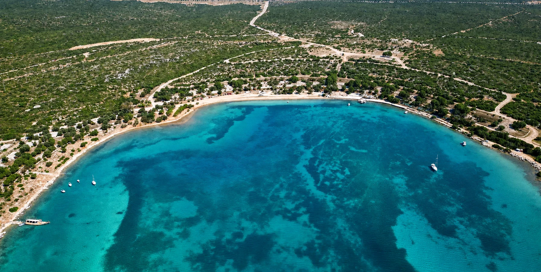
Discover the wider Didim region, from sandy beaches and peaceful bays to the magnificent Temple of Apollo and historic coastal communities.
View Didim GuideDiscover destinations where beautiful nature meets thousands of years of history.
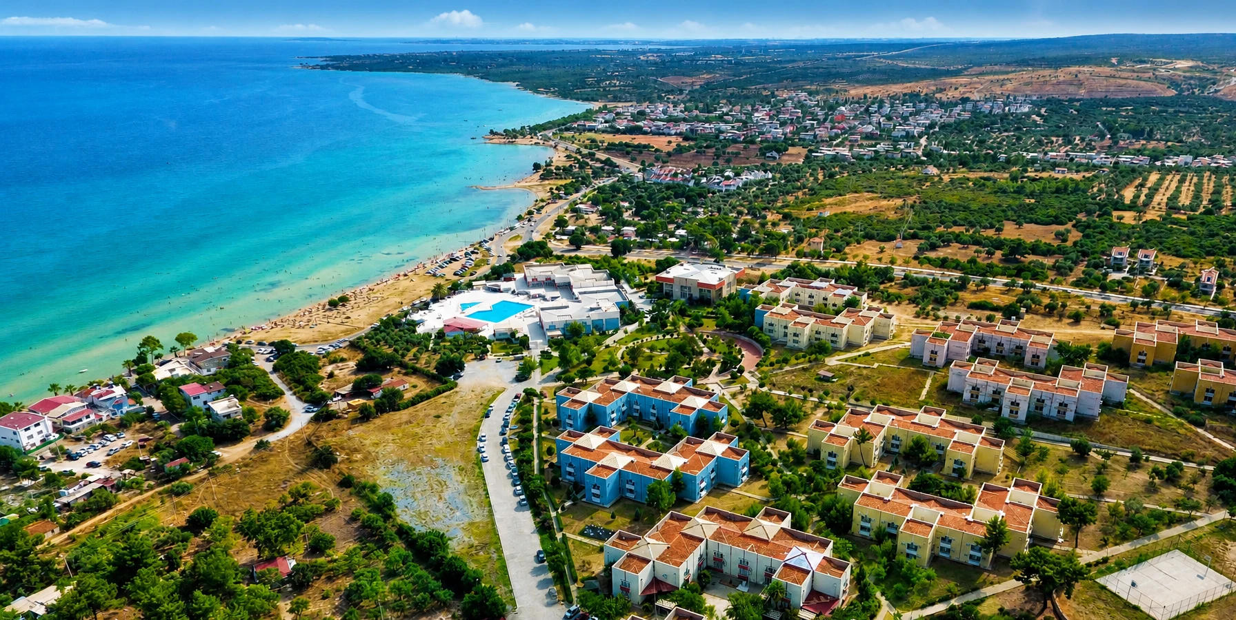
Explore one of Didim's most appealing coastal areas, with beautiful bays, peaceful waterfront scenery and inviting beaches.
Explore Akbük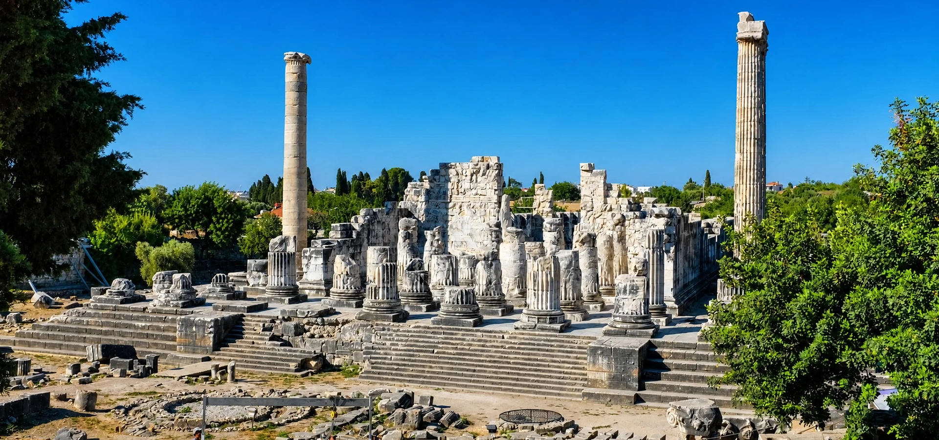
Step into one of the ancient Greek world's great oracular sanctuaries and admire its extraordinary monumental architecture.
Explore Didyma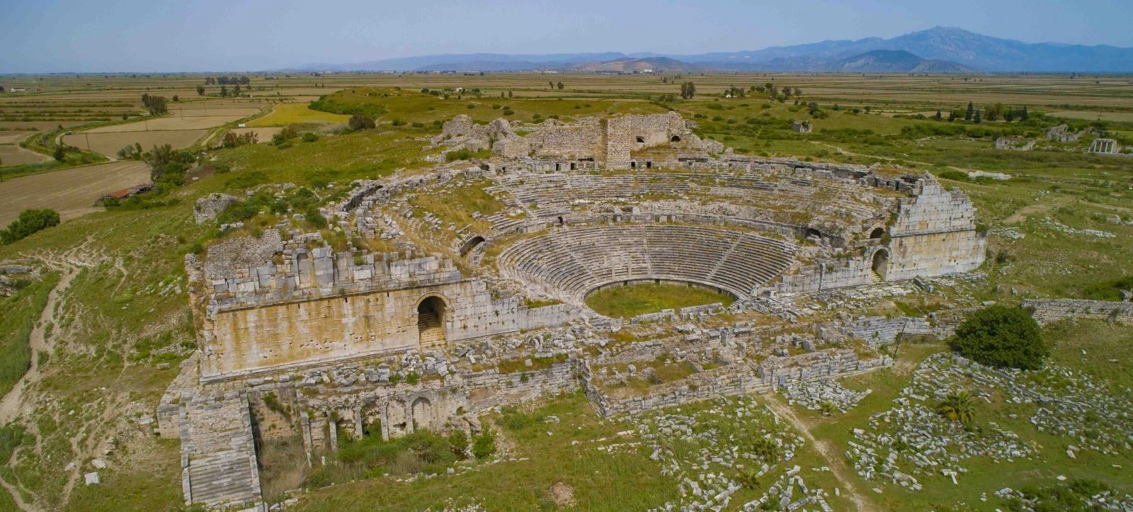
Explore the influential Ionian city associated with early philosophy, remarkable architecture and the maritime history of the Aegean.
Explore Miletus