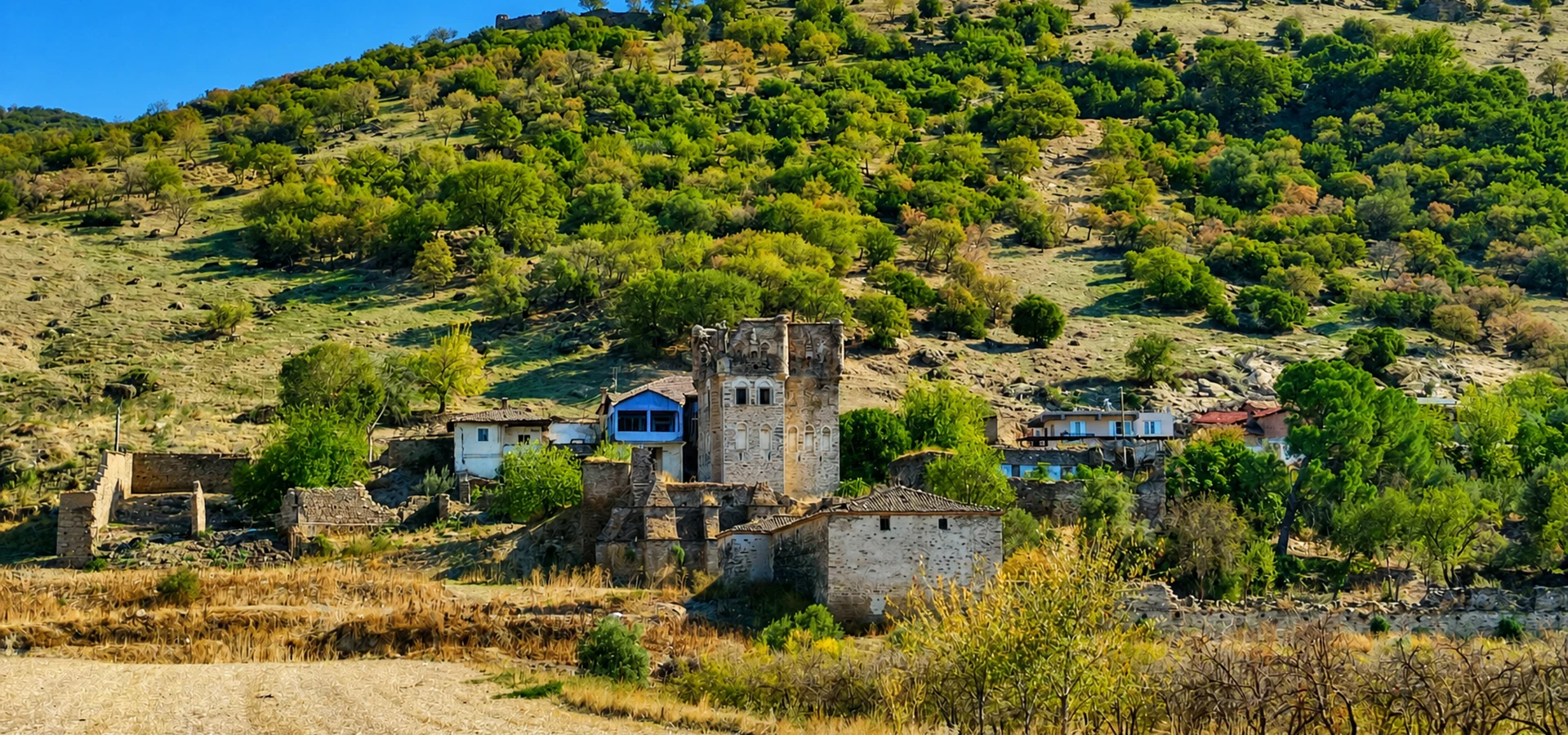
Private Harpasa Heritage Experience
Ask us about a tailored archaeological excursion exploring the history of Harpasa, the Akçay Valley and the nearby Arpaz heritage landscape, subject to access conditions.
Request a Custom Experience





Hidden among the hills of western Türkiye, Harpasa Ancient City is one of the lesser-known archaeological sites of ancient Caria. Located above Esenköy (historically Arpaz) in the Nazilli district of Aydın Province, Harpasa occupies a commanding hillside overlooking the fertile landscape of the Akçay Valley, once associated with the ancient Harpasos River.
Unlike the extensively excavated monuments of Ephesus or Aphrodisias, Harpasa retains the atmosphere of an archaeological landscape still being investigated. Visitors encounter surviving defensive walls, traces of an ancient theatre, terraced settlement areas and the remains of a later Byzantine fortress.
The city's history reaches back into the Archaic period, while its visible remains reveal Hellenistic, Roman and Byzantine activity. The surrounding district continued to develop through the Turkish Beylik and Ottoman periods, giving the historic settlement of Arpaz an unusually long cultural story.
Harpasa also possesses one of antiquity's more curious literary associations. The Roman writer Pliny the Elder described an extraordinary rock near the city that supposedly moved at the touch of a finger but resisted the force of an entire body. Although the stone has not been securely identified today, the account offers a fascinating connection between archaeology, natural phenomena and ancient storytelling.
For travelers interested in the quieter side of Türkiye's ancient history, Harpasa offers something different: a landscape where monumental ruins, rural life and the long history of the Büyük Menderes region meet.
Explore a historic settlement overlooking the Akçay Valley.
Discover the remains of a theatre with Hellenistic architectural features.
See evidence of Archaic defenses and later Byzantine occupation.
Experience a less-developed archaeological landscape near Nazilli.
Essential information for discovering ancient Harpasa near Nazilli, Aydın.
Above Esenköy (Arpaz), Nazilli district, Aydın Province, Türkiye.
Open on Google MapsCaria, in southwestern Anatolia, near the historic Lydia–Caria frontier.
Archaic, Hellenistic, Roman, Byzantine and later Turkish periods.
Ancient theatre, defensive walls, terraced settlement, castle and burial remains.
No reliable current ticketing schedule confirmed; check local access conditions.
Allow approximately 1–2 hours, depending on accessible areas and walking conditions.
Harpasa reveals the strategic and cultural significance of a Carian hilltop settlement that remained connected to the surrounding valley for centuries.
Harpasa was positioned in a landscape where rivers, fertile plains and mountain routes shaped settlement patterns. Its location near the ancient Harpasos River provided access to agricultural resources and communication routes connecting communities of inland Caria with the wider Meander basin.
The site is particularly significant for its long history of occupation. The Aydın Provincial Directorate of Culture and Tourism identifies surviving Archaic fortifications, a theatre displaying Hellenistic characteristics and evidence of activity during Roman, Byzantine, Beylik and Ottoman periods.
The ancient city also helps researchers understand the relationship between Carian and Lydian cultural traditions. Burial mounds on hills north of Harpasa have been interpreted as showing Lydian influence, demonstrating the cultural interaction that characterized this part of western Anatolia.
Harpasa continued to matter after antiquity. During the Byzantine period, occupation became concentrated around its hilltop fortification. Centuries later, the settlement of Arpaz developed as a local administrative and rural center under Turkish rule.
Today, Harpasa is important not because it possesses a fully reconstructed city center, but because its surviving ruins preserve evidence of settlement, defense, religion, burial traditions and landscape use across many historical periods.
Harpasa Ancient City stands on the elevated terrain above Esenköy, a rural settlement in the Nazilli district of Aydın. The archaeological remains occupy the hill locally associated with Asar or Hisar Tepe and its surrounding slopes.
The site lies south of the Büyük Menderes River, within the landscape of the Akçay Valley. The modern Akçay is associated with the ancient Harpasos, from which the city takes its historically recorded name.
The elevated position provides a broad perspective across the agricultural land and surrounding hills. This relationship between settlement and countryside is essential for understanding Harpasa's location.
The site is not a compact archaeological park with a single clearly defined tourist circuit. Ancient remains occur across the hillside, and access may vary according to archaeological protection, terrain, vegetation and neighboring land use.
Although Harpasa is recognized as an ancient Carian settlement, its precise foundation date remains uncertain. Archaeological remains indicate an early settlement history, but the limited written record does not allow every phase of the city's development to be reconstructed confidently.
Archaic Period: The earliest major architectural evidence includes defensive walls traditionally dated to the Archaic period. Sections of the northern fortifications survived sufficiently well to demonstrate the importance of this hilltop settlement during early Carian history.
Hellenistic Period: Harpasa developed as part of a politically complex landscape influenced by regional kingdoms and shifting alliances. The surviving theatre exhibits Hellenistic characteristics, while terraced construction demonstrates the adaptation of civic architecture to the hillside.
Roman Period: Harpasa belonged to the wider provincial and commercial world of Roman Asia Minor. Ancient literary references and surviving civic coinage confirm its identity as an established community during the Roman era.
Late Antiquity and Byzantine Period: The settlement continued into the Christian Byzantine world. Over time, the inhabited area contracted, and the elevated fortified sector became increasingly important for defense and observation.
Turkish Beylik and Ottoman Periods: The surrounding Arpaz settlement remained active, eventually becoming associated with local administration and landed families. The later Arpaz Tower and Beyler Mansion complex below the ancient hill illustrates this continuation of regional importance.
Modern Archaeological Research: Harpasa has attracted archaeological documentation and survey projects rather than the extensive monumental excavations seen at some larger ancient cities. Recent studies, including research associated with Pamukkale University, have helped document its architecture and conservation needs.
Early fortifications demonstrate the establishment of a defended hilltop settlement.
Terraced urban development and a theatre reflecting Hellenistic architectural traditions.
The city participates in Roman Asia Minor's provincial and monetary networks.
Settlement activity becomes increasingly associated with a hilltop fortified area.
Arpaz develops as a local administrative and agricultural center.
Archaeological surface surveys support the documentation and conservation of Harpasa.
Harpasa's architecture reflects the challenges of constructing an urban settlement on a steep hillside. Rather than occupying a single level plain, the ancient city developed across a series of terraces and elevated areas.
Terracing provided more manageable surfaces for buildings and circulation while allowing the settlement to take advantage of its natural defensive position. The relationship between the built environment and the surrounding topography remains one of Harpasa's most important archaeological characteristics.
Surviving architecture belongs to different historical phases. Monumental stonework, damaged defensive structures, later fortification remains and scattered architectural fragments illustrate a settlement that changed significantly over time.
Artificial and natural terraces helped accommodate buildings on the hillside.
Early stone fortifications enclosed and protected strategically important areas.
The theatre provides evidence of communal life in the ancient city.
Multiple building phases reveal changes in construction techniques and repair practices.
The higher fortified area became especially important during Byzantine occupation.
Steep slopes and broad views helped reinforce the settlement's position.
One of the most important surviving monuments of Harpasa is its ancient theatre, located on the hillside above modern Esenköy. The Aydın Provincial Directorate of Culture and Tourism identifies the theatre as a structure displaying Hellenistic architectural characteristics.
Like many ancient Anatolian theatres, Harpasa's theatre made use of the natural slope. This approach reduced the amount of artificial support required and incorporated the surrounding landscape into the architectural design.
The theatre is not preserved as a complete or extensively restored monument. Its surviving structural elements and seating remains may be partly obscured by vegetation, accumulated soil or later changes to the area.
Its presence nevertheless confirms that Harpasa possessed facilities associated with civic and cultural life. Ancient theatres could accommodate dramatic performances, music and public gatherings, although the precise program of activities at Harpasa remains unknown.
The defensive walls are among Harpasa's most valuable surviving archaeological features. According to the official provincial tourism description, substantial sections of the northern Archaic-period walls remained visible at the site.
These fortifications help explain why the settlement developed on elevated terrain. Defended heights offered surveillance over approaches through the surrounding valley and provided protection during periods of regional political instability.
Studying the surviving masonry can reveal differences between ancient construction and later repairs. Stone sizes, courses, joints and the relationship between walls and natural rock all contribute to understanding how the defenses developed.
The ruins should not be interpreted as belonging to a single construction campaign. Harpasa's long occupation history means that different wall sections may reflect distinct periods of construction, alteration and reuse.
Important surviving evidence of the city's early defensive architecture.
Elevated terrain offered observation and natural protection.
Historic masonry reveals building techniques and later alterations.
The walls connect the settlement with routes through the Akçay Valley.
Harpasa's elevated fortified sector preserves another important chapter in its history: the transformation of an ancient settlement into a more concentrated Byzantine stronghold.
As regional security conditions and settlement patterns changed, the fortified hilltop became a focus of occupation. The later castle reused the strategic advantages of the site while introducing defensive construction associated with the Byzantine period.
Archaeological and conservation research has documented surviving portions of the Byzantine castle walls. These remains help researchers distinguish the city's earlier defensive system from later fortification activity.
The transition illustrates a broader pattern found across Anatolia, where ancient urban centers sometimes contracted toward defensible hilltops during periods of political or military uncertainty.
Byzantine defensive structures were established in the elevated settlement area.
Occupation became more closely associated with the protected hilltop.
Studies examine surviving castle walls and their present condition.
The castle demonstrates the continued strategic importance of Harpasa's location.
The burial landscape surrounding Harpasa provides valuable evidence of ancient cultural practices. The Aydın Provincial Directorate of Culture and Tourism identifies burial mounds on hills extending northward from the city and associates their architectural tradition with Lydian influence.
Such monuments are significant because Harpasa stood within a zone of interaction between Carian communities and neighboring cultural regions. Burial architecture can preserve evidence of shared customs, artistic influences and social status.
The surrounding hills should therefore be understood as part of the archaeological landscape, rather than as undeveloped ground separated from the city itself.
Burial remains are especially vulnerable to erosion, unauthorized digging and accidental damage. Visitors should observe them only from appropriate public areas and never disturb stones or exposed archaeological material.
Harpasa's location cannot be fully understood without the river system below the ancient settlement. The Harpasos River, generally identified with the modern Akçay, was an important feature of the regional landscape.
Flowing through the broader Büyük Menderes basin, the river supported agriculture and helped structure communication between settlements in the valley and the surrounding uplands.
Ancient writers connected Harpasa directly with its river. The city's name and its relationship with the Harpasos preserve the close association between settlement identity and local geography.
In the present landscape, cultivated fields, villages, hills and river corridors continue to demonstrate why this region supported settlement over such a long period.
Harpasos, the river associated with ancient Harpasa.
Akçay, part of the wider Büyük Menderes river system.
Fertile valley land encouraged long-term settlement and cultivation.
Waterways and valleys helped define routes through inland Caria.
Harpasa appears in surviving Greek and Roman geographical literature, including references associated with Pliny the Elder, Ptolemy and Stephanus of Byzantium.
One of the most memorable accounts comes from Pliny's Natural History. He describes a remarkable stone near Harpasa that could apparently be moved by the touch of a single finger but could not be shifted by the pressure of an entire body.
This curious observation belongs to a wider ancient tradition of recording unusual natural phenomena. Rocking stones, unusual geological formations and seemingly mysterious physical properties frequently attracted the attention of ancient authors.
Although the exact stone mentioned by Pliny has not been securely identified at Harpasa, his description gives the settlement a distinctive place in the literary geography of the ancient world.
The account should be approached as an ancient report, not as proof that an identifiable supernatural stone survives at the archaeological site.
Coins provide important historical evidence for Harpasa because the city's surviving written history is limited. Roman provincial coinage documents the community's name, religious imagery and participation in the monetary life of Asia Minor.
The Roman Provincial Coinage research project records coins issued at Harpasa, including examples bearing the name of its inhabitants.
One recorded coin type from the reign of Antoninus Pius, dated approximately AD 139–146, depicts the personification of the civic community, or Demos, on one side and the goddess Athena on the other.
Such coins remind us that Harpasa was more than a fortified hilltop. It was also an organized ancient community with a civic identity expressed through inscriptions and imagery.
Greek inscriptions identify the community of the Harpasians.
Local coinage connects Harpasa to the economy of Roman Asia Minor.
The goddess appears in surviving examples of Harpasa's civic coinage.
Coin inscriptions and designs preserve information about ancient civic identity.
For further study, consult the Roman Provincial Coinage catalogue entry for Harpasa.
Harpasa has long been known to researchers studying ancient Caria, but it has not undergone the same large-scale excavation and restoration programs as the region's major international archaeological destinations.
Historical surveys, architectural studies and documentation projects have helped establish the layout and significance of its surviving remains.
Recent surface research has added an important new dimension to the investigation of Harpasa. Pamukkale University identifies archaeological survey work conducted under the direction of Dr. Ali Yaşar with permission from Türkiye's Ministry of Culture and Tourism.
Research topics include architectural remains, historic masonry, conservation conditions and archaeological evidence from the ancient city and its surrounding territory.
These studies contribute to understanding Harpasa as a changing settlement rather than merely a collection of isolated ruins. They also help identify priorities for future documentation and heritage protection.
Archaeologists document visible ruins and material across the settlement landscape.
Studies examine fortifications, construction techniques and historical alterations.
Ancient written sources, inscriptions and earlier studies are compared with the ruins.
Research supports the long-term protection of vulnerable archaeological structures.
Harpasa offers a very different experience from a fully excavated archaeological park. Its attractions are distributed across the landscape, and some remains may be difficult to distinguish without background knowledge.
Discover evidence of the city's Hellenistic-style performance building above Esenköy.
Observe surviving stretches of stone defenses associated with the early city.
Explore the history of the later fortified settlement through surviving hilltop remains.
Understand how buildings and circulation routes were adapted to steep terrain.
Learn about the ancient necropolis and Lydian-influenced burial traditions.
Appreciate the geographical position that shaped Harpasa's settlement history.
Experience the rural settlement at the foot of the ancient hill.
Connect the ancient city with a remarkable later Ottoman tower and mansion complex.
One of the most interesting features of visiting Harpasa is the close geographical relationship between the ancient settlement and the later Arpaz Castle and Beyler Mansion complex.
Located near the foot of the hill in Esenköy, the complex reflects a much later chapter in the region's history. Its development is associated with local Ottoman landholding families and the agricultural economy of the Akçay Valley.
The Aydın Provincial Directorate of Culture and Tourism identifies substantial early 19th-century construction connected with the Arpaz Bey family, along with evidence of earlier Ottoman-period structures.
The complex includes a distinctive defensive tower, mansion and associated service buildings. Together they demonstrate how rural wealth, local security and political authority could shape architecture in Ottoman Anatolia.
The ancient and Ottoman sites should not be confused. Harpasa is the ancient Carian settlement on the hill, while Arpaz Castle refers to the much later architectural complex below.
Continue with our Arpaz Castle and Beyler Mansion visitor guide for a closer look at the Ottoman monuments associated with this historic landscape.
Harpasa is a protected archaeological landscape rather than a heavily developed tourist attraction. Visitors should not assume that the site provides the facilities, marked circuits or regular staffing associated with major archaeological museums.
As of October 2026, a reliable official daily opening timetable and admission price for Harpasa could not be confirmed from the provincial tourism information consulted for this guide.
Access to archaeological remains may depend on local conditions, conservation work, vegetation and the status of nearby land. The safest approach is to confirm current arrangements with local tourism authorities before making a special journey.
Daylight visits are preferable, and sturdy footwear is important. Depending on the chosen route, the terrain can include steep paths, loose stones, grass, uneven ground and exposed slopes.
Harpasa is predominantly an outdoor archaeological landscape with exposed hillside terrain. Temperature, rain, vegetation and available daylight can significantly affect the visit.
Generally comfortable temperatures and green hillsides make spring attractive for exploration.
Milder weather and softer light provide favorable conditions for walking and photography.
Visit early, since exposed slopes can become very hot during the afternoon.
Cooler weather may suit walking, but wet or muddy surfaces require additional care.
Early daylight can reveal masonry textures and hillside details.
Warm light can enhance valley landscapes, but allow enough time to return before dark.
Suitable for a short orientation to Esenköy and the historic hillside from accessible viewpoints.
Enough for a focused archaeological introduction where accessible remains can be reached safely.
A reasonable allowance for a fuller visit, depending on pathways, conditions and permitted access.
Combine Harpasa with Esenköy and the Arpaz Castle surroundings, subject to current access.
Create a broader Nazilli-area heritage itinerary including other ancient cities and local villages.
Keep the visit short and avoid exposed slopes, unstable ruins and difficult hillside paths.
Begin your visit in Esenköy, the modern settlement associated with the ancient site. Take time to observe the surrounding terrain and identify the hill where Harpasa developed.
If the current conditions and permitted paths allow, continue toward the accessible archaeological remains. The ancient theatre and defensive structures provide the principal historical focus, although reaching individual monuments may require local guidance.
Pay particular attention to how the hillside, terraces and remaining fortifications relate to one another. Harpasa's landscape is as important to understanding the city as its surviving architecture.
After returning to the village, continue your historical excursion with the Arpaz Castle and Beyler Mansion complex. Even where building interiors are inaccessible, the exterior setting helps connect the ancient settlement with the later Ottoman history of the district.
Harpasa offers opportunities to photograph ancient masonry, rural landscapes and the contrast between a historic hilltop settlement and the cultivated valley below.
The site's undeveloped character makes natural details particularly important. Rather than searching only for large monuments, look for the relationship between stonework, vegetation, slopes and distant agricultural fields.
Use side lighting to reveal surviving stone courses and masonry textures.
Include cultivated fields and surrounding hills to communicate Harpasa's location.
Photograph the natural landscape that shaped ancient urban development.
Look for stone joints, weathering, foundation remains and differences in masonry.
Capture the relationship between the modern village and the ancient hill.
Remain on safe ground and avoid climbing fragile archaeological structures.
Accessibility at Harpasa is limited by its hillside location and the relatively undeveloped nature of the archaeological landscape.
Visitors may encounter steep gradients, loose stones, vegetation, uneven ground and unprotected archaeological remains. A step-free route through the main archaeological areas has not been verified.
Travelers with limited mobility may prefer to experience the historic landscape from accessible locations in or around Esenköy rather than attempting to reach elevated ruins.
Natural slopes and archaeological ground may be difficult to walk across.
No verified accessible archaeological circuit is available in the consulted information.
Exposed hillsides can be uncomfortable during hot weather.
Young visitors require close supervision near ruins and steep ground.
Consider a shorter landscape-focused visit if uphill walking is difficult.
Seek reliable local advice about current routes and conditions before ascending.
Harpasa is located near Esenköy in the Nazilli district. Travelers normally approach the area through Nazilli before following local roads toward the village.
The rural location means that a private vehicle is generally the most flexible option. Public transport possibilities should be confirmed locally, since routes and schedules may not conveniently serve the archaeological site itself.
Follow local directions toward Esenköy, historically known as Arpaz.
Travel toward Nazilli, then continue to Esenköy by local road.
A longer inland excursion is possible through the Büyük Menderes region toward Nazilli.
Offers flexibility for reaching the village and combining nearby heritage sites.
Check current connections to Esenköy, as village services may be limited.
Confirm the safest legal route toward accessible archaeological remains.
Harpasa can be included in a broader exploration of the Nazilli district and inland Aydın, where ancient cities, Ottoman monuments and rural landscapes preserve different periods of western Anatolian history.
Discover the Ottoman tower and Beyler Mansion complex below Harpasa.
Explore another important ancient settlement associated with the Nazilli region.
Visit a remarkable ancient urban site near Sultanhisar, famous for its dramatic topography.
Discover an ancient religious center associated with healing traditions near Nysa.
Explore archaeological collections that illuminate the ancient cultures of the province.
Experience the contemporary regional center and its local culinary traditions.
Harpasa is located above Esenköy village in the Nazilli district of Aydın Province, western Türkiye.
Harpasa was an ancient Carian settlement that remained occupied through different historical periods, including Hellenistic, Roman and Byzantine times.
The surviving fortifications include remains associated with the Archaic period, but the exact foundation date of Harpasa has not been securely established.
Harpasa is generally identified as a Carian city. Its geographical position near Lydia helps explain Lydian cultural influences, particularly in surrounding burial traditions.
The settlement is historically associated with the name Arpaz, while Harpasa is the name of the ancient city occupying the nearby hill.
Important remains include ancient defensive walls, a Hellenistic-style theatre, settlement terraces, later Byzantine fortifications and traces of ancient burial areas.
Yes. A theatre displaying Hellenistic architectural features survives in a partially preserved state on the hillside above Esenköy.
No. Harpasa is not a fully restored archaeological attraction, and the theatre's surviving remains may be difficult to recognize without archaeological knowledge.
They are surviving defensive structures, including sections associated with the Archaic period, which protected the elevated settlement.
Yes. The hilltop preserves evidence of a later Byzantine fortified area associated with the contraction and defense of the settlement.
The Harpasos was the ancient river associated with Harpasa and is generally identified with the modern Akçay in the Büyük Menderes basin.
Pliny described an unusual rock near Harpasa that supposedly moved under the touch of one finger but resisted the force of an entire body.
The precise location and identification of the stone described by Pliny have not been securely established.
Yes. Surviving Roman provincial coins document Harpasa's civic identity, including examples with Greek inscriptions and representations of Athena.
No. Harpasa is the ancient settlement on the hill, while Arpaz Castle is a later Ottoman architectural complex located below it near Esenköy.
Harpasa is a recognized archaeological site, but current visitor access arrangements should be confirmed locally. Not all ruins are necessarily accessible.
A current official admission price could not be verified from the consulted provincial tourism information. Check locally before traveling.
No reliable regular opening timetable was confirmed as of October 2026. Daylight travel and local access checks are recommended.
Approximately 1–2 hours may be sufficient for an introductory visit, depending on accessible ruins, walking conditions and the route selected.
Spring and autumn generally offer more comfortable weather for exploring the exposed hillside. Summer visits are best planned for cooler morning hours.
Families can appreciate the historic landscape, but young children need close supervision because of steep slopes, loose stones and unprotected ruins.
No verified step-free archaeological route has been identified. Accessible viewpoints around Esenköy may be a more practical alternative for visitors with limited mobility.
Yes. Harpasa can form part of a Nazilli-area heritage excursion including Mastaura, Nysa and other archaeological attractions in inland Aydın.
Yes. Modern archaeological surface surveys and conservation studies have contributed to the documentation of Harpasa and its surrounding heritage landscape.
For travelers interested in Carian archaeology, lesser-known historical places and rural Anatolian landscapes, Harpasa can be a rewarding destination, provided access and site conditions are suitable.
Harpasa's exposed ruins are vulnerable to natural weathering and human disturbance. Responsible visitors can help protect the site by following conservation rules and respecting the surrounding rural community.
Historic masonry may be unstable and can suffer damage from climbing.
Never remove pottery fragments, stones, coins or other archaeological material.
Follow barriers, signs and any restrictions introduced by heritage authorities.
Do not cross cultivated fields or enter private property without permission.
Carry away all rubbish and avoid disturbing the natural environment.
Choose safe viewing locations and encourage respectful archaeological tourism.
Discover Harpasa, Arpaz Castle and the archaeological heritage of inland Aydın through a private excursion designed around your interests, subject to local site access and without compulsory shopping stops.
Connect ancient Carian archaeology with Ottoman architectural heritage and the historic landscapes of the Akçay Valley.
Ask us about a tailored archaeological excursion exploring the history of Harpasa, the Akçay Valley and the nearby Arpaz heritage landscape, subject to access conditions.
Request a Custom Experience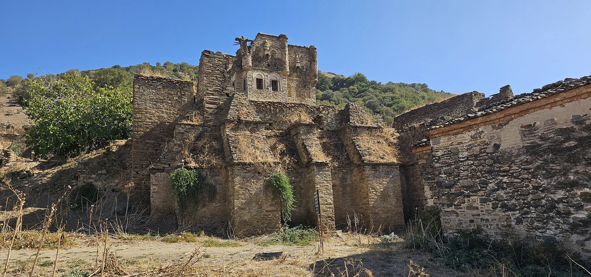
Continue through the centuries with the Ottoman tower, historic mansion and rural heritage associated with the settlement below ancient Harpasa.
Explore Arpaz CastleDiscover archaeological landscapes that reveal the extraordinary depth of history in the Büyük Menderes region.
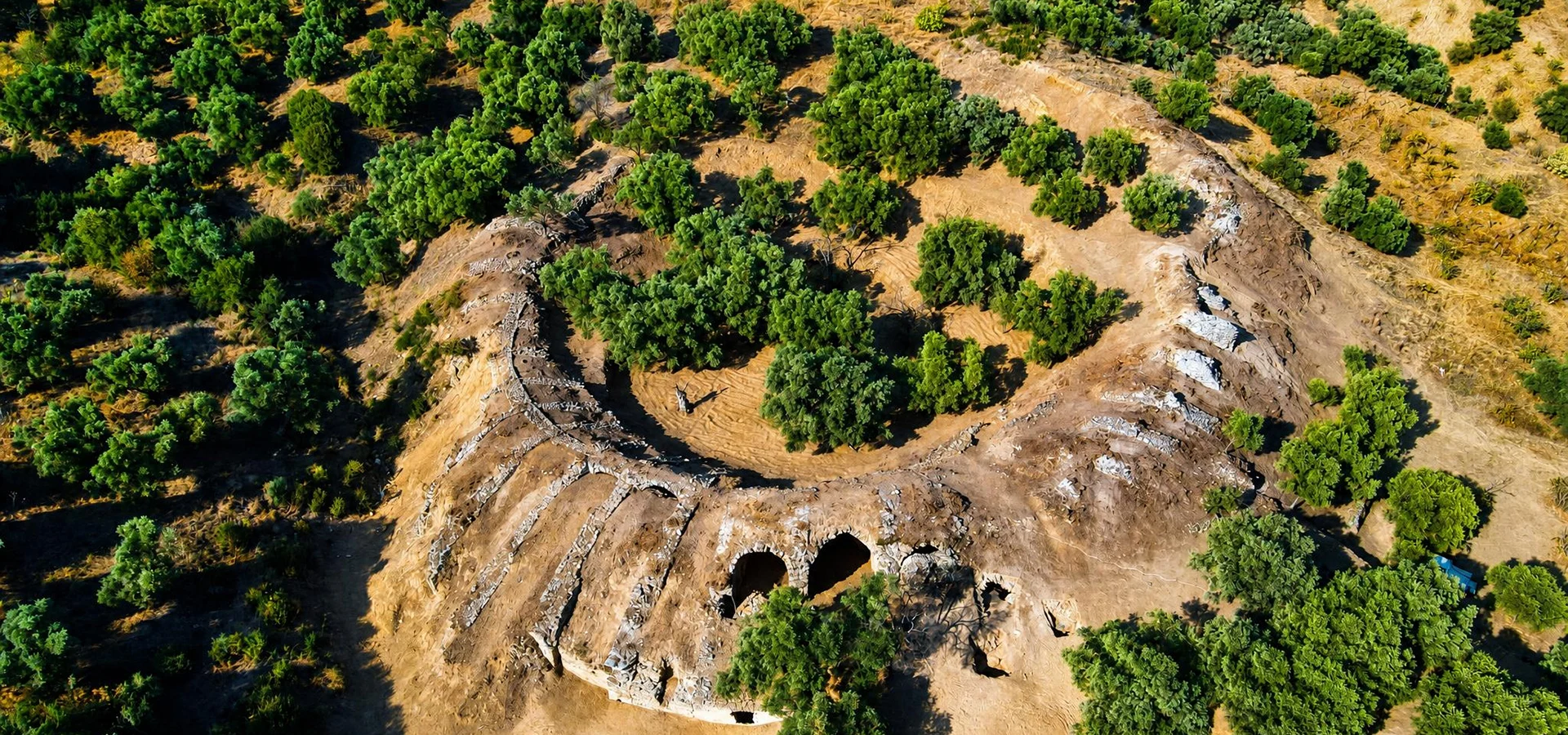
Discover another remarkable settlement in the Nazilli area and learn about its Roman archaeological heritage.
Explore Mastaura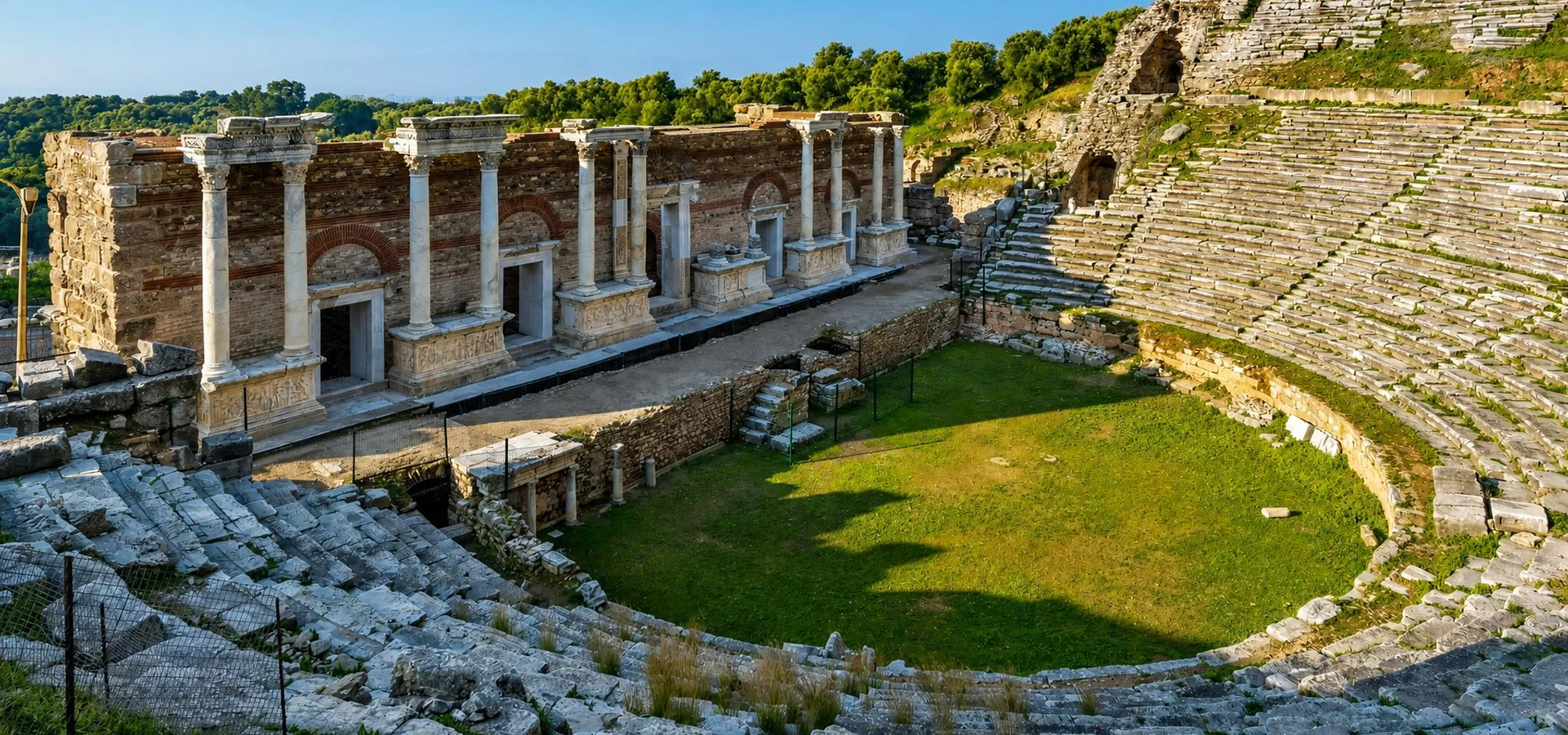
Explore an important ancient city known for its architectural remains and extraordinary valley setting.
Explore Nysa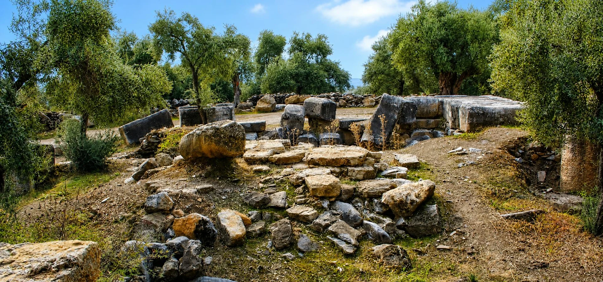
Discover an unusual sacred landscape associated with healing, ancient religious practice and the nearby city of Nysa.
Explore Akharaka