Private Nysa Ancient City Tour
Explore Nysa's remarkable Roman library, theatre, Gerontikon, stadium, bridges and ravine landscape with a licensed private guide at a comfortable pace.
Request Your Private Nysa Tour





Nysa Ancient City, located near Sultanhisar in Aydın Province, is one of western Türkiye's most fascinating archaeological sites. Established on the southern slopes of the ancient Messogis Mountains, the city developed around a deep ravine carrying a seasonal torrent through its centre.
This unusual landscape gave Nysa its defining character. Ancient buildings, streets and public spaces occupied both sides of the gorge, while bridges, vaulted structures and sophisticated engineering connected the different parts of the city.
Nysa became particularly prosperous during the Roman Imperial period. Its theatre, monumental agora, Gerontikon, gymnasium, stadium and exceptionally important Roman library reveal a city where education, politics, athletics, commerce and public culture were closely connected.
The city is also associated with the celebrated ancient geographer Strabo of Amasia, author of the Geographica, who studied at Nysa and later described the settlement as a city divided into two parts by a deep torrent valley.
Explore one of Anatolia's most important surviving ancient library buildings, constructed around the 2nd century CE.
Discover a monumental theatre whose Roman stage decoration once displayed elaborate sculptures and mythological reliefs.
See how bridges, tunnels, vaulted foundations and streets transformed a difficult ravine into part of the functioning city.
Walk through an ancient centre of learning where the famous geographer Strabo pursued part of his education.
A practical introduction to one of the most distinctive Roman archaeological cities of the Büyük Menderes Valley.
Approximately 3 kilometres northwest of Sultanhisar in Aydın Province, western Türkiye.
Open on Google MapsRoman library, theatre, Gerontikon, stadium, bridges, tunnel and dramatic ravine setting.
Nysa was celebrated in antiquity as a centre of learning and is closely associated with the geographer Strabo.
The ancient city developed on both sides of a deep ravine connected through an extraordinary system of bridges and infrastructure.
One of the important cities of ancient Caria near the fertile Maeander Valley.
Hellenistic origins followed by major expansion during the Roman Imperial period and continued occupation into Byzantine times.
Nysa combines monumental architecture with one of the most unusual urban landscapes in western Anatolia.
The archaeological importance of Nysa lies not only in individual monuments but in the way the entire city was adapted to an exceptionally difficult natural landscape.
A deep torrent valley cuts through the centre of the settlement. Rather than avoiding this obstacle, ancient architects incorporated it into the city's infrastructure using bridges, vaulted substructures, streets, retaining systems and a remarkable tunnel.
At the same time, Nysa developed into an important centre of education and intellectual culture. Its monumental gymnasium and library demonstrate that learning formed an important part of civic identity.
The city also preserves major institutions of Roman public life: a theatre decorated with mythological sculpture, an enormous stadium, a monumental agora and the council building generally known as the Gerontikon.
Nysa therefore offers travellers an unusually complete introduction to the functioning of a prosperous ancient city — including education, politics, entertainment, athletics, commerce, infrastructure and religion.
For travellers exploring the province, Nysa forms an essential part of the archaeological heritage introduced in our Aydın travel guide.
The most distinctive feature of Nysa is immediately visible in its geography.
A steep natural ravine carrying a torrent divided the settlement into eastern and western sectors. The ancient geographer Strabo famously described Nysa as resembling a double city because of this division.
The challenge facing ancient planners was therefore very different from that of cities constructed across open plains.
Important public monuments stood on both sides of the gorge. The theatre, library, stadium and gymnasium occupied areas primarily to the west, while the agora and Gerontikon developed on the eastern side.
Movement between these districts depended upon bridges incorporated into the urban street system.
Ancient architects also constructed vaulted substructures and engineered the passage of water through the city, creating one of the finest examples of architecture being adapted directly to natural topography.
A torrent valley divided the ancient settlement and became one of the defining features of Nysa's urban landscape.
Major public buildings developed on both sides of the ravine rather than within a single continuous centre.
Bridges integrated into the street network connected important districts and public institutions.
Extensive substructures allowed buildings and circulation routes to occupy difficult terrain around the gorge.
Nysa belonged to the cultural landscape of ancient Caria, close to the fertile valley of the Maeander River and important routes connecting western Anatolia with inland regions.
Ancient traditions concerning the foundation of the city are complex. Strabo records traditions involving earlier settlements associated with Athymbrus, Athymbradus and Hydrelus, while later sources connect the development of Nysa with the Hellenistic period.
The organised city known archaeologically appears to have developed during the Hellenistic period, particularly from the 3rd century BCE onward.
Its position was advantageous. Nysa stood near major communication and trade routes crossing the Maeander Valley and connecting the interior of Anatolia with the cities of Caria and Ionia.
During the Roman Imperial period, the city experienced its greatest architectural development.
Major structures were rebuilt or monumentalised during the 1st and 2nd centuries CE, including the theatre, library, Gerontikon, gymnasium and other civic buildings.
A major earthquake in 178 CE damaged parts of the region and affected Nysa's monumental architecture. Important structures, including the theatre stage building, subsequently underwent reconstruction.
Life continued through Late Antiquity and into the Byzantine period. Ancient buildings were adapted to new functions, Christian occupation developed within the city and settlement survived for many centuries after the height of Roman Nysa.
Archaeological evidence indicates continued occupation into the medieval period before the ancient settlement was ultimately abandoned and population concentrated around modern Sultanhisar.
Nysa developed as an important city of ancient Caria from approximately the 3rd century BCE.
The Roman Imperial centuries produced many of the monumental structures that dominate the archaeological site today.
A major regional earthquake damaged important buildings and was followed by reconstruction projects.
Ancient monuments continued to be repaired, transformed and reused as urban life changed.
Christian and medieval occupation continued within parts of the ancient city.
Settlement eventually shifted away from ancient Nysa toward the area of modern Sultanhisar.
One of Nysa's most important connections with ancient intellectual history is the geographer Strabo of Amasia.
Born during the 1st century BCE, Strabo travelled widely and eventually composed the monumental Geographica, one of the most important surviving geographical works from the ancient world.
Strabo tells us that he studied at Nysa under Aristodemus, an important grammarian associated with the city's scholarly tradition.
His description of Nysa is particularly valuable because he knew the city personally.
He describes its extraordinary topography, including the torrent valley dividing the settlement, bridges connecting its two sides and major public structures positioned around the gorge.
Archaeological discoveries at Nysa have confirmed just how important education and cultural life became within the city.
The gymnasium represented the traditional Greek integration of physical and intellectual education, while the monumental library provided another architectural expression of scholarship and civic culture.
One of antiquity's most important geographers studied at Nysa during his youth.
Strabo studied under the distinguished grammarian Aristodemus while pursuing his education in the city.
Strabo's surviving work preserves an invaluable ancient description of Nysa and its remarkable landscape.
The library and gymnasium demonstrate the prominent role of learning within Nysa's urban identity.
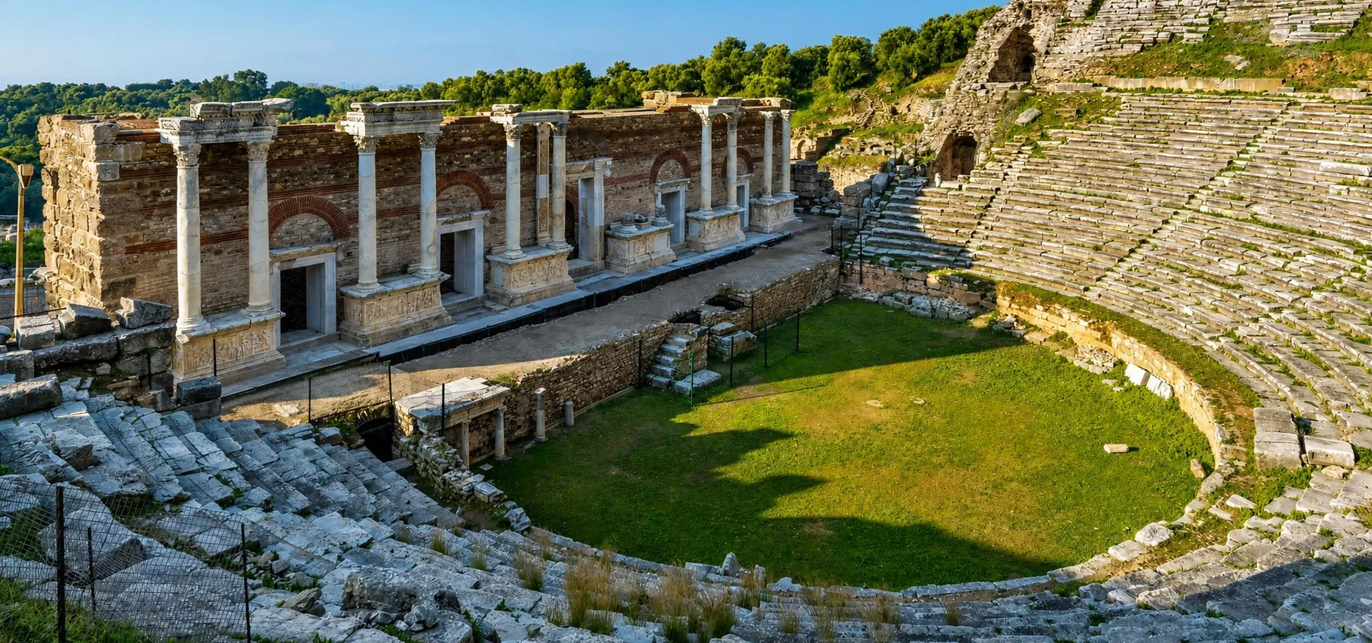
The Theatre of Nysa is one of the most impressive surviving monuments of the ancient city.
Its earliest monumental form is thought to belong to the Late Hellenistic period, while major architectural additions transformed the theatre during the Roman Imperial era.
The cavea, or seating area, extends slightly beyond a true semicircle and takes advantage of the natural hillside.
During approximately 120–140 CE, an elaborate Roman stage building and monumental scaenae frons were constructed.
After damage associated with the earthquake of 178 CE, the stage complex was rebuilt during the later 2nd century.
Particularly remarkable were the decorative reliefs belonging to the stage architecture.
These included scenes connected with Dionysos and the mythological marriage of Plouton and Kore, together with figures and imagery referring to the local landscape.
Important sculptural works and reliefs discovered at the theatre are today displayed in the Aydın Archaeology Museum.
The theatre developed from a monumental building first created during the later Hellenistic period.
A richly decorated stage complex transformed the theatre during the 2nd century CE.
The sculptural decoration included scenes connected with Dionysos, Plouton, Kore and the mythology of the surrounding region.
Important sculpture and architectural decoration from Nysa's theatre can be seen today in the Aydın Archaeology Museum.
The Library of Nysa is one of the archaeological site's greatest treasures.
Constructed around 130 CE, the monumental building stood on the western side of the city and belonged to the intellectual heart of Roman Nysa.
Archaeological investigation indicates that the building served more than a single function. In addition to storing written works, it could accommodate meetings and judicial or public activity.
The building measured approximately 25 by 14 metres externally and originally rose through two levels.
The main hall contained a system of wall niches associated with the storage of scrolls and written material. Archaeological reconstruction identifies 16 book niches, while upper circulation was provided through wooden galleries.
The library underwent repairs in Late Antiquity. By the 6th century its original public function had largely ended, and during later centuries the building and its surroundings were reused for workshops, burials and Christian religious activity.
Its preservation makes the Nysa Library particularly valuable for understanding the architecture of knowledge in the Roman cities of Anatolia.
The monumental council building traditionally known as the Gerontikon stands among the best-preserved public structures at Nysa.
Located close to the agora on the eastern side of the city, it formed part of Nysa's principal civic district.
The building contained a semicircular arrangement of stepped seating facing an architectural stage area.
Its seating capacity is estimated at approximately 700 people.
During the middle of the 2nd century CE, the complex was substantially reconstructed through the patronage of the wealthy Nysan Sextus Iulius Antoninus Pythodoros, acting according to his mother's wishes.
The completed structure included an entrance propylon, forecourt, seating area and monumental architectural façade.
It probably accommodated political, ceremonial and cultural gatherings, making it one of the clearest architectural expressions of organised civic life at Nysa.
The interior created a substantial enclosed assembly space for civic gatherings.
Political, ceremonial and cultural business could take place within the building.
The surviving monumental form largely reflects major Roman Imperial rebuilding.
Its position beside the commercial centre demonstrates the close relationship between political and public life.
The Agora of Nysa occupied a large area on the eastern side of the ravine.
The complex extended approximately 113.5 metres east-west and 130 metres north-south, creating one of the city's largest organised public spaces.
Colonnaded stoas surrounded the central square, providing sheltered circulation and space for commercial and social activity.
Architectural evidence suggests that important elements of the agora originated during the Late Hellenistic period.
The northern and eastern sides incorporated Ionic colonnades, while Doric architectural traditions appeared elsewhere around the complex.
A row of vaulted shops behind one of the stoas demonstrates the agora's role in the economic life of the city.
The area continued to be adapted and reused through the Roman and Byzantine periods.
The agora formed one of Nysa's principal spaces for commerce, movement and everyday social interaction.
Covered porticoes framed the central open area and created sheltered public circulation.
Commercial spaces associated with the stoas reveal the practical economic functions of the district.
The agora district continued to be reused and transformed long after its original Hellenistic construction.
The Stadium of Nysa demonstrates perhaps better than any other monument how Roman engineers responded creatively to the city's difficult landscape.
Rather than constructing the stadium on a broad natural plain, the architects incorporated the building into the ravine.
The monumental structure followed a U-shaped plan measuring approximately 248 by 93 metres.
Large substructures supported seating and circulation areas while the natural valley became part of the architectural design.
Surviving seating and foundations remain particularly visible in sections of the monument.
Roman bridges positioned near the ends of the stadium helped connect the surrounding urban districts and illustrate the close relationship between sport, infrastructure and city planning.
The stadium followed a monumental elongated form adapted directly to the natural valley.
Its scale demonstrates the importance of athletics and public spectacles within Roman Nysa.
Vaulted engineering helped support the building across the steep and irregular terrain.
Nearby Roman bridges formed part of the circulation system surrounding this extraordinary monument.
Nysa could not have functioned as a unified city without sophisticated infrastructure.
Archaeological research has identified three bridges integrated into the city's street network.
These bridges crossed the ravine at strategically important points and connected public buildings positioned on opposite sides of the valley.
Their placement was therefore part of the overall urban design rather than a series of isolated engineering projects.
Even more remarkable was the treatment of the torrent itself.
Ancient engineers channelled water through a monumental vaulted passage commonly described as the Nysa Tunnel.
Strabo already referred to the extraordinary relationship between the city, its torrent and underground water passage in antiquity.
Together, the bridges and tunnel make Nysa one of the most fascinating archaeological sites in Türkiye for understanding Roman urban engineering.
Ancient bridges connected streets and important public buildings across the central ravine.
The bridges formed part of the organised street network rather than functioning independently from the city.
A monumental vaulted passage allowed the natural watercourse to move through the built environment.
The system demonstrates the ability of Roman architects to transform difficult terrain into functioning urban space.
The monumental Gymnasium of Nysa reinforces the city's reputation as an important centre of education.
Constructed in its major surviving form during the 2nd century CE, the complex stood on the western side of the city.
Ancient Greek and Roman gymnasia were not simply athletic centres. They brought together physical training, education, social life and the preparation of younger members of the community for civic adulthood.
Nysa's gymnasium contained an enormous palaestra measuring approximately 170 by 82 metres, placing it among the largest examples of its type in Anatolia.
A bath complex positioned to the south complemented the gymnasium and expanded its social and physical functions.
The scale of the monument demonstrates the resources invested in public education and citizen life during Roman Nysa's period of prosperity.
Intellectual instruction formed an important part of gymnasium culture alongside physical training.
Exercise and competition helped prepare younger citizens for participation in public life.
The exercise court was exceptionally large and demonstrates the monumental scale of the complex.
Bathing facilities associated with the gymnasium expanded its role as an important social institution.
Nysa's monumental structures were connected through an organised network of streets rather than developing randomly around the ravine.
Archaeological excavations have revealed streets intersecting within an orthogonal urban system, with routes running broadly east-west and north-south.
The principal east-west route is generally identified by archaeologists as Plateia / Street 1, while another important north-south route connected major areas of the eastern city.
Colonnaded sections of streets gave monumental character to important urban approaches.
The extraordinary feature of this street system is the way bridges were incorporated directly into it.
Roads did not simply stop at the edges of the gorge. Engineering structures carried movement across the valley and linked the city's major civic buildings.
Excavations have revealed streets arranged within a structured system of intersecting routes.
Major east-west and north-south routes organised movement through the city's public districts.
Important streets were monumentalised with columns and architectural façades.
Bridges formed extensions of streets and allowed the planned city to continue across the ravine.
The religious landscape associated with Nysa extended beyond the main urban centre.
Several kilometres west of the city lay Acharaca, an important sanctuary associated with Plouton and Kore.
Ancient authors describe the sanctuary as an unusual sacred place connected with an underground cave traditionally associated with the powers of the underworld.
The cult belonged to a wider religious landscape in which caves, subterranean gases and geological phenomena could acquire sacred meaning.
The connection with Plouton and Kore is particularly interesting because the same mythological world appears in the sculptural decoration of Nysa's theatre.
Acharaca therefore helps demonstrate that Nysa should be understood not only as an urban centre but also as the centre of a wider sacred and rural territory.
The sanctuary was strongly associated with the ruler of the underworld.
The cult also honoured Kore, or Persephone, whose mythology concerned descent into and return from the underworld.
Ancient traditions connected the sanctuary with a subterranean feature regarded as an entrance to the underworld.
Acharaca formed part of the religious landscape connected with the wider territory of Nysa.
The archaeological remains visible today are dominated by the architecture of Roman Imperial Nysa.
During the 1st and particularly the 2nd centuries CE, wealthy citizens and civic authorities invested heavily in monumental public architecture.
Existing Hellenistic institutions were enlarged or rebuilt, producing the theatre, Gerontikon, library, gymnasium and other monuments whose remains still define the site.
The city survived destructive earthquakes and repeatedly repaired important public buildings.
During Late Antiquity, patterns of settlement gradually changed.
Parts of monumental structures lost their original functions and were adapted for workshops, houses, burials and Christian religious use.
The Nysa Library provides particularly clear archaeological evidence of this transformation, eventually receiving Christian and funerary uses after its original function ended.
Occupation continued into the Byzantine and medieval periods, demonstrating that Nysa remained part of the inhabited landscape long after the end of classical antiquity.
The Imperial period produced most of Nysa's great surviving monumental architecture.
Buildings were reconstructed after destructive earthquakes rather than simply abandoned.
New religious practices gradually transformed parts of the ancient urban landscape.
Settlement survived for centuries before population ultimately shifted toward modern Sultanhisar.
Explore one of the most important surviving ancient library buildings in Anatolia.
See the monumental cavea and remains of a stage complex once decorated with exceptional mythological sculpture.
Enter one of Nysa's best-preserved civic buildings and imagine the political and ceremonial meetings once held here.
Walk through the enormous colonnaded commercial and social centre of the eastern city.
Discover a monumental athletic structure ingeniously integrated into the natural ravine.
Study the structures that physically united the two halves of the ancient city.
See one of the most remarkable surviving examples of ancient engineering associated with the torrent valley.
Explore the remains of one of the institutions that helped establish Nysa's reputation for education and culture.
Follow excavated routes that reveal how the city's organised street network crossed an exceptionally difficult landscape.
Pause above the gorge to understand the engineering achievement involved in transforming two slopes into a single functioning city.
Nysa is best explored slowly because many of its most important features become understandable only when the relationship between individual monuments and the ravine is observed.
The archaeological site contains slopes, ancient paving, exposed stone, uneven terrain and sections where changes in elevation require additional care.
Begin by taking a few moments to understand the site's natural setting. The ravine is not simply scenery — it explains how the entire city was organised.
Continue toward the theatre, one of the clearest monumental introductions to Roman Nysa.
From the theatre district, explore the Library and consider the city's reputation for education and the connection with Strabo.
Follow the surviving street system and viewpoints overlooking the ravine to examine the relationship between ancient roads and the city's Roman bridges.
Continue toward the Stadium, where the engineering required to build across the valley becomes especially impressive.
Cross toward the eastern civic district to explore the Gerontikon and Agora.
Depending on current visitor routes and available time, continue toward the gymnasium, bath structures and additional excavated areas before returning toward the entrance.
Orientation viewpoint and first understanding of Nysa's ravine-split urban landscape.
Ancient Theatre and monumental Roman stage architecture.
Roman Library and the intellectual history of Nysa.
Ancient streets, bridges, ravine infrastructure and stadium.
Gerontikon and the political institutions of the eastern city.
Agora, gymnasium and additional Roman and Late Antique remains.
Aydın Province contains an extraordinary concentration of ancient cities, yet each archaeological site presents a very different story.
The ravine city — famous for Roman engineering, education, its library, bridges, stadium and Gerontikon.
The monumental city above modern Aydın, remembered for its great Roman structures and commanding position over the Maeander Valley.
The city of Aphrodite — internationally celebrated for marble sculpture, monumental architecture and one of Türkiye's finest archaeological landscapes.
The planned Greek city — one of the clearest examples of ancient urban organisation preserved anywhere in the Aegean world.
The maritime metropolis — famous for philosophy, trade, political history and monumental Roman architecture.
The sacred centre — home to one of the ancient Mediterranean's most extraordinary oracular sanctuaries.
Continue exploring the region with our Aydın travel guide, Tralleis Ancient City guide, Aphrodisias Ancient City guide, Priene Ancient City guide, Miletus Ancient City guide and Didyma & Didymaion guide.
Nysa can be visited during much of the year, but seasonal conditions strongly influence the comfort of an archaeological visit.
One of the best seasons for Nysa, with greener landscapes, mild temperatures and comfortable walking conditions.
Long daylight and clear weather provide excellent conditions for archaeology and photography before peak summer heat.
Temperatures in the Büyük Menderes Valley can become very high. Earlier morning visits are usually much more comfortable.
An excellent period for combining Nysa with other archaeological destinations across Aydın Province.
The site can be wonderfully quiet, although rain may make ancient stone surfaces and sloping paths more slippery.
Morning and later-afternoon light is particularly attractive around the theatre, bridges and ravine viewpoints.
Nysa offers a very different photographic experience from many ancient cities because architecture is constantly interacting with dramatic terrain.
The theatre provides strong compositions from both the seating area and the lower stage zone.
The Library is ideal for architectural detail, especially where surviving walls reveal the building's original internal organisation.
Perhaps the most distinctive Nysa photographs are taken around the ravine and Roman bridges, where the engineering of the ancient city can be shown within its natural landscape.
The stadium also provides opportunities for wide-angle images demonstrating how monumental architecture was constructed around the valley.
Lower-angle morning or afternoon sunlight often creates stronger shadows across masonry, arches, columns and ancient streets.
Use higher viewpoints to photograph the relationship between the cavea, stage area and surrounding landscape.
Architectural details and surviving walls help communicate Nysa's intellectual character.
Include the ravine in wider compositions to reveal why these engineering structures were necessary.
Wide views show how the athletic complex was integrated into terrain that would normally appear unsuitable for monumental construction.
Symmetrical viewpoints can emphasise the semicircular seating and architectural organisation of the building.
Morning and afternoon shadows bring greater depth to arches, ancient walls and the irregular terrain.
Exploring Nysa requires walking across an active archaeological landscape rather than smooth modern surfaces.
Expect ancient paving, exposed stone, gravel and irregular archaeological paths.
The city's location around a ravine means some sections involve slopes, steps and changes in height.
Access around the theatre, bridges and excavated monuments may involve narrow or irregular surfaces.
High temperatures can make walking considerably more tiring during summer afternoons.
Comfortable walking shoes with reliable grip are strongly recommended.
A private itinerary makes it easier to adjust the pace and concentrate on the sections most suitable for individual mobility requirements.
Nysa Ancient City is located approximately 3 kilometres northwest of Sultanhisar in Aydın Province and around 30 kilometres east of Aydın city centre.
Nysa lies immediately north of the modern town and can be reached by the local road climbing toward the ancient settlement.
Travel east through the Büyük Menderes Valley toward Sultanhisar before turning north toward the archaeological site.
Nysa can be incorporated easily into a westbound archaeological journey through the Maeander Valley.
Nysa can be visited on a longer private excursion combining the coastal region with archaeological sites around central Aydın.
Travellers moving between Denizli and the Aegean coast can include Nysa as an archaeological stop along the wider Maeander Valley route.
Private transportation is the most practical option when combining Nysa with other ancient cities and archaeological museums in the region.
Explore the modern town immediately below Nysa and the fertile agricultural landscapes of the Büyük Menderes Valley.
Continue west toward ancient Aydın with our Tralleis Ancient City guide.
See important sculpture and architectural finds from Nysa together with artefacts from archaeological sites across Aydın Province.
Continue into the interior of the province with our Aphrodisias Ancient City guide.
Compare Nysa's Roman ravine city with one of antiquity's great planned Greek cities in our Priene Ancient City guide.
Explore the history of one of the ancient Aegean's greatest cities with our Miletus Ancient City guide.
Discover Apollo's monumental sanctuary with our Didyma & Didymaion guide.
Plan a wider archaeological journey through the province with our Aydın travel guide.
Nysa is located approximately 3 kilometres northwest of Sultanhisar in Aydın Province, western Türkiye.
Nysa is approximately 30 kilometres east of Aydın city centre, close to the modern town of Sultanhisar.
Nysa is famous for its dramatic ravine setting, Roman library, ancient theatre, Gerontikon, enormous stadium, bridges, tunnel, gymnasium and association with the geographer Strabo.
The ancient city developed during the Hellenistic period, with important traditions connecting its foundation history with the 3rd century BCE. Most of the major visible monuments belong to later Roman phases.
Nysa had Hellenistic Greek origins within ancient Caria and later became an important city of the Roman province of Asia. Its archaeological remains therefore preserve both Greek urban traditions and extensive Roman development.
A deep torrent valley divided the settlement into two sections. Strabo described Nysa as resembling a double city because major urban districts occupied both sides of this ravine.
Ancient streets were connected across the ravine through a system of Roman bridges integrated directly into the city's urban plan.
Archaeological research has identified three bridges incorporated into Nysa's ancient street system.
The tunnel is part of the extraordinary engineering used to manage the torrent flowing through the ravine beneath sections of the ancient city.
The famous geographer Strabo studied at Nysa during his youth and later described the city and its unusual topography in his geographical writings.
Strabo records studying at Nysa under Aristodemus, a distinguished grammarian associated with the city's intellectual tradition.
Built around 130 CE, the Library of Nysa is one of the most important surviving ancient library structures in Anatolia and originally contained two levels and architectural niches associated with the storage of written works.
The Gerontikon was a monumental assembly building used for civic, political, ceremonial and cultural gatherings. Its surviving Roman form accommodated approximately 700 people.
The stadium followed a U-shaped plan measuring approximately 248 by 93 metres and was ingeniously constructed around the natural valley.
Visitors can explore the ancient seating area and surviving stage architecture. Important mythological reliefs and sculptures excavated from the theatre are displayed in the Aydın Archaeology Museum.
The city continued to be occupied during Late Antiquity and the Byzantine period. Ancient buildings were gradually adapted for new residential, religious and funerary purposes.
Allow approximately two to three hours for a comfortable visit if you want to explore the principal monuments and understand the relationship between the city and its ravine.
The site contains slopes, uneven ancient surfaces, steps and archaeological paths. Supportive walking shoes are recommended.
Spring and autumn provide particularly comfortable conditions. During high summer, an earlier morning visit is preferable because temperatures in the Büyük Menderes Valley can become very high.
Yes. Nysa becomes much more meaningful when the relationship between the ravine, bridges, tunnel, library, stadium, theatre and civic buildings is explained as part of one interconnected urban system.
Yes. Nysa can be combined with Tralleis, the Aydın Archaeology Museum and other archaeological destinations across the Büyük Menderes Valley and Aydın Province.
Follow designated paths and respect areas temporarily closed for archaeological excavation, restoration or conservation.
Ancient walls, arches, bridge structures and architectural blocks may be fragile or unstable and should never be climbed.
Exercise additional care around elevated viewpoints, bridge areas and sections overlooking the ancient torrent valley.
Never remove pottery, stone fragments, marble or any other archaeological material from the site.
Nysa remains an active archaeological research and conservation landscape where new discoveries continue to refine our understanding of the city.
Carry waste responsibly and help preserve both the ancient monuments and the natural environment surrounding the archaeological site.
Discover Nysa with a licensed private guide and comfortable vehicle, with an itinerary designed around archaeology, Roman history, architecture, photography and your preferred pace, without compulsory shopping stops.
Combine Nysa with Tralleis, the Aydın Archaeology Museum, Aphrodisias or other archaeological destinations across the Büyük Menderes Valley.
Explore Nysa's remarkable Roman library, theatre, Gerontikon, stadium, bridges and ravine landscape with a licensed private guide at a comfortable pace.
Request Your Private Nysa Tour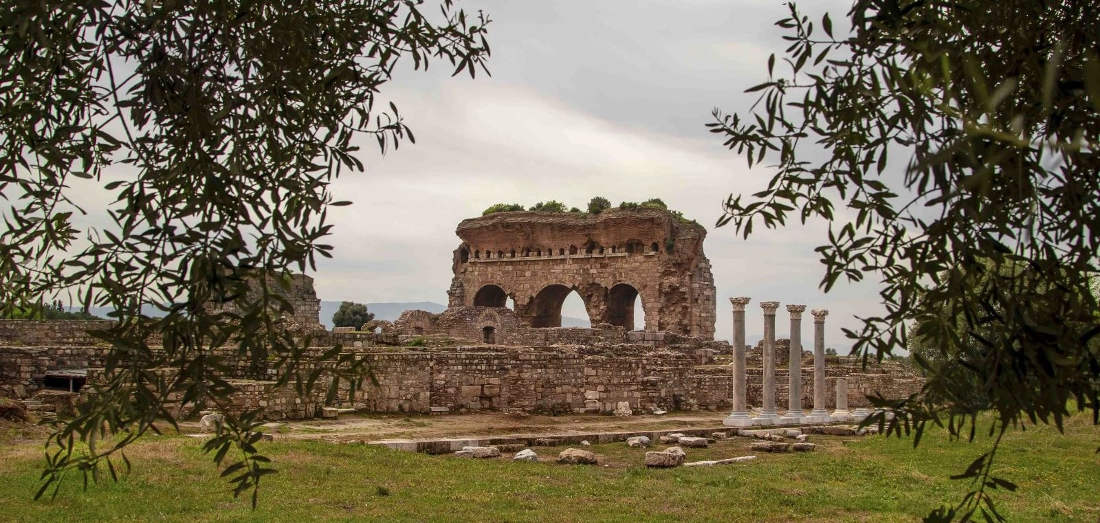
Combine Nysa with Tralleis, the Aydın Archaeology Museum and other carefully selected archaeological sites for a deeper journey through the ancient Maeander Valley.
Design Your Private Aydın Journey