Private Karaburun Peninsula Tour
Ask us about a tailor-made day combining Mordoğan, Karaburun center, selected villages, coastal viewpoints, Sarpıncık Lighthouse and time for a relaxed Aegean lunch.
Request a Custom Tour





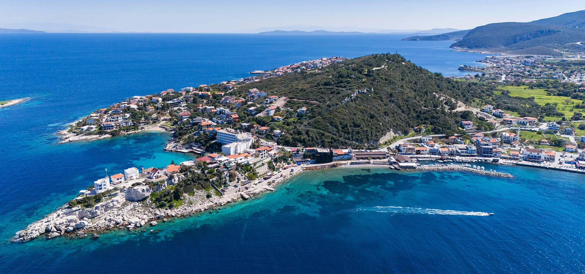
At the northwestern edge of the İzmir Peninsula, Karaburun feels noticeably different from the busier resort towns farther south.
The landscape is more rugged, the villages are smaller, the coast is deeply indented with bays and rocky headlands, and long sections of the peninsula still feel wonderfully undeveloped.
Known in antiquity as Mimas, Karaburun combines layers of mythology, rural life, maritime culture, old stone settlements, traditional agriculture and some of the clearest water on the Aegean coast of western Türkiye.
Most visitors come for the sea, but the peninsula rewards anyone willing to slow down and explore beyond the beaches.
You can wander through hillside villages, drive to the remote Sarpıncık Lighthouse, stop at tiny fishing harbors, walk sections of the old peninsula routes, taste local olive products, see fields associated with Karaburun's famous narcissus flowers and continue south toward atmospheric Mordoğan.
Karaburun is especially appealing to travelers who prefer quiet scenery over crowded resort life. It is a destination for swimming, road trips, walking, photography, small village discoveries and long lunches by the sea.
Swim in small coves, public beaches and rocky bays where the water is often exceptionally clear.
Explore Saip, Bozköy, Tepeboz, Sarpıncık, Kösedere and other rural settlements across the peninsula.
Travel to one of Karaburun's most dramatic viewpoints, overlooking the open Aegean from the western edge of the peninsula.
Combine Karaburun with the beaches, waterfront, history and relaxed coastal atmosphere of Mordoğan.
Essential information for planning a visit to Karaburun, Mordoğan, the villages and the remote coastline of the peninsula.
Northwestern İzmir Peninsula, approximately 100 km from central İzmir by road.
Open on Google MapsClear sea, quiet coves, rugged coastline, small villages, Mordoğan and Sarpıncık Lighthouse.
By private vehicle, as many villages, coves and viewpoints are spread across the peninsula.
One full day for a scenic introduction; two or three days for beaches, villages and a slower coastal experience.
May–June and September–October for mild weather; July–August for swimming and summer atmosphere.
Ideal for independent exploration, nature, photography, walking, swimming and quiet coastal road trips.
Karaburun offers a slower, more natural alternative to the famous resort towns of the western Aegean coast.
The real appeal of Karaburun is not one single monument, beach or village.
It is the combination of sea, landscape, village life, agriculture, history and relative isolation that gives the peninsula its character.
Roads move through hills covered with Mediterranean vegetation, olive groves, small agricultural plots and open views toward the Aegean.
At the coast, you encounter everything from organized public beaches to tiny harbors, rocky swimming spots and remote bays reached by narrow roads.
The peninsula is also deeply connected with rural traditions. Narcissus flowers, olives, grapes, herbs, figs, artichokes, goat husbandry and fishing have all shaped local life.
Karaburun's villages preserve another layer of identity. Some retain historic stone houses, old fountains, mosques, traces of former Greek communities and agricultural structures that recall a very different period of peninsula life.
For travelers moving through western İzmir, Karaburun also forms an interesting contrast with Çeşme, Alaçatı and Urla.
Those destinations are better known internationally; Karaburun feels quieter, rougher around the edges and much closer to the rhythm of a working Aegean peninsula.
Karaburun has been inhabited for thousands of years, and archaeological evidence from the peninsula reaches back into prehistoric periods.
In ancient geography, the peninsula was associated with the name Mimas, a name that survives today in cultural routes, mythological references and modern descriptions of the region.
The wider İzmir Peninsula stood within the cultural world of ancient Ionia, with important cities such as Erythrai, Klazomenai and Phokaia shaping trade and settlement around the surrounding coasts.
Karaburun itself developed through a mixture of inland villages, small coastal landing points, agriculture, stone extraction, herding and maritime activity.
Different communities lived across the peninsula during the Ottoman period, and several villages preserve architectural traces, religious remains and local memories connected with the years before the population exchange of the early twentieth century.
The modern district center was once associated with the name Ahırlı, while nearby villages such as Saip had important local commercial and agricultural roles.
Today, the history of Karaburun is encountered not through one monumental archaeological site, but through a dispersed cultural landscape of villages, old roads, ruins, mosques, fountains, stone houses, fields and coastal settlements.
The Karaburun Peninsula was known in antiquity as Mimas, a name still used in cultural and walking routes today.
Finds from areas of the peninsula indicate human activity extending back into prehistoric periods.
Karaburun belonged to the broader cultural geography shaped by the Ionian cities of the western Anatolian coast.
Mosques, fountains, rural houses and village layouts preserve traces of later Ottoman-period life.
Several villages were historically home to Muslim and Greek Orthodox communities before the population exchange era.
Agriculture, fishing, animal husbandry, viticulture and small-scale trade shaped the peninsula for generations.
Karaburun is one of the most geographically dramatic parts of İzmir Province.
The peninsula rises quickly from the sea, creating a landscape of rocky slopes, ridges, small valleys, terraces and deeply cut sections of coastline.
Unlike flatter resort areas, Karaburun often feels vertical. Roads climb above the sea, villages sit on hillsides and many viewpoints open suddenly toward a wide horizon.
The vegetation is characteristically Aegean and Mediterranean, with olive trees, maquis, aromatic herbs, pines in selected areas and agricultural plots around villages.
Strong winds and maritime exposure are part of the peninsula's identity, especially along the more open western side.
This geography creates a surprising variety of swimming places. One bay may be calm and sheltered, while another can be open to swell or wind on the same day.
It also explains why driving distances can feel longer than expected. The roads frequently bend around hills, settlements and coves rather than following straight lines.
Rocky headlands and small coves create a much wilder shoreline than the large resort beaches of western Çeşme.
Many bays are known for transparent Aegean water, especially during calm summer conditions.
Olive trees remain an important part of the agricultural and visual landscape of the peninsula.
Thyme, sage and other Mediterranean plants contribute to the distinctive scent and texture of the countryside.
The western side of the peninsula offers broad views toward the open Aegean and nearby Greek islands on clear days.
Narrow and winding rural roads are part of the experience; allow extra time when exploring remote villages and coves.
Karaburun town center is a practical base for exploring the northern half of the peninsula.
The atmosphere is small-scale and local, with everyday shops, restaurants, accommodation and roads branching toward nearby bays and villages.
Down by the sea, Karaburun İskele and the harbor area provide a more maritime atmosphere. Fishing boats, small cafés, seafood restaurants and evening walks along the waterfront make this one of the most pleasant places to finish the day.
The town is also well positioned for short drives toward Saip, İncirlikoy, Bozköy, Tepeboz, Yeniliman and Sarpıncık.
Travelers who want to spend several days exploring the peninsula often find the center convenient because it allows easy movement between beaches, villages and the more remote western coast.
The waterfront is particularly pleasant in the late afternoon and evening when fishing boats return and the light softens.
Fish and Aegean meze are natural choices for a relaxed meal near the coast.
Karaburun center is convenient for exploring the northern villages, Sarpıncık and several nearby swimming bays.
After beach traffic disappears, the waterfront becomes quieter and more local in character.
Karaburun's coastline is one of the main reasons to visit.
Rather than one continuous resort beach, the peninsula offers a chain of smaller bays, rocky swimming areas, public beaches and quiet coves separated by headlands and hills.
İncirlikoy, also known as Akvaryum, is one of the better-known swimming spots close to Karaburun center and is valued for its clear water.
Kuyucak is another popular option near the main settlement, while more remote places such as Dolungaz and Badembükü offer a stronger sense of escape.
Around Mordoğan, beaches including Ardıç, Kocakum and Ayıbalığı create additional swimming possibilities on the eastern side of the peninsula.
Conditions vary greatly between bays. Wind direction, wave exposure, road access, shade and available facilities should all be considered before choosing where to spend the day.
A well-known public swimming area close to Karaburun center, especially popular for its transparent water.
A convenient coastal option near Karaburun for visitors wanting to combine swimming with time in the district center.
A more natural-feeling bay that appeals to travelers looking for a quieter coastal setting away from the main town.
A remote bay near Parlak on the western side of the peninsula, suited to travelers comfortable with longer rural drives.
One of the principal beaches around Mordoğan, with a broader sandy character and public-beach facilities.
A small sandy Blue Flag beach in Mordoğan that works well for a short swim during a wider peninsula itinerary.
South of Karaburun center, Mordoğan is the peninsula's best-known resort settlement and an easy first stop for travelers arriving from İzmir or Urla.
The town combines beaches, a working waterfront, restaurants, summer houses, small cultural sites and access to nearby coves.
Its name is traditionally associated with the many purple flowers found in the area, and the surrounding landscape becomes especially attractive in spring.
Mordoğan is also linked with the local story of Narkissos and the Dilek / Narcissus spring tradition, adding a mythological layer to the natural landscape.
Visitors interested in local history can look for old fountains, windmills, traditional houses, the Ayşe Kadın Mosque and small collections connected with local memory.
For many travelers, Mordoğan works best as the southern gateway to Karaburun: a place for breakfast, a swim or an evening meal before continuing deeper into the peninsula.
Fishing boats, restaurants and a relaxed promenade give Mordoğan a strong coastal-town atmosphere.
Ardıç, Kocakum and other nearby swimming areas make Mordoğan one of the easiest places to combine sea and town life.
Mordoğan is associated with the local Narkissos legend and with the floral identity of the Karaburun Peninsula.
The rocky coast and clear water around Mordoğan have made the area popular with divers and underwater enthusiasts.
Few places capture the wild character of Karaburun as strongly as Sarpıncık Lighthouse.
The lighthouse stands on the western side of the peninsula beyond Sarpıncık village, where the road leaves the more settled coast and continues toward a dramatic headland above the Aegean.
Built in 1938, the lighthouse has a 12-meter tower and stands approximately 97 meters above sea level. It continues to operate using solar power.
The approach itself is part of the experience. The final section passes through increasingly empty terrain, with low vegetation, strong sea air and broad views opening toward the horizon.
On clear days, the position of the lighthouse makes it possible to look toward both Chios and Lesbos across the Aegean.
This is one of the best sunset and landscape-photography locations on the peninsula, but visitors should remember that the access road is rural and conditions can vary.
The inland villages are essential to understanding Karaburun beyond its beaches.
Most were historically built away from the immediate shoreline, often on slopes or in sheltered positions connected with farming, herding and seasonal use of the coast.
Many settlements preserve old stone houses, fountains, mosques, terraced fields, olive groves and traces of earlier communities.
The pleasure is not necessarily in checking every village off a list. Choose two or three, stop for tea or coffee where possible, walk slowly and pay attention to the architecture, landscape and local agricultural patterns.
A historic village only a few kilometers from Karaburun center, with old houses, agricultural heritage and a coastal landing area at Saipaltı.
Known for historic stone architecture, rural scenery, narcissus cultivation and access toward the western countryside.
A quiet rural settlement west of Karaburun, often combined with Yeniliman and drives toward Sarpıncık.
A small western village that forms the gateway to the famous lighthouse and one of the peninsula's most remote coastal landscapes.
A traditional agricultural village known for olives, local foods, herbs and the revival of grape growing.
A historic inland village with agricultural traditions, old streets and views toward both the inner gulf and the open Aegean from surrounding high ground.
One of the larger rural settlements, with a long agricultural history and strong connections with village life on the peninsula.
A small village on the western side of the peninsula, particularly associated with access to Badembükü Bay.
Among Karaburun's most evocative cultural landscapes is Sazak, a former village on the western side of the peninsula.
Before the population exchange, the settlement was associated with viticulture, olives and wine production.
The village was abandoned in the early twentieth century, and later earthquake damage contributed to the ruinous condition visible today.
What remains is less a conventional attraction than an atmospheric landscape of stone walls, ruined structures, old agricultural ground and distant sea views.
The site should be approached carefully and respectfully. Ruins may be unstable, paths can be rough and there are no large-scale visitor facilities.
For travelers interested in photography, rural history and abandoned settlements, Sazak can be one of the most memorable stops in Karaburun.
Karaburun is one of the strongest walking destinations on the İzmir Peninsula because its landscape remains comparatively open and rural.
Walking routes connect villages, agricultural areas, old paths, hillsides and coastal viewpoints.
The wider peninsula is also connected with the Ephesus–Mimas cultural route network, which links important archaeological and natural landscapes across western İzmir.
One particularly attractive area follows the northern villages around Karaburun, Bozköy, Tepeboz and Yeniliman, where walkers move through olive groves, maquis vegetation and open countryside.
The approach toward Sarpıncık Lighthouse is another rewarding landscape for walkers, although weather, wind and summer heat must be taken seriously.
Spring is usually the most beautiful season for hiking, when the peninsula is greener and wildflowers are more abundant.
March through May offers greener landscapes, flowering plants and more comfortable temperatures than midsummer.
Short walks between or around rural settlements reveal the peninsula's stone architecture and agricultural heritage.
Sarpıncık offers dramatic open scenery for travelers who enjoy remote coastal walks and photography.
Shade and services can be limited on rural routes, especially in summer and on the western side of the peninsula.
Strong Aegean winds can make exposed ridges and coastal viewpoints feel significantly cooler or more difficult.
Many paths pass close to working agricultural land, so remain on established routes and avoid entering private fields.
The clear water around Karaburun makes the peninsula particularly attractive for swimming, snorkeling and diving.
Rocky sections of coastline create underwater habitats very different from long sandy resort beaches, and visibility can be excellent when the sea is calm.
Mordoğan has become one of the better-known diving areas on the peninsula, with underwater experiences that attract both recreational divers and photographers.
The coastline is also part of the habitat of the Mediterranean monk seal, one of the world's most endangered marine mammals.
Visitors should never approach seal caves, seek out animals for photographs or disturb isolated rocky areas where wildlife may be resting or breeding.
Responsible marine tourism is particularly important in a place whose appeal depends on the survival of its relatively undisturbed coastline.
The rural identity of Karaburun is inseparable from agriculture.
Olive groves, small vineyards, fig trees, citrus, artichokes, herbs and seasonal crops shape the countryside between the villages.
The peninsula is especially famous for nergis, or narcissus flowers, which have become one of Karaburun's strongest cultural symbols.
Another distinctive local product is hurma olive, a table olive associated with the Karaburun Peninsula and valued for the way the fruit naturally loses bitterness on the tree under particular environmental conditions.
Grape growing also has deep historical roots in several villages, and local communities have worked in recent years to revive viticulture and traditional agricultural festivals.
For visitors, these products transform Karaburun from a simple beach destination into a living agricultural landscape.
Winter and early spring bring the flower most closely associated with Karaburun's modern identity.
A distinctive local table olive strongly associated with villages such as Kösedere and the wider peninsula.
Several villages have old viticultural traditions, and grape growing has been returning to parts of the peninsula.
Aegean greens, aromatic plants and seasonal herbs remain important in both the landscape and local cooking.
Small orchards and household agriculture contribute to the varied food culture of inland villages.
The peninsula shares the wider western İzmir tradition of seasonal artichoke cultivation and Aegean vegetable dishes.
Food in Karaburun reflects the peninsula's position between the sea and a traditional agricultural hinterland.
Along the coast, fresh fish, seafood, meze and simple Aegean dishes dominate many menus.
In the villages, the culinary identity becomes more rustic, with olive oil, wild greens, goat products, local herbs, pastries, stuffed vegetables and dishes shaped by seasonal produce.
Kösedere in particular is known for a rich local food tradition, including village pastries, mantı-style dishes, herb-based recipes and regional sweets.
Instead of searching only for famous restaurants, Karaburun is a good place to follow the landscape: seafood near the harbor, a village breakfast inland, local olives and olive oil from producers, and seasonal vegetables wherever they appear.
Choose local fish restaurants around Karaburun İskele, Mordoğan and smaller coastal settlements.
Olive-oil vegetables, yogurt dishes, herbs and seafood meze are natural companions to a long coastal meal.
Seasonal Aegean herbs and greens are among the most characteristic flavors of western İzmir cuisine.
Look for peninsula-grown table olives and olive oil, especially products connected with traditional village agriculture.
Different villages preserve their own savory pastries, stuffed breads and household recipes.
Artichokes, figs, grapes, herbs and vegetables change throughout the year and are best enjoyed in season.
Karaburun is one of the most rewarding places in İzmir for landscape photography.
The peninsula offers a strong contrast between deep blue water, dry summer hills, old stone architecture, olive groves, small fishing boats and empty coastal roads.
Sarpıncık Lighthouse is the obvious dramatic location, but many of the best images appear unexpectedly while driving between villages.
In spring, fields and roadside vegetation become greener and more colorful.
During summer, the visual character shifts toward golden hills, intense sunlight and vivid blue sea.
Late afternoon is particularly beautiful on the western side of the peninsula, where the sun drops directly toward the Aegean horizon.
The lighthouse and western headlands create some of the most dramatic sunset compositions in the district.
Stone houses, old doors, fountains and quiet lanes provide intimate architectural subjects.
Small boats and waterfront life around Karaburun, Saip and Mordoğan are especially atmospheric in the morning.
Elevated roads frequently reveal unexpected turquoise bays framed by dry Aegean hillsides.
The greener season offers a softer side of Karaburun that many summer visitors never see.
The western coast is ideal for wide landscape photography with minimal development in the frame.
Karaburun changes dramatically through the year, and the best season depends on the experience you want.
Spring is arguably the most beautiful period for landscapes. The hills are greener, flowers are more abundant and temperatures are comfortable for walking and village exploration.
May and June combine increasingly warm sea conditions with relatively calm roads before the height of the summer season.
July and August are the main swimming months. The sea is warm, days are long and coastal settlements become much livelier, especially on weekends.
September is excellent for travelers who want warm water with slightly quieter conditions.
October can still be beautiful for road trips, walking and coastal meals, although weather becomes less predictable.
Winter is much quieter and can be fascinating for local life, photography and the narcissus season, but many summer-oriented businesses operate reduced schedules.
Green landscapes, wildflowers and ideal temperatures for hiking, photography and village exploration.
One of the best overall periods, combining pleasant weather, clear water and lighter summer crowds.
Best for swimming and summer atmosphere, but expect hotter weather and busier weekends.
Warm sea, softer light and generally calmer conditions after the main summer holiday period.
Excellent for scenic driving and village life, with cooler evenings and more changeable weather.
Very peaceful, with local agricultural life and the narcissus season creating a completely different atmosphere.
Enough for Mordoğan plus one beach, or Karaburun center with a short nearby coastal stop.
Ideal for Karaburun center, a village, one swimming stop and Sarpıncık Lighthouse at sunset.
Allows time for Mordoğan, several bays, northern villages and the remote western side without rushing.
Best for travelers who want swimming, hiking, village exploration, local food and slower mornings by the sea.
Karaburun fits beautifully into a wider İzmir Peninsula route with Urla, Alaçatı, Çeşme and Ildırı.
A longer stay suits visitors who value quiet beaches and rural life more than conventional sightseeing.
Begin early from İzmir, Urla, Alaçatı or Çeşme and travel toward Mordoğan.
Stop first at the Mordoğan waterfront for coffee, a short walk or a quick look at the local harbor before continuing north.
Choose one swimming stop according to the weather. Around the southern section, Ardıç is convenient; closer to Karaburun center, İncirlikoy / Akvaryum is a strong option.
Continue to Karaburun center for lunch or a short harbor walk, then turn inland toward Saip, Bozköy or Tepeboz for a taste of the peninsula's village landscape.
During late afternoon, continue west toward Sarpıncık and the lighthouse.
If road and weather conditions are good, finish the day with sunset over the open Aegean before returning carefully toward Karaburun.
Explore Mordoğan, swim at Ardıç or Kocakum, continue through Kösedere and İnecik, then finish in Karaburun center for dinner.
Visit Saip, Bozköy and Tepeboz, continue toward Sarpıncık and finish at the lighthouse before returning to Karaburun.
Add İncirlikoy / Akvaryum, Dolungaz or another bay according to sea conditions and the direction of your route.
Travelers interested in abandoned settlements and rural history can dedicate additional time to the Sazak area.
Karaburun is a large rural district rather than a compact sightseeing destination.
Distances between villages, beaches and viewpoints are significant enough that road planning matters.
Fuel, water, sun protection and a realistic daily route are especially important if you plan to explore the western coast or remote bays.
Mobile coverage is generally adequate around settlements, but it is wise to download your route before heading toward isolated roads.
Many beaches and coves have limited facilities outside high summer, and some rural roads can be narrow or rough.
Always follow local signs, respect private land and avoid driving onto tracks that are clearly unsuitable for your vehicle.
Accessibility differs greatly depending on the location.
Karaburun center, the main waterfront areas and some organized beaches can be relatively straightforward, while remote coves, old villages and walking routes may involve steep slopes, gravel, steps or uneven surfaces.
Ardıç Beach in Mordoğan is one of the beaches where accessibility facilities have been provided, including ramped access and equipment intended to assist visitors with disabilities.
By contrast, Sarpıncık Lighthouse, Sazak and remote rural viewpoints should be considered much more challenging.
Travelers with mobility requirements should confirm the conditions of individual beaches, restaurants and accommodation before departure.
Main streets and waterfront areas are generally easier than rural villages, although slopes can still occur.
Selected public beaches provide better access and facilities than remote rocky coves.
Expect uneven paving, inclines and occasional steps in older settlements.
Natural bays may require walking over gravel, rocks or steep ground and often lack formal accessibility infrastructure.
Karaburun lies roughly 100 km from central İzmir at the northwestern end of the peninsula.
The usual driving route follows the main corridor west from İzmir toward Urla and Çeşme, then turns north toward Mordoğan and Karaburun.
The road becomes increasingly scenic after leaving the main highway network, with long views over the sea and hills.
Mordoğan is reached before Karaburun center, which makes it a natural stopping point for breakfast, a swim or a short waterfront walk.
Travelers coming from Urla can combine Karaburun with the wine route or the coast, while visitors based in Çeşme or Alaçatı should allow a substantial portion of the day for the drive and exploration.
Public transport reaches the main settlements, but a car is far more practical for villages, remote beaches and Sarpıncık Lighthouse.
Drive west toward the peninsula and continue north through the Mordoğan corridor to Karaburun.
Karaburun works well as a full-day northern peninsula extension after exploring Urla's center, coast or vineyards.
Allow plenty of time, as the road journey crosses the peninsula and then continues north along more winding coastal routes.
Karaburun is best treated as a dedicated day trip rather than a quick stop because the lighthouse and villages are spread out.
A chauffeured vehicle is useful if you want to combine long scenic drives, villages, beaches and a relaxed meal without navigation concerns.
Useful for reaching the main settlements, but less practical for the remote western coastline and scattered coves.
Karaburun can be combined with several of western İzmir's most interesting coastal destinations.
Explore vineyards, art streets, archaeology, Karantina Island, village life and one of the Aegean coast's most exciting food scenes.
Spend a day among boutique vineyards, olive groves and contemporary Aegean gastronomy before continuing north toward Karaburun.
Combine Karaburun's wild northern landscape with Çeşme Castle, beaches, thermal springs and a livelier resort atmosphere.
Discover stone houses, windmills, boutiques, restaurants and one of Türkiye's best-known Aegean towns.
Explore the ancient Ionian city of Erythrai and a peaceful coastal village on the eastern side of the Çeşme Peninsula.
Discover Urla's unusual combination of ancient Klazomenai, Ottoman quarantine history and coastal scenery.
Yes. Karaburun is especially rewarding for travelers who enjoy clear sea, quiet villages, nature, scenic drives and places that feel less commercial than major resort towns.
Karaburun is roughly 100 km from central İzmir by road. Driving time depends heavily on your starting point, traffic and how far into the peninsula you plan to continue.
A car is strongly recommended if you want to explore villages, remote beaches and Sarpıncık Lighthouse. Public transport is more useful for the main settlements than for a full peninsula itinerary.
Karaburun is known for its clear Aegean water, rugged coastline, narcissus flowers, rural villages, olive culture, Mordoğan and Sarpıncık Lighthouse.
There is no single best choice for every day. İncirlikoy / Akvaryum is one of the best-known beaches near the center, while Ardıç, Kocakum, Dolungaz and Badembükü offer very different settings. Wind and sea conditions should influence your choice.
Yes. The peninsula is particularly attractive for swimming because of its clear water and numerous small bays, although some beaches are rocky and the sea can become rough when exposed to wind.
Yes, the lighthouse area can be reached from the Sarpıncık side of the peninsula. The final approach is rural, so drive carefully and plan your return before dark.
The lighthouse was built in 1938. Its 12-meter tower stands approximately 97 meters above sea level and the light operates using solar energy.
Mimas is the ancient name associated with the Karaburun Peninsula. The name survives today in references to the region's history, mythology and cultural walking routes.
Yes. Mordoğan is within Karaburun district and is the main coastal settlement travelers encounter when approaching from İzmir and Urla.
One full day gives a good introduction, but two days are much better if you want beaches, villages, Mordoğan and Sarpıncık without rushing.
July and August are the busiest months, especially on weekends and at popular beaches. Even then, Karaburun generally feels less intensely developed than Çeşme or Alaçatı.
May, June and September are excellent overall choices. For swimming, July and August are warmest; for hiking and green landscapes, spring is better.
Yes. The two destinations work very well together, but Karaburun deserves its own day because the villages and western coastline are spread across a large area. See our Urla travel guide for planning the southern part of the peninsula.
Yes, especially on a multi-day İzmir Peninsula road trip. Use our Çeşme guide and Alaçatı guide to plan the western coast.
Yes, particularly if you choose accessible beaches and keep driving distances reasonable. Remote coves and rough walking routes require more care with young children.
Very much so. The peninsula offers lighthouses, stone villages, fishing harbors, clear bays, open sea views and especially beautiful sunset light on the western coast.
Yes. Karaburun center, İskele and Mordoğan have restaurants, while smaller villages and remote bays may have far fewer options.
Remote bays often have limited services. Carry your rubbish out and leave natural areas exactly as you found them.
Never enter caves used by seals, approach wildlife for photographs or disturb isolated rocky coastlines.
Keep noise low, park thoughtfully and remember that picturesque streets and houses are part of everyday local life.
Do not drive across farmland, olive groves or fragile coastal vegetation simply to reach a viewpoint.
Buy local olives, olive oil, village products and seasonal food directly from small businesses where possible.
Karaburun has a dry Mediterranean climate, especially in summer, so avoid unnecessary water use during your stay.
Explore Karaburun through a private itinerary designed around your interests, with comfortable transportation, scenic coastal stops, quiet villages, selected beaches and no compulsory shopping stops.
Combine Mordoğan, Karaburun, village landscapes, remote Aegean viewpoints and Sarpıncık Lighthouse at a relaxed pace.
Ask us about a tailor-made day combining Mordoğan, Karaburun center, selected villages, coastal viewpoints, Sarpıncık Lighthouse and time for a relaxed Aegean lunch.
Request a Custom Tour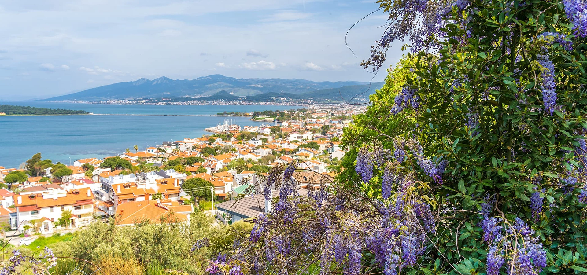
Continue south through the İzmir Peninsula to discover vineyards, art streets, archaeology, coastal neighborhoods and the remarkable gastronomy of Urla.
View Urla GuideCombine Karaburun with the historic towns, beaches, vineyards and archaeological landscapes of western İzmir.
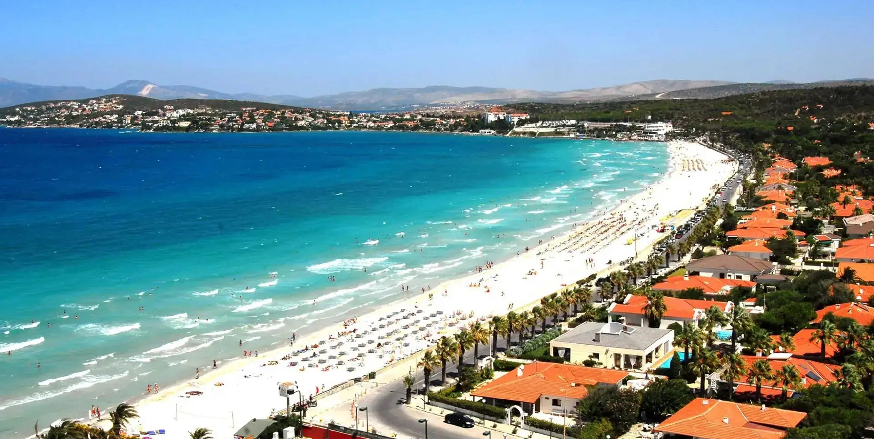
Explore historic stone streets, windmills, restaurants, boutiques and one of the most atmospheric towns on the Aegean coast.
Explore Alaçatı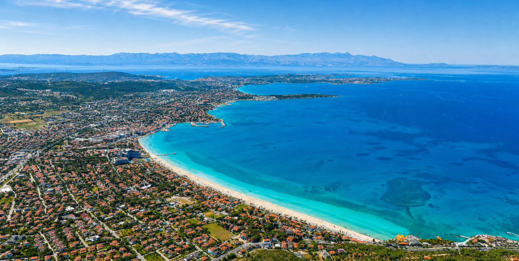
Discover Çeşme Castle, marina life, beaches, thermal springs and the lively western end of the peninsula.
Explore Çeşme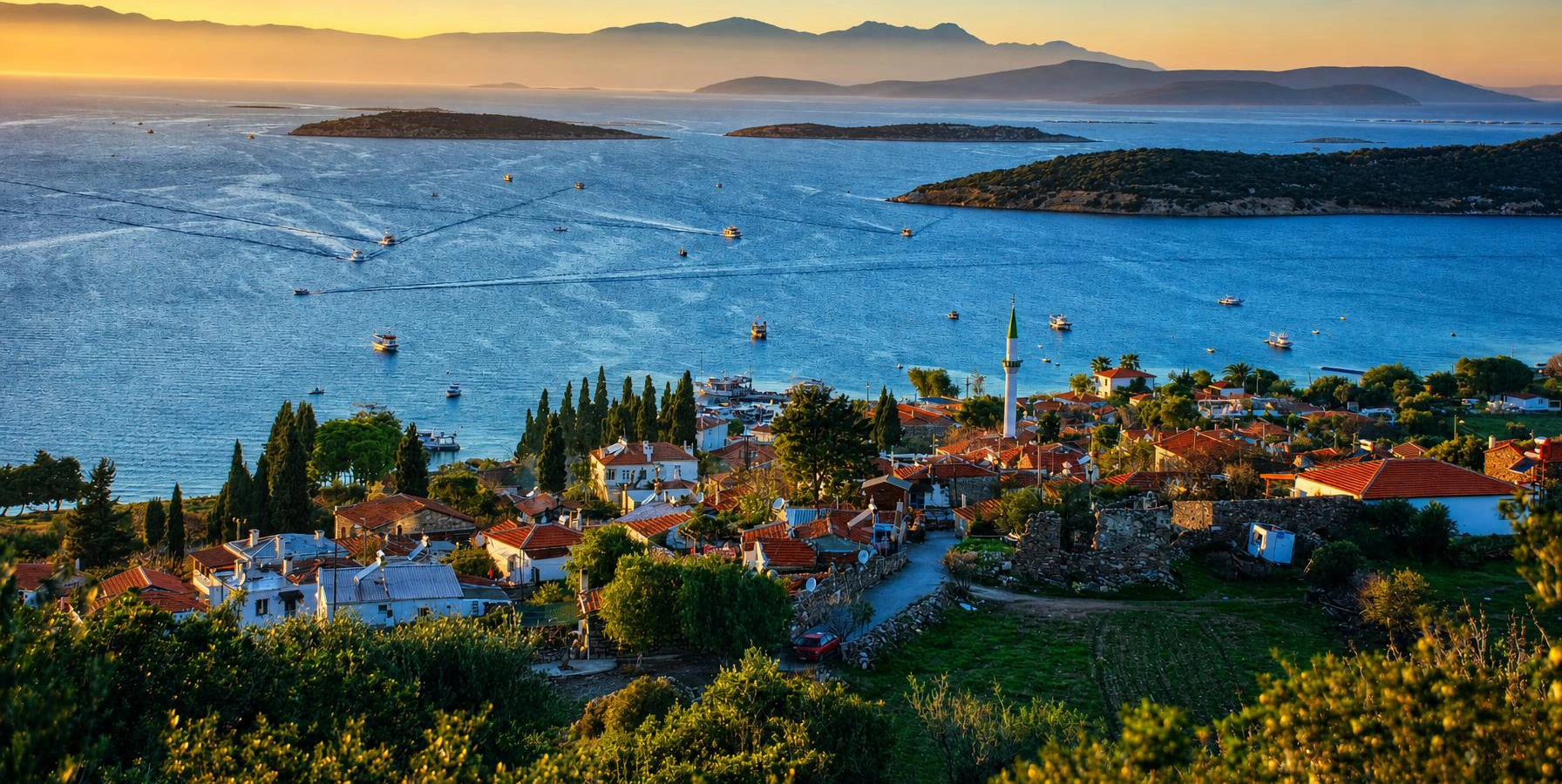
Combine a peaceful fishing village with the ruins and hilltop views of ancient Erythrai on the Çeşme Peninsula.
Explore Ildırı