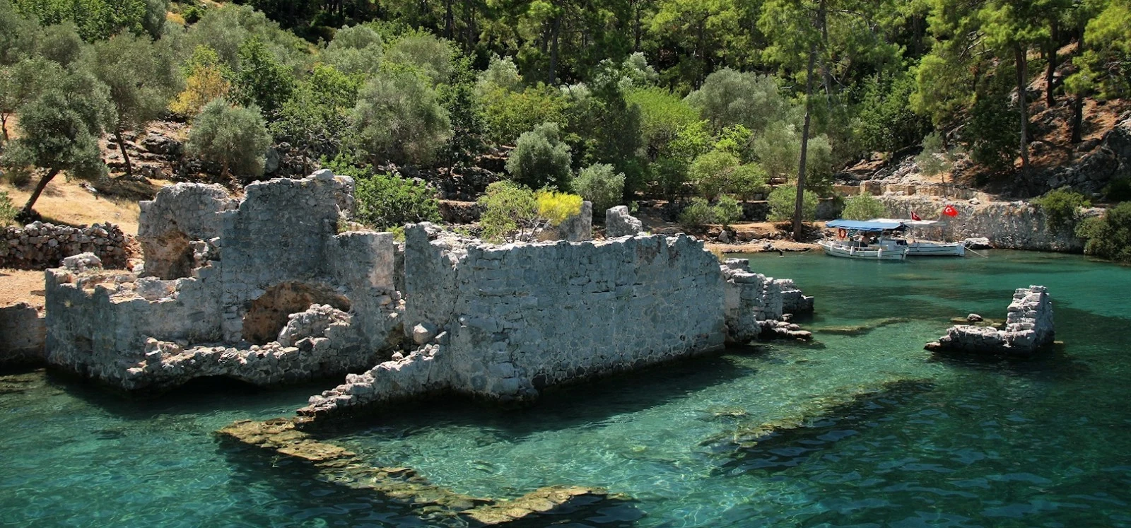
Private Myus Ancient City Experience
Explore the fascinating history of Myus, its ancient sanctuaries, Byzantine remains and transformed coastal landscape through a customized cultural itinerary, subject to site access.
Request a Private Experience





Hidden among the agricultural landscapes of the Büyük Menderes Valley near Avşar village in Aydın Province, Myus Ancient City is one of the most intriguing archaeological sites of western Türkiye. Although considerably less famous than neighbouring Miletus and Priene, Myus belonged to the prestigious Ionian League, the confederation of twelve cities that shaped the political, cultural and religious history of ancient Ionia.
In antiquity, Myus occupied a coastal landscape connected to the Latmian Gulf, where maritime routes, river navigation and fertile agricultural lands supported the settlements of the Maeander region. Today, the sea is far away. The transformation resulted from the enormous quantities of sediment carried downstream by the Maeander River, known in Türkiye as the Büyük Menderes.
This environmental transformation gradually changed the city's fortunes. Its harbour lost its former importance, surrounding waters became increasingly marshy, and the settlement eventually lost its independence. Ancient writers describe how its inhabitants relocated to nearby Miletus, carrying their possessions and sacred images with them.
Among the archaeological remains are the foundations of ancient sanctuaries, traces of defensive walls, rock-cut features and the impressive ruins of a Byzantine fortress. Although Myus lacks the monumental theatres and extensive streets of better-preserved ancient cities, its isolated location offers an extraordinary opportunity to understand the relationship between geography, history and human settlement.
Discover a small but historically significant member of the ancient Ionian League.
Explore how the Maeander River transformed an ancient coastal settlement.
Learn about the temples associated with Dionysus and Apollo.
See the medieval walls that form the most prominent surviving ruins.
Essential information about one of the lesser-known archaeological sites of ancient Ionia.
Near Avşar village, Söke district, Aydın Province, Türkiye.
Open on Google MapsAn Ionian Greek city situated in the historical region of Caria.
One of the twelve traditional member cities of the Ionian League.
A coastal settlement connected with the former Latmian Gulf and Maeander waterways.
Contributed three ships to the Ionian fleet in 494 BC.
The ruins of a medieval Byzantine fortress, alongside earlier archaeological remains.
A relatively undeveloped archaeological landscape surrounded by rural countryside.
Approximately 45–90 minutes, depending on access and walking conditions.
A relatively small ancient city that played a meaningful role in Ionian history and reveals the environmental transformation of the Aegean coastline.
Myus is historically important for several reasons. First, it belonged to the twelve-city Ionian League, an association whose members included major cultural and commercial centres such as Miletus, Ephesus, Priene and Teos. Membership connected Myus with the broader political and religious identity of the Ionian Greeks.
Second, Myus participated in the events surrounding the Ionian Revolt against Persian rule. Its contribution to the Battle of Lade in 494 BC was small compared with the fleets of larger cities, but it demonstrates that Myus remained part of the wider Ionian political community.
Third, Myus provides a particularly instructive example of environmental change in antiquity. The sediment deposited by the Maeander River gradually altered coastal geography, transforming marine inlets into lagoons, marshlands and eventually areas of agricultural plain.
Finally, the abandonment of Myus is unusually well represented in ancient literature. The geographical writer Strabo discussed the city's declining independence, while Pausanias described the consequences of environmental change and the relocation of its inhabitants to Miletus.
For modern visitors, Myus therefore offers more than a collection of ruins. It provides a landscape in which the interaction between natural processes and ancient civilization can still be understood.
The history of Myus extends through several major periods of western Anatolian civilization. Its geographical position connected the settlement with the maritime world of ancient Ionia, while its political history was closely linked to larger neighbouring cities.
Ancient tradition attributed the foundation of Myus to a member of the family of Codrus, the legendary king of Athens. The geographer Strabo referred to a founder named Kydrelos, while Pausanias preserved a related tradition naming Cyaretus. These accounts belong to the traditional narratives of Ionian settlement rather than providing a securely established foundation date.
During the Archaic period, Myus developed as an Ionian community with religious sanctuaries and connections to other cities of the Aegean world. Its participation in the Ionian League gave the settlement a recognized position within the region's shared cultural institutions.
Under Persian domination, Myus became involved in the political struggles of western Anatolia. Herodotus connected the area with Persian naval activity during the Ionian Revolt, and recorded the city's participation in the Battle of Lade.
Later, Myus appeared in the histories of the Classical and Hellenistic periods. Its political independence gradually weakened as changing waterways and regional power relationships increasingly favoured larger settlements.
By the time of Strabo, Myus had become closely incorporated with Miletus. Pausanias, writing in the second century AD, described it as an abandoned city whose former religious importance was represented by a marble sanctuary of Dionysus.
The site's history did not completely end with the abandonment of the ancient polis. During the Byzantine period, a fortified structure was established on the prominent hill, providing the surviving landscape with another distinct architectural layer.
Ancient writers associated the city's founding with descendants of Codrus, the legendary Athenian king.
Myus develops as an Ionian settlement with temples and connections to the wider Aegean world.
Persian naval activity near Myus is recorded in the historical accounts of the Ionian Revolt.
Myus contributes three ships to the Ionian fleet at the Battle of Lade.
The city remains involved in Aegean political affairs while retaining a comparatively small scale.
Changing political conditions and environmental pressures contribute to the city's decline.
Ancient geographical accounts describe Myus as having lost its separate political identity.
Pausanias describes an abandoned city and recalls its white-marble Temple of Dionysus.
A fortress is built on the hill, introducing a medieval phase into the archaeological landscape.
Historical research and archaeological investigations identify temples, fortifications and settlement remains.
Ancient Greek accounts connected the origins of Myus with the movement of Ionian settlers from the Aegean world to the western coast of Anatolia.
According to the geographical tradition preserved by Strabo, Myus was founded by Kydrelos, a son of Codrus, the legendary king of Athens. Pausanias preserved a similar tradition but identified the founder as Cyaretus.
Codrus appears repeatedly in the foundation legends of Ionian communities. Such stories connected different settlements through a shared ancestry and helped explain their religious and cultural relationships.
However, these accounts should not be interpreted as precise archaeological records. They represent historical traditions written down long after the period in which Ionian settlement was believed to have taken place.
Archaeological evidence from the wider region indicates a complicated history involving local Anatolian populations, Aegean cultural influences and the gradual development of Greek-speaking communities.
Myus belonged to the Ionian League, also known as the Ionian Dodecapolis, a confederation traditionally comprising twelve major Ionian city communities along the western Anatolian coast and nearby islands.
These cities shared religious traditions and cultural connections, although their political interests were not always identical. Their common sanctuary was associated with the Panionion, dedicated to Poseidon Helikonios in the region of Mount Mycale.
Membership in the league gave Myus a place within a prestigious community that included much larger and more influential cities.
Unlike Miletus, which established overseas colonies and developed into a major centre of maritime commerce, Myus remained a relatively modest settlement. Nevertheless, ancient sources consistently recognized its Ionian identity.
An exceptionally important Ionian city associated with maritime trade, philosophy and overseas colonization.
A major Ionian city celebrated for its urban development and sanctuary of Artemis.
A neighbouring Ionian settlement famous for its later planned city and Temple of Athena.
A smaller member whose harbour and political independence were affected by the changing Maeander landscape.
The shared religious gathering place traditionally associated with the Ionian League.
Common religious festivals, traditions and cultural associations helped connect the different communities.
Myus is therefore significant not because of the size of its surviving monuments, but because its inclusion in the Ionian League demonstrates the diversity of settlements that formed the ancient Ionian world.
During the sixth century BC, western Anatolia came under the control of the expanding Achaemenid Persian Empire. The Ionian cities retained aspects of their local institutions but operated within a much larger imperial political system.
Tensions between Persian authorities and certain Greek communities eventually contributed to the Ionian Revolt, traditionally dated from 499 to 494 BC.
The historian Herodotus recorded Persian naval activity around Myus during the early stages of the revolt. This reference demonstrates the strategic importance of the waterways connecting the Maeander region with the Aegean Sea.
Although Myus was considerably smaller than Miletus, it became involved in events that affected the future of the entire Ionian world.
The uprising eventually culminated in the naval confrontation at Lade, near Miletus, where the combined Ionian forces were defeated by the Persian fleet.
One of the clearest historical references to Myus concerns its participation in the Battle of Lade, the decisive naval engagement of the Ionian Revolt.
According to Herodotus, Myus contributed three warships to the Ionian fleet. Although this was a very small contingent compared with the contributions of larger cities, it confirms that Myus participated in the collective military efforts of the Ionian communities.
The battle took place near Miletus in a maritime landscape that has since changed dramatically because of sediment deposition.
The defeat of the Ionian fleet was followed by the Persian capture of Miletus, an event that profoundly affected the political situation of western Anatolia.
494 BC, during the final phase of the Ionian Revolt.
Near the ancient island of Lade and the maritime approaches to Miletus.
Three ships, as recorded by Herodotus.
A Persian naval victory that contributed to the collapse of the Ionian Revolt.
The participation of Myus also shows why smaller archaeological sites can be historically important even when relatively little monumental architecture survives.
After the Persian Wars, the city continued to appear in the political geography of the Aegean region. Myus belonged to the wider network of communities involved in the changing relationships between Athens, Persia and the cities of western Anatolia.
Ancient sources identify Myus as one of the settlements assigned to the Athenian statesman Themistocles after his exile and association with the Persian court. The traditions concerning this grant connect Myus with the political history of the fifth century BC.
The city also appeared in the financial records of the Athenian maritime alliance, reflecting its participation in the political institutions of the Classical Greek world.
During the Hellenistic period, the region experienced further changes as Macedonian and successor kingdoms competed for influence across Anatolia.
Ancient historical accounts associate Myus with transactions involving Macedonian rulers and the neighbouring city of Magnesia on the Maeander.
Despite these changing political relationships, environmental transformation was becoming increasingly important. The harbour and waterways that once supported Myus were losing their original geographical character.
As its economic and strategic position weakened, the city became more closely connected with Miletus and eventually ceased to function as a separate urban community.
Understanding Myus requires imagining a landscape very different from the agricultural plain visible today.
During antiquity, the western Anatolian coastline extended much farther inland in this region. The Latmian Gulf formed a marine inlet, while the Maeander River flowed through the surrounding lowlands and delivered enormous quantities of sediment toward the sea.
Myus occupied a strategically positioned settlement near these waterways. Its coastal connections allowed access to the maritime networks of the Aegean and the river systems of inland Anatolia.
Over many centuries, sediment gradually accumulated, forming new land and changing the depth and shape of the waterways.
Marine environments were progressively transformed into lagoons, lakes, wetlands and agricultural plains. These changes affected several settlements, including Myus, Miletus and the earlier harbour landscape of Priene.
The Latmian Gulf connected inland settlements with the Aegean maritime world.
The river carried sediment from inland Anatolia toward the coast.
Accumulated material gradually altered river mouths, harbours and marine inlets.
Former coastal waters became increasingly enclosed and changed in character.
Marshy conditions affected settlement, navigation and agricultural use.
Land once associated with coastal waterways now forms part of the cultivated Büyük Menderes landscape.
The abandonment of Myus is among the most fascinating examples of environmental change influencing the history of an ancient city.
The central problem was the progressive transformation of the coastal landscape through sediment deposition by the Maeander River.
As marine inlets became increasingly enclosed, the area developed shallow water environments and marshes. These conditions reduced the usefulness of the harbour and created difficulties for settlement.
The second-century AD writer Pausanias described a former sea inlet that had been transformed into a lake after the river blocked its entrance with mud.
According to his account, enormous numbers of mosquitoes developed in the stagnant waters, eventually making life so unpleasant that the inhabitants abandoned the settlement.
Pausanias also recorded that the population relocated to Miletus, taking its movable possessions and sacred images.
Modern historical interpretation generally considers the city's decline in a broader context. Harbour silting, flooding, environmental deterioration, economic change and the growing influence of Miletus may all have contributed.
The mosquito story is therefore an important ancient explanation, but the disappearance of Myus should not be reduced to a single cause.
The gradual deposition of sediment reduced access to navigable coastal waters.
Changing water conditions created wetland environments around the settlement.
Pausanias described swarms of insects as a major reason for the city's abandonment.
The changing landscape reduced advantages once provided by maritime connections.
Myus became increasingly connected with the larger neighbouring city of Miletus.
Ancient tradition describes the movement of inhabitants and religious possessions to Miletus.
The Greek traveller and writer Pausanias, who lived during the second century AD, provides one of the most memorable ancient descriptions of Myus.
In his Description of Greece, Book 7, Chapter 2, Pausanias explained that a small marine inlet near Myus had been blocked by sediment deposited by the Maeander River.
He described how the changing water conditions produced swarms of mosquitoes and made the settlement increasingly difficult to inhabit.
According to his account, the inhabitants eventually moved to Miletus, taking their personal belongings and the statues of their gods.
Pausanias reported that, by the time of his visit, the principal monument remaining was a white-marble Temple of Dionysus.
This account is especially valuable because it links three important aspects of the city's history: environmental transformation, population movement and the continuing religious importance of an ancient sanctuary.
Nevertheless, Pausanias wrote long after the earlier phases of the city's decline. His account combines inherited local historical traditions with observations from his own period.
The relationship between Myus and Miletus Ancient City is central to understanding the final centuries of Myus's existence.
Both cities belonged to the Ionian League and occupied parts of the coastal environment shaped by the Maeander River.
However, Miletus was considerably larger and more influential. It developed extensive overseas trading connections and became associated with leading thinkers of early Greek philosophy.
Myus, by comparison, was a smaller settlement with a more limited political and economic position.
As the waterways around Myus changed, its population became increasingly integrated with Miletus. Strabo described the relationship in terms of political union, while Pausanias recorded the eventual relocation of inhabitants and possessions.
The transfer of sacred images is particularly interesting because it suggests that the religious life of the community continued after the physical settlement was abandoned.
For visitors interested in this history, exploring both archaeological sites provides a valuable comparison between the fortunes of a major Ionian metropolis and those of a much smaller neighbouring city.
Both cities belonged to the traditional twelve-member Ionian League.
Their coastal environments were influenced by the same river and sedimentary system.
Miletus became a major regional centre, while Myus remained comparatively small.
Ancient writers described Myus becoming incorporated into the political community of Miletus.
The relocation of sacred images symbolized the continuation of communal traditions.
Visiting both sites reveals contrasting patterns of urban survival and abandonment.
Myus has attracted archaeological attention because of its historical importance and its unusually limited surviving architectural remains.
Investigations in the twentieth century helped identify the location and arrangement of ancient sanctuary terraces, defensive structures and areas of settlement.
Research by archaeologists including Theodor Wiegand and Hans Weber contributed to understanding the site's monuments and their relationship with ancient literary descriptions.
The archaeological landscape contains evidence of structures from different periods, including religious buildings associated with the Greek city and a later Byzantine fortress.
One of the most striking features is the relative scarcity of surviving carved architectural material. Scholars have discussed whether stone from Myus was reused elsewhere, including at Miletus, after the decline of the settlement.
Although this explanation is plausible, individual architectural fragments cannot automatically be assigned to particular monuments without archaeological evidence.
Two principal terrace levels preserve evidence of ancient religious architecture.
Architectural remains contribute to the identification of ancient sanctuaries.
Surviving masonry provides evidence of early construction and defensive arrangements.
Cuttings, cisterns and other traces provide clues to former settlement activity.
Substantial medieval walls represent a later phase of occupation.
Geomorphological studies help explain why the city's ancient coastal landscape disappeared.
The architectural remains at Myus reflect the very different historical periods represented within the site.
The ancient Greek settlement included religious sanctuaries on prepared terraces, together with buildings and installations associated with the surrounding urban community.
Today, much of the ancient architecture survives only at foundation level. Visitors should not expect the substantial standing columns and large public buildings characteristic of better-preserved archaeological cities.
The most visually prominent structure is the ruined Byzantine fortress, identifiable by its surviving stone walls, arches and enclosed architectural spaces.
These later walls are important historical monuments in their own right, but they should not be confused with the original Greek temples of Myus.
Artificially prepared levels provided spaces for ancient religious buildings.
Fragmentary masonry preserves evidence of ancient sacred architecture.
Large stone blocks helped stabilize and define the terrace arrangements.
Rock-cut features and traces of buildings indicate areas of former habitation.
Wall remains document different phases of construction at the site.
Architectural openings within the Byzantine ruins create distinctive surviving silhouettes.
One of the most historically significant monuments of Myus was the Temple of Dionysus, described by Pausanias in the second century AD.
Dionysus was an important deity in ancient Greek religion, associated with wine, vegetation, transformation, festivals and theatrical performance.
Pausanias specifically described the temple at Myus as being constructed of white marble. According to his account, it remained visible when the rest of the city had largely disappeared.
Archaeological investigations identified the remains of an ancient sanctuary on the lower of the principal temple terraces. These remains have been associated with the Temple of Dionysus described in the literary sources.
Published archaeological descriptions identify an Ionic temple approximately 30 metres long and 17 metres wide, with a surrounding colonnade. The building is generally associated with the Archaic period.
Only limited architectural material survives in its original setting today. The ancient temple should therefore be understood primarily through its foundations, remaining fragments and archaeological reconstruction.
Dionysus, a prominent deity in ancient Greek religious traditions.
Pausanias remembered a temple constructed of white marble.
Associated with the lower of the principal sanctuary terraces.
An Ionic temple whose original arrangement is known largely through archaeological evidence.
Foundation remains and limited architectural fragments.
One of the last monuments specifically remembered at the abandoned ancient city.
Archaeological research has also identified evidence for another ancient sanctuary on the upper terrace of the site.
This sanctuary has been associated with Apollo Terbintheos, an epithet of Apollo linked in scholarly interpretation with the terebinth tree.
Published archaeological descriptions discuss the architectural remains of a substantial temple on the upper terrace, including foundations and cuttings associated with its original structural arrangement.
The identification of this sanctuary is not as straightforward as that of monuments preserved through extensive standing architecture. Its dedication and original design depend on the interpretation of archaeological evidence and ancient inscriptions.
Nevertheless, the sanctuary provides important evidence that Myus possessed a more developed religious landscape than the small quantity of visible remains might initially suggest.
Apollo Terbintheos, according to archaeological interpretations.
Associated with the upper of the principal ancient sanctuary terraces.
Limited foundations, stonework and architectural cuttings.
Evidence of another significant cult within the ancient Ionian community.
The ruined Byzantine fortress is the most visually recognizable architectural feature at Myus today.
Its standing stone walls and arched openings occupy a prominent position within the archaeological landscape, overlooking surrounding fields and the former coastal environment.
The fortress belongs to a much later historical period than the ancient Ionian city. Its construction demonstrates that the hill continued to possess strategic or practical value after the ancient urban settlement had declined.
Unlike the temple foundations, parts of the fortress still rise above ground level, allowing visitors to appreciate the arrangement of surviving walls and enclosed spaces.
However, the ruined masonry is fragile. Openings, unstable stones, vegetation and uneven ground may create hazards, and not all parts of the structure should be approached or entered.
Byzantine, substantially later than the Classical Greek settlement.
Stone fortification remains with walls, arches and enclosed spaces.
A hilltop setting that provides views across the surrounding plain.
The weathered walls create atmospheric compositions against the rural landscape.
The fortress demonstrates reuse of the location long after the decline of ancient Myus.
Remain outside unstable structures and avoid climbing damaged masonry.
Beyond the principal sanctuaries and fortress, archaeological investigations have documented traces of the former settlement across the surrounding hills and slopes.
These features include rock-cut installations interpreted as parts of buildings, cisterns and burial-related structures.
Such remains are important because they provide evidence of everyday occupation rather than monumental religious architecture alone.
Cisterns and water-management installations were particularly valuable in ancient settlements, supporting domestic activities and helping communities manage local water supplies.
Rock-cut features can be difficult for non-specialists to identify, especially when partly covered by vegetation, soil or later alterations.
Visitors should therefore avoid interpreting every visible cutting or stone arrangement as a securely identified ancient building.
Features associated with storing or managing water.
Fragmentary remains that indicate former areas of occupation.
Rock-cut evidence contributing to the archaeological understanding of the site.
Modified slopes created usable surfaces for structures and activities.
The Büyük Menderes River, known in antiquity as the Maeander, played a fundamental role in the history of Myus and the surrounding Ionian cities.
The river drains a large area of inland western Anatolia before flowing toward the Aegean coast. Over thousands of years, it transported sediment downstream, gradually transforming the geography of the lower valley.
The river's winding course also gave rise to the term meander, widely used in geography to describe looping river bends.
The accumulation of sediment helped form the modern delta landscape and contributed to the separation of former marine environments from the open sea.
At Myus, these processes altered the relationship between the settlement and its original harbour environment.
Similar transformations affected the neighbouring cities of Miletus and Priene, whose ancient maritime settings also differ considerably from their present-day surroundings.
The landscape around Myus is consequently an excellent location for understanding the long-term interaction between rivers, coastlines and human history.
The historical geography of Myus is closely connected with the wider region of Lake Bafa and the ancient Latmian Gulf.
Lake Bafa represents a remarkable example of landscape transformation. The lake occupies part of a former marine gulf whose relationship with the open Aegean Sea changed as sediment accumulated across the lower Maeander region.
Scientific studies of sediment cores, coastal evolution and ancient environmental conditions have helped researchers reconstruct this process.
Myus and the settlements around Lake Bafa illustrate the same broad historical phenomenon: communities originally connected with maritime environments experienced dramatic changes in geography over time.
For travellers, combining Myus with Lake Bafa and Heracleia offers an opportunity to explore both the archaeological and natural history of the region.
Parts of the modern lake and plain once belonged to a connected coastal environment.
River sediment gradually transformed the boundaries between land and water.
Myus and Heracleia developed within landscapes strongly influenced by ancient waterways.
Lake Bafa and the surrounding agricultural plain preserve different results of long-term landscape change.
Myus is most rewarding for travellers who enjoy interpreting archaeological landscapes rather than visiting extensively reconstructed monuments.
The surviving features are relatively scattered, and their visibility depends on vegetation, weather conditions and current access arrangements.
See the most prominent surviving structure, with weathered walls and medieval architectural openings.
Discover the historical setting of the white-marble sanctuary described by Pausanias.
Understand the location of another important ancient temple, tentatively associated with Apollo.
Examine visible masonry associated with the early phases of the settlement where safely accessible.
Look for archaeological traces of former occupation and installations in the surrounding terrain.
Observe the relationship between the low hills and the extensive cultivated plain.
Appreciate the quiet setting that contrasts with the monumental ruins of larger archaeological cities.
Imagine how the surrounding land was connected to ancient marine and river waterways.
Compared with famous archaeological destinations such as Ephesus, Priene and Miletus, Myus offers a quieter and less developed visitor experience.
The site lies within an agricultural landscape where ancient remains, natural vegetation and modern rural land use exist close together.
Some archaeological features may be difficult to recognize without historical background. In particular, the foundations of ancient sanctuaries are less visually obvious than the standing walls of the Byzantine fortress.
Visitors should expect potentially uneven terrain, exposed areas and limited on-site facilities. Conditions may vary depending on the season, agricultural activity and maintenance.
For travellers primarily interested in large classical monuments, Myus may be best appreciated as a shorter supplementary visit.
For those fascinated by ancient geography, the Ionian League and the disappearance of historic harbours, however, the site can be unusually rewarding.
A lesser-known archaeological destination away from major sightseeing crowds.
Limited standing ancient architecture requires imagination and historical context.
Fields, hills and vegetation form a significant part of the experience.
Do not assume that toilets, refreshments or staffed visitor services will be available.
Reading about the city's history before arrival greatly improves the visit.
Allow extra time for locating permitted access routes and identifying the visible remains.
Myus Ancient City is located near Avşar village in the Söke district of Aydın Province. It is a lesser-developed archaeological location, and visitors should not assume that its arrangements are the same as those of major ticketed archaeological sites.
As of October 2026, a separately verified official daily opening schedule, fixed admission fee and staffed ticket-office arrangement for Myus have not been established for this guide.
The absence of a published admission price should not be interpreted as a guarantee of unrestricted or free entry. Access may depend on heritage-protection rules, agricultural boundaries, maintenance or other local conditions.
Travellers intending to visit should check the latest information locally, particularly if the archaeological site is an essential part of their itinerary.
Myus lies in a largely open rural landscape, so weather and ground conditions have a major influence on the comfort of a visit.
Spring and autumn are generally the most comfortable seasons for walking and archaeological exploration in this part of western Anatolia.
Mild temperatures and green countryside make spring attractive, although vegetation may conceal some remains.
Comfortable weather and softer sunlight are well suited to historical sightseeing.
Early visits are preferable because exposed archaeological areas can become very hot.
High temperatures and limited shade may make walking uncomfortable.
Cooler conditions may be pleasant, but rain can make rural tracks and archaeological surfaces slippery.
Low sunlight can emphasize the fortress walls and surrounding landscape, subject to safe access.
The ideal duration depends on the current accessibility of the remains and your interest in archaeology.
A brief exterior look at accessible fortress remains and the surrounding landscape.
A short archaeological visit focusing on the principal visible structures.
A more thoughtful exploration with time for understanding the sanctuary locations and historical geography.
Allow for travel and a combined visit with another accessible archaeological or natural attraction.
Combine Myus with selected highlights of the surrounding Maeander Valley.
Explore Myus together with Miletus, Priene or the Lake Bafa region.
These durations are approximate planning suggestions rather than formal walking routes. Actual time requirements will depend on road conditions, access and individual mobility.
Myus offers distinctive opportunities for landscape and architectural photography. Unlike heavily visited archaeological parks, the site is characterized by ruined masonry set against fields, low hills and open countryside.
The Byzantine fortress is especially photogenic, although its historical period should be correctly identified when photographs are published.
Use surviving medieval masonry as the foreground for views across the plain.
Frame the surrounding countryside through architectural openings where safe viewing positions exist.
Capture the contrast between archaeological ruins and the extensive cultivated fields.
Look for texture, mortar, weathering and different phases of surviving masonry.
Directional sunlight can reveal surface details and create atmospheric shadows.
Include the surrounding terrain to illustrate the transformation of the ancient coastal environment.
Myus should be approached as a relatively undeveloped archaeological landscape rather than a fully adapted tourist attraction.
The ground may include irregular tracks, slopes, loose stones and areas of natural vegetation. Routes and access conditions can change with weather and surrounding land use.
Expect irregular surfaces around the archaeological remains.
A verified fully accessible route through the archaeological site has not been established.
Walls, arches and loose masonry may present risks if approached too closely.
Access routes may be affected by agricultural use and seasonal ground conditions.
Bring sun protection and water, particularly during warmer months.
Visitors with limited mobility should confirm accessible viewing options before travelling.
Myus Ancient City is located near Avşar village in the Söke district of Aydın Province.
The site is approximately 18 kilometres south of Söke in geographical terms and about 15 kilometres east of ancient Miletus. Actual driving distances depend on the chosen route and local access conditions.
A private vehicle is generally the most practical way to explore the surrounding region. However, the final approach to Myus may involve local rural tracks, and road suitability should be confirmed before attempting to drive to the ruins.
Travel toward the Avşar area and use updated navigation to identify an appropriate approach to the archaeological site.
Myus lies northeast of Miletus in the Maeander Valley, but road distance is greater than the approximate direct distance.
Include Myus in a regional archaeological excursion with appropriate route planning.
Travel toward Söke and the lower Maeander region, preferably with private transport.
Combine the journey with archaeological sites in the Miletus and Söke region.
Regular transport directly to the archaeological remains has not been independently verified.
Myus is considerably less developed for tourism than major archaeological sites. Careful preparation will help visitors enjoy the experience while protecting the historic remains.
Read about the Ionian League, the city's temples and the abandonment of Myus before visiting.
Confirm that the intended route and archaeological areas are legally and safely accessible.
Do not rely on finding refreshments or drinking-water facilities at the ruins.
Choose footwear suitable for uneven ground, loose stones and rural tracks.
Use a hat and sunscreen during warmer periods, when shade may be limited.
Visit during daylight and avoid exploring unfamiliar archaeological terrain after sunset.
Respect cultivated fields, fences and private property surrounding the site.
Stay away from unstable walls and avoid entering damaged fortress areas.
Rural navigation and identifying archaeological remains may require more time than expected.
Consider visiting Myus together with Miletus, Priene or the Lake Bafa region.
A visit to Myus is particularly rewarding when combined with other archaeological sites in the surrounding Maeander Valley.
Begin with Priene Ancient City, one of the finest surviving examples of ancient Greek urban planning. Its organized street network, impressive natural setting and Temple of Athena provide an excellent introduction to the architecture of Ionia.
Continue to Myus Ancient City, subject to confirmation of access. The contrast between Priene's planned urban layout and Myus's fragmentary remains illustrates the different histories of neighbouring Ionian communities.
Travel onward to Miletus Ancient City, whose monumental Roman theatre and archaeological landscape reveal the scale and importance of one of the ancient Aegean's most influential cities.
If time permits, include Milet Museum to examine archaeological material from the surrounding region.
For a longer day, visitors may prefer to add Didyma, famous for its monumental Temple of Apollo, or explore the landscapes of Lake Bafa.
The surrounding region contains some of the most historically important ancient cities of western Anatolia. These sites provide valuable context for the history of Myus.
Explore the major Ionian city with which the inhabitants of Myus eventually became associated.
Discover remarkable Greek urban planning, impressive hillside architecture and the Temple of Athena.
Explore archaeological collections illuminating the civilizations of the lower Maeander region.
Visit the monumental sanctuary and celebrated ancient oracle historically connected with Miletus.
Discover a landscape shaped by the ancient Latmian Gulf, with archaeological remains and remarkable natural scenery.
Explore an outstanding monument of medieval Anatolian architecture near the ruins of ancient Miletus.
Discover a popular coastal destination and convenient starting point for exploring ancient Ionia.
Visit a natural attraction near the Dilek Peninsula, combining regional mythology and geology.
Myus becomes particularly interesting when compared with its more famous neighbours, Miletus and Priene.
All three cities belonged to the Ionian League and developed within the historical geography of the Maeander region.
Yet their surviving archaeological landscapes are remarkably different.
Miletus became a major urban and maritime centre, leaving an extensive collection of Greek and Roman architectural remains.
Priene is celebrated for its carefully organized urban layout, constructed on a hillside with commanding views of the surrounding countryside.
Myus, by contrast, presents the story of a smaller city whose changing relationship with the sea contributed to its decline and eventual abandonment.
A former harbour settlement with temple foundations, a Byzantine fortress and a history of environmental decline.
A major Ionian metropolis associated with maritime commerce, philosophy and monumental urban architecture.
An exceptionally informative example of Greek urban planning and architectural organization.
All three settlements were influenced by the evolution of the Maeander delta and nearby coastal environments.
Each community experienced different patterns of urban transformation, political integration and survival.
Their remains help researchers reconstruct the interconnected history of the lower Maeander region.
Experiencing these three sites together offers a much richer understanding of ancient Ionia than visiting any one settlement in isolation.
Myus appeals most strongly to travellers interested in archaeology, ancient geography and places beyond the main tourist routes.
Explore a settlement associated with the Ionian League, Persian Wars and Classical Greek history.
Appreciate fragmentary remains and the methods used to identify ancient structures.
Discover one of the region's most informative examples of coastal transformation.
Capture weathered medieval walls within a quiet agricultural landscape.
Visit a lesser-known site associated with ancient literary sources and historical research.
Go beyond the major archaeological attractions to explore a quieter chapter of Ionian history.
Those expecting a fully restored archaeological park with extensive visitor services should prioritize Miletus or Priene. Myus is better suited to travellers who enjoy understanding places through their surviving fragments and historical setting.
Myus is located near Avşar village in the Söke district of Aydın Province, western Türkiye.
Myus is known as one of the twelve traditional cities of the Ionian League and for its unusual history of environmental decline, abandonment and integration with Miletus.
Yes. Myus belonged to the traditional twelve-member Ionian League, together with cities such as Miletus, Ephesus and Priene.
Ancient tradition attributed the foundation of Myus to a son of Codrus, the legendary Athenian king. Strabo named Kydrelos, while Pausanias preserved a tradition naming Cyaretus.
The precise foundation date is uncertain. The city belongs to the ancient Ionian settlement tradition, and its history is documented during the Archaic and Classical periods.
Yes. Myus was an Ionian Greek city located in the historical region of Caria in western Anatolia.
Yes. Myus developed within an ancient coastal environment connected with the Latmian Gulf and Maeander waterways, which have changed dramatically over time.
Sediment deposited by the Maeander River gradually transformed the ancient coastline, creating new land and altering former marine inlets.
The city's decline is associated with harbour silting, environmental change and its increasing dependence on Miletus. Pausanias specifically described swarms of mosquitoes developing around stagnant waters.
Pausanias recorded this explanation in the second century AD. Modern interpretations consider the mosquito story alongside wider environmental, economic and political changes.
Ancient sources describe the inhabitants relocating to Miletus, taking their movable possessions and sacred images with them.
Both were Ionian League cities. As Myus declined, it became politically integrated with Miletus, where its population is traditionally said to have relocated.
Yes. Herodotus recorded that Myus contributed three ships to the Ionian fleet in the Battle of Lade in 494 BC.
Myus is especially associated with the Temple of Dionysus. Archaeological research also discusses an upper sanctuary tentatively identified with Apollo Terbintheos.
It was an ancient religious sanctuary described by Pausanias as a white-marble temple. Its remains have been associated with foundations on the lower sanctuary terrace.
The prominent standing arches and substantial fortress walls belong to the later Byzantine period. They should not be confused with the ancient Greek temples.
The surviving features include Byzantine fortress remains, ancient sanctuary foundations, wall fragments and archaeological traces within the surrounding landscape.
No. The site has been investigated archaeologically, but the surviving remains are fragmentary and do not form a fully reconstructed ancient city.
Myus is a recognized archaeological location, but a current fixed visitor schedule and access arrangements have not been independently verified for this guide. Visitors should check locally before travelling.
A verified current official admission tariff has not been established. Visitors should not assume that the absence of published ticket information guarantees free access.
Approximately 45–90 minutes may be appropriate for exploring accessible principal remains, depending on the route and ground conditions.
A fully step-free visitor route has not been verified. Uneven surfaces, slopes and rural access conditions may make visiting difficult for people with limited mobility.
Yes, a combined visit is practical with appropriate private transport and confirmation of access to Myus.
Yes. Priene, Myus and Miletus form an especially interesting historical combination because all three were Ionian cities affected by the changing Maeander landscape.
Myus belongs to the wider historical region influenced by the ancient Latmian Gulf, but the archaeological site should not be confused with a monument standing directly on the modern shore of Lake Bafa.
Yes, particularly for travellers interested in lesser-known ancient cities, the Ionian League, historical geography and the relationship between archaeological sites and environmental change.
Myus preserves important archaeological remains within an active rural landscape. Responsible behaviour is essential for protecting both the historic site and the surrounding environment.
Follow existing accessible paths and observe archaeological boundaries.
Leave stones, pottery fragments and other archaeological material exactly where they are found.
Do not climb fortress walls or disturb ancient foundations.
Avoid walking through cultivated fields or damaging crops and irrigation infrastructure.
Carry away litter and avoid disturbing the surrounding natural environment.
Observe temporary closures, protective barriers and official instructions.
The history of Myus is reconstructed through ancient literary accounts, archaeological investigations and scientific research into the changing coastline of western Anatolia.
Official historical overview of Myus, including the Ionian League, Battle of Lade, Temple of Dionysus and Byzantine remains.
Book 7, Chapter 2, including the ancient account of Myus's abandonment and the Temple of Dionysus.
Archaeological and historical information about Myous, including its temple terraces and surviving monuments.
Scientific study of Lake Bafa and the development of the lower Maeander coastal environment.
These sources help distinguish ancient traditions from archaeological evidence and provide additional context for the environmental changes that transformed Myus.
Explore the remarkable history of ancient Ionia with a personalized cultural itinerary connecting archaeological sites, ancient harbours and the extraordinary landscapes of western Anatolia. Our private experiences can be tailored to your interests, with comfortable transportation, flexible scheduling and no compulsory shopping stops. Visits to Myus are subject to confirmation of local access conditions.
Discover how ancient geography, political history and environmental transformation shaped one of Ionia's lesser-known settlements.
Explore the fascinating history of Myus, its ancient sanctuaries, Byzantine remains and transformed coastal landscape through a customized cultural itinerary, subject to site access.
Request a Private Experience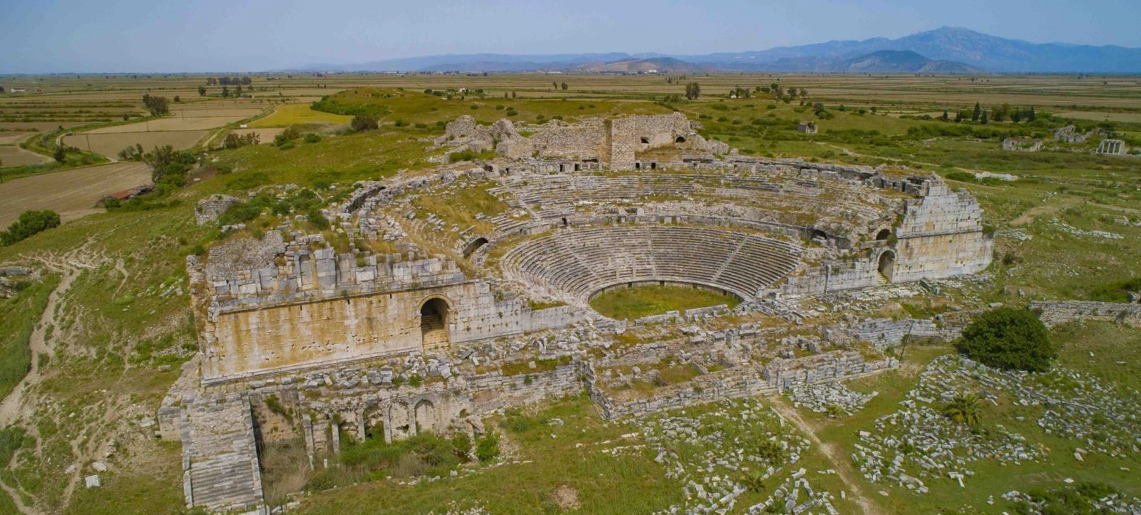
Discover the great Ionian metropolis whose history became closely connected with the decline and eventual abandonment of Myus.
Explore Ancient MiletusDiscover nearby cities and landscapes that reveal the cultural achievements and changing geography of western Anatolia.
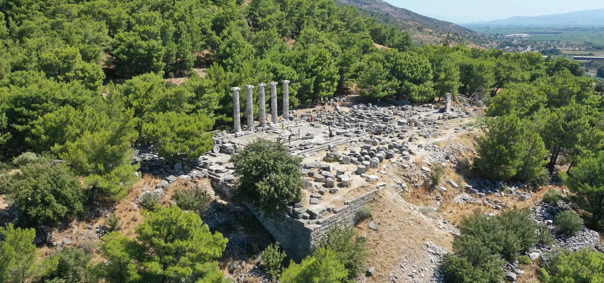
Explore an exceptionally informative example of ancient Greek urban planning, with temples, streets and dramatic mountain scenery.
Discover Priene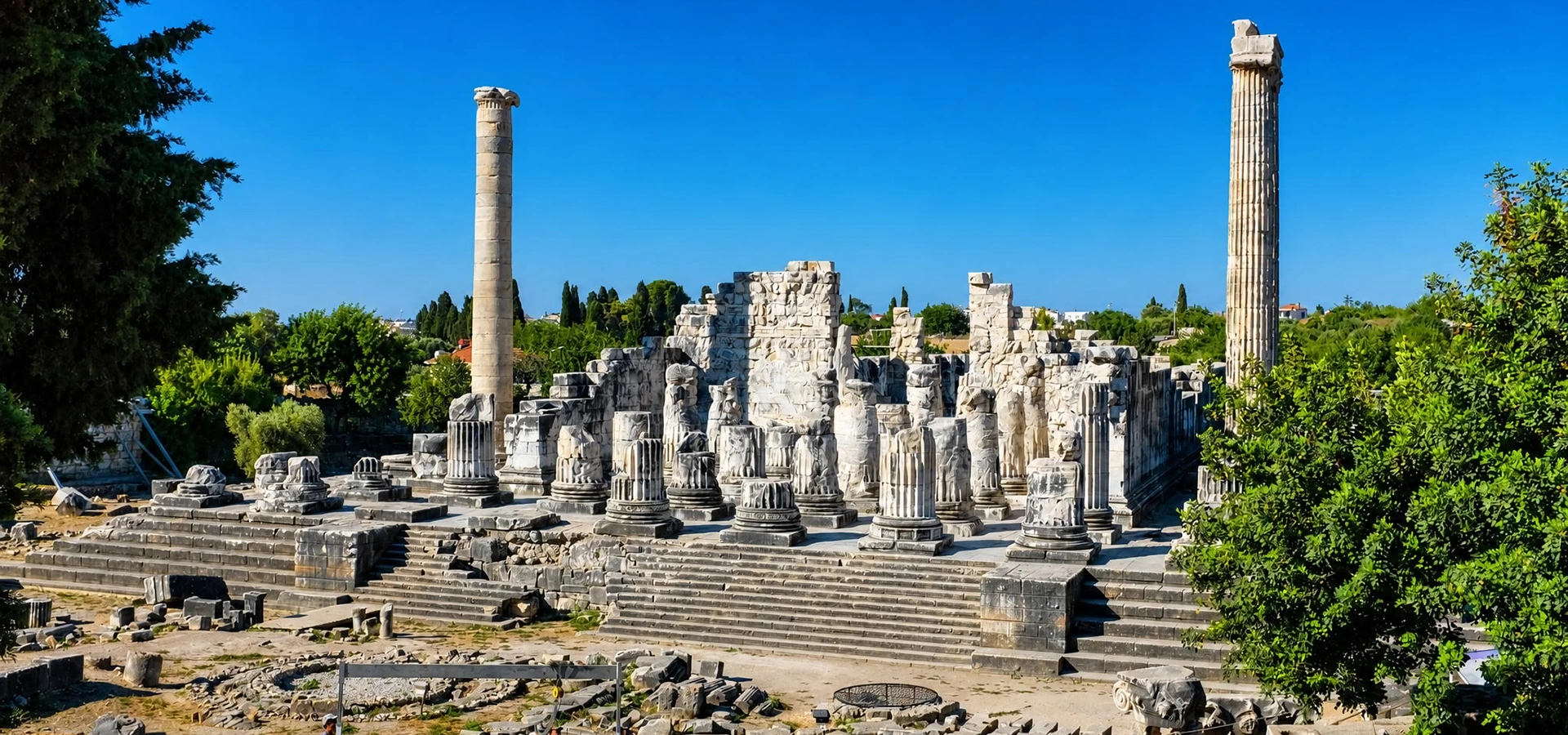
Visit one of the most impressive ancient religious sanctuaries of the Mediterranean world and discover its connection with Miletus.
Explore Didyma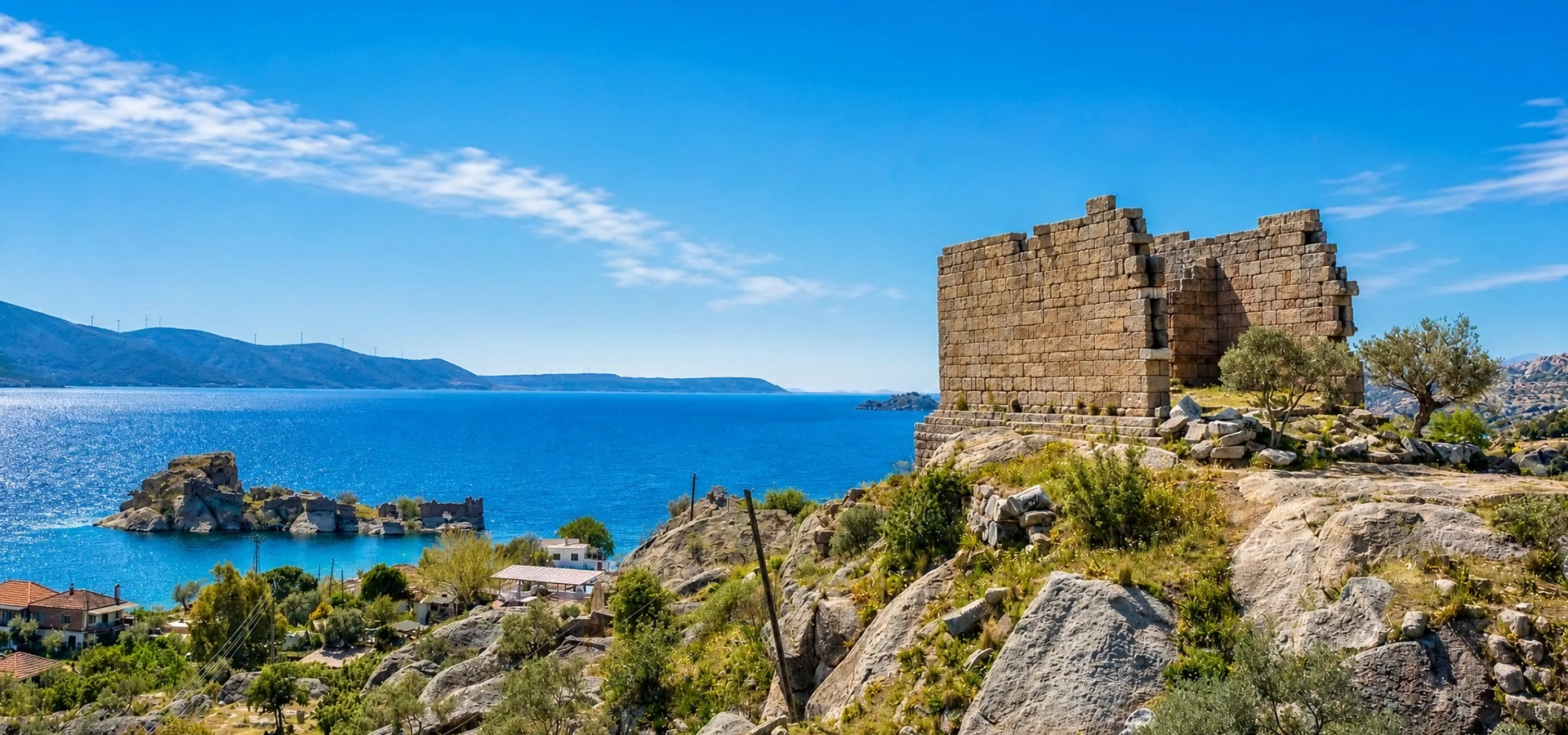
Discover the extraordinary natural and archaeological landscape of the former Latmian Gulf, with ancient ruins and Byzantine heritage.
Explore Lake Bafa